Category:Administrative maps of Europe
Jump to navigation
Jump to search
Subcategories
This category has the following 10 subcategories, out of 10 total.
Media in category "Administrative maps of Europe"
The following 71 files are in this category, out of 71 total.
-
 Albania Input Administrative Boundaries (5457147201).jpg 2,524 × 3,209; 623 KB
-
 Andorra Input Administrative Boundaries (5457753410).jpg 2,524 × 3,209; 565 KB
-
 Armenia Input Administrative Boundaries (5457753574).jpg 2,524 × 3,209; 608 KB
-
 Austria Input Administrative Boundaries (5457147557).jpg 2,550 × 3,209; 675 KB
-
 Azerbaijan Input Administrative Boundaries (5457147595).jpg 2,550 × 3,209; 731 KB
-
 Bayern Gemeindegrenzen 1892.jpg 11,530 × 11,823; 35.16 MB
-
 Belarus Input Administrative Boundaries (5457754260).jpg 2,550 × 3,209; 691 KB
-
 Belgium Input Administrative Boundaries (5457753894).jpg 2,524 × 3,209; 775 KB
-
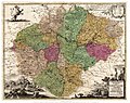 Bohemia 1712 administrative map by Johann Georg Vogt.jpg 2,059 × 1,639; 1.15 MB
-
 Bohemia 1712 administrative map by Johann Georg Vogt.tiff 2,256 × 1,816; 12.1 MB
-
 Bosnia and Herzegovina Input Administrative Boundaries (5457147975).jpg 2,524 × 3,209; 644 KB
-
 Bulgaria Input Administrative Boundaries (5457147833).jpg 2,524 × 3,209; 765 KB
-
 Caithness Shire 1845 parish map.jpg 2,492 × 3,000; 1.69 MB
-
 Charte vom Konigreich Boheim F.L. Güssefeld 1804.jpg 14,813 × 12,420; 37.71 MB
-
 Croatia Input Administrative Boundaries (5457757378).jpg 2,527 × 3,209; 783 KB
-
 Cyprus Input Administrative Boundaries (5457149223).jpg 2,524 × 3,209; 642 KB
-
 Czech Republic Input Administrative Boundaries (5457149281).jpg 2,524 × 3,209; 864 KB
-
 Estonia Input Administrative Boundaries (5457755966).jpg 2,524 × 3,209; 770 KB
-
 Europe Input Administrative Boundaries (5457149939).jpg 2,550 × 3,209; 904 KB
-
 Faeroe Islands Input Administrative Boundaries (5457150155).jpg 2,524 × 3,209; 611 KB
-
 Federated States of Micronesia Input Administrative Boundaries (5457756126).jpg 2,550 × 3,209; 893 KB
-
 General-Post und Straßen-Karte des Konigreichs Böhmen 1889.jpg 9,292 × 6,261; 9.36 MB
-
 Georgia Input Administrative Boundaries (5457150345).jpg 2,524 × 3,209; 607 KB
-
 Gibraltar Input Administrative Boundaries (5457150475).jpg 2,524 × 3,209; 528 KB
-
 Greece Input Administrative Boundaries (5457150789).jpg 2,524 × 3,209; 806 KB
-
 Guernsey Input Administrative Boundaries (5457150391).jpg 2,524 × 3,209; 551 KB
-
 Holy See Input Administrative Boundaries (5457157135).jpg 2,524 × 3,209; 552 KB
-
 Hungary Input Administrative Boundaries (5457757450).jpg 2,524 × 3,209; 882 KB
-
 Iceland Input Administrative Boundaries (5457151631).jpg 2,524 × 3,209; 679 KB
-
 Ireland Input Administrative Boundaries (5457151507).jpg 2,524 × 3,209; 989 KB
-
 Isle of Man Input Administrative Boundaries (5457151343).jpg 2,524 × 3,209; 618 KB
-
 Italy Input Administrative Boundaries (5457757944).jpg 2,550 × 3,209; 1,013 KB
-
 Jersey Input Administrative Boundaries (5457151837).jpg 2,524 × 3,209; 550 KB
-
 Karte Provinz Schlesien 1849.jpg 8,273 × 6,616; 11.75 MB
-
 Karte Schlesien von Petrus Schenk 1710 flächenkoloriert.jpg 3,882 × 3,294; 3.04 MB
-
 Karte Schlesien von Petrus Schenk 1710.jpg 3,971 × 3,333; 3.16 MB
-
 Karte von dem Koenigreich Boeheim 1798.jpg 14,422 × 12,874; 38.87 MB
-
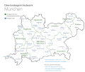 Karte-olg-muenchen.gif 931 × 787; 62 KB
-
 Kosovo Licence Plate numbers and administrative divisions.png 529 × 599; 59 KB
-
 Kralovstvi Ceske 1877.jpg 18,293 × 13,391; 61.28 MB
-
 Landkreis Berchtesgaden Gemeindegrenzen - cropped from Bayern Gemeindegrenzen 1892.jpg 1,166 × 1,361; 427 KB
-
 Landkreis Dingolfing Gemeindegrenzen 1892 (cropped).jpg 842 × 953; 249 KB
-
 Latvia Input Administrative Boundaries (5457758844).jpg 2,524 × 3,209; 770 KB
-
 Liechtenstein Input Administrative Boundaries (5457152529).jpg 2,524 × 3,209; 603 KB
-
 Lithuania Input Administrative Boundaries (5457152621).jpg 2,524 × 3,209; 652 KB
-
 Luxembourg Input Administrative Boundaries (5457152655).jpg 2,524 × 3,209; 651 KB
-
 Macedonia Input Administrative Boundaries (5457153143).jpg 2,524 × 3,209; 691 KB
-
 Malta Input Administrative Boundaries (5457759338).jpg 2,524 × 3,209; 623 KB
-
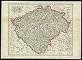
 Mapa království českého 1847.jpg 2,633 × 2,343; 1.95 MB
-
 Moldova Input Administrative Boundaries (5457759006).jpg 2,524 × 3,207; 668 KB
-
 Monaco Input Administrative Boundaries (5457152787).jpg 2,524 × 3,209; 527 KB
-
 Netherlands Input Administrative Boundaries (5457760122).jpg 2,524 × 3,209; 742 KB
-
 Norway Input Administrative Boundaries (5457760188).jpg 2,537 × 3,209; 848 KB
-
 Organizarea administrativă a Rep.Moldova.jpg 1,490 × 1,459; 961 KB
-
 Portugal Input Administrative Boundaries (5457760968).jpg 2,524 × 3,209; 756 KB
-
 Romania Input Administrative Boundaries (5457761208).jpg 2,450 × 3,169; 1.03 MB
-
 Romania proposed Euroregions.jpg 1,364 × 958; 610 KB
-
 San Marino Input Administrative Boundaries (5457761798).jpg 2,524 × 3,209; 535 KB
-
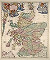 Scotland 1689 map by Nicolaes Visscher II.jpg 5,504 × 6,536; 10.93 MB
-
 Serbia & Montenegro Input Administrative Boundaries (5457761428).jpg 2,524 × 3,209; 606 KB
-
 Slovakia Input Administrative Boundaries (5457762176).jpg 2,524 × 3,209; 741 KB
-
 Slovenia Input Administrative Boundaries (5457762328).jpg 2,524 × 3,209; 1,024 KB
-
 Spain Input Administrative Boundaries (5457149809).jpg 2,524 × 3,209; 914 KB
-
 Svalbard Input Administrative Boundaries (5457762124).jpg 2,524 × 3,209; 642 KB
-
 Sweden Input Administrative Boundaries (5457156029).jpg 2,524 × 3,209; 813 KB
-
 Switzerland Input Administrative Boundaries (5457148473).jpg 2,524 × 3,209; 849 KB
-
 Turkey Input Administrative Boundaries (5457762984).jpg 2,550 × 3,209; 731 KB
-
 UBBasel Map 1659-1688 Kartenslg Mappe 247-42.tif 11,328 × 8,766, 2 pages; 284.13 MB
-
 Ukraine Input Administrative Boundaries (5457156931).jpg 2,550 × 3,209; 802 KB
-
 United Kingdom Input Administrative Boundaries (5457756512).jpg 2,530 × 3,209; 763 KB
-
 Yugoslavia Input Administrative Boundaries (5457763836).jpg 2,450 × 3,169; 597 KB
.jpg)
.jpg)
.jpg)
.jpg)
.jpg)

.jpg)
.jpg)

.jpg)
.jpg)


.jpg)
.jpg)
.jpg)
.jpg)
.jpg)
.jpg)
.jpg)

.jpg)
.jpg)
.jpg)
.jpg)
.jpg)
.jpg)
.jpg)
.jpg)
.jpg)
.jpg)
.jpg)


.jpg)
.jpg)
.jpg)
.jpg)
.jpg)
.jpg)
.jpg)

.jpg)
.jpg)
.jpg)
.jpg)

.jpg)
.jpg)

.jpg)

.jpg)
.jpg)
.jpg)
.jpg)
.jpg)
.jpg)
.jpg)
.jpg)
.jpg)
.jpg)
.jpg)