Category:Administrative maps of Périgueux
Jump to navigation
Jump to search
Subcategories
This category has the following 2 subcategories, out of 2 total.
Media in category "Administrative maps of Périgueux"
The following 5 files are in this category, out of 5 total.
-
 CA Périgourdine 2012.png 1,244 × 1,294; 213 KB
-
 CA Périgourdine 2013.png 1,365 × 1,295; 230 KB
-
 Communes CA Périgourdine.png 1,086 × 1,295; 194 KB
-
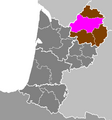 Département de la Dordogne - Arrondissement de Périgueux.PNG 462 × 494; 15 KB
-
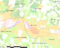 Map commune FR insee code 24322.png 756 × 605; 52 KB


