Category:Aerial photographs from Nederlands Instituut voor Militaire Historie uploaded in 2017
Jump to navigation
Jump to search
| Netherlands Institute for Military History
|
|||
|---|---|---|---|
.svg) |
|||
| Native name | Nederlands Instituut voor Militaire Historie (NIMH) | ||
| Parent institution | Ministry of Defence | ||
| Location | |||
| Coordinates | | ||
| Established | 1 July 2005 | ||
| Website | NIMH | ||
| Authority file | |||
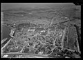
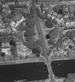
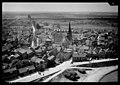
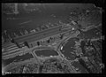
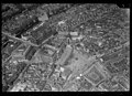
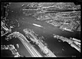
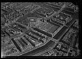
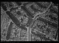
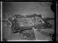
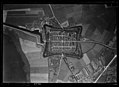
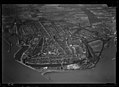
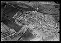
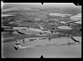
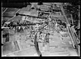
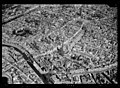
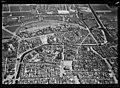
This category contains the aerial photographs of the Netherlands donated by Nederlands Instituut voor Militaire Historie and uploaded in 2017. The images were taken in the years 1920-1940 by the Luchtvaartafdeeling of the Dutch Army. The Luchtvaartafdeeling was a forerunner of the Royal Dutch Airforce. A few photographs have inscriptions detailing subject, f-number, height and photographer, for instance Batterij bij Poederoijen and Makkum. Photograph number 2011-0201 was an erroneous image, so it is not shown here.
Permission: see ticket #2017081410006725.
- Usage of the present images on Wikimedia projects.
Media in category "Aerial photographs from Nederlands Instituut voor Militaire Historie uploaded in 2017"
The following 200 files are in this category, out of 1,194 total.
(previous page) (next page)-
 NIMH - 2011 - 0551 - Aerial photograph of Venlo, The Netherlands - 1920 - 1940.jpg 3,500 × 2,536; 2.52 MB
-
 NIMH - 2011 - 0544 - Aerial photograph of Venlo, The Netherlands - 1920 - 1940.jpg 3,500 × 2,547; 2.19 MB
-
 NIMH - 2011 - 0549 - Aerial photograph of Venlo, The Netherlands - 1920 - 1940.jpg 3,500 × 2,531; 1.74 MB
-
 Aerial photograph of Westerkerk and Anne Frank House - 1920 - 1940.jpg 1,141 × 853; 293 KB
-
 Gereformeerde Kerk Maasland.jpg 425 × 342; 83 KB
-
 Hereplein - luchtfoto.png 964 × 1,052; 1.18 MB
-

-
 NIMH - 2011 - 0002 - Aerial photograph of Alkmaar, The Netherlands - 1920 - 1940.jpg 3,500 × 2,493; 2.69 MB
-
 NIMH - 2011 - 0003 - Aerial photograph of Alkmaar, The Netherlands - 1920 - 1940.jpg 3,500 × 2,505; 2.22 MB
-
 NIMH - 2011 - 0004 - Aerial photograph of Almelo, The Netherlands - 1920 - 1940.jpg 3,500 × 2,520; 1.95 MB
-
 NIMH - 2011 - 0005 - Aerial photograph of Almelo, The Netherlands - 1920 - 1940.jpg 3,500 × 2,521; 1.92 MB
-
 NIMH - 2011 - 0006 - Aerial photograph of Almelo, The Netherlands - 1920 - 1940.jpg 3,500 × 2,509; 1.92 MB
-

-

-
 NIMH - 2011 - 0009 - Aerial photograph of Ameide, The Netherlands - 1920 - 1940.jpg 3,500 × 2,482; 2.1 MB
-
 NIMH - 2011 - 0010 - Aerial photograph of Ameide, The Netherlands - 1920 - 1940.jpg 3,500 × 2,501; 2.27 MB
-
 NIMH - 2011 - 0011 - Aerial photograph of Amersfoort, The Netherlands - 1920 - 1940.jpg 3,500 × 2,437; 2.32 MB
-
 NIMH - 2011 - 0012 - Aerial photograph of Amersfoort, The Netherlands - 1920 - 1940.jpg 3,500 × 2,494; 2.43 MB
-

-

-
 NIMH - 2011 - 0015 - Aerial photograph of Amersfoort, The Netherlands - 1920 - 1940.jpg 3,500 × 2,518; 2.29 MB
-
 NIMH - 2011 - 0016 - Aerial photograph of Amersfoort, The Netherlands - 1920 - 1940.jpg 3,500 × 2,496; 2.26 MB
-
 NIMH - 2011 - 0017 - Aerial photograph of Amersfoort, The Netherlands - 1920 - 1940.jpg 3,500 × 2,531; 1.88 MB
-
 NIMH - 2011 - 0018 - Aerial photograph of Amersfoort, The Netherlands - 1920 - 1940.jpg 3,500 × 2,538; 2.4 MB
-
 NIMH - 2011 - 0019 - Aerial photograph of Amstelveen, The Netherlands - 1920 - 1940.jpg 3,500 × 2,494; 1.68 MB
-
 NIMH - 2011 - 0020 - Aerial photograph of Amsterdam, The Netherlands - 1920 - 1940.jpg 3,500 × 2,492; 2.15 MB
-
 NIMH - 2011 - 0021 - Aerial photograph of Amsterdam, The Netherlands - 1920 - 1940.jpg 3,500 × 2,533; 2.03 MB
-

-
 NIMH - 2011 - 0023 - Aerial photograph of Amsterdam, The Netherlands - 1920 - 1940.jpg 3,500 × 2,499; 2.64 MB
-
 NIMH - 2011 - 0024 - Aerial photograph of Amsterdam, The Netherlands - 1920 - 1940.jpg 3,500 × 2,536; 2.2 MB
-

-

-
 NIMH - 2011 - 0027 - Aerial photograph of Amsterdam, The Netherlands - 1920 - 1940.jpg 3,500 × 2,545; 1.6 MB
-
 NIMH - 2011 - 0028 - Aerial photograph of Amsterdam, The Netherlands - 1920 - 1940.jpg 3,500 × 2,541; 1.52 MB
-
 NIMH - 2011 - 0029 - Aerial photograph of Amsterdam, The Netherlands - 1920 - 1940.jpg 3,500 × 2,474; 2.26 MB
-
 NIMH - 2011 - 0030 - Aerial photograph of Amsterdam, The Netherlands - 1920 - 1940.jpg 3,500 × 2,516; 2.16 MB
-
 NIMH - 2011 - 0031 - Aerial photograph of Amsterdam, The Netherlands - 1920 - 1940.jpg 3,500 × 2,530; 2.15 MB
-
 NIMH - 2011 - 0032 - Aerial photograph of Amsterdam, The Netherlands - 1920 - 1940.jpg 3,500 × 2,467; 2.48 MB
-
 NIMH - 2011 - 0033 - Aerial photograph of Amsterdam, The Netherlands - 1920 - 1940.jpg 3,500 × 2,508; 2.7 MB
-
 NIMH - 2011 - 0034 - Aerial photograph of Amsterdam, The Netherlands - 1920 - 1940.jpg 3,500 × 2,565; 3.06 MB
-
 NIMH - 2011 - 0035 - Aerial photograph of Amsterdam, The Netherlands - 1920 - 1940.jpg 3,500 × 2,548; 2.89 MB
-
 NIMH - 2011 - 0036 - Aerial photograph of Amsterdam, The Netherlands - 1920 - 1940.jpg 3,500 × 2,527; 1.93 MB
-
 NIMH - 2011 - 0037 - Aerial photograph of Amsterdam, The Netherlands - 1920 - 1940.jpg 3,500 × 2,555; 1.92 MB
-
 NIMH - 2011 - 0038 - Aerial photograph of Amsterdam, The Netherlands - 1920 - 1940.jpg 3,500 × 2,546; 2.01 MB
-
 NIMH - 2011 - 0039 - Aerial photograph of Amsterdam, The Netherlands - 1920 - 1940.jpg 3,500 × 2,539; 2.33 MB
-
 NIMH - 2011 - 0040 - Aerial photograph of Amsterdam, The Netherlands - 1920 - 1940.jpg 3,500 × 2,543; 2.43 MB
-
 NIMH - 2011 - 0041 - Aerial photograph of Amsterdam, The Netherlands - 1920 - 1940.jpg 3,500 × 2,543; 2.06 MB
-
 NIMH - 2011 - 0042 - Aerial photograph of Amsterdam, The Netherlands - 1920 - 1940.jpg 3,500 × 2,518; 2.33 MB
-
 NIMH - 2011 - 0043 - Aerial photograph of Amsterdam, The Netherlands - 1920 - 1940.jpg 3,500 × 2,593; 2.2 MB
-
 NIMH - 2011 - 0044 - Aerial photograph of Amsterdam, The Netherlands - 1920 - 1940.jpg 3,500 × 2,548; 1.91 MB
-
 NIMH - 2011 - 0045 - Aerial photograph of Amsterdam, The Netherlands - 1920 - 1940.jpg 3,500 × 2,553; 2.64 MB
-
 NIMH - 2011 - 0046 - Aerial photograph of Amsterdam, The Netherlands - 1920 - 1940.jpg 3,500 × 2,545; 2.22 MB
-
 NIMH - 2011 - 0047 - Aerial photograph of Amsterdam, The Netherlands - 1920 - 1940.jpg 3,500 × 2,552; 2.27 MB
-
 NIMH - 2011 - 0048 - Aerial photograph of Amsterdam, The Netherlands - 1920 - 1940.jpg 3,500 × 2,580; 2.76 MB
-
 NIMH - 2011 - 0049 - Aerial photograph of Amsterdam, The Netherlands - 1920 - 1940.jpg 3,500 × 2,522; 1.68 MB
-
 NIMH - 2011 - 0050 - Aerial photograph of Amsterdam, The Netherlands - 1920 - 1940.jpg 3,500 × 2,557; 2.21 MB
-
 NIMH - 2011 - 0051 - Aerial photograph of Amsterdam, The Netherlands - 1920 - 1940.jpg 3,500 × 2,563; 2.25 MB
-

-

-

-
-
 NIMH - 2011 - 0052 - Aerial photograph of Amsterdam, The Netherlands - 1920 - 1940.jpg 3,500 × 2,547; 2.11 MB
-
 NIMH - 2011 - 0053 - Aerial photograph of Amsterdam, The Netherlands - 1920 - 1940.jpg 3,500 × 2,524; 2.18 MB
-
 NIMH - 2011 - 0054 - Aerial photograph of Amsterdam, The Netherlands - 1920 - 1940.jpg 3,500 × 2,536; 2.36 MB
-
 NIMH - 2011 - 0055 - Aerial photograph of Amsterdam, The Netherlands - 1920 - 1940.jpg 3,500 × 2,557; 1.9 MB
-
 NIMH - 2011 - 0056 - Aerial photograph of Amsterdam, The Netherlands - 1920 - 1940.jpg 3,500 × 2,578; 1.61 MB
-
 NIMH - 2011 - 0057 - Aerial photograph of Amsterdam, The Netherlands - 1920 - 1940.jpg 3,500 × 2,571; 2.3 MB
-
 NIMH - 2011 - 0058 - Aerial photograph of Amsterdam, The Netherlands - 1920 - 1940.jpg 3,500 × 2,573; 2.41 MB
-
 NIMH - 2011 - 0059 - Aerial photograph of Amsterdam, The Netherlands - 1920 - 1940.jpg 3,500 × 2,543; 2.3 MB
-
 NIMH - 2011 - 0060 - Aerial photograph of Amsterdam, The Netherlands - 1920 - 1940.jpg 3,500 × 2,523; 2.26 MB
-

-
 NIMH - 2011 - 0062 - Aerial photograph of Amsterdam, The Netherlands - 1920 - 1940.jpg 3,500 × 2,577; 2.06 MB
-
 NIMH - 2011 - 0063 - Aerial photograph of Amsterdam, The Netherlands - 1920 - 1940.jpg 3,500 × 2,575; 2.17 MB
-
 NIMH - 2011 - 0064 - Aerial photograph of Amsterdam, The Netherlands - 1920 - 1940.jpg 3,500 × 2,544; 2.29 MB
-
 NIMH - 2011 - 0065 - Aerial photograph of Amsterdam, The Netherlands - 1920 - 1940.jpg 3,500 × 2,511; 2.72 MB
-
 NIMH - 2011 - 0066 - Aerial photograph of Rotterdam, The Netherlands - 1920 - 1940.jpg 3,500 × 2,514; 1.86 MB
-
 NIMH - 2011 - 0067 - Aerial photograph of Apeldoorn, The Netherlands - 1920 - 1940.jpg 3,500 × 2,514; 2.12 MB
-
 NIMH - 2011 - 0068 - Aerial photograph of Apeldoorn, The Netherlands - 1920 - 1940.jpg 3,500 × 2,578; 1.43 MB
-
 NIMH - 2011 - 0069 - Aerial photograph of Apeldoorn, The Netherlands - 1920 - 1940.jpg 3,500 × 2,553; 1.88 MB
-
 NIMH - 2011 - 0070 - Aerial photograph of Apeldoorn, The Netherlands - 1920 - 1940.jpg 3,500 × 2,535; 2.2 MB
-
 NIMH - 2011 - 0071 - Aerial photograph of Apeldoorn, The Netherlands - 1920 - 1940.jpg 3,500 × 2,552; 2.33 MB
-
 NIMH - 2011 - 0072 - Aerial photograph of Arnemuiden, The Netherlands - 1920 - 1940.jpg 3,500 × 2,592; 2.13 MB
-
 NIMH - 2011 - 0073 - Aerial photograph of Arnemuiden, The Netherlands - 1920 - 1940.jpg 3,500 × 2,576; 2.28 MB
-
 NIMH - 2011 - 0074 - Aerial photograph of Arnhem, The Netherlands - 1920 - 1940.jpg 3,500 × 2,552; 2.39 MB
-
 NIMH - 2011 - 0075 - Aerial photograph of Bergen op Zoom, The Netherlands - 1920 - 1940.jpg 3,500 × 2,546; 2.18 MB
-
 NIMH - 2011 - 0076 - Aerial photograph of Bunschoten, The Netherlands - 1920 - 1940.jpg 3,500 × 2,586; 1.46 MB
-
 NIMH - 2011 - 0077 - Aerial photograph of Bilthoven, The Netherlands - 1920 - 1940.jpg 3,500 × 2,542; 2.31 MB
-
 NIMH - 2011 - 0078 - Aerial photograph of Bilthoven, The Netherlands - 1920 - 1940.jpg 3,500 × 2,539; 2.52 MB
-

-
 NIMH - 2011 - 0080 - Aerial photograph of Delden, The Netherlands - 1920 - 1940.jpg 3,500 × 2,512; 2.78 MB
-
 NIMH - 2011 - 0081 - Aerial photograph of Delft, The Netherlands - 1920 - 1940.jpg 3,500 × 2,554; 2.46 MB
-
 NIMH - 2011 - 0082 - Aerial photograph of Delft, The Netherlands - 1920 - 1940.jpg 3,500 × 2,545; 2.51 MB
-
 NIMH - 2011 - 0083 - Aerial photograph of Delft, The Netherlands - 1920 - 1940.jpg 3,500 × 2,551; 1.96 MB
-
 NIMH - 2011 - 0084 - Aerial photograph of Delft, The Netherlands - 1920 - 1940.jpg 3,500 × 2,554; 2.32 MB
-
 NIMH - 2011 - 0085 - Aerial photograph of Delft, The Netherlands - 1920 - 1940.jpg 3,500 × 2,538; 2.51 MB
-
 NIMH - 2011 - 0086 - Aerial photograph of Delft, The Netherlands - 1920 - 1940.jpg 3,500 × 2,531; 2.37 MB
-
 NIMH - 2011 - 0087 - Aerial photograph of Delft, The Netherlands - 1920 - 1940.jpg 3,500 × 2,556; 2.22 MB
-
 NIMH - 2011 - 0088 - Aerial photograph of Delft, The Netherlands - 1920 - 1940.jpg 3,500 × 2,578; 1.94 MB
-
 NIMH - 2011 - 0089 - Aerial photograph of Delft, The Netherlands - 1920 - 1940.jpg 3,500 × 2,545; 2.16 MB
-
 NIMH - 2011 - 0090 - Aerial photograph of Deventer, The Netherlands - 1920 - 1940.jpg 3,500 × 2,576; 1.9 MB
-
 NIMH - 2011 - 0091 - Aerial photograph of Deventer, The Netherlands - 1920 - 1940.jpg 3,500 × 2,531; 2.21 MB
-
 NIMH - 2011 - 0092 - Aerial photograph of Dinteloord, The Netherlands - 1920 - 1940.jpg 3,500 × 2,555; 1.9 MB
-
 NIMH - 2011 - 0093 - Aerial photograph of Dinteloord, The Netherlands - 1920 - 1940.jpg 3,500 × 2,577; 1.6 MB
-
 NIMH - 2011 - 0094 - Aerial photograph of Dokkum, The Netherlands - 1920 - 1940.jpg 3,500 × 2,535; 2.33 MB
-
 NIMH - 2011 - 0095 - Aerial photograph of Dokkum, The Netherlands - 1920 - 1940.jpg 3,500 × 2,564; 2.23 MB
-
 NIMH - 2011 - 0096 - Aerial photograph of Doorn, The Netherlands - 1920 - 1940.jpg 3,500 × 2,544; 2.55 MB
-
 NIMH - 2011 - 0097 - Aerial photograph of Doorn, The Netherlands - 1920 - 1940.jpg 3,500 × 2,555; 2.48 MB
-
 NIMH - 2011 - 0098 - Aerial photograph of Dordrecht, The Netherlands - 1920 - 1940.jpg 3,500 × 2,515; 2.06 MB
-
 NIMH - 2011 - 0099 - Aerial photograph of Dordrecht, The Netherlands - 1920 - 1940.jpg 3,500 × 2,534; 2.61 MB
-
 NIMH - 2011 - 0100 - Aerial photograph of Dordrecht, The Netherlands - 1920 - 1940.jpg 3,500 × 2,527; 2.41 MB
-
 NIMH - 2011 - 0101 - Aerial photograph of Dordrecht, The Netherlands - 1920 - 1940.jpg 3,500 × 2,541; 2.2 MB
-
 NIMH - 2011 - 0102 - Aerial photograph of Dordrecht, The Netherlands - 1920 - 1940.jpg 3,500 × 2,529; 2.03 MB
-
 NIMH - 2011 - 0103 - Aerial photograph of Dordrecht, The Netherlands - 1920 - 1940.jpg 3,500 × 2,579; 1.97 MB
-
 NIMH - 2011 - 0104 - Aerial photograph of Dordrecht, The Netherlands - 1920 - 1940.jpg 3,500 × 2,554; 2.1 MB
-
 NIMH - 2011 - 0105 - Aerial photograph of Oss, The Netherlands - 1920 - 1940.jpg 3,500 × 2,502; 2.04 MB
-
 NIMH - 2011 - 0106 - Aerial photograph of Driebergen, The Netherlands - 1920 - 1940.jpg 3,500 × 2,508; 2.2 MB
-
 NIMH - 2011 - 0107 - Aerial photograph of Edam, The Netherlands - 1920 - 1940.jpg 3,500 × 2,546; 2.18 MB
-
 NIMH - 2011 - 0108 - Aerial photograph of Edam, The Netherlands - 1920 - 1940.jpg 3,500 × 2,536; 1.63 MB
-
 NIMH - 2011 - 0109 - Aerial photograph of Edam, The Netherlands - 1920 - 1940.jpg 3,500 × 2,543; 2.36 MB
-
 NIMH - 2011 - 0110 - Aerial photograph of Edam, The Netherlands - 1920 - 1940.jpg 3,500 × 2,540; 2.16 MB
-
 NIMH - 2011 - 0111 - Aerial photograph of Ede, The Netherlands - 1920 - 1940.jpg 3,500 × 2,524; 2.03 MB
-
 NIMH - 2011 - 0112 - Aerial photograph of Ede, The Netherlands - 1920 - 1940.jpg 3,500 × 2,550; 2.19 MB
-
 NIMH - 2011 - 0113 - Aerial photograph of Ede, The Netherlands - 1920 - 1940.jpg 3,500 × 2,508; 1.97 MB
-

-
 NIMH - 2011 - 0114 - Aerial photograph of Ede, The Netherlands - 1920 - 1940.jpg 3,500 × 2,499; 2.03 MB
-
 NIMH - 2011 - 0115 - Aerial photograph of Eefde, The Netherlands - 1920 - 1940.jpg 3,500 × 2,544; 1.61 MB
-
 NIMH - 2011 - 0116 - Aerial photograph of Egmond, The Netherlands - 1920 - 1940.jpg 3,500 × 2,523; 2.4 MB
-
 NIMH - 2011 - 0117 - Aerial photograph of Egmond, The Netherlands - 1920 - 1940.jpg 3,500 × 2,514; 2.04 MB
-
 NIMH - 2011 - 0118 - Aerial photograph of Egmond, The Netherlands - 1920 - 1940.jpg 3,500 × 2,563; 2.11 MB
-
 NIMH - 2011 - 0119 - Aerial photograph of Eindhoven, The Netherlands - 1920 - 1940.jpg 3,500 × 2,515; 2.19 MB
-
 NIMH - 2011 - 0120 - Aerial photograph of Eindhoven, The Netherlands - 1920 - 1940.jpg 3,500 × 2,541; 2.03 MB
-
 NIMH - 2011 - 0121 - Aerial photograph of Eindhoven, The Netherlands - 1920 - 1940.jpg 3,500 × 2,540; 2.14 MB
-

-

-

-
 NIMH - 2011 - 0122 - Aerial photograph of Eindhoven, The Netherlands - 1920 - 1940.jpg 3,500 × 2,522; 2.01 MB
-
 NIMH - 2011 - 0123 - Aerial photograph of Elburg, The Netherlands - 1920 - 1940.jpg 3,500 × 2,526; 2.15 MB
-
 NIMH - 2011 - 0124 - Aerial photograph of Elburg, The Netherlands - 1920 - 1940.jpg 3,500 × 2,526; 2.02 MB
-
 NIMH - 2011 - 0125 - Aerial photograph of Elburg, The Netherlands - 1920 - 1940.jpg 3,500 × 2,557; 2.2 MB
-
 NIMH - 2011 - 0126 - Aerial photograph of Elburg, The Netherlands - 1920 - 1940.jpg 3,500 × 2,551; 1.99 MB
-
 NIMH - 2011 - 0127 - Aerial photograph of Elburg, The Netherlands - 1920 - 1940.jpg 3,500 × 2,524; 2.08 MB
-
 NIMH - 2011 - 0128 - Aerial photograph of Elst, The Netherlands - 1920 - 1940.jpg 3,500 × 2,507; 2.32 MB
-
 NIMH - 2011 - 0129 - Aerial photograph of Elst, The Netherlands - 1920 - 1940.jpg 3,500 × 2,520; 2.82 MB
-
 NIMH - 2011 - 0130 - Aerial photograph of Emmen, The Netherlands - 1920 - 1940.jpg 3,500 × 2,536; 1.8 MB
-
 NIMH - 2011 - 0131 - Aerial photograph of Enkhuizen, The Netherlands - 1920 - 1940.jpg 3,500 × 2,550; 1.91 MB
-
 NIMH - 2011 - 0132 - Aerial photograph of Enkhuizen, The Netherlands - 1920 - 1940.jpg 3,500 × 2,550; 2.02 MB
-
 NIMH - 2011 - 0133 - Aerial photograph of Enkhuizen, The Netherlands - 1920 - 1940.jpg 3,500 × 2,548; 2.03 MB
-
 NIMH - 2011 - 0134 - Aerial photograph of Enkhuizen, The Netherlands - 1920 - 1940.jpg 3,500 × 2,577; 2.1 MB
-
 NIMH - 2011 - 0135 - Aerial photograph of Ermelo, The Netherlands - 1920 - 1940.jpg 3,500 × 2,552; 1.91 MB
-
 NIMH - 2011 - 0136 - Aerial photograph of Van Ewijcksluis, The Netherlands - 1920 - 1940.jpg 3,500 × 2,573; 2.21 MB
-
 NIMH - 2011 - 0137 - Aerial photograph of Garderen, The Netherlands - 1920 - 1940.jpg 3,500 × 2,509; 2.28 MB
-
 NIMH - 2011 - 0138 - Aerial photograph of Geldermalsen, The Netherlands - 1920 - 1940.jpg 3,500 × 2,546; 1.91 MB
-
 NIMH - 2011 - 0139 - Aerial photograph of Genemuiden, The Netherlands - 1920 - 1940.jpg 3,500 × 2,505; 1.98 MB
-
 NIMH - 2011 - 0140 - Aerial photograph of Gennep, The Netherlands - 1920 - 1940.jpg 3,500 × 2,564; 1.9 MB
-
 NIMH - 2011 - 0141 - Aerial photograph of Ottersum, The Netherlands - 1920 - 1940.jpg 3,500 × 2,564; 1.84 MB
-
 NIMH - 2011 - 0142 - Aerial photograph of Gennep, The Netherlands - 1920 - 1940.jpg 3,500 × 2,535; 3.14 MB
-
 NIMH - 2011 - 0143 - Aerial photograph of Gennep, The Netherlands - 1920 - 1940.jpg 3,500 × 2,501; 2.18 MB
-
 NIMH - 2011 - 0144 - Aerial photograph of Goes, The Netherlands - 1920 - 1940.jpg 3,500 × 2,531; 2.28 MB
-
 NIMH - 2011 - 0145 - Aerial photograph of Goes, The Netherlands - 1920 - 1940.jpg 3,500 × 2,550; 2.45 MB
-
 NIMH - 2011 - 0146 - Aerial photograph of Gouda, The Netherlands - 1920 - 1940.jpg 3,500 × 2,542; 2.73 MB
-
 NIMH - 2011 - 0147 - Aerial photograph of Gouda, The Netherlands - 1920 - 1940.jpg 3,500 × 2,526; 2.41 MB
-
 NIMH - 2011 - 0148 - Aerial photograph of Gouda, The Netherlands - 1920 - 1940.jpg 3,500 × 2,506; 2.35 MB
-
 NIMH - 2011 - 0149 - Aerial photograph of Gouda, The Netherlands - 1920 - 1940.jpg 3,500 × 2,565; 2.58 MB
-
 NIMH - 2011 - 0150 - Aerial photograph of Gouda, The Netherlands - 1920 - 1940.jpg 3,500 × 2,543; 2.7 MB
-
 NIMH - 2011 - 0151 - Aerial photograph of Gouda, The Netherlands - 1920 - 1940.jpg 3,500 × 2,556; 2.74 MB
-
 NIMH - 2011 - 0152 - Aerial photograph of Gouda, The Netherlands - 1920 - 1940.jpg 3,500 × 2,548; 2.31 MB
-
 NIMH - 2011 - 0153 - Aerial photograph of Nederasselt, The Netherlands - 1920 - 1940.jpg 3,500 × 2,553; 2.12 MB
-
 NIMH - 2011 - 0154 - Aerial photograph of Grave, The Netherlands - 1920 - 1940.jpg 3,500 × 2,559; 2.27 MB
-
 NIMH - 2011 - 0155 - Aerial photograph of Grave, The Netherlands - 1920 - 1940.jpg 3,500 × 2,544; 2.01 MB
-
 NIMH - 2011 - 0156 - Aerial photograph of Grave, The Netherlands - 1920 - 1940.jpg 3,500 × 2,558; 2.09 MB
-
 NIMH - 2011 - 0157 - Aerial photograph of Grave, The Netherlands - 1920 - 1940.jpg 3,500 × 2,557; 3.11 MB
-
 NIMH - 2011 - 0158 - Aerial photograph of The Hague, The Netherlands - 1920 - 1940.jpg 3,500 × 2,536; 2.28 MB
-
 NIMH - 2011 - 0159 - Aerial photograph of The Hague, The Netherlands - 1920 - 1940.jpg 3,500 × 2,562; 2.33 MB
-
 NIMH - 2011 - 0160 - Aerial photograph of The Hague, The Netherlands - 1920 - 1940.jpg 3,500 × 2,545; 2.43 MB
-

-
 NIMH - 2011 - 0161 - Aerial photograph of The Hague, The Netherlands - 1920 - 1940.jpg 3,500 × 2,543; 2.28 MB
-
 NIMH - 2011 - 0162 - Aerial photograph of The Hague, The Netherlands - 1920 - 1940.jpg 3,500 × 2,532; 2.68 MB
-
 NIMH - 2011 - 0163 - Aerial photograph of The Hague, The Netherlands - 1920 - 1940.jpg 3,500 × 2,505; 2.52 MB
-
 NIMH - 2011 - 0164 - Aerial photograph of The Hague, The Netherlands - 1920 - 1940.jpg 3,500 × 2,564; 2.56 MB
-
 NIMH - 2011 - 0165 - Aerial photograph of The Hague, The Netherlands - 1920 - 1940.jpg 3,500 × 2,529; 2.41 MB
-
 NIMH - 2011 - 0166 - Aerial photograph of The Hague, The Netherlands - 1920 - 1940.jpg 3,500 × 2,527; 2.06 MB
-
 NIMH - 2011 - 0167 - Aerial photograph of The Hague, The Netherlands - 1920 - 1940.jpg 3,500 × 2,543; 2.29 MB
-
 NIMH - 2011 - 0168 - Aerial photograph of The Hague, The Netherlands - 1920 - 1940.jpg 3,500 × 2,558; 2.25 MB
-
 NIMH - 2011 - 0169 - Aerial photograph of The Hague, The Netherlands - 1920 - 1940.jpg 3,500 × 2,542; 2.71 MB
-
 NIMH - 2011 - 0170 - Aerial photograph of Groesbeek, The Netherlands - 1920 - 1940.jpg 3,500 × 2,548; 2.21 MB
-
 NIMH - 2011 - 0171 - Aerial photograph of Groesbeek, The Netherlands - 1920 - 1940.jpg 3,500 × 2,557; 1.74 MB
-
 NIMH - 2011 - 0172 - Aerial photograph of Groningen, The Netherlands - 1920 - 1940.jpg 3,500 × 2,574; 2.59 MB
-
 NIMH - 2011 - 0173 - Aerial photograph of Groningen, The Netherlands - 1920 - 1940.jpg 3,500 × 2,555; 2.86 MB
-
 NIMH - 2011 - 0174 - Aerial photograph of Groningen, The Netherlands - 1920 - 1940.jpg 3,500 × 2,551; 2.77 MB
-
 NIMH - 2011 - 0175 - Aerial photograph of Groningen, The Netherlands - 1920 - 1940.jpg 3,500 × 2,558; 2.64 MB
-
 NIMH - 2011 - 0176 - Aerial photograph of Groningen, The Netherlands - 1920 - 1940.jpg 3,500 × 2,560; 2.54 MB
-
 NIMH - 2011 - 0177 - Aerial photograph of Groningen, The Netherlands - 1920 - 1940.jpg 3,500 × 2,523; 2.52 MB
-
 NIMH - 2011 - 0178 - Aerial photograph of Groningen, The Netherlands - 1920 - 1940.jpg 3,500 × 2,567; 2.82 MB
-
 NIMH - 2011 - 0179 - Aerial photograph of Groningen, The Netherlands - 1920 - 1940.jpg 3,500 × 2,541; 2.77 MB
-
 NIMH - 2011 - 0180 - Aerial photograph of Groningen, The Netherlands - 1920 - 1940.jpg 3,500 × 2,572; 2.39 MB
-
 NIMH - 2011 - 0181 - Aerial photograph of Groningen, The Netherlands - 1920 - 1940.jpg 3,500 × 2,584; 1.99 MB
-
 NIMH - 2011 - 0182 - Aerial photograph of Groningen, The Netherlands - 1920 - 1940.jpg 3,500 × 2,565; 2.5 MB
-
 NIMH - 2011 - 0183 - Aerial photograph of Groningen, The Netherlands - 1920 - 1940.jpg 3,500 × 2,578; 2.14 MB
-
 NIMH - 2011 - 0184 - Aerial photograph of Groningen, The Netherlands - 1920 - 1940.jpg 3,500 × 2,590; 2.18 MB
-
 NIMH - 2011 - 0185 - Aerial photograph of Grouw, The Netherlands - 1920 - 1940.jpg 3,500 × 2,552; 2.27 MB


.jpg)
.jpg)
.jpg)


.jpg)


.jpg)


.jpg)