Category:Aerial photographs of Dunedin
Jump to navigation
Jump to search
Media in category "Aerial photographs of Dunedin"
The following 16 files are in this category, out of 16 total.
-
 De Havilland DH86 Express ZK-AEG over Dunedin, NZ.JPG 1,101 × 931; 487 KB
-
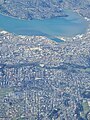
 Dunedin Aerial (1).jpg 3,024 × 4,032; 2.93 MB
-
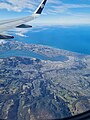
 Dunedin Aerial (2).jpg 3,024 × 4,032; 2.72 MB
-
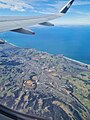
 Dunedin Aerial (3).jpg 3,024 × 4,032; 2.92 MB
-
 Dunedin Aerial (4).jpg 4,032 × 3,024; 2.9 MB
-
 Dunedin Aerial (5).jpg 3,024 × 4,032; 2.42 MB
-
 Dunedin Aerial (6).jpg 960 × 1,280; 210 KB
-
 Dunedin Aerial (7).jpg 960 × 1,280; 165 KB
-
 Dunedin Airport From the air.JPG 2,592 × 1,944; 1.22 MB
-
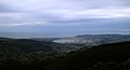 Dunedin from Mt Cargill.jpg 1,200 × 650; 222 KB
-
 Dunedin, Otago, New Zealand, 12th. Dec. 2010 - Flickr - PhillipC (1).jpg 4,288 × 2,848; 2.43 MB
-
 Dunedin, Otago, New Zealand, 12th. Dec. 2010 - Flickr - PhillipC.jpg 4,288 × 2,848; 3.52 MB
-
 Dunedin, Otago, New Zealand, 30 May 2007 - Flickr - PhillipC.jpg 3,872 × 2,592; 6.39 MB
-
 Kaikorai Valley, Dunedin, 1926 ATLIB 313249.png 6,422 × 4,598; 30.47 MB
-
 Logan Park, Dunedin (1955).jpg 4,034 × 3,056; 3.52 MB
-
 Mainland Air Socata TB-10 Tobago ZK-JIG over Dunedin city, NZ.jpg 2,048 × 1,536; 1.33 MB

.jpg)
.jpg)
.jpg)
.jpg)
.jpg)
.jpg)
.jpg)


.jpg)


.jpg)
