Category:Aerial photographs of Landkreis Tirschenreuth
Jump to navigation
Jump to search
Urban districts (cities): Amberg · Ansbach · Aschaffenburg · Augsburg · Bamberg · Bayreuth · Coburg · Erlangen · Fürth · Hof · Kaufbeuren · Kempten · Landshut · Memmingen · Munich · Nuremberg · Passau · Regensburg · Rosenheim · Schwabach · Straubing · Weiden in der Oberpfalz · Würzburg
Deutsch: Luftaufnahmen aus dem Landkreis Tirschenreuth.
Subcategories
This category has only the following subcategory.
Media in category "Aerial photographs of Landkreis Tirschenreuth"
The following 5 files are in this category, out of 5 total.
-
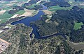 Aerial image of Liebensteinspeicher (view from the west).jpg 5,100 × 3,300; 8.84 MB
-
 Aerial image of the Erbendorf-Schweißlohe gliding site.jpg 3,600 × 2,700; 3.98 MB
-
 Aerial image of the Im Unteren Stadtteich gliding site.jpg 4,700 × 3,200; 6.74 MB
-
 Burgruine Waldeck (Oberpfalz) 007.jpg 6,016 × 3,384; 10.14 MB
-
 Schönficht 1995.jpg 2,592 × 1,936; 1.97 MB
.jpg)


_007.jpg)
