Category:Aerial photographs of Oakland, California
Jump to navigation
Jump to search
Subcategories
This category has only the following subcategory.
A
Media in category "Aerial photographs of Oakland, California"
The following 104 files are in this category, out of 104 total.
-
-
 01-bay-farm-island.jpg 3,876 × 2,888; 5.09 MB
-
 02-oakland-airport.jpg 3,928 × 2,480; 4.05 MB
-
 03-bay-farm-island.jpg 4,160 × 3,120; 4.52 MB
-
 04-alameda.jpg 3,512 × 2,008; 3.24 MB
-
 05-alameda.jpg 3,756 × 2,056; 3.44 MB
-
 06-alameda-crab-cove.jpg 3,456 × 2,640; 4.46 MB
-
 07-alameda-and-downtown-oakland.jpg 4,008 × 2,968; 6.07 MB
-
 08-alameda naval air station-west oakland-downtown oakland.jpg 3,904 × 2,880; 3.98 MB
-
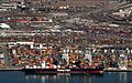
 09-port-of-oakland east-bay.jpg 4,052 × 2,840; 3.96 MB
-
 10-bay-bridge-east-span port-of-oakland east-bay.jpg 4,096 × 2,780; 4.19 MB
-
 11-bay-bridge treasure-island east-bay.jpg 4,044 × 2,860; 2.57 MB
-
 1984 Mother's Cookies - Oakland Coliseum.JPG 1,514 × 1,100; 463 KB
-

-

-

-

-

-
 Aerial of High Street Bridge and Tidal Canal from northwest.jpg 4,000 × 3,000; 4.73 MB
-
 Aerial view of Bay Farm Island Bridge in 2009.jpg 1,439 × 893; 430 KB
-
 Aerial view of city of Oakland 1.jpg 3,264 × 2,448; 6.37 MB
-
 Aerial view of city of Oakland 2.jpg 3,264 × 2,448; 6.19 MB
-
 Aerial view of Coliseum station complex (1), October 2020.JPG 4,285 × 3,072; 2.88 MB
-
 Aerial view of Coliseum station complex (2), October 2020.JPG 2,870 × 2,158; 1.36 MB
-
 Aerial view of Coliseum station complex (3), October 2020.JPG 2,725 × 2,047; 1.15 MB
-
 Aerial view of Downtown Oakland, December 2022.JPG 4,169 × 3,123; 7.68 MB
-
 Aerial view of East Oakland Yard and waterfront development, September 2022.JPG 5,184 × 3,888; 9.91 MB
-
 Aerial view of Eastmont Town Center, October 2020.JPG 3,945 × 2,963; 2.7 MB
-
 Aerial view of Government Island in Oakland, California.jpg 3,264 × 2,448; 6 MB
-
 Aerial view of High Street Bridge from northwest (2010).jpg 2,225 × 1,317; 1.18 MB
-
 Aerial view of I-880 in Oakland.jpg 4,288 × 2,848; 3.94 MB
-
 Aerial View of Knowland Park in Oakland California.jpg 1,670 × 850; 327 KB
-
 Aerial view of Lake Merritt and Laney College, September 2022.JPG 5,184 × 3,888; 10.32 MB
-
 Aerial view of Maxwell Park area, December 2018.JPG 5,184 × 3,888; 4.14 MB
-
 Aerial view of Merritt College, October 2020.JPG 2,846 × 1,903; 1.34 MB
-
 Aerial view of Oakland and Alameda, September 2019.JPG 5,004 × 3,400; 4.06 MB
-
 Aerial view of Oakland International Airport.jpg 4,288 × 2,848; 3.03 MB
-

-
 Aerial view of Uptown Oakland and Lakeside (1), September 2022.JPG 5,184 × 3,888; 10.64 MB
-
 Aerial view of Uptown Oakland and Lakeside (2), September 2022.JPG 5,184 × 3,888; 10.31 MB
-
 Aerial view of West Oakland rail yards, December 2022.JPG 5,056 × 3,252; 10.18 MB
-
 Alameda and Oakland.jpg 4,032 × 1,908; 2.59 MB
-
 Alameda Oakland Berkley Albany Aerial.jpg 3,600 × 2,400; 4.68 MB
-
 Bay Bridge double-deck transition early 1970s (21292845831).jpg 3,681 × 2,443; 4 MB
-
 Bay Bridge Toll Plaza (21315559111).jpg 3,696 × 2,474; 4.32 MB
-
 Bay Bridge Toll Plaza early 1970s (21292826331).jpg 3,685 × 2,443; 3.84 MB
-
 Bay Farm Island, Alameda Island and Oakland.jpg 4,032 × 1,908; 3.17 MB
-
 California - Oakland - NARA - 23934697.jpg 3,838 × 2,100; 1.86 MB
-
 California - Oakland - NARA - 23934699.jpg 3,544 × 2,776; 513 KB
-
 California - Oakland - NARA - 23934701.jpg 3,544 × 2,776; 656 KB
-
 California - Oakland - NARA - 23934713.jpg 1,847 × 1,408; 379 KB
-
 California - Oakland - NARA - 23934715.jpg 3,552 × 2,768; 952 KB
-
 California - Oakland - NARA - 23934717.jpg 3,552 × 2,768; 973 KB
-
 California - Oakland - NARA - 23934719.jpg 3,552 × 2,768; 906 KB
-
 California - Oakland - NARA - 23934721.jpg 3,552 × 2,768; 660 KB
-
 California - Oakland - NARA - 23934723.jpg 3,552 × 2,768; 952 KB
-
 California - Oakland - NARA - 23934725.jpg 3,552 × 2,768; 804 KB
-
 California - Oakland - NARA - 23934727.jpg 3,552 × 2,768; 1.02 MB
-
 California - Oakland - NARA - 23934729.jpg 3,552 × 2,768; 552 KB
-
 California - Oakland - NARA - 23934731.jpg 3,552 × 2,768; 529 KB
-
 California - Oakland - NARA - 23934733.jpg 3,552 × 2,768; 653 KB
-
 California - Oakland - NARA - 23934735.jpg 3,552 × 2,768; 964 KB
-
 California - Oakland - NARA - 23934737.jpg 3,552 × 2,768; 813 KB
-
 California - Oakland - NARA - 23934739.jpg 3,552 × 2,768; 957 KB
-
 California - Oakland - NARA - 23934741.jpg 3,552 × 2,768; 903 KB
-
 California - Oakland - NARA - 23934743.jpg 3,552 × 2,800; 817 KB
-
 California - Oakland - NARA - 23934745.jpg 3,552 × 2,800; 872 KB
-
 California - Oakland - NARA - 23934747.jpg 3,304 × 2,408; 567 KB
-
 California - Oakland - NARA - 23934749.jpg 3,304 × 2,408; 517 KB
-
 California - Oakland - NARA - 23934751.jpg 3,304 × 2,408; 543 KB
-
 California - Oakland - NARA - 23934753.jpg 3,304 × 2,408; 549 KB
-
 California - Oakland - NARA - 23934755.jpg 3,304 × 2,408; 664 KB
-
 California - Oakland - NARA - 23934757.jpg 3,304 × 2,408; 612 KB
-
 California - San Francisco - NARA - 23935611.jpg 4,350 × 3,382; 3.25 MB
-
 Closeup aerial view of Downtown Oakland and Lakeside Park.jpg 3,264 × 2,448; 5.55 MB
-
 Oakland Downtown and Tribune Tower (5073823667).jpg 1,332 × 929; 391 KB
-
 Downtown Oakland California.jpg 400 × 345; 52 KB
-
 FJ-1 Oakland NAR NAN3-51.jpg 878 × 635; 213 KB
-
 FJ-1 Oakland Naval Air Reserve.jpg 513 × 314; 68 KB
-
 Harbor, Port of Oakland, Coast Guard Island, Alameda (5673887758).jpg 1,536 × 1,024; 112 KB
-
 Harbor, Port of Oakland, Coast Guard Island, Alameda (5681677342).jpg 1,494 × 996; 146 KB
-
 High St Bridge aerial view - Alameda-Oakland, CA (2010).jpg 4,000 × 3,000; 4.44 MB
-
 High St Bridge aerial view 2010.jpg 2,467 × 1,673; 1.56 MB
-
 KeySystemMole.jpeg 1,340 × 487; 173 KB
-
 Lake Merritt and uptown Oakland aerial view, December 2017.JPG 3,552 × 2,376; 2.3 MB
-
 Lake Merritt Oakland aerial.jpg 2,356 × 1,604; 3.75 MB
-
 Naval Air Reserve FJ-1s over Oakland c1950.jpg 1,872 × 1,440; 216 KB
-
 Oak-knoll.jpg 942 × 739; 97 KB
-
 Oakland Alameda Estuary.png 3,240 × 2,160; 9.61 MB
-
 Oakland and Alameda.jpg 1,799 × 1,324; 490 KB
-
 Oakland by Sentinel-2, 2019-03-11.jpg 2,446 × 2,457; 7.67 MB
-
 Oakland California 20041129.jpg 700 × 344; 77 KB
-
 Oakland California aerial view.jpg 1,500 × 1,000; 884 KB
-
 Oakland Long Wharf aerial.jpg 3,961 × 3,066; 1.65 MB
-
 Oakland Naval S C 07808.JPG 2,560 × 1,920; 1.62 MB
-
 Oakland Skyline Aerial (49811531542).jpg 3,600 × 2,400; 3.54 MB
-
 Oakland-International-Airport-Aerial-2.jpg 4,704 × 2,646; 4.3 MB
-

-
 Port of Oakland.jpg 4,032 × 2,520; 3.38 MB
-
 Robert Kurrle aerial photo of Oakland CA 1913.jpg 1,748 × 1,233; 604 KB
-
 San Leandro Bay aerial from south.jpg 3,220 × 1,995; 2.01 MB
-
 SFOBBESREasterTouchdownBypass.jpg 414 × 293; 45 KB
-
 South-er East Bay, Oakland, Alameda (5673888382).jpg 1,536 × 1,024; 126 KB
-
 View southeast from Oakland Medical Center, March 2024.jpg 4,032 × 2,689; 5.21 MB


,_October_2020.JPG)
,_October_2020.JPG)
,_October_2020.JPG)


.jpg)


,_circa_in_1950_(NH_94198).jpg)
,_September_2022.JPG)
,_September_2022.JPG)


.jpg)
.jpg)


.jpg)


.jpg)
.jpg)
.jpg)


.jpg)


.jpg)

.jpg)