Category:Aerial photographs of Santa Clara County, California
Jump to navigation
Jump to search
Counties of California: Alameda · Contra Costa · Inyo · Los Angeles · Madera · Marin · Merced · Mono · Napa · Orange · Riverside · San Bernardino · San Diego · San Mateo · Santa Barbara · Santa Clara · Shasta · Siskiyou · Sonoma · Stanislaus · Ventura · Yolo · – Consolidated city-county: San Francisco
Subcategories
This category has the following 4 subcategories, out of 4 total.
A
- Aerial photographs of Apple Park (12 F)
S
- Aerial photographs of San Jose (19 F)
Media in category "Aerial photographs of Santa Clara County, California"
The following 25 files are in this category, out of 25 total.
-
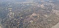
 Aerial photograph of Los Altos, CA 2.jpg 4,096 × 1,940; 3.74 MB
-
 Aerial photograph of Los Altos, CA.jpg 4,096 × 1,940; 3.74 MB
-
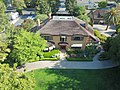 Aerial view of Ainsley House in Campbell, California.jpg 4,000 × 3,000; 4.64 MB
-
 Aerial view of Ames Unitary Plan Wind Tunnel complex.tif 1,187 × 931; 3.2 MB
-
 Aerial view of Campbell farmer's market.jpg 3,000 × 4,000; 4.58 MB
-
 Apple Campus 3.jpg 5,280 × 2,970; 10.5 MB
-
 Apple Infinite Loop Aerial.jpg 5,280 × 2,970; 12.45 MB
-
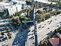
 CA-237 looking east near exit 5.jpg 4,000 × 3,000; 4.4 MB
-
 Calero Reservoir Aerial - South San Jose (49394873971).jpg 3,600 × 2,400; 3.42 MB
-
 Calero Reservoir aerial.jpg 1,512 × 1,018; 713 KB
-
 Calero Reservoir smoky aerial.jpg 3,024 × 4,032; 1.5 MB
-
 Campbell Park from the air looking South.jpg 4,000 × 3,000; 3.79 MB
-
 Campbell water tower, aerial view.jpg 3,000 × 4,000; 4.65 MB
-
 Cupertino-junction-280-and-85-Aerial-from-west-August-2014.jpg 3,264 × 1,840; 2.55 MB
-
 Google Moffett Place offices from the air.jpg 3,669 × 2,752; 2.2 MB
-
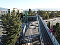 Hamilton Station from across the street.jpg 4,000 × 3,000; 4.6 MB
-
 Henry W. Coe State Park - Aerial (49394747016).jpg 3,600 × 2,400; 4.64 MB
-
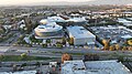
 Milpitas California Aerial (49811217406).jpg 3,600 × 2,400; 4.58 MB
-
 Nvidia campus aerial.jpg 825 × 1,025; 763 KB
-
 Pacheco Lake at Pacheco Pass Aerial (49395074612).jpg 3,600 × 2,400; 3.6 MB
-
 Pruneyard complex and CA-17 from the air.jpg 4,000 × 3,000; 2.75 MB
-
 Pruneyard towers and CA-17 from the air.jpg 3,874 × 2,906; 3.12 MB
-
 Sunnyvale Water Pollution Control Plant from the air.jpg 4,000 × 3,000; 5.36 MB
-
 Top down view of Ainsley House in Campbell, California.jpg 4,000 × 3,000; 5.03 MB
-
 Train pulling into Hamilton Station, aerial view.jpg 4,000 × 3,000; 4.78 MB


.jpg)


.jpg)
.jpg)

.jpg)


