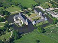
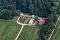
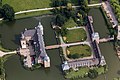
Category:Aerial photographs of Schloss Lembeck
Jump to navigation
Jump to search
| Object location | | View all coordinates using: OpenStreetMap |
|---|
Media in category "Aerial photographs of Schloss Lembeck"
The following 84 files are in this category, out of 84 total.
-
 20140720 105711 Schloss Lembeck, Dorsten (DSC04008).jpg 4,912 × 3,264; 4.37 MB
-
 20140720 105715 Schloss Lembeck, Dorsten (DSC04009).jpg 4,912 × 3,264; 4.75 MB
-
 20140720 105719 Schloss Lembeck, Dorsten (DSC04010).jpg 4,912 × 3,264; 4.68 MB
-
 20140720 105720 Schloss Lembeck, Dorsten (DSC04011).jpg 4,912 × 3,264; 4.34 MB
-
 20140720 105730 Schloss Lembeck, Dorsten (DSC04012).jpg 4,912 × 3,264; 4.52 MB
-
 20140720 105736 Schloss Lembeck, Dorsten (DSC04013).jpg 4,912 × 3,264; 4.61 MB
-
 20140720 105741 Schloss Lembeck, Dorsten (DSC04014).jpg 4,912 × 3,264; 5.12 MB
-
 20140720 105746 Schloss Lembeck, Dorsten (DSC04015).jpg 4,912 × 3,264; 4.75 MB
-
 20140720 105802 Schloss Lembeck, Dorsten (DSC04017).jpg 4,912 × 3,264; 4.82 MB
-
 20140720 105808 Schloss Lembeck, Dorsten (DSC04018).jpg 4,912 × 3,264; 4.87 MB
-
 20140720 105811 Schloss Lembeck, Dorsten (DSC04019).jpg 4,912 × 3,264; 4.96 MB
-
 20140720 105815 Schloss Lembeck, Dorsten (DSC04020).jpg 4,912 × 3,264; 4.79 MB
-
 20140720 105818 Schloss Lembeck, Dorsten (DSC04021).jpg 4,912 × 3,264; 4.7 MB
-
 20140720 105826 Schloss Lembeck, Dorsten (DSC04022).jpg 4,912 × 3,264; 4.59 MB
-
 20140720 105828 Schloss Lembeck, Dorsten (DSC04023).jpg 4,912 × 3,264; 4.65 MB
-
 20140720 105830 Schloss Lembeck, Dorsten (DSC04024).jpg 4,912 × 3,264; 4.61 MB
-
 20140720 105837 Schloss Lembeck, Dorsten (DSC04025).jpg 4,912 × 3,264; 4.56 MB
-
 20140720 105839 Schloss Lembeck, Dorsten (DSC04026).jpg 4,912 × 3,264; 4.57 MB
-
 20140720 105841 Schloss Lembeck, Dorsten (DSC04027).jpg 4,912 × 3,264; 4.68 MB
-
 20140720 105846 Schloss Lembeck, Dorsten (DSC04028).jpg 4,912 × 3,264; 4.62 MB
-
 20140720 105852 Schloss Lembeck, Dorsten (DSC04029).jpg 4,912 × 3,264; 4.52 MB
-
 20140720 105859 Schloss Lembeck, Dorsten (DSC04030).jpg 4,912 × 3,264; 4.78 MB
-
 20140720 105901 Schloss Lembeck, Dorsten (DSC04031).jpg 4,912 × 3,264; 4.64 MB
-
 20140720 105904 Schloss Lembeck, Dorsten (DSC04032).jpg 4,912 × 3,264; 4.39 MB
-
 20140720 105908 Schloss Lembeck, Dorsten (DSC04033).jpg 4,912 × 3,264; 4.73 MB
-
 20140720 105912 Schloss Lembeck, Dorsten (DSC04034).jpg 4,912 × 3,264; 5.07 MB
-
 20140720 105925 Schloss Lembeck, Dorsten (DSC04035).jpg 4,912 × 3,264; 5.03 MB
-
 20140720 105928 Schloss Lembeck, Dorsten (DSC04036).jpg 4,912 × 3,264; 4.74 MB
-
 20140720 105934 Schloss Lembeck, Dorsten (DSC04037).jpg 4,912 × 3,264; 4.78 MB
-
 20140720 105941 Schloss Lembeck, Dorsten (DSC04038).jpg 4,912 × 3,264; 4.78 MB
-
 20140720 105946 Schloss Lembeck, Dorsten (DSC04039).jpg 4,912 × 3,264; 5.03 MB
-
 20140720 105957 Schloss Lembeck, Dorsten (DSC04040).jpg 4,912 × 3,264; 5.11 MB
-
 20140720 110000 Schloss Lembeck, Dorsten (DSC04041).jpg 4,912 × 3,264; 4.7 MB
-
 20140720 110016 Schloss Lembeck, Dorsten (DSC04042).jpg 4,912 × 3,264; 5 MB
-
 20140720 110018 Schloss Lembeck, Dorsten (DSC04043).jpg 4,912 × 3,264; 5.2 MB
-
 20140720 110021 Schloss Lembeck, Dorsten (DSC04044).jpg 4,912 × 3,264; 4.93 MB
-
 20140720 110024 Schloss Lembeck, Dorsten (DSC04045).jpg 4,912 × 3,264; 5.02 MB
-
 20140720 110027 Schloss Lembeck, Dorsten (DSC04046).jpg 4,912 × 3,264; 5.17 MB
-
 20140720 110032 Schloss Lembeck, Dorsten (DSC04047).jpg 4,912 × 3,264; 5.02 MB
-
 20140720 110035 Schloss Lembeck, Dorsten (DSC04048).jpg 4,912 × 3,264; 5 MB
-
 20140720 110040 Schloss Lembeck, Dorsten (DSC04049).jpg 4,912 × 3,264; 5.37 MB
-
 20140720 110049 Schloss Lembeck, Dorsten (DSC04050).jpg 4,912 × 3,264; 4.94 MB
-
 20140720 110057 Schloss Lembeck, Dorsten (DSC04051).jpg 4,912 × 3,264; 4.75 MB
-
 20140720 110101 Schloss Lembeck, Dorsten (DSC04052).jpg 4,912 × 3,264; 4.97 MB
-
 20140720 110109 Schloss Lembeck, Dorsten (DSC04053).jpg 4,912 × 3,264; 4.89 MB
-
 20140720 110117 Schloss Lembeck, Dorsten (DSC04054).jpg 4,912 × 3,264; 5.2 MB
-
 20140720 110121 Schloss Lembeck, Dorsten (DSC04055).jpg 4,912 × 3,264; 5.25 MB
-
 20140720 110131 Schloss Lembeck, Dorsten (DSC04056).jpg 4,912 × 3,264; 4.9 MB
-
 20140720 110135 Schloss Lembeck, Dorsten (DSC04057).jpg 4,912 × 3,264; 4.47 MB
-
 20140720 110140 Schloss Lembeck, Dorsten (DSC04058).jpg 4,912 × 3,264; 4.75 MB
-
 20140720 110147 Schloss Lembeck, Dorsten (DSC04059).jpg 4,912 × 3,264; 4.73 MB
-
 20140720 110153 Schloss Lembeck, Dorsten (DSC04060).jpg 4,912 × 3,264; 4.63 MB
-
 20140720 110157 Schloss Lembeck, Dorsten (DSC04061).jpg 3,264 × 4,912; 4.3 MB
-
 20140720 110211 Schloss Lembeck, Dorsten (DSC04062).jpg 4,912 × 3,264; 5.05 MB
-
 20140720 110214 Schloss Lembeck, Dorsten (DSC04063).jpg 4,912 × 3,264; 4.72 MB
-
 20140720 110216 Schloss Lembeck, Dorsten (DSC04064).jpg 4,912 × 3,264; 4.88 MB
-
 20140720 110218 Schloss Lembeck, Dorsten (DSC04065).jpg 4,912 × 3,264; 5.04 MB
-
 Aerial image of Schloss Lembeck (view from the southwest).jpg 4,300 × 3,200; 6.48 MB
-
 Dorsten, Lembeck, Schloss Lembeck -- 2014 -- 0030.jpg 5,184 × 3,456; 11.08 MB
-
 Dorsten, Lembeck, Schloss Lembeck -- 2014 -- 0031.jpg 5,184 × 3,456; 12.11 MB
-
 Dorsten, Lembeck, Schloss Lembeck -- 2014 -- 1957 -- Ausschnitt.jpg 2,725 × 1,844; 3.22 MB
-
 Dorsten, Lembeck, Schloss Lembeck -- 2014 -- 1957.jpg 4,842 × 3,228; 10.48 MB
-
 Dorsten, Lembeck, Schloss Lembeck -- 2014 -- 1959.jpg 4,689 × 3,126; 9.81 MB
-
 Dorsten, Lembeck, Schloss Lembeck -- 2014 -- 1961.jpg 4,971 × 3,314; 9.73 MB
-
 Dorsten, Lembeck, Schloss Lembeck -- 2014 -- 1963.jpg 5,472 × 3,648; 13.31 MB
-
 Dorsten, Lembeck, Schloss Lembeck -- 2014 -- 1964.jpg 5,472 × 3,648; 13.52 MB
-
 Dorsten, Lembeck, Schloss Lembeck -- 2014 -- 1965.jpg 5,472 × 3,648; 13.31 MB
-
 Dorsten, Lembeck, Schloss Lembeck -- 2014 -- 1967.jpg 5,472 × 3,648; 12.05 MB
-
 Dorsten, Lembeck, Schloss Lembeck -- 2014 -- 1968.jpg 5,472 × 3,648; 14.79 MB
-
 Dorsten, Lembeck, Schloss Lembeck -- 2014 -- 1969.jpg 5,472 × 3,648; 13.05 MB
-
 Dorsten, Lembeck, Schloss Lembeck -- 2014 -- 1970.jpg 5,156 × 3,437; 10.84 MB
-
 Dorsten, Lembeck, Schloss Lembeck -- 2014 -- 1971.jpg 5,182 × 3,455; 12.32 MB
-
 Dorsten, Lembeck, Schloss Lembeck -- 2014 -- 1972.jpg 5,002 × 3,335; 12.58 MB
-
 Dorsten, Lembeck, Schloss Lembeck -- 2014 -- 1976.jpg 5,134 × 3,423; 13 MB
-
 Dorsten, Lembeck, Schloss Lembeck -- 2014 -- 1977.jpg 5,167 × 3,445; 11.95 MB
-
 Dorsten, Lembeck, Schloss Lembeck -- 2014 -- 1978.jpg 4,875 × 3,250; 10.76 MB
-
 Dorsten, Lembeck, Schloss Lembeck -- 2014 -- 1979.jpg 5,389 × 3,593; 12.84 MB
-
 Dorsten, Lembeck, Schloss Lembeck -- 2014 -- 1980.jpg 5,472 × 3,648; 14.15 MB
-
 Dorsten, Lembeck, Schloss Lembeck -- 2014 -- 1981.jpg 5,472 × 3,648; 13.15 MB
-
 Dorsten, Lembeck, Schloss Lembeck -- 2014 -- 1982.jpg 5,472 × 3,648; 13.53 MB
-
 Dorsten, Lembeck, Schloss Lembeck -- 2014 -- 1983.jpg 5,180 × 3,453; 11.23 MB
-
 Dorsten, Lembeck, Schloss Lembeck -- 2014 -- 1985.jpg 4,736 × 3,157; 9.09 MB
-
 Dorsten, Lembeck, Schloss Lembeck -- 2014 -- 1986.jpg 5,472 × 3,648; 13.28 MB
-
 Dorsten, Lembeck, Schloss Lembeck -- 2014 -- 1989.jpg 5,472 × 3,648; 11.65 MB
.jpg)
.jpg)
.jpg)
.jpg)
.jpg)
.jpg)
.jpg)
.jpg)
.jpg)
.jpg)
.jpg)
.jpg)
.jpg)
.jpg)
.jpg)
.jpg)
.jpg)
.jpg)
.jpg)
.jpg)
.jpg)
.jpg)
.jpg)
.jpg)
.jpg)
.jpg)
.jpg)
.jpg)
.jpg)
.jpg)
.jpg)
.jpg)
.jpg)
.jpg)
.jpg)
.jpg)
.jpg)
.jpg)
.jpg)
.jpg)
.jpg)
.jpg)
.jpg)
.jpg)
.jpg)
.jpg)
.jpg)
.jpg)
.jpg)
.jpg)
.jpg)
.jpg)
.jpg)
.jpg)
.jpg)
.jpg)
.jpg)
.jpg)


