Category:Aerial photographs of Zwijndrecht, Netherlands
Jump to navigation
Jump to search
Media in category "Aerial photographs of Zwijndrecht, Netherlands"
The following 6 files are in this category, out of 6 total.
-
 Brug in A16 tussen Zwijndrecht en Dordrecht - luchtfoto.jpg 2,581 × 1,890; 387 KB
-
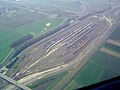 Classification yard Kijfhoek 01.jpg 1,280 × 960; 469 KB
-
 Dordrecht 20040313.jpg 2,202 × 1,383; 1.38 MB
-
 Drechttunnel - Dordrecht 20040313.jpg 1,422 × 477; 155 KB
-
 Luchtfoto buizenopslag van leeuwen.jpg 1,300 × 1,038; 295 KB
-
 Waterbushalte Zwijndrecht Veerplein luchtfoto.jpg 3,924 × 2,616; 2.65 MB


