Category:Aerial photographs of airports in Kansas
Jump to navigation
Jump to search
States of the United States: Alabama · Alaska · Arizona · Arkansas · California · Colorado · Connecticut · Delaware · Florida · Georgia · Hawaii · Idaho · Illinois · Indiana · Iowa · Kansas · Kentucky · Louisiana · Maine · Maryland · Massachusetts · Michigan · Minnesota · Mississippi · Missouri · Montana · Nebraska · Nevada · New Hampshire · New Jersey · New Mexico · New York · North Carolina · North Dakota · Ohio · Oklahoma · Oregon · Pennsylvania · Rhode Island · South Carolina · South Dakota · Tennessee · Texas · Utah · Vermont · Virginia · Washington · West Virginia · Wisconsin · Wyoming
Puerto Rico
Puerto Rico
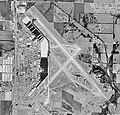
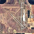
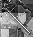
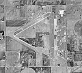
English: Aerial photographs of airports in the state of Kansas, United States
Media in category "Aerial photographs of airports in Kansas"
The following 40 files are in this category, out of 40 total.
-
1943 Topeka Army Airfield Kansas.jpg 723 × 448; 88 KB
-
Atkinson Municipal Airport-KS-30Sep1991-USGS.jpg 367 × 464; 54 KB
-
Coffeevilleaaf-10071991.jpg 400 × 400; 52 KB
-
Coffeyville Army Airfield KS 10 Oct 1943.jpg 776 × 471; 86 KB
-
Coffeyville Municipal Airport KS 2006 USGS.jpg 731 × 760; 205 KB
-
Dodge City Army Airfield KS 2006 USGS.jpg 899 × 647; 186 KB
-
Dodgecityaaf-29091991.jpg 400 × 401; 56 KB
-
Fairfax Army Airfield KS 2006 USGS.jpg 918 × 727; 252 KB
-
FLV SHERMAN AAF AIRPORT FLIGHT CDG-IAH 777 F-GSQM (10316274616).jpg 2,016 × 1,343; 1.96 MB
-
Forbes Field Air National Guard Base KS 2006 USGS.jpg 1,383 × 1,217; 568 KB
-
Forbesafb-02242002.jpg 400 × 383; 54 KB
-
Garden City Regional Airport KS 2006 USGS.jpg 780 × 764; 190 KB
-
Gardencityaaf-09081991.jpg 400 × 324; 47 KB
-
Goodland Municipal Airport-KS-28Aug1991-USGS.jpg 803 × 908; 178 KB
-
Great Bend Municipal Airport KS 2006 USGS.jpg 955 × 917; 257 KB
-
Greatbendaaf-03292002.jpg 400 × 357; 42 KB
-
Herington Regional Airport KS 2006 USGS.jpg 844 × 841; 259 KB
-
Heringtonaaf-10021991.jpg 400 × 383; 47 KB
-
Hutchinson Air Force Station - Kansas - 1 October 1991.jpg 764 × 706; 152 KB
-
IDP INDEPENDENCE MUNICIPAL AIRPORT FLIGHT CDG-IAH 777 F-GSQM (10350659285).jpg 1,941 × 1,293; 1.84 MB
-
Independence Municipal Airport KS 2006 USGS.jpg 769 × 796; 216 KB
-
Independenceaaf-9301991.jpg 594 × 528; 75 KB
-
Liberal Mid-America Regional Airport KS 2006 USGS.jpg 939 × 650; 222 KB
-
Liberalaaf-09081991.jpg 411 × 310; 53 KB
-
Marshall Army Airfield KS 2006 USGS.jpg 822 × 855; 262 KB
-
Marshallaaf-16oct1991.jpg 480 × 518; 84 KB
-
McConnel AFB KS - 20 Mar 1996.jpg 565 × 616; 124 KB
-
Osage City Kansas Municipal Airport, Osage Kansas 09-04-2013.JPG 4,928 × 3,264; 4.53 MB
-
OWI OTTAWA MUNICIPAL AIRPORT FROM FLIGHT CDG-IAH 777 F-GSQM (10351698273).jpg 2,732 × 1,820; 3.32 MB
-
Pratt Regional Airport KS 2006 USGS.jpg 896 × 848; 236 KB
-
Schilling Air Force Base - Kansas.jpg 757 × 741; 238 KB
-
Sherman Army Airfield KS 2006 USGS.jpg 844 × 846; 299 KB
-
Shermanaaf-03271997.jpg 400 × 413; 58 KB
-
Smokyhillaaf-08171991.jpg 1,000 × 1,300; 268 KB
-
Strother Field aerial view.JPG 5,184 × 3,456; 2.5 MB
-
Strother Field KS 2006 USGS.jpg 705 × 685; 197 KB
-
Strotheraa-may76-usgs.jpg 700 × 558; 105 KB
-
Strotheraaf-03201996.jpg 400 × 361; 46 KB
-
Walker Army Airfield KS 2006 USGS.jpg 928 × 941; 262 KB
-
Walkeraaf-08151991.jpg 390 × 440; 50 KB


