Category:Aerial photographs of bays in Canada
Jump to navigation
Jump to search
Countries of North America: Canada
Subcategories
This category has the following 3 subcategories, out of 3 total.
A
- Aerial photographs of Hudson Bay (12 F)
G
Media in category "Aerial photographs of bays in Canada"
The following 14 files are in this category, out of 14 total.
-
 Aerial view of Bonnet Island while flying over Hay Bay - panoramio.jpg 1,600 × 1,200; 353 KB
-
 Aerial View Red Lake 1936.jpg 1,280 × 853; 1.15 MB
-
 Bruce Mines ON 2.JPG 2,000 × 1,333; 908 KB
-
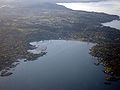 Cadborobay2.jpg 900 × 675; 172 KB
-
 Hastings County Archives 2017-85-10 (37173775212).jpg 2,053 × 1,370; 209 KB
-
 Islands of the Bay of Exploits, Newfoundland.jpg 3,648 × 2,736; 2.36 MB
-
 ISS059-E-113948 - View of the Province of Quebec.jpg 5,568 × 3,712; 2.09 MB
-
 La Malbaie vue du ciel.jpg 3,124 × 2,754; 2.31 MB
-
 Looking toward English Bay from Pacific Spirit Park, BC.jpg 3,784 × 2,049; 2.77 MB
-
 Nain Bay, Tasisuak Lake and Cape Toski in mid-winter Canada - panoramio.jpg 3,264 × 2,448; 1.7 MB
-
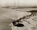 Shore of Barrie in 1935.jpg 1,920 × 1,545; 751 KB
-
 Storm bay bc can(1).png 1,920 × 1,080; 1.37 MB
-
 Tatamagouche Aerial.jpg 800 × 551; 90 KB
-
 Victoria Island - panoramio (7).jpg 3,664 × 2,748; 2.55 MB


.jpg)


.png)

.jpg)