Category:Aerial photographs of construction sites in Canada
Jump to navigation
Jump to search
Media in category "Aerial photographs of construction sites in Canada"
The following 17 files are in this category, out of 17 total.
-

-
 Brightwater new development 2021.jpg 4,000 × 3,000; 8.25 MB
-
 Clifton Road Extension.png 498 × 406; 233 KB
-
 Fort mcmurray (5743874131).jpg 4,288 × 3,216; 1.84 MB
-
 Fort mcmurray 2011 (5743864187).jpg 4,288 × 3,216; 1.73 MB
-
 Fort mcmurray 2011 (5744414972).jpg 4,288 × 3,216; 2.23 MB
-
 Hastings County Archives 2017-85-06 (37203467741).jpg 1,973 × 1,376; 194 KB
-
 Highway 17 Michipicoten, 1959.jpg 500 × 449; 60 KB
-
 Highway 427 Construction colourised.png 478 × 362; 359 KB
-
 Highway 427 Construction.png 478 × 362; 508 KB
-
 King George Hub (20230507 150235).jpg 4,000 × 2,250; 3.86 MB
-
 King George Hub (20230507 150318).jpg 4,000 × 2,250; 3.99 MB
-
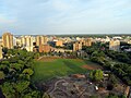 Kinsmen Park Ball Diamonds (16367628145).jpg 4,000 × 3,000; 4.75 MB
-
 Kinsmen Park Construction (16367609485).jpg 3,264 × 2,448; 3.7 MB
-
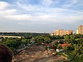
 Ontario Highway 407 Construction at Harmony Road.JPG 3,264 × 2,448; 1.2 MB
-
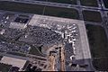 Ottawa Airport overview.jpg 1,023 × 682; 250 KB
-
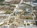
 Sea Island Way and Garden City Road Aerial - Richmond (50729695507).jpg 3,600 × 2,400; 3.98 MB
.jpg)


.jpg)
.jpg)
.jpg)
.jpg)


.jpg)
.jpg)
.jpg)
.jpg)


.jpg)