Category:Aerial photographs of the Cyclades
Jump to navigation
Jump to search
Subcategories
This category has the following 15 subcategories, out of 15 total.
- Aerial photographs of Andros (1 F)
- Aerial photographs of Milos (51 F)
- Aerial photographs of Naxos (6 F)
- Aerial photographs of Paros (2 F)
- Aerial photographs of Santorini (40 F)
- Aerial photographs of Sifnos (2 F)
- Aerial photographs of Syros (2 F)
- Aerial photographs of Tinos (1 F)
!
- Aerial photographs of Delos (3 F)
Media in category "Aerial photographs of the Cyclades"
The following 13 files are in this category, out of 13 total.
-
 Amorgos Island - Αμοργός - panoramio.jpg 4,320 × 2,432; 1.76 MB
-
 Cyclades-sat-blank.png 727 × 850; 344 KB
-
 Cícladas 1.jpg 4,136 × 2,712; 9.09 MB
-
 Cícladas 2.jpg 4,288 × 2,848; 9.4 MB
-
 ISS-40 Ionian Sea, Crete, Cyclades and Greece's land mass.jpg 4,256 × 2,832; 811 KB
-
 ISS009-E-15405-Kea-Makronisos-N-at-top.jpg 1,153 × 1,581; 465 KB
-
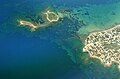
 Corissia port, Kea island airview.JPG 2,748 × 3,664; 2.43 MB
-
 ISS009-E-15405-Kea-Makronisi.jpg 358 × 258; 10 KB
-
 ISS009-E-15405-Kea-Makronisos-britannic.JPG 1,581 × 1,153; 105 KB
-
 ISS009-E-15405-Kea-Makronisos.JPG 1,581 × 1,153; 375 KB
-
 Kea by Sentinel-2 Cloudless.jpg 1,669 × 1,737; 326 KB
-
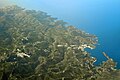
 Piperi Kithnou from SW.JPG 3,664 × 2,748; 2.14 MB
-
 Satellite image of Cyclades in March 2003.jpg 885 × 786; 99 KB


