Category:Aerial photographs of the Galápagos Islands
Jump to navigation
Jump to search
Subcategories
This category has the following 3 subcategories, out of 3 total.
Media in category "Aerial photographs of the Galápagos Islands"
The following 31 files are in this category, out of 31 total.
-
 Aerial photograph Galápagos Islands 002.JPG 4,608 × 3,456; 4.09 MB
-
 Aerial photograph Galápagos Islands 002a.JPG 4,608 × 3,456; 4 MB
-
 Aerial photograph Galápagos Islands 01.JPG 4,608 × 3,456; 4.11 MB
-
 Aerial photograph Galápagos Islands 02a.JPG 4,608 × 3,456; 3.3 MB
-
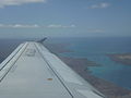
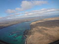
 Aerial photograph Itabaca Channel, to the right Santa Cruz Island is on the left.JPG 4,608 × 3,456; 3.13 MB
-
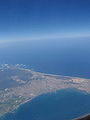
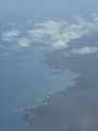
 Aerial photograph over the Galápagos Islands.JPG 4,608 × 3,456; 2.16 MB
-
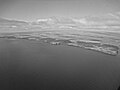
 Aerial photograph, Galápagos Black and white.JPG 4,608 × 3,456; 3.87 MB
-
 Aerial photograph, Galápagos Ecuador 01a.JPG 4,608 × 3,456; 2.96 MB
-
 Aerial photograph, Galápagos Ecuador.JPG 4,608 × 3,456; 3.04 MB
-
 Alvaro Sevilla Design Isla Santa Cruz Galapagos foto tomada desde el avión.jpg 4,000 × 3,000; 3.91 MB
-
-
 An Aerial photograph, Baltra Island, a small island of the Galápagos Islands.JPG 4,608 × 3,456; 3.72 MB
-

-
 Arribo a San Cristóbal (46231006642).jpg 1,836 × 1,116; 1.1 MB
-
 Baltra Island Aerial photograph,a small island in the Galápagos.JPG 4,608 × 3,456; 3.61 MB
-
 Baltra Island Aerial photograph.JPG 4,608 × 3,456; 3.92 MB
-
 Baltra Island.jpg 2,736 × 3,648; 2.17 MB
-
 Black and white Aerial photograph, Galápagos.JPG 4,608 × 3,456; 3.67 MB
-
 Daphne Major.png 4,282 × 2,848; 19.21 MB
-
 Galápagos Inseln, Ecuador (13899318252).jpg 3,448 × 4,592; 1.9 MB
-
 Galápagos Islands Aerial photograph.JPG 4,608 × 3,456; 3.06 MB
-
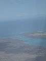
 Galápagos Islands, Aerial photograph.JPG 4,608 × 3,456; 2.51 MB
-
-
 Isla Santa Cruz Galápagos foto tomada desde el avión Alvaro Sevilla Design.JPG 3,000 × 4,000; 3.6 MB
-
 Isla Seymour Norte, islas Galápagos, Ecuador, 2015-07-23, DD 01.JPG 4,246 × 2,291; 7.45 MB
-
 Islands of the Galápagos Islands.JPG 4,608 × 3,456; 2.15 MB
-
 Islas Baltra y Santa Cruz, islas Galápagos, Ecuador, 2015-07-26, DD 89.JPG 7,125 × 4,750; 10.01 MB
-
 Itabaca channel between Baltra Island on the right and Santa Cruz on the left.JPG 4,608 × 3,456; 3.13 MB
-
 LaCumbre Fernandina 1968.jpg 640 × 424; 25 KB
-
 The Itabaca channel between Baltra Island on the right and Santa Cruz on the left.JPG 4,608 × 3,456; 3.12 MB
-
 US Army Airfield on Baltra.jpg 850 × 567; 57 KB


_and_Major_(16492022288).jpg)
.jpg)


.jpg)


