Category:Aerial views of Cape Cod
Jump to navigation
Jump to search
Subcategories
This category has the following 2 subcategories, out of 2 total.
S
- Satellite pictures of Cape Cod (288 F)
Media in category "Aerial views of Cape Cod"
The following 45 files are in this category, out of 45 total.
-
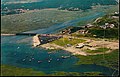
 Aerial view of Allen Harbor.jpg 8,256 × 5,461; 3.23 MB
-
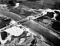
 Aerial view of Bourne village and highway bridge, 1925.png 4,229 × 3,384; 20.44 MB
-
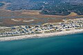 Aerial view of North Shore Boulevard along East Sandwich Beach, 1982.jpg 8,213 × 5,482; 3.16 MB
-
 Cape Cod Canal Railroad Bridge 1975 postcard.jpg 1,552 × 1,011; 426 KB
-

-
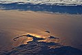 Cape Cod ISS026-E-34517.JPG 4,248 × 2,832; 1.6 MB
-
 Cuttyariel-291x225.jpg 291 × 225; 11 KB
-
 DJI 20151011 0005-2 (21483566524).jpg 2,048 × 1,421; 2.08 MB
-
 EC-121 Warning Star over the Cape Cod Canal.jpg 891 × 591; 39 KB
-
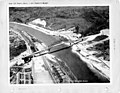
 Massachusetts - Cape Cod Canal - NARA - 23941257 (cropped).jpg 3,567 × 2,730; 2.88 MB
-
 Massachusetts - Cape Cod Canal - NARA - 23941257.jpg 4,385 × 3,382; 3.33 MB
-
 Massachusetts - Cape Cod Canal - NARA - 23941259 (cropped).jpg 3,577 × 2,749; 2.97 MB
-
 Massachusetts - Cape Cod Canal - NARA - 23941259.jpg 4,385 × 3,382; 3.59 MB
-
 Massachusetts - Cape Cod Canal through Lexington - NARA - 23941285.jpg 4,385 × 3,382; 1.92 MB
-
 Pamet River 1960s aerial postcard.jpg 3,328 × 2,148; 2.24 MB
-
 Phinney's Point 1950s aerial postcard.jpg 1,530 × 998; 308 KB
-
 Pocasset north shore 1950s aerial postcard.jpg 1,347 × 852; 249 KB
-
 RB-Pkg3-002 (49716856652).jpg 8,191 × 5,439; 3.5 MB
-
 RB-Pkg3-005 (49716855962).jpg 8,213 × 5,440; 3.64 MB
-
 RB-Pkg3-006 (49716001058).jpg 8,234 × 5,440; 3.48 MB
-
 RB-Pkg3-007 (49716000768).jpg 8,170 × 5,461; 3.38 MB
-
 RB-Pkg3-008 (49716540966).jpg 8,234 × 5,461; 3.86 MB
-
 RB-Pkg3-010 (49715999968).jpg 8,191 × 5,418; 3.37 MB
-
 RB-Pkg3-012 (49715999408).jpg 8,170 × 5,439; 3.37 MB
-
 RB-Pkg3-013 (49715999098).jpg 8,170 × 5,439; 2.55 MB
-
 RB-Pkg3-014 (49716853617).jpg 8,191 × 5,141; 2.16 MB
-
 RB-Pkg3-019 (49716537991).jpg 8,149 × 5,439; 3.5 MB
-
 RB-Pkg3-020 (49715997098).jpg 8,170 × 5,440; 3.46 MB
-
 Sagamore Bridge aerial postcard.jpg 1,578 × 1,020; 275 KB
-
 Wellfleet Elementary School.jpg 4,000 × 2,459; 4.54 MB
-
 Wingard 000022 157443 497651 4578 (36169329722).jpg 1,920 × 1,280; 2.68 MB
-
 Wingard 000023 157444 497652 4578 (36293684456).jpg 1,920 × 1,280; 2.62 MB
-
 Wingard 000024 157445 497655 4578 (36169328922).jpg 1,920 × 820; 809 KB
-
 Wingard 000025 157446 497657 4578 (36293683706).jpg 1,920 × 1,280; 2.61 MB
-
 Wingard 000026 157447 497659 4578 (36169328622).jpg 1,920 × 1,280; 2.61 MB
-
 Wingard 000027 157448 497660 4578 (36293688136).jpg 1,920 × 1,280; 2.68 MB
-
 Wingard 000091 157436 497633 4578 (35502215744).jpg 1,920 × 1,080; 853 KB
-
 Wingard 000092 157437 497636 4578 (36201427531).jpg 1,920 × 1,080; 1.06 MB
-
 Wingard 000093 157438 497638 4578 (36293689236).jpg 1,920 × 1,080; 1.05 MB
-
 Wingard 000094 157439 497639 4578 (36201427211).jpg 1,920 × 1,080; 941 KB
-
 Wingard 000095 157440 497641 4578 (36293689106).jpg 1,920 × 1,080; 953 KB
-
 Wingard 000096 157441 497643 4578 (36293688886).jpg 1,920 × 1,080; 1.06 MB
-
 Wingard 000097 157442 497648 4578 (35502215414).jpg 1,920 × 1,080; 1.13 MB
-
 Woods Hole 1950s aerial postcard.jpg 1,600 × 1,014; 682 KB
-
 Woods Hole Oceanographic Institution and ferry terminal aerial postcard.jpg 1,496 × 954; 208 KB


.jpg)

.jpg)

.jpg)


.jpg)
.jpg)
.jpg)
.jpg)
.jpg)
.jpg)
.jpg)
.jpg)
.jpg)
.jpg)
.jpg)


.jpg)
.jpg)
.jpg)
.jpg)
.jpg)
.jpg)
.jpg)
.jpg)
.jpg)
.jpg)
.jpg)
.jpg)
.jpg)

