Category:Aike
Jump to navigation
Jump to search
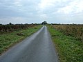
English: Aike is a village in the East Riding of Yorkshire, England. It is situated approximately 4 miles (6.4 km) north of Beverley town centre and lies to the west of the River Hull. It is approached by a 2.5 miles (4 km) no through road off the A164 road.
village in United Kingdom .jpg) | |||||
| Upload media | |||||
| Pronunciation audio | |||||
|---|---|---|---|---|---|
| Instance of | |||||
| Location | Lockington, East Riding of Yorkshire, Yorkshire and the Humber, England | ||||
 | |||||
Media in category "Aike"
The following 38 files are in this category, out of 38 total.
-
 Aike - geograph.org.uk - 1497186.jpg 640 × 480; 59 KB
-
 Aike East Riding of Yorkshire.jpg 1,600 × 1,200; 358 KB
-
 Aike Grange Stud.jpg 640 × 480; 95 KB
-
 Aike Lane - geograph.org.uk - 1497180.jpg 640 × 480; 61 KB
-
 Aike Lane, Aike - geograph.org.uk - 1193306.jpg 640 × 386; 225 KB
-
 Aike Lane, Aike - geograph.org.uk - 1540648.jpg 427 × 640; 163 KB
-
 Aike Plantation - geograph.org.uk - 249283.jpg 640 × 409; 78 KB
-
 Aike village street.jpg 4,000 × 3,000; 3 MB
-

-
 Aike, East Riding of Yorkshire, England (August 2005).jpg 640 × 480; 103 KB
-
 Barff Hill Farm - geograph.org.uk - 1497176.jpg 640 × 480; 57 KB
-
 Barff Hill Farm - geograph.org.uk - 1516581.jpg 640 × 427; 403 KB
-
 Barff Hill Farm and Trig Pillar - geograph.org.uk - 46014.jpg 640 × 480; 135 KB
-
 Beverley and Barmston Drain - geograph.org.uk - 1497191.jpg 640 × 480; 71 KB
-
 Beverley and Barmston Drain - geograph.org.uk - 1541357.jpg 640 × 429; 171 KB
-
 Beverley and Barmston Drain - geograph.org.uk - 1541372.jpg 640 × 427; 211 KB
-
 Beverley and Barmston Drain at Aike - geograph.org.uk - 1194161.jpg 640 × 451; 198 KB
-
 Beverley and Barmston Drain at Aike - geograph.org.uk - 249291.jpg 640 × 482; 125 KB
-
 Boat House - River Hull - geograph.org.uk - 46070.jpg 640 × 480; 80 KB
-
 Bridleway to Aike - geograph.org.uk - 1497193.jpg 640 × 480; 77 KB
-
 Bridleway to Aike - geograph.org.uk - 1541346.jpg 640 × 427; 239 KB
-
 Bridleway, Aike - geograph.org.uk - 1497189.jpg 640 × 480; 66 KB
-
 Entrance to Aike Grange Stud - geograph.org.uk - 1497183.jpg 640 × 480; 75 KB
-
 Footpath signpost near Aike - geograph.org.uk - 1194162.jpg 475 × 640; 203 KB
-
 Grazing land south east of Aike - geograph.org.uk - 1194160.jpg 426 × 640; 213 KB
-
 Laurel Farm Aike.jpg 640 × 480; 88 KB
-
 Looking towards Aike.jpg 800 × 600; 264 KB
-
 North east of Aike - geograph.org.uk - 1194155.jpg 640 × 426; 216 KB
-
 Pond at Aike - geograph.org.uk - 249300.jpg 640 × 430; 122 KB
-
 River Hull at Linley Hill - geograph.org.uk - 1194151.jpg 640 × 462; 218 KB
-
 Road to Barffhill Causeway - geograph.org.uk - 1516586.jpg 640 × 427; 372 KB
-
 Stables, Aike - geograph.org.uk - 1497190.jpg 640 × 480; 64 KB
-
 The entrance to New Farm, Aike - geograph.org.uk - 1540646.jpg 640 × 427; 143 KB
-
 The Grange, Aike - geograph.org.uk - 1193298.jpg 640 × 401; 187 KB
-
 The River Hull near Aike - geograph.org.uk - 1497196.jpg 640 × 480; 83 KB
-
 The road to Aike - geograph.org.uk - 1425716.jpg 640 × 480; 47 KB
-
 Towards Aike Whin - geograph.org.uk - 1516577.jpg 640 × 427; 381 KB
-
 Weathervane Aike.jpg 4,000 × 3,000; 2.03 MB


