Category:Aldeburgh
Jump to navigation
Jump to search

town in the English county of Suffolk  | |||||
| Upload media | |||||
| Instance of | |||||
|---|---|---|---|---|---|
| Location | East Suffolk, Suffolk, East of England, England | ||||
| Located in or next to body of water | |||||
| Population |
| ||||
 | |||||
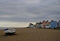
English: Aldeburgh is a coastal town in Suffolk, East Anglia, England. Located on the River Alde, the town is notable for its Blue Flag shingle beach and fisherman huts where freshly caught fish are sold daily, and the Aldeburgh Yacht Club.
Subcategories
This category has the following 12 subcategories, out of 12 total.
Media in category "Aldeburgh"
The following 200 files are in this category, out of 698 total.
(previous page) (next page)-
 "Two Belles" - dilapidated boat on Aldeburgh beach - geograph.org.uk - 5898274.jpg 4,939 × 3,736; 3.49 MB
-
 1929 Nash 442 Cabriolet - geograph.org.uk - 6154867.jpg 2,592 × 1,936; 2.15 MB
-
 A1094 Aldeburgh Road - geograph.org.uk - 2520683.jpg 3,072 × 2,304; 1.17 MB
-
 A1094 approaches junction with Fairfield Road - geograph.org.uk - 3566806.jpg 3,437 × 2,667; 1.07 MB
-
 A1094 at Hazlewood - geograph.org.uk - 4361972.jpg 1,024 × 768; 342 KB
-
 A1094 passes entrance to Hazelwood House - geograph.org.uk - 3566789.jpg 3,368 × 2,492; 1.69 MB
-
 Access track serving houses off the B1122 - geograph.org.uk - 5545190.jpg 1,600 × 1,064; 472 KB
-
 Aldeburgh (347824185).jpg 2,048 × 1,532; 435 KB
-
 Aldeburgh - 2013 - geograph.org.uk - 4078689.jpg 3,648 × 2,736; 1.58 MB
-
 Aldeburgh - 2013 - geograph.org.uk - 4078861.jpg 3,648 × 2,736; 1.55 MB
-
 Aldeburgh - 2013 - geograph.org.uk - 4079111.jpg 3,648 × 2,736; 1.98 MB
-
 Aldeburgh - 2013 - geograph.org.uk - 4079138.jpg 3,648 × 2,736; 3.97 MB
-
 Aldeburgh - 2013 - geograph.org.uk - 4079144.jpg 3,648 × 2,736; 1.59 MB
-
 Aldeburgh - 2013 - geograph.org.uk - 4079152.jpg 3,648 × 2,736; 3.97 MB
-
 Aldeburgh - 2013 - geograph.org.uk - 4079745.jpg 3,648 × 2,736; 3.7 MB
-
 Aldeburgh - 2013 - geograph.org.uk - 4079746.jpg 3,648 × 2,736; 3.61 MB
-
 Aldeburgh - 2013 - geograph.org.uk - 4079747.jpg 3,648 × 2,736; 3.72 MB
-
 Aldeburgh - 2013 - geograph.org.uk - 4079749.jpg 3,648 × 2,736; 3.94 MB
-
 Aldeburgh - 2013 - geograph.org.uk - 4079750.jpg 3,648 × 2,736; 4.19 MB
-
 Aldeburgh - 2013 - geograph.org.uk - 4079751.jpg 3,648 × 2,736; 4.09 MB
-
 Aldeburgh - 2013 - geograph.org.uk - 4079753.jpg 3,648 × 2,736; 3.86 MB
-
 Aldeburgh - 2013 - geograph.org.uk - 4079771.jpg 2,736 × 3,648; 1.19 MB
-
 Aldeburgh - 2013 - geograph.org.uk - 4079774.jpg 3,648 × 2,736; 3.58 MB
-
 Aldeburgh - 2013 - geograph.org.uk - 4079779.jpg 3,648 × 2,736; 3.41 MB
-
 Aldeburgh - 2013 - geograph.org.uk - 4079782.jpg 3,648 × 2,736; 3.78 MB
-
 Aldeburgh - 2013 - geograph.org.uk - 4079785.jpg 3,648 × 2,736; 3.62 MB
-
 Aldeburgh - 2013 - geograph.org.uk - 4079786.jpg 3,648 × 2,736; 3.78 MB
-
 Aldeburgh - 2013 - geograph.org.uk - 4079819.jpg 3,648 × 2,736; 3.97 MB
-
 Aldeburgh - 2013 - geograph.org.uk - 4079820.jpg 3,648 × 2,736; 3.53 MB
-
 Aldeburgh - 2013 - geograph.org.uk - 4079822.jpg 3,648 × 2,736; 4.15 MB
-
 Aldeburgh - 2013 - geograph.org.uk - 4079824.jpg 3,648 × 2,736; 1.14 MB
-
 Aldeburgh - fishermen's huts - geograph.org.uk - 4237419.jpg 640 × 480; 84 KB
-
 Aldeburgh - fishing industry - geograph.org.uk - 4193703.jpg 640 × 480; 76 KB
-
 Aldeburgh - geograph.org.uk - 3594145.jpg 640 × 481; 330 KB
-
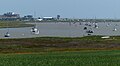
 Aldeburgh A race in progress (177034199).jpg 2,048 × 1,532; 239 KB
-
 Aldeburgh Anchors (347825680).jpg 2,048 × 1,532; 418 KB
-
 Aldeburgh and the River Alde - geograph.org.uk - 5918619.jpg 5,472 × 3,648; 2.38 MB
-
 Aldeburgh at sunset - geograph.org.uk - 3392125.jpg 640 × 480; 88 KB
-
 Aldeburgh beach - geograph.org.uk - 5545277.jpg 1,600 × 899; 212 KB
-
 Aldeburgh beach - geograph.org.uk - 5577963.jpg 1,600 × 1,099; 241 KB
-
 Aldeburgh Beach - geograph.org.uk - 5914276.jpg 5,472 × 3,648; 6.13 MB
-
 Aldeburgh beach - geograph.org.uk - 6103572.jpg 3,648 × 2,432; 2.33 MB
-
 Aldeburgh beach - geograph.org.uk - 6205479.jpg 1,024 × 683; 238 KB
-
 Aldeburgh beach - geograph.org.uk - 6205485.jpg 1,024 × 683; 213 KB
-
 Aldeburgh Beach Shelter - geograph.org.uk - 4132648.jpg 1,600 × 1,067; 369 KB
-
 Aldeburgh Beach South Lookout - geograph.org.uk - 3562174.jpg 640 × 425; 121 KB
-
 Aldeburgh Beach Suffolk The South Lookout - geograph.org.uk - 5465882.jpg 3,888 × 5,184; 3.48 MB
-
 Aldeburgh Beach Suffolk The South Lookout - geograph.org.uk - 5465886.jpg 2,811 × 3,347; 2.09 MB
-
 Aldeburgh Beach, Boat ^ Bulldozer - geograph.org.uk - 3997894.jpg 3,648 × 2,736; 3.2 MB
-
 Aldeburgh beach, Christmas Day 2018 - geograph.org.uk - 6012988.jpg 899 × 1,600; 204 KB
-
 Aldeburgh Beach, Fishing Tackle ^ Bait Shop - geograph.org.uk - 3997878.jpg 3,648 × 2,736; 3.15 MB
-
 Aldeburgh Boatyard after the fire - geograph.org.uk - 1884882.jpg 2,048 × 1,536; 599 KB
-
 Aldeburgh buildings (10) (geograph 6730258).jpg 4,207 × 3,155; 2.21 MB
-
 Aldeburgh buildings (2) (geograph 6729431).jpg 3,155 × 4,207; 2.03 MB
-
 Aldeburgh Co-op foodstore - geograph.org.uk - 2676357.jpg 2,848 × 2,144; 1.48 MB
-
 Aldeburgh Festival 2011 - 2.jpg 3,456 × 5,184; 3.28 MB
-
 Aldeburgh Festival 2011.jpg 3,456 × 5,184; 3.46 MB
-
 Aldeburgh Fish ^ Chip Shop - geograph.org.uk - 3562192.jpg 640 × 425; 142 KB
-
 Aldeburgh Fresh Fish Company - geograph.org.uk - 979263.jpg 640 × 480; 81 KB
-
 Aldeburgh Fresh Fish Company - geograph.org.uk - 979268.jpg 640 × 480; 72 KB
-
 Aldeburgh From the Sea - geograph.org.uk - 2090999.jpg 800 × 531; 62 KB
-
 Aldeburgh from the shore - geograph.org.uk - 2864169.jpg 1,600 × 1,067; 239 KB
-
 Aldeburgh from the shore - geograph.org.uk - 2865155.jpg 1,600 × 1,067; 348 KB
-
 Aldeburgh from the Town Steps - geograph.org.uk - 5764517.jpg 1,600 × 1,064; 406 KB
-
 Aldeburgh from the Town Steps, Christmas Day 2018 - geograph.org.uk - 6012983.jpg 1,600 × 1,064; 331 KB
-
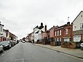
 Aldeburgh High Street - geograph.org.uk - 5545280.jpg 1,600 × 899; 171 KB
-
 Aldeburgh High Street - geograph.org.uk - 5672591.jpg 1,600 × 1,200; 269 KB
-
 Aldeburgh High Street - geograph.org.uk - 5914231.jpg 5,472 × 3,648; 5.5 MB
-
 Aldeburgh Hollyhocks - geograph.org.uk - 6205367.jpg 1,024 × 683; 310 KB
-
 Aldeburgh houses (1) (geograph 6729404).jpg 3,129 × 4,173; 1.91 MB
-
 Aldeburgh houses (10) (geograph 6730251).jpg 3,240 × 4,320; 2.81 MB
-
 Aldeburgh houses (11) (geograph 6730253).jpg 3,239 × 4,319; 2.01 MB
-
 Aldeburgh houses (12) (geograph 6730254).jpg 4,320 × 3,240; 2.53 MB
-
 Aldeburgh houses (13) (geograph 6730271).jpg 4,320 × 3,240; 2.32 MB
-
 Aldeburgh houses (17) (geograph 6730321).jpg 4,320 × 3,240; 2.72 MB
-
 Aldeburgh houses (18) (geograph 6730324).jpg 2,849 × 3,799; 1.41 MB
-
 Aldeburgh houses (19) (geograph 6730331).jpg 4,223 × 3,167; 1.87 MB
-
 Aldeburgh houses (2) (geograph 6729430).jpg 4,320 × 3,240; 2.27 MB
-
 Aldeburgh houses (20) (geograph 6730334).jpg 4,223 × 3,167; 2.22 MB
-
 Aldeburgh houses (3) (geograph 6729441).jpg 4,207 × 3,155; 2.3 MB
-
 Aldeburgh houses (4) (geograph 6730229).jpg 3,359 × 2,519; 1.08 MB
-
 Aldeburgh houses (5) (geograph 6730235).jpg 3,722 × 2,792; 1.7 MB
-
 Aldeburgh houses (6) (geograph 6730239).jpg 3,361 × 2,520; 1.54 MB
-
 Aldeburgh houses (8) (geograph 6730249).jpg 4,320 × 3,240; 2.09 MB
-
 Aldeburgh houses (9) (geograph 6730250).jpg 4,067 × 3,051; 2.5 MB
-
 Aldeburgh Jubilee Hall - geograph.org.uk - 4330604.jpg 1,385 × 2,744; 1.16 MB
-
 Aldeburgh Jubilee Hall - geograph.org.uk - 4330615.jpg 2,935 × 2,199; 2.44 MB
-
 Aldeburgh library - geograph.org.uk - 2894313.jpg 1,600 × 1,133; 594 KB
-
 Aldeburgh Lifeboat - geograph.org.uk - 5915133.jpg 5,472 × 3,648; 2.5 MB
-
 Aldeburgh Lifeboat Station, Suffolk - geograph.org.uk - 5638611.jpg 1,600 × 900; 329 KB
-
 Aldeburgh Lodge School 1914 - 18 War Memorial - geograph.org.uk - 6202891.jpg 2,592 × 3,456; 2.84 MB
-
 Aldeburgh Marsh and dyke - geograph.org.uk - 3591357.jpg 640 × 421; 164 KB
-
 Aldeburgh Marshes - geograph.org.uk - 1959683.jpg 640 × 427; 95 KB
-
 Aldeburgh Marshes - geograph.org.uk - 5535215.jpg 1,600 × 1,064; 318 KB
-
 Aldeburgh Marshes - geograph.org.uk - 5535222.jpg 1,600 × 1,064; 389 KB
-
 Aldeburgh Marshes - geograph.org.uk - 5856838.jpg 1,600 × 1,064; 516 KB
-
 Aldeburgh Martello Tower - geograph.org.uk - 6202460.jpg 1,024 × 683; 260 KB
-
 Aldeburgh Martello Tower - geograph.org.uk - 6202462.jpg 1,024 × 667; 223 KB
-
 Aldeburgh milestone - geograph.org.uk - 3225808.jpg 783 × 1,044; 343 KB
-
 Aldeburgh Moot Hall - geograph.org.uk - 6205351.jpg 1,024 × 683; 226 KB
-
 Aldeburgh Music Room - geograph.org.uk - 3536445.jpg 640 × 473; 154 KB
-

-
 Aldeburgh Police Station in Leiston Road - geograph.org.uk - 2284686.jpg 640 × 480; 130 KB
-
 Aldeburgh Post Office - geograph.org.uk - 4330573.jpg 3,072 × 2,304; 1.89 MB
-
 Aldeburgh Post Office - geograph.org.uk - 4414150.jpg 4,724 × 3,140; 3.69 MB
-
 Aldeburgh Public Library - geograph.org.uk - 4327290.jpg 3,072 × 2,304; 1.98 MB
-
 Aldeburgh Public Library - geograph.org.uk - 4327291.jpg 3,072 × 2,304; 1.89 MB
-
 Aldeburgh Public Library - geograph.org.uk - 4327966.jpg 3,072 × 2,304; 1.74 MB
-
 Aldeburgh Pump House - geograph.org.uk - 3591359.jpg 640 × 431; 136 KB
-
 Aldeburgh River Alde eschews the sea - geograph.org.uk - 3566840.jpg 3,648 × 2,736; 1.7 MB
-
 Aldeburgh Scallop - geograph.org.uk - 6205539.jpg 1,024 × 674; 238 KB
-
 Aldeburgh Scallop - geograph.org.uk - 6205546.jpg 1,024 × 677; 198 KB
-
 Aldeburgh seafront, 2008 - geograph.org.uk - 3106748.jpg 640 × 480; 70 KB
-
 Aldeburgh Shop Doorway - geograph.org.uk - 4566314.jpg 2,190 × 3,588; 1.38 MB
-
 Aldeburgh shore - geograph.org.uk - 2864168.jpg 1,600 × 1,067; 269 KB
-
 Aldeburgh sign on the roundabout - geograph.org.uk - 4338205.jpg 2,216 × 2,947; 3.25 MB
-
 Aldeburgh sign on the roundabout - geograph.org.uk - 4338209.jpg 2,240 × 2,978; 2.87 MB
-
 Aldeburgh Telephone Exchange - geograph.org.uk - 3965815.jpg 3,072 × 2,304; 1.78 MB
-
 Aldeburgh town from the marshes - geograph.org.uk - 5539499.jpg 1,600 × 1,064; 408 KB
-
 Aldeburgh Town sign - geograph.org.uk - 4327273.jpg 2,304 × 3,072; 4.22 MB
-
 Aldeburgh Town sign - geograph.org.uk - 4327275.jpg 2,253 × 2,995; 5.53 MB
-
 Aldeburgh Town Steps, Christmas Day 2018 - geograph.org.uk - 6012981.jpg 1,064 × 1,600; 263 KB
-
 Aldeburgh Town Tennis Courts this way - geograph.org.uk - 2284680.jpg 640 × 480; 176 KB
-
 Aldeburgh village sign.jpg 1,500 × 1,500; 441 KB
-
 Aldeburgh, evening sky - geograph.org.uk - 1155043.jpg 640 × 428; 43 KB
-
 Aldeburgh, fish filleter - geograph.org.uk - 3106738.jpg 640 × 427; 72 KB
-
 Aldeburgh, Fishermens' bric a brac 1 - geograph.org.uk - 4880854.jpg 3,679 × 2,456; 4.51 MB
-
 Aldeburgh, Fishermens' bric a brac 2 - geograph.org.uk - 4880860.jpg 3,618 × 2,353; 5.6 MB
-
 Aldeburgh, former railway line, at a footpath crossing - geograph.org.uk - 5526559.jpg 1,600 × 1,064; 368 KB
-

-

-
 Aldeburgh, Moot Hall Museum (detail) 1 - geograph.org.uk - 4880945.jpg 3,678 × 2,456; 4.45 MB
-
 Aldeburgh, Moot Hall Museum (detail) 2 - geograph.org.uk - 4880949.jpg 4,471 × 2,907; 6.3 MB
-
 Aldeburgh, Reuben William fishing boat 1 - geograph.org.uk - 4880866.jpg 3,678 × 2,456; 5.77 MB
-
 Aldeburgh, Reuben William fishing boat 2 - geograph.org.uk - 4880875.jpg 4,314 × 2,874; 6.32 MB
-
 Aldeburgh, Suffolk - November Beach Scene by Amanda Slater.jpg 3,456 × 2,592; 4.57 MB
-
 Aldeburgh, The memorial to Snooks the dog - geograph.org.uk - 4877516.jpg 3,960 × 2,619; 5.67 MB
-
 Aldeburgh, The Mill Inn PH - geograph.org.uk - 4880908.jpg 3,655 × 2,415; 3.61 MB
-
 Aldeburgh, The Mill Inn PH - geograph.org.uk - 4880929.jpg 3,511 × 2,179; 2.67 MB
-
 Aldeburgh, town sign - geograph.org.uk - 4145481.jpg 4,320 × 3,240; 4.49 MB
-
 Aldeburgh, UK - panoramio.jpg 4,032 × 2,519; 1.9 MB
-
 Aldeburgh, War Memorial plaque - geograph.org.uk - 4880899.jpg 3,719 × 2,484; 6.48 MB
-
 Allotments, Aldeburgh - geograph.org.uk - 2245203.jpg 640 × 480; 124 KB
-
 Animal pens by Sluice Cottage - geograph.org.uk - 3563684.jpg 640 × 425; 203 KB
-
 Anti Tank Blocks - geograph.org.uk - 4758629.jpg 1,024 × 768; 214 KB
-
 Apple Orchard sign - geograph.org.uk - 4336877.jpg 3,072 × 2,304; 1.35 MB
-
 Appleton-Alb345b.1Cropped.jpg 2,892 × 2,001; 740 KB
-
 Approaching Aldeburgh from the south - geograph.org.uk - 6103566.jpg 3,648 × 2,432; 2 MB
-
 Art Deco Style House - geograph.org.uk - 2820825.jpg 3,648 × 2,736; 2.36 MB
-
 At Fort Green, Aldeburgh - geograph.org.uk - 5892980.jpg 5,184 × 3,888; 7.41 MB
-
 B1122 Aldeburgh Road - geograph.org.uk - 1827206.jpg 3,072 × 2,304; 1.17 MB
-
 B1122 Aldeburgh Road at North Warren - geograph.org.uk - 6132366.jpg 800 × 665; 218 KB
-
 B1122 heading north out of Aldeburgh - geograph.org.uk - 3225809.jpg 1,142 × 857; 316 KB
-
 B1122 Leiston Road ^ footpath - geograph.org.uk - 4341925.jpg 3,072 × 2,304; 1.78 MB
-
 B1122 Leiston Road ^ Leiston Road Postbox - geograph.org.uk - 4340424.jpg 3,072 × 2,304; 1.7 MB
-
 B1122 Leiston Road ^ Leiston Road Postbox - geograph.org.uk - 4340434.jpg 3,072 × 2,304; 1.79 MB
-
 B1122 Leiston Road ^ Leiston Road Postbox - geograph.org.uk - 4340451.jpg 3,072 × 2,304; 1.78 MB
-
 B1122 Leiston Road, Aldeburgh - geograph.org.uk - 4340383.jpg 3,072 × 2,304; 1.99 MB
-
 B1122 Leiston Road, Aldeburgh - geograph.org.uk - 4340439.jpg 3,072 × 2,304; 1.73 MB
-
 B1122 Leiston Road, Aldeburgh - geograph.org.uk - 4340646.jpg 2,697 × 2,307; 2.21 MB
-
 B1122 Leiston Road, Aldeburgh - geograph.org.uk - 4340647.jpg 3,072 × 1,846; 1.57 MB
-
 B1122 Leiston Road, Aldeburgh - geograph.org.uk - 4341869.jpg 3,072 × 2,304; 1.87 MB
-
 B1122 Leiston Road, Aldeburgh - geograph.org.uk - 4341880.jpg 3,072 × 2,304; 1.74 MB
-
 B1122 Leiston Road, Aldeburgh - geograph.org.uk - 4341898.jpg 3,072 × 2,304; 1.87 MB
-
 Bare bones of the disused jetty at Stanny Point - geograph.org.uk - 4361992.jpg 1,024 × 768; 405 KB
-
 Beach and sea defences at Slaughden - geograph.org.uk - 6134973.jpg 800 × 499; 118 KB
-
 Beach fishing - geograph.org.uk - 6203090.jpg 1,024 × 675; 259 KB
-
 Beach Lookout, Aldeburgh - geograph.org.uk - 3619376.jpg 3,072 × 2,304; 1.87 MB
-
 Beach Scene - geograph.org.uk - 5914267.jpg 5,472 × 3,648; 6.89 MB
-

-
 Beached boats - geograph.org.uk - 6103555.jpg 3,284 × 2,181; 759 KB
-
 Beached fishing boats, Aldeburgh - geograph.org.uk - 4413395.jpg 4,928 × 3,264; 2.07 MB
-
 Beacon and path at Aldeburgh - geograph.org.uk - 6135122.jpg 800 × 504; 68 KB
-
 Beside the seaside - Aldeburgh - geograph.org.uk - 5863412.jpg 1,024 × 768; 150 KB
-

-
 Boat burial - geograph.org.uk - 4362005.jpg 1,024 × 768; 508 KB
-
 Boat in the mud - geograph.org.uk - 3392145.jpg 480 × 640; 79 KB
-
 Boat shed by the disused jetty - geograph.org.uk - 4362012.jpg 1,024 × 768; 288 KB
-
 Boating lake, Aldeburgh - geograph.org.uk - 758214.jpg 640 × 427; 70 KB
-
 Boating pond, Aldeburgh - geograph.org.uk - 3561473.jpg 640 × 416; 94 KB
-
 Boats along the River Alde at Slaughden - geograph.org.uk - 6134934.jpg 800 × 623; 105 KB
-
 Boats at Westrow Reach - geograph.org.uk - 3392153.jpg 640 × 480; 85 KB
-
 Boats laid up for the winter - geograph.org.uk - 4361993.jpg 1,024 × 768; 332 KB
-
 Boats Moored - geograph.org.uk - 4758624.jpg 1,024 × 768; 229 KB
-
-
 Boats of Aldeburgh, Suffolk, East Anglia, England.jpg 3,072 × 2,304; 3.09 MB
-
 Boats on the beach at Aldeburgh - geograph.org.uk - 5824942.jpg 640 × 389; 73 KB
-
 Bullocks on Aldeburgh Marshes - geograph.org.uk - 5539496.jpg 1,600 × 1,064; 269 KB
-
 Bus Stop ^ Birch Tree Lodge sign - geograph.org.uk - 4342074.jpg 2,228 × 2,962; 2.95 MB
-
 Can you see the lighthouse^ - geograph.org.uk - 2284650.jpg 640 × 480; 127 KB
-
 Car park and path at Aldeburgh - geograph.org.uk - 6135129.jpg 800 × 502; 97 KB
-
 Chimney repairs - geograph.org.uk - 758240.jpg 427 × 640; 65 KB
-
 Chopping's Hill, Aldeburgh - geograph.org.uk - 4187537.jpg 640 × 480; 78 KB
-
 Church Farm Holiday Park sign - geograph.org.uk - 4341811.jpg 2,995 × 2,244; 2.69 MB
-
 Church Farm Road sign - geograph.org.uk - 4340652.jpg 3,072 × 2,304; 2.96 MB
-
 Church Farm Road, Aldeburgh - geograph.org.uk - 4340657.jpg 2,836 × 2,124; 1.75 MB
-
 Church Farm Road, Aldeburgh - geograph.org.uk - 4340659.jpg 3,072 × 2,304; 1.79 MB
-
 Church Farm Road, Aldeburgh - geograph.org.uk - 4340660.jpg 3,072 × 2,304; 1.64 MB
-
 Church Farm Road, Aldeburgh - geograph.org.uk - 4341795.jpg 2,776 × 2,080; 1.93 MB
-
 Church Farm Road, Aldeburgh - geograph.org.uk - 4341850.jpg 3,072 × 2,304; 2.27 MB


.jpg)


.jpg)
.jpg)


_(geograph_6730258).jpg)
_(geograph_6729431).jpg)


_(geograph_6729404).jpg)
_(geograph_6730251).jpg)
_(geograph_6730253).jpg)
_(geograph_6730254).jpg)
_(geograph_6730271).jpg)
_(geograph_6730321).jpg)
_(geograph_6730324).jpg)
_(geograph_6730331).jpg)
_(geograph_6729430).jpg)
_(geograph_6730334).jpg)
_(geograph_6729441).jpg)
_(geograph_6730229).jpg)
_(geograph_6730235).jpg)
_(geograph_6730239).jpg)
_(geograph_6730249).jpg)
_(geograph_6730250).jpg)


_1_-_geograph.org.uk_-_4880945.jpg)
_2_-_geograph.org.uk_-_4880949.jpg)


