Category:Aldercar and Langley Mill
Jump to navigation
Jump to search
civil parish in Amber Valley district, Derbyshire, England  | |||||
| Upload media | |||||
| Instance of | |||||
|---|---|---|---|---|---|
| Named after | |||||
| Location | Amber Valley, Derbyshire, East Midlands, England | ||||
 | |||||
Subcategories
This category has the following 5 subcategories, out of 5 total.
Media in category "Aldercar and Langley Mill"
The following 200 files are in this category, out of 324 total.
(previous page) (next page)-
 "Lekkerland" by the Erewash Canal - geograph.org.uk - 6067515.jpg 3,888 × 5,184; 5.81 MB
-
 15 miles to Cromford, 14 to Nottingham, 12 to Trent Lock - geograph.org.uk - 6185452.jpg 1,600 × 1,201; 391 KB
-
 A fabulous clear view across towards distant Nottinghamshire - geograph.org.uk - 4993789.jpg 3,072 × 1,728; 4.21 MB
-
 A small business estate - geograph.org.uk - 6269781.jpg 2,000 × 1,330; 2.08 MB
-

-
 A610 between Aldercar and Woodlinkin - geograph.org.uk - 1893709.jpg 1,280 × 854; 222 KB
-
 A610 between Aldercar and Woodlinkin - geograph.org.uk - 1893714.jpg 1,280 × 854; 209 KB
-
 A610 bridge across Aldercar Lane - geograph.org.uk - 4814601.jpg 1,024 × 768; 188 KB
-

-
 A610 near Eastwood - geograph.org.uk - 1810747.jpg 640 × 480; 56 KB
-

-
 A610 towards Eastwood - geograph.org.uk - 1810741.jpg 640 × 480; 59 KB
-
 Abandoned Castle Farm near Codnor Castle - geograph.org.uk - 4964016.jpg 5,184 × 3,888; 5.79 MB
-
 Aerial view of Great Northern Basin - geograph.org.uk - 2511265.jpg 1,529 × 1,019; 2.24 MB
-
 Aldercar Lane - geograph.org.uk - 1920921.jpg 1,280 × 854; 302 KB
-
 Aldercar Lane - geograph.org.uk - 4723267.jpg 640 × 480; 94 KB
-
 Aldercar Lane north of Aldercar - geograph.org.uk - 4814604.jpg 1,024 × 768; 202 KB
-
 Anchor Road, looking north - geograph.org.uk - 6209731.jpg 1,600 × 1,200; 654 KB
-
 Backs of Houses on Bailey Brook Drive - geograph.org.uk - 6066753.jpg 5,184 × 3,888; 6.39 MB
-
 Barn conversion - geograph.org.uk - 1920902.jpg 1,280 × 854; 327 KB
-
 Benchmark on Bridge TCC-39, Langley Mill Station - geograph.org.uk - 5614315.jpg 1,024 × 683; 240 KB
-
 Benchmark on wall of Lower Dunstead Road - geograph.org.uk - 5614336.jpg 1,024 × 676; 313 KB
-
 Benty Fields farm - geograph.org.uk - 1872568.jpg 1,280 × 854; 190 KB
-
 Boat Lane - geograph.org.uk - 1920949.jpg 1,280 × 854; 464 KB
-
 Bridge 26, Erewash Canal, from the north-west - geograph.org.uk - 6185423.jpg 1,646 × 1,234; 612 KB
-
 Bridge 26, Erewash Canal, from the south-east - geograph.org.uk - 6186203.jpg 1,600 × 1,199; 473 KB
-

-
 Buildings at Park Farm - geograph.org.uk - 1920914.jpg 1,280 × 844; 301 KB
-
 Bus stop on Upper Dunstead Road - geograph.org.uk - 4723262.jpg 640 × 480; 66 KB
-
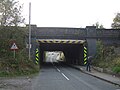
 Bypass bridge - geograph.org.uk - 1921138.jpg 1,280 × 854; 383 KB
-
 Byway at Loscoe Fields - 2 - geograph.org.uk - 3770414.jpg 3,648 × 2,736; 3.82 MB
-
 Byway at Loscoe Fields - geograph.org.uk - 3762617.jpg 3,648 × 2,736; 3.35 MB
-
 Canal basin on the Nottingham Canal - geograph.org.uk - 4856451.jpg 800 × 534; 146 KB
-
 Canal boat Gone Roaming - geograph.org.uk - 5037824.jpg 1,200 × 799; 341 KB
-
 Canal boat Hawkeye - geograph.org.uk - 5037754.jpg 1,200 × 799; 382 KB
-
 Canal southeast of bridge 26 - geograph.org.uk - 3669449.jpg 1,600 × 1,200; 754 KB
-
 Castle Farm - geograph.org.uk - 1872586.jpg 1,280 × 854; 296 KB
-
 Castle Farm, Codnor Castle.jpg 1,600 × 1,200; 479 KB
-
 Castle Lane near Stoneyford Farm - geograph.org.uk - 1872575.jpg 1,280 × 854; 323 KB
-
 Cattle field - geograph.org.uk - 2057491.jpg 1,600 × 1,067; 369 KB
-
 Cattle near Woodlinkin - geograph.org.uk - 2696763.jpg 3,551 × 2,632; 3.38 MB
-
 Cattle trough - geograph.org.uk - 1893712.jpg 854 × 1,280; 381 KB
-
 Cottage at Park Farm - geograph.org.uk - 1920895.jpg 1,280 × 854; 487 KB
-
 Countryside near Woodlinkin - geograph.org.uk - 3827568.jpg 3,934 × 2,908; 2.26 MB
-
 Cromford Road (A610) - geograph.org.uk - 4723280.jpg 640 × 480; 52 KB
-
 Cromford Road - geograph.org.uk - 1921162.jpg 1,280 × 854; 306 KB
-
 Cromford Road - geograph.org.uk - 1921163.jpg 1,280 × 847; 460 KB
-
 Cromford Road - geograph.org.uk - 1921186.jpg 1,280 × 851; 286 KB
-
 Crossing the remains of the Cromford Canal - geograph.org.uk - 4993751.jpg 2,982 × 1,548; 4.64 MB
-
 Crowfield Farm - geograph.org.uk - 1920936.jpg 1,280 × 846; 212 KB
-
 Crowfields Farm - geograph.org.uk - 3608340.jpg 640 × 543; 47 KB
-
 Derby Road (A608) - geograph.org.uk - 4725362.jpg 640 × 480; 55 KB
-
 Derbyshire Please Drive Carefully Sign - geograph.org.uk - 6106991.jpg 1,024 × 1,002; 232 KB
-
 Derbyshire UK parish map highlighting Aldercar and Langley Mill.svg 888 × 1,308; 2.34 MB
-
 Elnor Street, Langley Mill - geograph.org.uk - 6383042.jpg 3,648 × 1,744; 1.98 MB
-
 End of Aldercar Lane - geograph.org.uk - 1921171.jpg 1,280 × 835; 419 KB
-
 Entrance to The Great Northern Basin - geograph.org.uk - 909585.jpg 640 × 427; 263 KB
-
 Erewash Canal above Eastwood Lock (no 73) - geograph.org.uk - 6185416.jpg 1,703 × 1,277; 777 KB
-
 Erewash Canal, between bridges 26 and 27 - geograph.org.uk - 6185474.jpg 1,600 × 1,200; 556 KB
-
 Erewash Meadows - geograph.org.uk - 1921019.jpg 1,280 × 854; 376 KB
-
 Erewash Meadows - geograph.org.uk - 1921028.jpg 1,280 × 854; 357 KB
-
 Erewash Meadows Nature Reserve - geograph.org.uk - 2888005.jpg 3,294 × 2,470; 1.24 MB
-
 Erewash Meadows Nature Reserve - geograph.org.uk - 2994975.jpg 1,600 × 1,200; 700 KB
-
 Erewash meadows nature reserve. - geograph.org.uk - 5941365.jpg 1,024 × 768; 141 KB
-
 Erewash Valley - geograph.org.uk - 1920917.jpg 1,280 × 854; 395 KB
-
 Erewash Valley - geograph.org.uk - 1920930.jpg 1,280 × 854; 338 KB
-
 Erewash Valley from near Codnor Castle - geograph.org.uk - 2994990.jpg 1,600 × 1,200; 719 KB
-
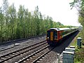
 Erewash Valley Line - geograph.org.uk - 1920976.jpg 1,280 × 854; 451 KB
-
 Erewash Valley Line - geograph.org.uk - 1920979.jpg 1,280 × 849; 476 KB
-
 Erewash Valley Line - geograph.org.uk - 4290637.jpg 640 × 430; 69 KB
-
 Erewash Valley Line, Codnor Park - geograph.org.uk - 3275653.jpg 1,280 × 856; 287 KB
-
 Erewash Valley near Eastwood - geograph.org.uk - 3557331.jpg 1,280 × 960; 544 KB
-
 Erewash Valley Trail Marker - geograph.org.uk - 5037820.jpg 1,200 × 799; 215 KB
-
 Esso Garage on Derby Road, Langley Mill - geograph.org.uk - 5036977.jpg 1,200 × 799; 313 KB
-
 Face in The Woods - geograph.org.uk - 6066754.jpg 5,184 × 3,888; 6.69 MB
-
 Farm in the Erewash Valley - geograph.org.uk - 4290653.jpg 640 × 430; 42 KB
-
 Farm track - geograph.org.uk - 1872622.jpg 1,280 × 854; 288 KB
-
 Farmland with pylon - geograph.org.uk - 3608339.jpg 640 × 480; 43 KB
-
 Farmland, Erewash Valley - geograph.org.uk - 4290677.jpg 640 × 342; 33 KB
-
 Fast food restaurant, Langley Mill - geograph.org.uk - 4725356.jpg 640 × 480; 66 KB
-
 Field entrance off Cromford Road (A610) - geograph.org.uk - 4723276.jpg 640 × 480; 116 KB
-
 Fields near Woodlinkin - geograph.org.uk - 1920883.jpg 1,280 × 854; 395 KB
-
 Fishing pond near Park Farm - geograph.org.uk - 3608344.jpg 640 × 480; 69 KB
-
 Flower Meadow - geograph.org.uk - 1921037.jpg 1,280 × 854; 436 KB
-
 Flowery field, south of Langley Mill - geograph.org.uk - 6209737.jpg 1,600 × 1,199; 606 KB
-
 Footbridge over a damp patch - geograph.org.uk - 2057472.jpg 1,600 × 1,067; 635 KB
-
 Footbridge over the Erewash - geograph.org.uk - 1920989.jpg 854 × 1,280; 615 KB
-
 Footbridge over the railway south of Codnor Park - geograph.org.uk - 5309276.jpg 1,600 × 1,200; 672 KB
-
 Footbridge over the River Erewash - geograph.org.uk - 2052126.jpg 1,024 × 683; 392 KB
-
 Footbridge over the River Erewash - geograph.org.uk - 3556338.jpg 1,280 × 960; 544 KB
-
 Footpath alongside the railway - geograph.org.uk - 1921048.jpg 1,280 × 854; 421 KB
-
 Footpath and bridleway at Castle Plantation - geograph.org.uk - 5309732.jpg 1,600 × 1,200; 761 KB
-
 Footpath by the Erewash Nature Reserve - geograph.org.uk - 2888016.jpg 3,218 × 2,364; 1.67 MB
-
 Footpath in the Erewash Valley - geograph.org.uk - 1921005.jpg 1,280 × 854; 538 KB
-
 Footpath in the Erewash Valley - geograph.org.uk - 1921010.jpg 1,280 × 854; 435 KB
-
 Footpath to Heanor - geograph.org.uk - 1893717.jpg 1,280 × 854; 285 KB
-
 Footpath to Park Farm - geograph.org.uk - 1921022.jpg 966 × 1,280; 347 KB
-
 Grazing on Erewash Meadows - geograph.org.uk - 1921044.jpg 1,280 × 854; 320 KB
-
 Greylag geese in Erewash Meadows - geograph.org.uk - 4963981.jpg 3,004 × 3,698; 2.81 MB
-
 Head of a young swan on The Erewash Canal - geograph.org.uk - 6067519.jpg 4,511 × 3,534; 2.88 MB
-
 Hide on Erewash Meadows - geograph.org.uk - 1921033.jpg 1,280 × 854; 251 KB
-
 Hogbarn Lane - geograph.org.uk - 2898885.jpg 3,172 × 2,296; 1.24 MB
-
 Hogbarn Lane - geograph.org.uk - 3770464.jpg 3,648 × 2,736; 3.17 MB
-
 Hogsbarn Lane - geograph.org.uk - 1893695.jpg 1,280 × 854; 356 KB
-
 Homestead, Aldercar - geograph.org.uk - 4814594.jpg 1,024 × 768; 134 KB
-
 House overlooking the Erewash Canal - geograph.org.uk - 5037816.jpg 1,200 × 799; 267 KB
-
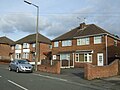
 Houses on Cromford Road (A610) - geograph.org.uk - 4723277.jpg 640 × 480; 60 KB
-
 Houses on Cromford Road (A610) - geograph.org.uk - 4723278.jpg 640 × 448; 65 KB
-
 Houses on Derby Road (A608) - geograph.org.uk - 4725365.jpg 640 × 480; 74 KB
-
 Houses on Lime Avenue - geograph.org.uk - 4290674.jpg 640 × 430; 56 KB
-
 Houses on Milnhay Road - geograph.org.uk - 4725354.jpg 640 × 480; 68 KB
-
 Junction of Cromford Road and Station Road - geograph.org.uk - 5602144.jpg 1,024 × 615; 112 KB
-
 Junction of Ebenezer Street with North Road - geograph.org.uk - 5614367.jpg 1,024 × 683; 129 KB
-

-
 Junction of the Nottingham and Cromford Canals - geograph.org.uk - 5607048.jpg 1,024 × 799; 197 KB
-
 Langley Lock No 14 on the Cromford Canal - geograph.org.uk - 4856130.jpg 800 × 562; 136 KB
-
 Langley Lock No 74 on the Cromford Canal - geograph.org.uk - 4856118.jpg 800 × 524; 124 KB
-
 Langley Mill Car Wash - geograph.org.uk - 6066739.jpg 4,796 × 3,549; 4.07 MB
-
 Leafy lane, Aldercar - geograph.org.uk - 4723273.jpg 640 × 480; 138 KB
-
 Lock ^14, Langley Mill Lock - geograph.org.uk - 5036987.jpg 1,200 × 799; 355 KB
-
 Looking across the canal - geograph.org.uk - 6269791.jpg 2,000 × 1,330; 2.73 MB
-
 Low railway bridge on Milnhay Road - geograph.org.uk - 4725343.jpg 640 × 480; 78 KB
-
 Low railway bridge on Milnhay Road - geograph.org.uk - 4725347.jpg 640 × 480; 69 KB
-
 Marshland in the Erewash Valley - geograph.org.uk - 4290687.jpg 640 × 430; 45 KB
-
 Milnhay Road - geograph.org.uk - 4725351.jpg 640 × 480; 57 KB
-
 Milnhay Road railway bridge - geograph.org.uk - 3556294.jpg 1,280 × 960; 331 KB
-
 Muddy gateway - geograph.org.uk - 1893727.jpg 1,280 × 854; 332 KB
-
 Narrow path - geograph.org.uk - 2057423.jpg 683 × 1,024; 423 KB
-
 Near Park Farm - geograph.org.uk - 1920889.jpg 1,280 × 854; 482 KB
-
 New mown hay - geograph.org.uk - 1921000.jpg 1,280 × 854; 503 KB
-
 No public right of way - geograph.org.uk - 3556344.jpg 1,280 × 960; 508 KB
-
 Numbers On A Street Light - geograph.org.uk - 5151416.jpg 1,200 × 1,600; 152 KB
-

-
 Paddock at Park Farm - geograph.org.uk - 1920911.jpg 1,280 × 854; 318 KB
-
 Path from Langley Mill to Loscoe - geograph.org.uk - 6066931.jpg 4,881 × 3,598; 4.91 MB
-
 Path off the Erewash Valley Trail - geograph.org.uk - 5038088.jpg 1,200 × 799; 720 KB
-
 Path through the wood - geograph.org.uk - 1893702.jpg 854 × 1,280; 557 KB
-
 Path under the railway - geograph.org.uk - 2057461.jpg 1,600 × 1,067; 487 KB
-
 Patterns on the ground - geograph.org.uk - 1920986.jpg 1,280 × 854; 347 KB
-
 Plantation recovery - geograph.org.uk - 1872620.jpg 1,280 × 854; 261 KB
-
 Plumptre Road - geograph.org.uk - 1921145.jpg 1,280 × 854; 269 KB
-
 Pump house alongside the Cromford Canal - geograph.org.uk - 5607055.jpg 1,024 × 768; 201 KB
-
 Pylon by the Erewash Valley Line - geograph.org.uk - 4290638.jpg 640 × 430; 44 KB
-
 Quarry Houses - geograph.org.uk - 1893708.jpg 1,280 × 854; 237 KB
-
 Railway footbridge - geograph.org.uk - 4290680.jpg 640 × 430; 65 KB
-
 Railway running north - geograph.org.uk - 3608345.jpg 640 × 498; 115 KB
-
 Railway Tavern - geograph.org.uk - 5036975.jpg 1,200 × 800; 297 KB
-
 Railway towards Nottingham - geograph.org.uk - 4719664.jpg 640 × 480; 66 KB
-
 River Erewash - geograph.org.uk - 1921008.jpg 1,280 × 854; 645 KB
-
 River Erewash - geograph.org.uk - 1921062.jpg 854 × 1,280; 591 KB
-
 River Erewash - geograph.org.uk - 3557202.jpg 1,280 × 960; 389 KB
-
 River Erewash at Anchor Road - geograph.org.uk - 3556332.jpg 960 × 1,280; 502 KB
-
 River Erewash. - geograph.org.uk - 5941361.jpg 1,024 × 768; 303 KB
-
 Service road alongside Cromford Road - geograph.org.uk - 1921189.jpg 1,280 × 848; 346 KB
-
 Service station on Derby Road - geograph.org.uk - 4725361.jpg 640 × 480; 73 KB
-

-
 Silage clamp - geograph.org.uk - 1893699.jpg 1,280 × 854; 337 KB
-
 Sir Charles Napier - geograph.org.uk - 1921147.jpg 1,280 × 854; 302 KB
-
 Sir Charles Napier - geograph.org.uk - 1921154.jpg 1,280 × 854; 277 KB
-
 Site of Bailey Brook Colliery - geograph.org.uk - 1893742.jpg 1,280 × 854; 283 KB
-
 Small lake within Foxhole Plantation - geograph.org.uk - 4993778.jpg 3,072 × 1,728; 5.48 MB
-
 St Andrew's Anglican Methodist Church, Langley Mill - geograph.org.uk - 6383041.jpg 3,648 × 1,744; 1.87 MB
-
 Stagnant Pond - geograph.org.uk - 2994980.jpg 1,600 × 1,200; 931 KB
-
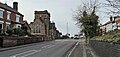
 Station Road and Wesley Street, Langley Mill - geograph.org.uk - 6383036.jpg 3,648 × 1,744; 1.46 MB
-
 Stile by Erewash Meadows - geograph.org.uk - 2057453.jpg 1,600 × 1,067; 525 KB
-
 Stone marker, Erewash Canal near Eastwood - geograph.org.uk - 5037763.jpg 1,200 × 799; 485 KB
-
 Stoney Lane - geograph.org.uk - 2057445.jpg 1,600 × 1,067; 729 KB
-
 Stony Lane crosses the Erewash - geograph.org.uk - 2055606.jpg 1,024 × 683; 382 KB
-
 Swans on the Erewash Canal - geograph.org.uk - 4856093.jpg 800 × 569; 182 KB
-
 Teasels north of Heanor - geograph.org.uk - 6066916.jpg 4,891 × 3,752; 3.9 MB
-
 The canal basin - geograph.org.uk - 6269785.jpg 2,000 × 1,330; 2.38 MB
-
 The defunct Nottingham Canal - geograph.org.uk - 4856459.jpg 800 × 520; 117 KB
-
 The end of Bailey Brook Drive - geograph.org.uk - 1893732.jpg 1,280 × 854; 291 KB
-
 The Erewash Canal - geograph.org.uk - 6269788.jpg 2,000 × 1,330; 3.04 MB
-
 The Erewash Canal near Anchor Road Bridge - geograph.org.uk - 6067522.jpg 4,734 × 3,738; 4.31 MB
-
 The Erewash Canal towpath - geograph.org.uk - 6269793.jpg 2,000 × 1,330; 2.6 MB
-
 The former Anchor Inn, now a house - geograph.org.uk - 6185429.jpg 1,600 × 1,200; 563 KB
-
-
 The River Erewash - geograph.org.uk - 2057501.jpg 1,600 × 1,067; 582 KB
-
 The River Erewash - geograph.org.uk - 4725368.jpg 478 × 640; 103 KB
-
 Thirteenth Tee - geograph.org.uk - 1872580.jpg 1,280 × 854; 254 KB
-
 Top of Boat Lane - geograph.org.uk - 1920941.jpg 1,280 × 854; 556 KB
-
 Top of Cromford Road - geograph.org.uk - 1921192.jpg 1,280 × 854; 349 KB
-
 Track beside Ormonde Fields golf course - geograph.org.uk - 4723291.jpg 640 × 480; 144 KB
-
 Track to Cromford Road - geograph.org.uk - 3770456.jpg 3,648 × 2,736; 3.32 MB
-
 Track to the south of Foxhole Plantation - geograph.org.uk - 4964003.jpg 3,888 × 5,184; 4.77 MB
-
 Tunnel-like path - geograph.org.uk - 2057433.jpg 683 × 1,024; 484 KB
-
 UK 100 Yards Ahead Sign - geograph.org.uk - 5103159.jpg 1,200 × 1,600; 128 KB
-
 UK 2 Way Traffic Sign - geograph.org.uk - 5086714.jpg 1,200 × 1,600; 105 KB
-
 UK Amber Traffic Light Signal - geograph.org.uk - 5114929.jpg 1,200 × 1,600; 92 KB
-
 UK Amber Traffic Light Signal - geograph.org.uk - 5114935.jpg 1,200 × 1,600; 82 KB
-
 UK Amber Traffic Light Signal - geograph.org.uk - 5162662.jpg 1,200 × 1,600; 107 KB
-
 UK back of a road sign - geograph.org.uk - 5162656.jpg 1,200 × 1,600; 164 KB
-
 UK back of a School Ahead Sign - geograph.org.uk - 5103162.jpg 1,200 × 1,600; 210 KB
-
 UK Back Of A School Ahead Sign - geograph.org.uk - 5135147.jpg 1,200 × 1,600; 185 KB
-
 UK Crossing Pole For Pedestrians Part 1 - geograph.org.uk - 5097507.jpg 1,200 × 1,600; 157 KB
-
 UK Crossing Pole For Pedestrians Part 2 - geograph.org.uk - 5097509.jpg 1,200 × 1,600; 213 KB
-
 UK Direction Sign - geograph.org.uk - 5094613.jpg 960 × 1,280; 97 KB
-
 UK Directions Sign - geograph.org.uk - 5086710.jpg 1,200 × 1,600; 174 KB
-
 UK Directions Sign - geograph.org.uk - 5157530.jpg 1,200 × 1,600; 73 KB


_-_geograph.org.uk_-_4723280.jpg)


_-_geograph.org.uk_-_4725362.jpg)


_-_geograph.org.uk_-_6185416.jpg)


_-_geograph.org.uk_-_4723276.jpg)


_-_geograph.org.uk_-_4723277.jpg)
_-_geograph.org.uk_-_4723278.jpg)
_-_geograph.org.uk_-_4725365.jpg)


