Category:Aldington, Kent
Jump to navigation
Jump to search
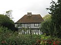
English: Aldington is a village and civil parish in the Ashford District of Kent, England. The village centre is eight miles (12 km) south-east of the town of Ashford. Set on a hill top above Romney Marsh, the village offers breathtaking views over the marsh out towards Lympne and Dungeness.
village and civil parish in the Ashford District of Kent, England  | |||||
| Upload media | |||||
| Instance of | |||||
|---|---|---|---|---|---|
| Location | Ashford, Kent, South East England, England | ||||
| Population |
| ||||
| Area |
| ||||
| Said to be the same as | Aldington (Wikimedia duplicated page, civil parish) | ||||
 | |||||
Subcategories
This category has the following 3 subcategories, out of 3 total.
M
O
Media in category "Aldington, Kent"
The following 200 files are in this category, out of 310 total.
(previous page) (next page)-

-
 1 Clap Hill Cottages - geograph.org.uk - 4338881.jpg 3,264 × 2,448; 1.51 MB
-
 A wet Bank Road - geograph.org.uk - 1670583.jpg 640 × 480; 137 KB
-
 Access road to Bank Farm - geograph.org.uk - 1892756.jpg 3,072 × 2,304; 1.71 MB
-
 Aldington 1905.jpg 990 × 1,583; 756 KB
-
 Aldington church - geograph.org.uk - 5315180.jpg 640 × 480; 197 KB
-
 Aldington church seen across the fields - geograph.org.uk - 4429467.jpg 1,024 × 768; 405 KB
-
 Aldington Eco Centre - geograph.org.uk - 1891648.jpg 3,072 × 2,304; 1.53 MB
-
 Aldington Eco Centre - geograph.org.uk - 2300009.jpg 2,560 × 1,920; 413 KB
-
 Aldington Evangelical Mission - geograph.org.uk - 3687704.jpg 4,000 × 3,000; 4.13 MB
-
 Aldington Evangelical Mission Church - geograph.org.uk - 1891686.jpg 3,072 × 2,304; 1.54 MB
-
 Aldington fire station - geograph.org.uk - 1284466.jpg 640 × 427; 210 KB
-
 Aldington Knoll - geograph.org.uk - 2117570.jpg 3,072 × 2,304; 1.83 MB
-
 Aldington Village Hall - geograph.org.uk - 1891675.jpg 3,072 × 2,304; 1.27 MB
-
 Aldington village sign - geograph.org.uk - 3104817.jpg 1,011 × 758; 172 KB
-
 Aldington, Handen Farm - geograph.org.uk - 5878154.jpg 7,360 × 4,912; 6.72 MB
-
 Aldington, Parsonage Farm, - geograph.org.uk - 5878168.jpg 6,867 × 4,582; 7.54 MB
-
 Aldington, Parsonage Farm, Large barn - geograph.org.uk - 5878177.jpg 5,848 × 3,902; 2.77 MB
-
 Aldington, St. Martin's Church - geograph.org.uk - 5878176.jpg 5,860 × 3,911; 4.77 MB
-
 Aldington, St. Martin's Church with farm building next to it - geograph.org.uk - 5878172.jpg 7,360 × 4,912; 7.24 MB
-
 Aldington, St. Martin's Church, Lych gate - geograph.org.uk - 5878175.jpg 6,127 × 4,089; 4.99 MB
-

-
 Aldington, St. Martin's Church, The churchyard - geograph.org.uk - 5878164.jpg 5,935 × 3,961; 5.85 MB
-

-

-
 Careless parking^ - geograph.org.uk - 1231047.jpg 640 × 480; 125 KB
-
 B2067 - road closed - geograph.org.uk - 4223987.jpg 640 × 428; 128 KB
-
 Badgers Close, Roman Road - geograph.org.uk - 4223158.jpg 1,175 × 881; 156 KB
-
 Badgers Close, Roman Road - geograph.org.uk - 4338860.jpg 3,264 × 2,448; 1.68 MB
-
 Badgers Close, Roman Road - geograph.org.uk - 4470923.jpg 3,264 × 2,448; 3.73 MB
-
 Bank Farm - geograph.org.uk - 1892758.jpg 2,980 × 2,183; 928 KB
-
 Bank Road enters Aldington - geograph.org.uk - 3275426.jpg 2,464 × 1,632; 1.02 MB
-
 Bank Road, leaving Aldington - geograph.org.uk - 1670496.jpg 640 × 480; 188 KB
-
 Barn near Middle Park Farm - geograph.org.uk - 1891501.jpg 3,072 × 2,304; 1.28 MB
-
 Barn, Goldenhurst Farm - geograph.org.uk - 5823473.jpg 1,024 × 681; 150 KB
-
 Bested House - geograph.org.uk - 5315191.jpg 640 × 480; 109 KB
-
 Bridge Cottage - geograph.org.uk - 2127448.jpg 3,072 × 2,304; 1.87 MB
-
 Bridges on Church Lane - geograph.org.uk - 5315207.jpg 640 × 428; 180 KB
-
 Brown field west of Calleywell Lane - geograph.org.uk - 5315217.jpg 640 × 480; 130 KB
-
 Building site, Calleywell Lane - geograph.org.uk - 4481278.jpg 3,264 × 2,448; 3.93 MB
-
 Building site, Roman Road - geograph.org.uk - 5543985.jpg 3,264 × 2,448; 1.68 MB
-
 Byway to Bank Road - geograph.org.uk - 1892760.jpg 3,072 × 2,304; 2.59 MB
-
 Byway to Frith Road - geograph.org.uk - 1892767.jpg 3,072 × 2,304; 2.58 MB
-
 Cattle and cliffs - geograph.org.uk - 2118718.jpg 3,072 × 1,728; 1.32 MB
-
 Church Farm - geograph.org.uk - 1891577.jpg 3,072 × 2,304; 1.96 MB
-
 Church Lane bridge over East Stour River - geograph.org.uk - 1891404.jpg 3,072 × 2,304; 2.17 MB
-
 Church Tower, St Martin's Aldington - geograph.org.uk - 3101300.jpg 1,496 × 2,256; 812 KB
-
 Clap Hill, Aldington - geograph.org.uk - 1670358.jpg 660 × 401; 60 KB
-

-
 Cobbs Hall Aldington Kent Geograph-2117504-by-David-Anstiss.jpg 3,072 × 2,304; 2.14 MB
-

-
 Cottage in Aldington - geograph.org.uk - 1891584.jpg 3,072 × 2,304; 2.02 MB
-
 Cottage in Church Lane, Aldington - geograph.org.uk - 3691951.jpg 4,000 × 3,000; 4.12 MB
-
 Cottages in Frith Road, Aldington - geograph.org.uk - 3102938.jpg 707 × 530; 115 KB
-
 Cross Country Horse Jump - geograph.org.uk - 1891455.jpg 3,072 × 2,304; 1.48 MB
-
 Cross Country Horse Jumps - geograph.org.uk - 1891474.jpg 3,072 × 2,304; 1.46 MB
-
 Crossroads at Aldington Frith, Kent - geograph.org.uk - 2134072.jpg 1,600 × 1,200; 480 KB
-
 Cyclists at Postling Green - geograph.org.uk - 4429485.jpg 1,024 × 768; 559 KB
-
 Cygnets near Lower Wall Road - geograph.org.uk - 2127439.jpg 2,304 × 3,072; 3.11 MB
-
 Derelict Barn at College Farm - geograph.org.uk - 1343738.jpg 640 × 480; 69 KB
-
 Derelict Barn at College Farm - geograph.org.uk - 1857902.jpg 1,024 × 768; 244 KB
-
 Development land, Roman Road - geograph.org.uk - 5489038.jpg 3,264 × 2,448; 3.82 MB
-
 Direction signs, Bonnington - geograph.org.uk - 3509254.jpg 1,600 × 1,101; 672 KB
-
 Drain along Gigger's Green Road - geograph.org.uk - 3275573.jpg 2,464 × 1,632; 1.07 MB
-
 Drainage channel beside Lower Wall Road - geograph.org.uk - 2127430.jpg 3,072 × 2,304; 1.99 MB
-
 Drainage ditch near Goldwell Farm - geograph.org.uk - 3692144.jpg 4,000 × 3,000; 4.55 MB
-
 Duck House near Lower Park Farm - geograph.org.uk - 1891494.jpg 3,072 × 2,304; 2.29 MB
-
 East Stour River - geograph.org.uk - 1891427.jpg 2,304 × 3,072; 2.94 MB
-
 Edge of Burch's Rough Wood - geograph.org.uk - 1857794.jpg 1,024 × 768; 215 KB
-
 Electricity pylon near Aldington Corner - geograph.org.uk - 3692163.jpg 4,000 × 3,000; 4.02 MB
-
 Electricity Pylon off Boat Lane - geograph.org.uk - 3275482.jpg 2,464 × 1,632; 1.01 MB
-
 Entrance to a building site, Calleywell Lane - geograph.org.uk - 4481312.jpg 3,264 × 2,448; 3.76 MB
-
 Entrance to a building site, Calleywell Lane - geograph.org.uk - 4584632.jpg 1,114 × 809; 179 KB
-
 Entrance to Lyons Gate, Calleywell Lane - geograph.org.uk - 5092639.jpg 3,264 × 2,448; 2.21 MB
-
 Entrance to Lyons Gate, Calleywell Lane - geograph.org.uk - 5490370.jpg 3,264 × 2,448; 2.11 MB
-
 Entrance to The Knowle Farm - geograph.org.uk - 3275589.jpg 2,464 × 1,632; 1.02 MB
-

-
 Erection of replacement dwelling, Roman Road, Aldington - geograph.org.uk - 4736209.jpg 3,264 × 2,448; 2.36 MB
-
 Erection of replacement dwelling, Roman Road, Aldington - geograph.org.uk - 4736213.jpg 3,264 × 2,448; 3.71 MB
-
 Erection of replacement dwelling, Roman Road, Aldington - geograph.org.uk - 4842717.jpg 3,264 × 2,448; 2.55 MB
-
 Falconhurst - geograph.org.uk - 5820336.jpg 1,024 × 681; 105 KB
-
 Falconhurst - geograph.org.uk - 5820354.jpg 1,024 × 681; 139 KB
-
 Falconhurst - geograph.org.uk - 5820358.jpg 1,024 × 681; 139 KB
-
 Farm track to Backhouse Wood - geograph.org.uk - 3099962.jpg 2,256 × 1,496; 875 KB
-
 Farmland by the railway - geograph.org.uk - 2703892.jpg 640 × 430; 36 KB
-
 Farmland off Bank Road - geograph.org.uk - 3275425.jpg 2,464 × 1,632; 1.02 MB
-
 Field of cereal crops, east of Bonnington, Kent - geograph.org.uk - 2309305.jpg 1,024 × 768; 138 KB
-
 Field off B2067 - geograph.org.uk - 1857798.jpg 1,024 × 768; 177 KB
-
 Field off Bank Road - geograph.org.uk - 1857724.jpg 1,024 × 439; 131 KB
-
 Fields at Postling Green - geograph.org.uk - 4429473.jpg 1,024 × 768; 632 KB
-
 Fields off Gigger's Green Road - geograph.org.uk - 3275580.jpg 2,464 × 1,632; 1.05 MB
-
 Flood Storage reservoir off Goldwell Lane - geograph.org.uk - 3099952.jpg 2,256 × 1,496; 885 KB
-
 Footbridge near Partridge Farm - geograph.org.uk - 1891419.jpg 3,072 × 2,304; 2.91 MB
-
 Footbridge over the East Stour River - geograph.org.uk - 1891409.jpg 3,072 × 2,304; 2.56 MB
-
 Footbridge over the East Stour River - geograph.org.uk - 1891433.jpg 3,072 × 2,304; 2.93 MB
-
 Footpath entering wood near Hogben Farm - geograph.org.uk - 3692133.jpg 4,000 × 3,000; 4.1 MB
-
 Footpath in South Hurst - geograph.org.uk - 2127484.jpg 3,072 × 2,304; 2.83 MB
-
 Footpath in Stockshill Wood - geograph.org.uk - 2117516.jpg 2,304 × 3,072; 2.44 MB
-
 Footpath junction near a pylon - geograph.org.uk - 1891607.jpg 2,304 × 3,072; 2.14 MB
-
 Footpath on Boat Lane - geograph.org.uk - 2084843.jpg 3,072 × 2,304; 2.57 MB
-
 Footpath to Aldington Corner - geograph.org.uk - 3692153.jpg 4,000 × 3,000; 4.26 MB
-
 Footpath to Church Lane - geograph.org.uk - 1891654.jpg 3,072 × 2,304; 1.65 MB
-
 Footpath to Lower Park Farm - geograph.org.uk - 1891499.jpg 3,072 × 2,304; 1.88 MB
-
 Footpath towards Aldington - geograph.org.uk - 1891601.jpg 3,072 × 2,304; 1.77 MB
-
 Footpath towards Aldington Church - geograph.org.uk - 1891488.jpg 2,304 × 3,072; 2.31 MB
-
 Footpath towards Middle Park Farm - geograph.org.uk - 1891513.jpg 3,072 × 2,304; 2.16 MB
-
 Footpath towards Partridge Farm - geograph.org.uk - 1891440.jpg 3,072 × 2,304; 2.24 MB
-
 Forge Hill and Mill Lane Junction - geograph.org.uk - 1891728.jpg 3,072 × 2,304; 2.01 MB
-
 Forge Hill, Aldington - geograph.org.uk - 1343763.jpg 640 × 480; 84 KB
-
 Frith Road off Bank Road - geograph.org.uk - 1670372.jpg 640 × 480; 148 KB
-
 Frustrating footpath near Goldwell Farm - geograph.org.uk - 1891624.jpg 3,072 × 2,304; 1.45 MB
-
 Gate and stile on the Saxon Shore Way - geograph.org.uk - 2118731.jpg 2,946 × 2,135; 1.11 MB
-
 Gate into Curtis Wood - geograph.org.uk - 2117611.jpg 3,072 × 2,304; 3.09 MB
-
 Gigger's Green Bridge - geograph.org.uk - 1004107.jpg 640 × 481; 79 KB
-
 Gigger's Green Bridge - geograph.org.uk - 5327962.jpg 640 × 428; 133 KB
-
 Gigger's Green Bridge - geograph.org.uk - 5820389.jpg 1,024 × 681; 302 KB
-
 Gigger's Green Bridge - geograph.org.uk - 5823452.jpg 1,024 × 681; 122 KB
-
 Gigger's Green Bridge - geograph.org.uk - 5823457.jpg 1,024 × 681; 110 KB
-
 Gigger's Green Bridge - geograph.org.uk - 5823458.jpg 1,024 × 681; 187 KB
-
 Gigger's Green Rd - geograph.org.uk - 5823451.jpg 1,024 × 681; 144 KB
-
 Gigger's Green Road Bridge - geograph.org.uk - 4329672.jpg 640 × 427; 93 KB
-
 Goldwell Cottages, Aldington - geograph.org.uk - 3102911.jpg 707 × 530; 112 KB
-
 Goldwell Lane, Aldington - geograph.org.uk - 2300020.jpg 2,560 × 1,920; 427 KB
-
 Green Gigger Bridge - geograph.org.uk - 3469309.jpg 4,320 × 3,240; 4.26 MB
-
 Grove Cottage - geograph.org.uk - 1891568.jpg 3,072 × 2,304; 1.63 MB
-
 Hedgerow near Lower Park Farm - geograph.org.uk - 3691956.jpg 4,000 × 3,000; 4.24 MB
-
 HMP Aldington (disused) - geograph.org.uk - 226756.jpg 640 × 426; 131 KB
-
 HMP Aldington, Ashford, Kent - geograph.org.uk - 349353.jpg 640 × 480; 110 KB
-
 House by Gigger's Green Bridge - geograph.org.uk - 5820385.jpg 1,024 × 681; 249 KB
-
 House just north of Gigger's Green Bridge - geograph.org.uk - 5823450.jpg 1,024 × 681; 136 KB
-
 Inside Pillbox - geograph.org.uk - 1858136.jpg 768 × 1,024; 183 KB
-
 Inside Pillbox - geograph.org.uk - 1858137.jpg 768 × 1,024; 186 KB
-
 Isolated tree - geograph.org.uk - 5820374.jpg 1,024 × 681; 88 KB
-

-

-

-
 Knoll Farm - geograph.org.uk - 5820364.jpg 1,024 × 681; 138 KB
-
 Knoll Farm - geograph.org.uk - 5820372.jpg 1,024 × 681; 90 KB
-
 Knoll Farm - geograph.org.uk - 5820377.jpg 1,024 × 681; 87 KB
-
 Knoll Farm - geograph.org.uk - 5820383.jpg 1,024 × 681; 92 KB
-
 Knoll Hill - geograph.org.uk - 3485993.jpg 3,776 × 2,520; 4.15 MB
-

-
 Lake through the trees - geograph.org.uk - 4028707.jpg 640 × 428; 71 KB
-
 Lone Tree - geograph.org.uk - 1857874.jpg 1,024 × 768; 251 KB
-
 Lone Tree - geograph.org.uk - 1857881.jpg 1,024 × 768; 205 KB
-
 Lone Tree - geograph.org.uk - 1857885.jpg 1,024 × 768; 256 KB
-
 Longsfield, Aldington - geograph.org.uk - 3102897.jpg 868 × 555; 118 KB
-
 Looking W along Frith Road - geograph.org.uk - 1670546.jpg 640 × 480; 145 KB
-
 Lower Park Farm access track - geograph.org.uk - 1891481.jpg 3,072 × 2,304; 2.64 MB
-
 Lower Wall Road and Drain - geograph.org.uk - 3275517.jpg 2,464 × 1,632; 1.03 MB
-
 Lower Wall Road towards Tame Lane - geograph.org.uk - 6352412.jpg 5,456 × 3,632; 2.96 MB
-
 Lower Wall Road towards Tame Lane - geograph.org.uk - 6352416.jpg 5,456 × 3,632; 2.39 MB
-
 Lyons Gate, Calleywell Lane - geograph.org.uk - 4841825.jpg 3,264 × 2,448; 3.59 MB
-
 Middle Park Farm - geograph.org.uk - 1891508.jpg 3,072 × 2,304; 1.53 MB
-
 Mill House - geograph.org.uk - 1891746.jpg 3,072 × 2,304; 1.67 MB
-
 Mill Lane - geograph.org.uk - 5315220.jpg 640 × 480; 133 KB
-
 New and Old Railway Bridges - geograph.org.uk - 3100008.jpg 2,256 × 1,496; 881 KB
-
 New Road Hill, Aldington - geograph.org.uk - 3275467.jpg 2,464 × 1,632; 1.02 MB
-
 New Road Hill, towards Aldington - geograph.org.uk - 1944992.jpg 3,488 × 2,616; 2.13 MB
-
 No footpaths in the field near Goldwell Farm - geograph.org.uk - 1891621.jpg 3,072 × 2,304; 2.3 MB
-
 Northeast view from Roman Road - geograph.org.uk - 3104832.jpg 1,077 × 807; 198 KB
-
 Oak Farm Barn - geograph.org.uk - 2127440.jpg 3,072 × 2,304; 1.94 MB
-
 Oilseed Rape Field - geograph.org.uk - 1857742.jpg 1,024 × 768; 345 KB
-
 Oilseed Rape Field - geograph.org.uk - 1858991.jpg 1,024 × 768; 349 KB
-
 Ongoing construction of Lyons Gate, Calleywell Lane - geograph.org.uk - 5092624.jpg 3,264 × 2,448; 2.37 MB
-
 Open space, Lyons Gate - geograph.org.uk - 5490338.jpg 3,264 × 2,448; 2.06 MB
-
 Ordnance Survey Flush Bracket S0691 - geograph.org.uk - 4928649.jpg 4,000 × 3,000; 4.52 MB
-
 Pastureland - geograph.org.uk - 5823474.jpg 1,024 × 681; 116 KB
-
 Peacock Cottages - geograph.org.uk - 2127473.jpg 3,072 × 2,304; 2.14 MB
-
 Peacock House - geograph.org.uk - 2127476.jpg 3,072 × 2,304; 2.34 MB
-
 Pillbox adjacent Royal Military Canal - geograph.org.uk - 1858131.jpg 1,024 × 768; 335 KB
-
 Pillbox alongside the Royal Military Canal - geograph.org.uk - 6348132.jpg 5,456 × 3,632; 4.51 MB
-
 Pillbox by Gigger's Green Bridge - geograph.org.uk - 5823460.jpg 1,024 × 681; 254 KB
-
 Pillbox by Royal Military Canal - geograph.org.uk - 5823461.jpg 1,024 × 681; 276 KB
-
 Ponds at Aldington Eco Centre - geograph.org.uk - 2300016.jpg 2,560 × 1,920; 424 KB
-
 Postbox near Gigger's Green Bridge - geograph.org.uk - 6348207.jpg 3,632 × 5,456; 2.77 MB
-
 Postling Green, Roman Road, Aldington - geograph.org.uk - 5235717.jpg 3,264 × 2,448; 3.88 MB
-
 Pylon by Church Lane - geograph.org.uk - 2957999.jpg 640 × 430; 27 KB
-
 Pylon on Bested Hill - geograph.org.uk - 5315186.jpg 640 × 480; 99 KB
-
 Quarry House, Calleywell Lane - geograph.org.uk - 5092647.jpg 3,264 × 2,448; 2.33 MB
-
 Ragstone Hollow, Aldington - geograph.org.uk - 3102882.jpg 1,011 × 758; 188 KB
-
 Railway Bridge over Church Road - geograph.org.uk - 1385330.jpg 640 × 480; 131 KB
-
 Railway bridges over Church Lane - geograph.org.uk - 1891400.jpg 3,072 × 2,304; 1.43 MB
-
 Recreation ground, Aldington - geograph.org.uk - 5315218.jpg 640 × 428; 84 KB
-
 Resting cat, White's Wood, Bonnington - geograph.org.uk - 3509248.jpg 1,600 × 1,200; 614 KB
-
 Ridge of high ground near Cobb's Hall - geograph.org.uk - 2127490.jpg 3,072 × 2,304; 1.61 MB
-
 Road sign at Postling Green - geograph.org.uk - 4429480.jpg 1,024 × 768; 560 KB
-
 Rocky Bourne Road - geograph.org.uk - 1892772.jpg 3,072 × 2,304; 1.4 MB
-
 Rocky Bourne Road - geograph.org.uk - 5315221.jpg 640 × 480; 192 KB
-
 Rocky Bourne Track (2) - geograph.org.uk - 1892792.jpg 2,304 × 3,072; 2.53 MB
-
 Rocky Bourne Track (3) - geograph.org.uk - 1892795.jpg 2,304 × 3,072; 2.4 MB
-
 Rocky Bourne Track - geograph.org.uk - 1892781.jpg 3,072 × 2,304; 1.94 MB
-
 Roman Road, Aldington - geograph.org.uk - 3103023.jpg 1,240 × 831; 189 KB
-
 Roman Road, Aldington - geograph.org.uk - 3103118.jpg 1,240 × 930; 169 KB
-
 Royal Military Canal - geograph.org.uk - 3275584.jpg 2,464 × 1,632; 1.03 MB
-
 Royal Military Canal - geograph.org.uk - 5823454.jpg 1,024 × 681; 186 KB
-
 Royal Military Canal - geograph.org.uk - 5823456.jpg 1,024 × 681; 181 KB
-
 Royal Military Canal - looking eastwards - geograph.org.uk - 2127443.jpg 3,072 × 2,304; 1.77 MB
-
 Royal Military Canal - looking westwards - geograph.org.uk - 2127445.jpg 3,072 × 2,304; 1.82 MB
-
 Royal Military Canal Path - geograph.org.uk - 5820346.jpg 1,024 × 681; 147 KB


_-_geograph.org.uk_-_226756.jpg)


_-_geograph.org.uk_-_1892792.jpg)
_-_geograph.org.uk_-_1892795.jpg)


