Category:All Saints Church, Sockburn
Jump to navigation
Jump to search
| Object location | | View all coordinates using: OpenStreetMap |
|---|
church in Sockburn, County Durham, UK  | |||||
| Upload media | |||||
| Instance of | |||||
|---|---|---|---|---|---|
| Location | Sockburn, Neasham, Darlington, County Durham, North East England, England | ||||
| Heritage designation |
| ||||
| Inception |
| ||||
 | |||||
Media in category "All Saints Church, Sockburn"
The following 7 files are in this category, out of 7 total.
-
 Arches in the ruins of All Saints Church, Sockburn.jpg 3,240 × 4,320; 4.3 MB
-
 Architectural detail of All Saints Church, Sockburn.jpg 3,240 × 4,320; 3.86 MB
-
 Graveyard and east end of All Saints Church, Sockburn.jpg 4,320 × 3,240; 4.98 MB
-
 Pre- and post-conquest sculpture stored in Conyers Chapel, All Saints Church, Sockburn.jpg 4,320 × 3,240; 2.78 MB
-
 Ruins of All Saints Church, Sockburn, looking towards Conyers Chapel.jpg 3,240 × 4,320; 4.48 MB
-
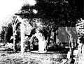 Sockburn.Church.1894.jpg 1,200 × 921; 257 KB
-
 View of Sockburn Manor from All Saints Church.jpg 3,240 × 4,320; 3.41 MB


