Category:Allerthorpe
Jump to navigation
Jump to search
English: Allerthorpe is a village and civil parish in the East Riding of Yorkshire, England. It is situated approximately 1.5 miles (2.4 km) south west of the town of Pocklington.
village in the East Riding of Yorkshire, England, United Kingdom  | |||||
| Upload media | |||||
| Instance of | |||||
|---|---|---|---|---|---|
| Location | East Riding of Yorkshire, Yorkshire and the Humber, England | ||||
| Population |
| ||||
 | |||||
Subcategories
This category has the following 4 subcategories, out of 4 total.
Media in category "Allerthorpe"
The following 200 files are in this category, out of 200 total.
-
 A bridleway leading to Tank Plantation - geograph.org.uk - 2517523.jpg 800 × 600; 321 KB
-
 A building near the warehouse - geograph.org.uk - 1053403.jpg 640 × 385; 303 KB
-
 A minor road near Fir Tree Cottage - geograph.org.uk - 2517539.jpg 800 × 600; 297 KB
-

-
 A walk from Wilberfoss ^47 - geograph.org.uk - 2003598.jpg 800 × 600; 322 KB
-
 A walk from Wilberfoss ^48 - geograph.org.uk - 2003602.jpg 800 × 600; 314 KB
-
 Above Giles Lock - geograph.org.uk - 1415118.jpg 640 × 480; 139 KB
-
 Allerthorpe - geograph.org.uk - 1398583.jpg 640 × 480; 119 KB
-
 Allerthorpe Business Park - geograph.org.uk - 1053406.jpg 640 × 427; 222 KB
-
 Allerthorpe Common woodland - geograph.org.uk - 5412723.jpg 480 × 640; 553 KB
-
 Allerthorpe golf course - geograph.org.uk - 1407827.jpg 640 × 480; 100 KB
-
 Allerthorpe Lakeland Park - geograph.org.uk - 744287.jpg 640 × 381; 58 KB
-
 Allerthorpe Lakeland Park fishing lake - geograph.org.uk - 2387764.jpg 1,600 × 1,200; 418 KB
-
-
 Allerthorpe Lakeland Park lakeside hide - geograph.org.uk - 2387780.jpg 1,600 × 1,200; 452 KB
-
 Allerthorpe UK parish locator map.svg 1,425 × 1,107; 1.68 MB
-
 Allerthorpe village - geograph.org.uk - 1407806.jpg 640 × 480; 126 KB
-
 Allerthorpe Village Hall - geograph.org.uk - 2036070.jpg 640 × 437; 37 KB
-
 Allerthorpe Village Sign - geograph.org.uk - 6518253.jpg 1,600 × 1,065; 690 KB
-
 Allerthorpe, East Yorks - geograph.org.uk - 5412719.jpg 640 × 480; 382 KB
-
 Approaching Warren Farm Cottages - geograph.org.uk - 5618421.jpg 1,600 × 1,200; 686 KB
-
 Back Lane, Allerthorpe - geograph.org.uk - 6518257.jpg 1,600 × 1,065; 900 KB
-
 Back Lane, Allerthorpe - geograph.org.uk - 6518260.jpg 1,600 × 1,065; 897 KB
-
 Back Lane, Allerthorpe - geograph.org.uk - 6518375.jpg 1,600 × 1,065; 546 KB
-
 Back Lane, Allerthorpe - geograph.org.uk - 6518376.jpg 1,600 × 1,065; 433 KB
-
 Back Lane, Allerthorpe - geograph.org.uk - 6518380.jpg 1,600 × 1,065; 569 KB
-
 Back Lane, Allerthorpe - geograph.org.uk - 6518540.jpg 1,600 × 1,065; 589 KB
-
 Barley in Allerthorpe - geograph.org.uk - 1407793.jpg 640 × 480; 113 KB
-
 Barn at Woodlands Farm - geograph.org.uk - 6518891.jpg 1,600 × 1,065; 609 KB
-
 Beck in Tank Plantation - geograph.org.uk - 3985348.jpg 1,024 × 768; 396 KB
-
 Bridge over Stone Beck - geograph.org.uk - 3979952.jpg 1,024 × 768; 227 KB
-
 Bridge over Stone Beck - geograph.org.uk - 3985287.jpg 1,024 × 768; 197 KB
-
 Bridleway at Allerthorpe Common - geograph.org.uk - 6518752.jpg 1,600 × 1,065; 846 KB
-
 Bridleway at Allerthorpe Common - geograph.org.uk - 6518760.jpg 1,600 × 1,065; 901 KB
-
 Bridleway at Allerthorpe Common - geograph.org.uk - 6518851.jpg 1,600 × 1,065; 700 KB
-
 Bridleway at Allerthorpe Common - geograph.org.uk - 6518865.jpg 1,600 × 1,065; 875 KB
-
 Bridleway at Allerthorpe Common - geograph.org.uk - 6518869.jpg 1,600 × 1,065; 880 KB
-
 Bridleway enters Tank Plantation - geograph.org.uk - 6518734.jpg 1,600 × 1,065; 642 KB
-
 Bridleway in Tank Plantation - geograph.org.uk - 5618429.jpg 1,600 × 1,200; 895 KB
-
 Bridleway in Tank Plantation - geograph.org.uk - 6518736.jpg 1,600 × 1,065; 875 KB
-
 Bridleway in Tank Plantation - geograph.org.uk - 6518748.jpg 1,600 × 1,065; 880 KB
-
 Bridleway in Tank Plantation - geograph.org.uk - 6518749.jpg 1,600 × 1,065; 923 KB
-
 Bridleway in the woods at Allerthorpe Common - geograph.org.uk - 5618433.jpg 1,600 × 1,200; 1.06 MB
-
 Bridleway through Tank Plantation - geograph.org.uk - 2036081.jpg 640 × 480; 134 KB
-
 Bridleway towards Allerthorpe Common - geograph.org.uk - 6518547.jpg 1,600 × 1,065; 612 KB
-
 Bridleway towards Allerthorpe Common - geograph.org.uk - 6518583.jpg 1,600 × 1,065; 628 KB
-
 Bridleway towards Allerthorpe Common - geograph.org.uk - 6518585.jpg 1,600 × 1,065; 457 KB
-
 Bridleway towards Allerthorpe Common - geograph.org.uk - 6518586.jpg 1,600 × 1,065; 586 KB
-
 Bridleway towards Allerthorpe Common - geograph.org.uk - 6518729.jpg 1,600 × 1,065; 845 KB
-
 Bridleway towards Allerthorpe Common - geograph.org.uk - 6518731.jpg 1,600 × 1,065; 565 KB
-
 Bridleway towards Allerthorpe Common - geograph.org.uk - 6518732.jpg 1,600 × 1,065; 762 KB
-
 Canal tow path, route of Wilberforce Way - geograph.org.uk - 6179216.jpg 2,000 × 1,450; 3.39 MB
-
 Clearing in Allerthorpe Woods - geograph.org.uk - 2203530.jpg 640 × 480; 235 KB
-
 Compost collecting area - geograph.org.uk - 3979960.jpg 1,024 × 768; 207 KB
-
 Derelict building at Warren Farm - geograph.org.uk - 4452804.jpg 1,600 × 1,062; 642 KB
-
 Ducks near Canal Head - geograph.org.uk - 1994343.jpg 2,628 × 3,390; 3.84 MB
-
 Entering Allerthorpe, East Yorkshire - geograph.org.uk - 2517515.jpg 800 × 600; 246 KB
-
 Entering Tank Plantation - geograph.org.uk - 3985320.jpg 1,024 × 768; 234 KB
-
 Entrance to Allerthorpe lakeland park - geograph.org.uk - 1411159.jpg 640 × 480; 110 KB
-
 Entrance to Lake Lodge near Waplington Hall - geograph.org.uk - 4463474.jpg 2,448 × 1,624; 2.08 MB
-
 Entrances to industrial estates on both sides of A1079 - geograph.org.uk - 5558699.jpg 3,409 × 2,545; 2.64 MB
-
 Exiting the woods - geograph.org.uk - 2203531.jpg 640 × 480; 256 KB
-
 Fallen tree in Tank Plantation - geograph.org.uk - 3985327.jpg 1,024 × 768; 352 KB
-
 Farm Land - geograph.org.uk - 586841.jpg 640 × 480; 67 KB
-
 Farm track leading to Warren Wood - geograph.org.uk - 4462355.jpg 2,448 × 1,624; 1.86 MB
-
 Farm track near Warren House - geograph.org.uk - 3989869.jpg 1,024 × 768; 254 KB
-
 Farm track to Waplington - geograph.org.uk - 3989888.jpg 1,024 × 768; 201 KB
-
 Farm track towards Waplington Hall - geograph.org.uk - 4462360.jpg 2,448 × 1,624; 1.22 MB
-
 Farm track towards Waplington Hall - geograph.org.uk - 4463464.jpg 2,448 × 1,624; 1.75 MB
-
 Farmland west of Allerthorpe - geograph.org.uk - 2036076.jpg 640 × 480; 65 KB
-
 Field Track by Fir Tree Cottage - geograph.org.uk - 6483313.jpg 1,024 × 768; 200 KB
-
 Footpath into Allerthorpe Common - geograph.org.uk - 6518877.jpg 1,600 × 1,065; 925 KB
-
 Footpath past pig farm - geograph.org.uk - 2250688.jpg 640 × 480; 258 KB
-
 Footpath to Allerthorpe Common - geograph.org.uk - 1387153.jpg 640 × 480; 149 KB
-
 Footpath to Allerthorpe Common - geograph.org.uk - 3979957.jpg 1,024 × 768; 198 KB
-
 Footpath to Waplington - geograph.org.uk - 3979954.jpg 1,024 × 768; 149 KB
-
 Footpath to Waplington - geograph.org.uk - 3989878.jpg 1,024 × 768; 165 KB
-
 Forestry on Low Moor - geograph.org.uk - 3564882.jpg 640 × 427; 94 KB
-
 Former Post Office on Back Lane, Allerthorpe - geograph.org.uk - 6518263.jpg 1,600 × 1,065; 597 KB
-
 Gap in the trees - geograph.org.uk - 3988936.jpg 1,024 × 768; 288 KB
-

-
 Gate on the bridleway at Tank Plantation - geograph.org.uk - 5618425.jpg 1,600 × 1,200; 849 KB
-
 Giles Lock - geograph.org.uk - 1415125.jpg 640 × 480; 166 KB
-
 Giles Lock - geograph.org.uk - 1994363.jpg 2,958 × 2,736; 2.91 MB
-
 Giles Lock Pocklington Canal - geograph.org.uk - 5314936.jpg 2,252 × 1,656; 2.09 MB
-
 Giles Lock, Pocklington Canal - geograph.org.uk - 3935365.jpg 1,600 × 1,200; 824 KB
-
 Giles Lock, Pocklington Canal - geograph.org.uk - 5627801.jpg 1,024 × 768; 236 KB
-
 Giles Lock, Pocklington Canal - geograph.org.uk - 871849.jpg 640 × 480; 250 KB
-
 Golf course near Allerthorpe - geograph.org.uk - 1411156.jpg 640 × 480; 100 KB
-
 Golf Practice - geograph.org.uk - 132979.jpg 640 × 425; 76 KB
-
 Halifax Way off York Road - geograph.org.uk - 6560529.jpg 1,600 × 1,065; 395 KB
-
 Heading for Tank Plantation - geograph.org.uk - 4848633.jpg 3,072 × 1,728; 1.89 MB
-
 High Moor - geograph.org.uk - 3989855.jpg 1,024 × 768; 254 KB
-
 House on Back Lane, Allerthorpe - geograph.org.uk - 4463571.jpg 2,448 × 1,624; 1.62 MB
-
 House on Back Lane, Allerthorpe - geograph.org.uk - 4463602.jpg 2,448 × 1,624; 837 KB
-
 Houses near Waplington Hall - geograph.org.uk - 4463468.jpg 2,448 × 1,624; 1.39 MB
-
 Houses on Back Lane, Allerthorpe - geograph.org.uk - 4463594.jpg 2,448 × 1,624; 1.21 MB
-
 J. O'gram Farms, The Gables, Allerthorpe - geograph.org.uk - 4463600.jpg 2,448 × 1,624; 1.1 MB
-
 Lane at Waplington - geograph.org.uk - 3989911.jpg 1,024 × 768; 277 KB
-
 Lock keepers cottage, Pocklington Canal Head - geograph.org.uk - 2387633.jpg 1,600 × 1,200; 415 KB
-
 Lock on the Pocklington Canal - geograph.org.uk - 2035158.jpg 640 × 480; 116 KB
-
 Manor Farm, Allerthorpe - geograph.org.uk - 2517518.jpg 800 × 600; 232 KB
-
 Manor Farm, Allerthorpe - geograph.org.uk - 6518552.jpg 1,600 × 1,065; 548 KB
-
 Memorial stone to Thomas Cooke - geograph.org.uk - 1409953.jpg 640 × 480; 128 KB
-
 Minor road through Allerthorpe Common - geograph.org.uk - 2371685.jpg 1,600 × 1,200; 620 KB
-
 Minor road towards Allerthorpe - geograph.org.uk - 2036061.jpg 640 × 480; 71 KB
-
 Minor road towards Melbourne - geograph.org.uk - 2036055.jpg 640 × 480; 78 KB
-
 Mole Catcher's Cottage - geograph.org.uk - 4463557.jpg 2,448 × 1,624; 1.82 MB
-
 Moon over Allerthorpe Woods - geograph.org.uk - 2203529.jpg 640 × 480; 226 KB
-

-
 Old Caravan - geograph.org.uk - 383023.jpg 640 × 467; 116 KB
-
 Parking area, Allerthorpe Common - geograph.org.uk - 5870124.jpg 1,024 × 768; 303 KB
-
 Path by Pocklington Canal - geograph.org.uk - 5870120.jpg 1,024 × 768; 270 KB
-
 Path by the Pocklington Canal - geograph.org.uk - 5870115.jpg 1,024 × 768; 305 KB
-
 Path leading to Allerthorpe - geograph.org.uk - 6518244.jpg 1,600 × 1,065; 680 KB
-
 Path leading to Warren Wood - geograph.org.uk - 4462352.jpg 2,448 × 1,624; 2.08 MB
-
 Path on Allerthorpe Common - geograph.org.uk - 5870140.jpg 1,024 × 768; 196 KB
-
 Path towards Common Lane - geograph.org.uk - 6518884.jpg 1,600 × 1,065; 672 KB
-
 Path towards Common Lane - geograph.org.uk - 6518886.jpg 1,600 × 1,065; 938 KB
-
 Petrol station and services on A1079 York Road - geograph.org.uk - 5558654.jpg 4,153 × 3,023; 3.44 MB
-
 Plough Inn, Allerthorpe - geograph.org.uk - 4848273.jpg 3,072 × 1,728; 1.68 MB
-
 Pocklington Canal at Giles Lock - geograph.org.uk - 1569978.jpg 426 × 640; 172 KB
-
 Pocklington Canal Head - geograph.org.uk - 2387618.jpg 1,600 × 1,200; 295 KB
-
 Pocklington Canal Path.JPG 2,736 × 3,648; 4.38 MB
-
 Pocklington Canal, northeast of Sandhill Lock - geograph.org.uk - 3935362.jpg 1,600 × 1,200; 875 KB
-
 Pond in Brickpit Plantation, Warren Farm - geograph.org.uk - 4462333.jpg 2,448 × 1,624; 2.1 MB
-
 Power lines at Allerthorpe Common - geograph.org.uk - 6518860.jpg 1,600 × 1,065; 556 KB
-
 Powerful clearway - geograph.org.uk - 4848641.jpg 3,072 × 1,728; 1.79 MB
-
 Public Footpath to Allerthorpe Common - geograph.org.uk - 295082.jpg 640 × 385; 108 KB
-
 Public Footpath to Allerthorpe Common - geograph.org.uk - 295083.jpg 640 × 480; 129 KB
-
 Rhododendrons in Warren Wood - geograph.org.uk - 3989883.jpg 1,024 × 768; 323 KB
-
 Ride on Allerthorpe Common - geograph.org.uk - 3989830.jpg 1,024 × 768; 350 KB
-
 Road exiting Allerthorpe Common - geograph.org.uk - 5356646.jpg 640 × 427; 218 KB
-
 Roundabout on the A1079 at Pocklington Services - geograph.org.uk - 6518211.jpg 1,600 × 1,065; 378 KB
-
 RSH Headquarters - geograph.org.uk - 1053404.jpg 640 × 427; 344 KB
-
 Rural Footpath - geograph.org.uk - 573708.jpg 640 × 480; 100 KB
-
 Rural Footpath - geograph.org.uk - 573713.jpg 640 × 480; 118 KB
-
 Silburn Lock, Pocklington Canal - geograph.org.uk - 2387642.jpg 1,600 × 1,200; 584 KB
-
 St Botolph Church, Allerthorpe - geograph.org.uk - 4463641.jpg 2,448 × 1,624; 1.84 MB
-
 St Botolph's Church, Allerthorpe - geograph.org.uk - 2036073.jpg 640 × 480; 80 KB
-
 St. Botolph, Allerthorpe - interior looking east - geograph.org.uk - 3985253.jpg 1,024 × 768; 152 KB
-
 St. Botolph, Allerthorpe - interior looking west - geograph.org.uk - 3985257.jpg 1,024 × 768; 122 KB
-
 Tank Plantation - geograph.org.uk - 2036083.jpg 640 × 480; 133 KB
-
 TDG Warehouse, Allerthorpe Business Park - geograph.org.uk - 1053405.jpg 640 × 427; 303 KB
-
 The churchyard, Allerthorpe - geograph.org.uk - 3985264.jpg 1,024 × 768; 191 KB
-
 The former Hodsow Lane - geograph.org.uk - 6678935.jpg 3,707 × 2,766; 1.58 MB
-
 The Gables, Allerthorpe - geograph.org.uk - 3979950.jpg 1,024 × 768; 143 KB
-
 The Old Chapel, Allerthorpe - geograph.org.uk - 4463650.jpg 2,448 × 1,624; 1.61 MB
-
 The pig farm - geograph.org.uk - 6483334.jpg 1,024 × 768; 179 KB
-
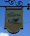
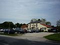 The Plough Inn - geograph.org.uk - 1407811.jpg 640 × 480; 111 KB
-
 The Plough Inn - geograph.org.uk - 4995581.jpg 1,500 × 764; 959 KB
-
 The Plough Inn at Allerthorpe - geograph.org.uk - 6483307.jpg 1,024 × 768; 143 KB
-
 The Plough Inn, Allerthorpe - geograph.org.uk - 2036066.jpg 640 × 355; 64 KB
-
 The Plough Inn, Allerthorpe - geograph.org.uk - 4452810.jpg 1,431 × 1,703; 907 KB
-
 The Plough Inn, Allerthorpe - geograph.org.uk - 4452814.jpg 2,036 × 1,255; 871 KB
-
 The Plough Inn, Allerthorpe - geograph.org.uk - 4463577.jpg 2,448 × 1,624; 1.31 MB
-
 The Plough Inn, Allerthorpe, East Yorkshire - geograph.org.uk - 2387693.jpg 1,600 × 1,200; 308 KB
-
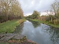
 The Pocklington Canal (disused) - geograph.org.uk - 573698.jpg 640 × 480; 189 KB
-
 The Pocklington Canal - geograph.org.uk - 2035170.jpg 640 × 480; 107 KB
-
 The Pocklington Canal - geograph.org.uk - 2035175.jpg 640 × 480; 116 KB
-
 The Pocklington Canal - geograph.org.uk - 5628009.jpg 1,024 × 768; 169 KB
-
 The Pocklington Canal above Giles Lock - geograph.org.uk - 1994357.jpg 3,582 × 2,736; 2.91 MB
-
 The Pocklington Canal above Giles Lock - geograph.org.uk - 5628031.jpg 1,024 × 768; 155 KB
-
 The Pocklington Canal at The Ings - geograph.org.uk - 5636809.jpg 1,024 × 768; 262 KB
-
 The Pocklington Canal Towpath - geograph.org.uk - 573686.jpg 640 × 480; 148 KB
-
 The towpath, Pocklington Canal - geograph.org.uk - 871861.jpg 640 × 480; 289 KB
-
 The track to Tank Plantation - geograph.org.uk - 237743.jpg 640 × 480; 98 KB
-
 The Village of Allerthorpe, East Yorkshire - geograph.org.uk - 4463565.jpg 2,448 × 1,624; 1.93 MB
-
 The way to the 6th tee - geograph.org.uk - 2517534.jpg 800 × 600; 327 KB
-
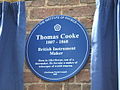 Thomas Cooke Plaque.jpg 640 × 480; 72 KB
-
 Towpath along the Pocklington Canal - geograph.org.uk - 6333685.jpg 1,024 × 683; 747 KB
-
 Towpath beside the Pocklington Canal - geograph.org.uk - 6333684.jpg 1,024 × 683; 661 KB
-

-
 Track to Allerthorpe Common - geograph.org.uk - 3985296.jpg 1,024 × 768; 162 KB
-
 Track to Manor Farm - geograph.org.uk - 2036051.jpg 640 × 480; 119 KB
-
 Track to the Tank Plantation - geograph.org.uk - 6483339.jpg 1,024 × 768; 157 KB
-
 Tracks near Waplinton - geograph.org.uk - 2250696.jpg 640 × 480; 272 KB
-
 Uprooted tree - geograph.org.uk - 3989836.jpg 1,024 × 768; 317 KB
-
 View back to Top Lock - geograph.org.uk - 548141.jpg 640 × 480; 129 KB
-
 View from a Lock - geograph.org.uk - 548190.jpg 480 × 640; 141 KB
-
 View towards Pocklington Industrial Estate - geograph.org.uk - 3985277.jpg 1,024 × 768; 137 KB
-
 Village Hall, Allerthorpe - geograph.org.uk - 4463582.jpg 2,448 × 1,624; 1.34 MB
-
 Waplington Hall - geograph.org.uk - 6483326.jpg 1,024 × 768; 210 KB
-
 Waplington Lane - geograph.org.uk - 3979962.jpg 1,024 × 768; 240 KB
-
 Warren House - geograph.org.uk - 3979959.jpg 1,024 × 768; 194 KB
-
 Warren House Farm - geograph.org.uk - 6483328.jpg 1,024 × 768; 162 KB
-
 Wilberforce Way at Giles Lock - geograph.org.uk - 6522916.jpg 1,600 × 1,065; 691 KB
-
 Wilberforce Way at Giles Lock - geograph.org.uk - 6522918.jpg 1,600 × 1,065; 551 KB
-
 Wilberforce Way at Silburn Lock - geograph.org.uk - 6523158.jpg 1,600 × 1,065; 711 KB
-
 Wilberforce Way towards Giles Lock - geograph.org.uk - 6522907.jpg 1,600 × 1,065; 1,006 KB
-
 Wilberforce Way towards Giles Lock - geograph.org.uk - 6522909.jpg 1,600 × 1,065; 1.08 MB
-
 Wilberforce Way towards Giles Lock - geograph.org.uk - 6522913.jpg 1,600 × 1,065; 934 KB
-
 Wilberforce Way towards Silburn Lock - geograph.org.uk - 6523154.jpg 1,600 × 1,065; 921 KB
-
 Woodland beside the Pocklington Canal - geograph.org.uk - 2035180.jpg 640 × 480; 128 KB
-
 Woodland edge - geograph.org.uk - 3989864.jpg 1,024 × 768; 334 KB
-
 Woodland path, Allerthorpe Common - geograph.org.uk - 5870128.jpg 1,024 × 768; 313 KB
-
 Woodland path, Allerthorpe Common - geograph.org.uk - 5870134.jpg 1,024 × 768; 325 KB
-
 Woodland, Allerthorpe Common - geograph.org.uk - 2371680.jpg 1,600 × 1,200; 903 KB
-
 Woods on Allerthorpe Common - geograph.org.uk - 4848635.jpg 3,072 × 1,728; 2.44 MB
-
 York Road A1079 passing Barmby Moor - geograph.org.uk - 5558722.jpg 3,429 × 2,562; 2.67 MB


_-_geograph.org.uk_-_573698.jpg)


_towards_Allerthorpe_Common_-_geograph.org.uk_-_2036079.jpg)


