Category:Alloa
Jump to navigation
Jump to search
town in Clackmannanshire, Scotland, UK  | |||||
| Upload media | |||||
| Instance of |
| ||||
|---|---|---|---|---|---|
| Location |
| ||||
| Population |
| ||||
| Area |
| ||||
 | |||||
Български: 515px|мини|Панорамен изглед от Алоа
English: Alloa is a small burgh in Clackmannanshire, Scotland, 7 miles to the east of Stirling, on the north bank of the River Forth. The town was a burgh of barony, and at one time of considerable commercial importance but is now relatively insignificant. It has a population of 18,989.
Gàidhlig: 'S e baile ann an Alba meadhonach a tha ann an Allmhagh Mòr. Tha e ann an Siorrachd Chlach Mhanainn agus faisg air Allmhagh Beag.
Italiano: Alloa ( gael. Allmhagh Mór) è una città del Regno Unito, capoluogo del Clackmannanshire, in Scozia, ca. 10 km E di Stirling, sulla riva nord del fiume Forth. Secondo le stime del 2004, Alloa conta circa 18.960 abitanti.
Nederlands: Alloa (Allmhagh Mòr) is een plaats en voormalige burgh in het Schotse bestuurlijke gebied Clackmannanshire, ten oosten van Stirling en ten westen van Clackmannan, op de oever van de rivier Forth.
Norsk bokmål: I løpet av 1700-tallet blomstret Alloa som en havn ved elven hvor produktene til fabrikasjonene i Glasgow ble eksportert til det kontinentale Europa. På denne tiden og fram til 1950-tallet var hovedindustrien på nord- og østsiden av byen kulldrift, og en omfattende nett av vogner på skinner eksisterte for å frakte kullen til havnen. Jarlene av Mar eide mange kullgruvene og Robert Bald, en uvanlig oppfinnsom lokal ingeniør var medvirkende til å skaffe vannkraft fra Gartmorn-dammen for å betjene både gruvene og annen industri som blant annet veving. Mange spor etter vognene og Gartmorn-dammen kan fortsatt bli sett i dag, og selv om dammen ikke lenger blir benyttet for energiproduksjon, eller vannforskyning, er den et egnet sted for fisking og fritidssysler.
Polski: Alloa ( gael. Allmhagh Mór) - miasto w Szkocji, położone 11 kilometrów od Stirling, ośrodek administracyjny hrabstwa Clackmannanshire. Ok. 19 tysięcy mieszkańców.
Русский: Аллоа — город в центральной части Шотландии, административный центр области Клакманнаншир. Расположен в 3 км к западу от Клакманна и в 11 км к востоку от Стерлинга, на северном берегу реки Форт.
Subcategories
This category has the following 17 subcategories, out of 17 total.
A
- Alloa Co-operative Society (4 F)
- Alloa Glass Works (6 F)
- Alloa Inch (2 F)
- Alloa Swing Bridge (6 F)
- Alloa Tower (27 F)
- Alloa Town Hall (2 F)
- Alloa War Memorial (7 F)
C
- County Buildings, Alloa (1 F)
G
- Gean House (3 F)
L
- Lime Tree Walk, Alloa (3 F)
R
- Alloa railway station (19 F)
S
Media in category "Alloa"
The following 200 files are in this category, out of 429 total.
(previous page) (next page)-
 0704 The Forth Valley east of Stirling - geograph.org.uk - 1832413.jpg 1,024 × 768; 62 KB
-
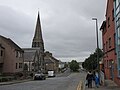
 25 Kirkgate, Alloa - geograph.org.uk - 5937990.jpg 1,024 × 924; 131 KB
-
 42 Glasshouse Loan - geograph.org.uk - 5871832.jpg 6,000 × 4,000; 6.65 MB
-
 61994 on a special working at Blackgrange.jpg 800 × 531; 132 KB
-
 64599 at Alloa, 1965 - geograph.org.uk - 6159347.jpg 1,280 × 834; 337 KB
-
 7 Norwood Ave in Alloa.jpg 965 × 632; 170 KB
-
 A frosty field - geograph.org.uk - 2228904.jpg 640 × 480; 75 KB
-
 A leafy lane near Alloa - geograph.org.uk - 6156282.jpg 1,600 × 1,067; 617 KB
-

-
 A Ronseal moment - geograph.org.uk - 4124211.jpg 473 × 640; 45 KB
-
 A weedy pond on the east fringe of Alloa - geograph.org.uk - 6156294.jpg 1,600 × 1,061; 421 KB
-
 A907 eastbound nearing Clackmannan - geograph.org.uk - 4569836.jpg 640 × 480; 42 KB
-
 A908 Main Street at Sauchie boundary - geograph.org.uk - 4568433.jpg 640 × 481; 84 KB
-
 A908 Whins Road at Alloa boundary - geograph.org.uk - 4568434.jpg 640 × 481; 48 KB
-
 Access path to Devon Way near Devon Village - geograph.org.uk - 3956642.jpg 1,600 × 1,067; 777 KB
-
 Access to Devon Way near Devon Village - geograph.org.uk - 3956668.jpg 1,600 × 1,067; 569 KB
-
 Access to Devon Way, Fishcross - geograph.org.uk - 3956620.jpg 5,184 × 3,456; 7.6 MB
-
 Air Spirit or Muirside Man - geograph.org.uk - 3518580.jpg 1,280 × 960; 201 KB
-
 Air Spirit or Muirside Man - geograph.org.uk - 3518584.jpg 960 × 1,280; 193 KB
-
 Aldi supermarket, Alloa - geograph.org.uk - 6155589.jpg 1,600 × 958; 350 KB
-
 Alexandra Drive, Alloa - geograph.org.uk - 2145512.jpg 640 × 480; 69 KB
-
 Alloa - geograph.org.uk - 352651.jpg 640 × 424; 36 KB
-
 Alloa - geograph.org.uk - 461132.jpg 640 × 424; 62 KB
-
 Alloa Academy Main Entrance.JPG 3,648 × 2,736; 2.4 MB
-
 Alloa Academy site - geograph.org.uk - 2585637.jpg 640 × 359; 217 KB
-
 Alloa Academy site - geograph.org.uk - 2585640.jpg 640 × 359; 209 KB
-
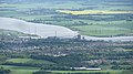 Alloa and the Forth - geograph.org.uk - 2599466.jpg 640 × 359; 77 KB
-
 Alloa Athletic FC Badge - geograph.org.uk - 4236466.jpg 520 × 494; 102 KB
-
 Alloa Auto Centre, Broad Street - geograph.org.uk - 4124721.jpg 640 × 480; 76 KB
-
 Alloa Co-operative, Scotland 2004 - 3272896002.jpg 1,182 × 1,710; 157 KB
-
 Alloa Co-operative, Scotland 2004.jpg 1,098 × 1,721; 159 KB
-
 Alloa Elim Church - geograph.org.uk - 5938063.jpg 1,024 × 768; 148 KB
-
 Alloa Elim Church - geograph.org.uk - 6157905.jpg 1,600 × 1,081; 336 KB
-
 Alloa Fire Station - geograph.org.uk - 5878986.jpg 1,024 × 768; 160 KB
-
 Alloa from Clackmannan Tower.jpg 640 × 279; 58 KB
-
 Alloa From The Air - geograph.org.uk - 1440457.jpg 473 × 487; 46 KB
-
 Alloa glassworks - geograph.org.uk - 3520373.jpg 832 × 1,280; 137 KB
-
 Alloa glassworks - geograph.org.uk - 3520383.jpg 1,280 × 853; 118 KB
-
 Alloa Golf Course - geograph.org.uk - 2579043.jpg 640 × 492; 116 KB
-
 Alloa Golf Course - geograph.org.uk - 4052272.jpg 640 × 480; 70 KB
-
 Alloa Harbour - geograph.org.uk - 352229.jpg 640 × 424; 52 KB
-
 Alloa marshalling yard, 1965 - geograph.org.uk - 6159311.jpg 1,280 × 829; 301 KB
-
 Alloa mercat cross, Bank Street - geograph.org.uk - 3681979.jpg 480 × 640; 72 KB
-
 Alloa Railway Station - geograph.org.uk - 6155567.jpg 1,600 × 1,031; 347 KB
-
 Alloa Railway Station - geograph.org.uk - 6155572.jpg 1,600 × 1,062; 386 KB
-
 Alloa railway station, Clackmannanshire - geograph.org.uk - 5980236.jpg 1,600 × 1,200; 660 KB
-
 Alloa Railway Viaduct - geograph.org.uk - 444885.jpg 640 × 480; 88 KB
-
 Alloa Road, Tullibody - geograph.org.uk - 2422399.jpg 640 × 480; 315 KB
-
 Alloa Road, Tullibody - geograph.org.uk - 2422410.jpg 640 × 480; 316 KB
-
 Alloa Tower - geograph.org.uk - 6157542.jpg 1,320 × 1,600; 463 KB
-
 Alloa Tower - geograph.org.uk - 6157673.jpg 1,600 × 953; 323 KB
-
 Alloa Waggonway.jpg 2,592 × 1,944; 1.53 MB
-
 Alloa West End Park.jpg 2,048 × 1,536; 688 KB
-
 Alloa's new railway - geograph.org.uk - 1010303.jpg 640 × 480; 85 KB
-
 Alloa, 60 High Street.jpg 4,000 × 3,000; 2.01 MB
-
 Alloa, ASDA.jpg 4,000 × 3,000; 1.91 MB
-
 Alloa, Drysdale Street, 1991 - geograph.org.uk - 4329993.jpg 2,392 × 1,461; 4.68 MB
-
 Alloa, Drysdale Street.jpg 4,000 × 3,000; 1.86 MB
-
 Alloa, drátěný program.jpg 3,000 × 4,000; 2.16 MB
-
 Alloa, High Street.jpg 4,000 × 3,000; 1.93 MB
-
 Alloa, Junction Place.jpg 4,000 × 3,000; 2.1 MB
-
 Alloa, Shillinghill Roundabout.jpg 4,000 × 3,000; 2.09 MB
-
 Alloa, Shillinghill.jpg 4,000 × 3,000; 1.81 MB
-
 Alongside the River Forth - geograph.org.uk - 5938579.jpg 1,024 × 768; 149 KB
-
 Andy Scott sculpture 'Lifeline' - geograph.org.uk - 3956467.jpg 3,456 × 5,184; 6.86 MB
-
 Anyone for malted crisps^ - geograph.org.uk - 3520375.jpg 853 × 1,280; 221 KB
-
 Approaching Cambus - geograph.org.uk - 5878928.jpg 1,024 × 768; 282 KB
-
 Archibald MacLaren Oxford Gymnasium.jpg 193 × 261; 6 KB
-
 Asda and the distant Ochil Hills - geograph.org.uk - 6156911.jpg 1,600 × 936; 394 KB
-
 Asda petrol and station car park - geograph.org.uk - 6155581.jpg 1,600 × 971; 293 KB
-
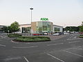
 Asda, Alloa - geograph.org.uk - 6155524.jpg 1,600 × 1,058; 315 KB
-
 Auchinbaird Windmill - geograph.org.uk - 4021438.jpg 640 × 428; 61 KB
-
 Auchinbaird Windmill - geograph.org.uk - 4021450.jpg 640 × 428; 43 KB
-
 Auchinbaird Windmill - geograph.org.uk - 4052281.jpg 640 × 481; 104 KB
-
 Auld Brig Road at Shillinghill Roundabout, Alloa - geograph.org.uk - 6156885.jpg 1,600 × 1,024; 376 KB
-
 Avenue to Alloa Tower - geograph.org.uk - 4702174.jpg 3,264 × 2,448; 1.57 MB
-
 B908 southbound near Westhaugh - geograph.org.uk - 4568430.jpg 640 × 481; 82 KB
-
 B909 at Alloa - geograph.org.uk - 6156314.jpg 1,600 × 1,067; 447 KB
-
 B909 near Alloa - geograph.org.uk - 6156273.jpg 1,600 × 1,067; 454 KB
-
 B9140 at Fishcross boundary - geograph.org.uk - 4568431.jpg 640 × 480; 52 KB
-
 Back of Shillinghill - geograph.org.uk - 2829843.jpg 640 × 360; 202 KB
-
 Banchory Place, Tullibody - geograph.org.uk - 2422404.jpg 640 × 480; 276 KB
-
 Bank Head Farm - geograph.org.uk - 3956957.jpg 5,184 × 3,456; 7.15 MB
-
 Bank Street, Alloa - geograph.org.uk - 6158878.jpg 1,600 × 1,030; 294 KB
-
 Bank Street, Alloa - geograph.org.uk - 6159331.jpg 1,600 × 1,116; 342 KB
-
 Bean crop, Longcarse - geograph.org.uk - 2585952.jpg 640 × 359; 203 KB
-
 Bedford House, Bedford Place, Alloa - geograph.org.uk - 6158933.jpg 1,600 × 990; 334 KB
-
 Behind Shillinghill - geograph.org.uk - 2824524.jpg 640 × 480; 251 KB
-
 Bell tower, Old Parish Church, Alloa - geograph.org.uk - 6158534.jpg 1,411 × 1,600; 378 KB
-
 Bell tower, Old Parish Church, Alloa - geograph.org.uk - 6158556.jpg 1,202 × 1,600; 356 KB
-
 Bellevue Road, Alloa - geograph.org.uk - 1758183.jpg 640 × 480; 88 KB
-
 Black Devon landfill site - geograph.org.uk - 2581829.jpg 640 × 359; 197 KB
-
 Black Devon landfill site - geograph.org.uk - 2585610.jpg 640 × 359; 269 KB
-
 Black Devon landfill site - geograph.org.uk - 2600503.jpg 640 × 346; 49 KB
-
 Blackfaulds farm - geograph.org.uk - 2933285.jpg 2,048 × 1,536; 888 KB
-
 Blackmuir wood - geograph.org.uk - 2505455.jpg 640 × 483; 206 KB
-
 Boats on the River Forth at Alloa - geograph.org.uk - 3520387.jpg 853 × 1,280; 114 KB
-
 Bonded Warehouses - geograph.org.uk - 4052502.jpg 3,115 × 1,752; 3.17 MB
-
 Brewing heritage - geograph.org.uk - 2836016.jpg 640 × 360; 205 KB
-
 Bridge on cycle route NCN768 - geograph.org.uk - 3922063.jpg 640 × 480; 339 KB
-
 Bridge Over the cycle route - geograph.org.uk - 4052288.jpg 1,280 × 852; 1.03 MB
-
 Bridge taking the A907 over the cycle route - geograph.org.uk - 4052392.jpg 1,280 × 853; 1.17 MB
-
 Bridge Terrace, Alloa - geograph.org.uk - 6156409.jpg 1,600 × 908; 271 KB
-
 Broad Street - geograph.org.uk - 1760521.jpg 640 × 480; 89 KB
-
 Broad Street, Alloa (geograph 3520392).jpg 1,280 × 954; 196 KB
-
 Broad Street, Alloa - geograph.org.uk - 4124766.jpg 640 × 480; 61 KB
-
 Broad Street, Alloa - geograph.org.uk - 5938066.jpg 1,024 × 768; 123 KB
-
 Brothie Burn and gabions - geograph.org.uk - 6155611.jpg 1,600 × 1,038; 482 KB
-
 Buick's, Alloa - geograph.org.uk - 4124779.jpg 640 × 480; 49 KB
-

-
 Bus Shelter ^ Primary School, Fishcross - geograph.org.uk - 3956606.jpg 5,184 × 3,456; 6.85 MB
-
 Bus stop, Glenochil - geograph.org.uk - 3322806.jpg 640 × 360; 238 KB
-
 Business centre - geograph.org.uk - 459906.jpg 640 × 407; 56 KB
-
 Cambus from the riverside path - geograph.org.uk - 5935747.jpg 1,024 × 768; 220 KB
-
 Cambus to Menstrie Cycle Path - geograph.org.uk - 4009142.jpg 640 × 480; 70 KB
-
 Candleriggs, Alloa - geograph.org.uk - 6159412.jpg 1,600 × 1,067; 354 KB
-
 CCTV camera in Hawkhill Road - geograph.org.uk - 4124193.jpg 640 × 480; 77 KB
-
 Clackmannan Road, Alloa - geograph.org.uk - 189138.jpg 640 × 480; 81 KB
-
 Clackmannanshire Community Healthcare Centre, Sauchie - geograph.org.uk - 3956498.jpg 5,184 × 3,456; 5.92 MB
-
 Claremont Lodge Hotel, Alloa - geograph.org.uk - 4236447.jpg 1,600 × 1,062; 577 KB
-
 Clock tower, former stables of Alloa House - geograph.org.uk - 6157492.jpg 1,151 × 1,600; 422 KB
-
 Closed filling station, Tullibody - geograph.org.uk - 2422392.jpg 640 × 480; 241 KB
-
 Co-op, Drysdale Street - geograph.org.uk - 2836076.jpg 640 × 480; 252 KB
-
 Co-operative Building, Drysdale Street, Alloa - geograph.org.uk - 3956452.jpg 5,184 × 3,456; 7.64 MB
-
 Coach House Theatre.jpg 4,032 × 3,024; 2.11 MB
-
 Coal train at Alloa, 1965 - geograph.org.uk - 6159335.jpg 1,280 × 842; 297 KB
-
 Coal train at Alloa, 1965 - geograph.org.uk - 6159344.jpg 1,280 × 845; 316 KB
-
 Coalgate and Union Street, Alloa - geograph.org.uk - 6158823.jpg 1,600 × 1,068; 315 KB
-
 Cobbled road to Alloa Tower - geograph.org.uk - 6157455.jpg 1,600 × 937; 374 KB
-
 Comfrey - geograph.org.uk - 3454479.jpg 640 × 480; 342 KB
-
 Cottage on Stirling Road, Alloa - geograph.org.uk - 4236442.jpg 1,600 × 1,062; 784 KB
-

-
 Crams Bar - geograph.org.uk - 6155441.jpg 1,216 × 1,600; 399 KB
-
 Cricket ground - geograph.org.uk - 460008.jpg 640 × 424; 62 KB
-
 Cycle path, Comely Bank - geograph.org.uk - 1760526.jpg 640 × 480; 77 KB
-

-
 Derelict building - geograph.org.uk - 340227.jpg 640 × 424; 63 KB
-
 Detail, Co-op - geograph.org.uk - 2836061.jpg 640 × 387; 224 KB
-
 Devon Colliery pump house - geograph.org.uk - 3518504.jpg 853 × 1,280; 306 KB
-
 Devon Colliery pump house - geograph.org.uk - 3518508.jpg 845 × 1,280; 284 KB
-
 Devon Colliery pump house - geograph.org.uk - 3518511.jpg 1,280 × 841; 214 KB
-
 Devon flood plain, Glenfoot - geograph.org.uk - 5185300.jpg 1,024 × 683; 304 KB
-
 Devon floodplain - geograph.org.uk - 2824470.jpg 640 × 360; 209 KB
-
 Devon Motors - geograph.org.uk - 2824460.jpg 640 × 360; 201 KB
-
 Devon Valley Drive, Alloa - geograph.org.uk - 4051916.jpg 640 × 480; 87 KB
-
 Devon Way at Sauchie - geograph.org.uk - 3956547.jpg 1,600 × 1,067; 908 KB
-
 Devon Way at Sauchie - geograph.org.uk - 3956577.jpg 1,600 × 1,067; 907 KB
-
 Devon Way near Devon Village - geograph.org.uk - 3956632.jpg 1,600 × 1,067; 1.02 MB
-
 Disused Alloa Railway - geograph.org.uk - 3453566.jpg 640 × 480; 440 KB
-
 Disused railway line at Knowfaulds - geograph.org.uk - 3518566.jpg 960 × 1,280; 300 KB
-
 Drysdale Street - geograph.org.uk - 2836031.jpg 640 × 480; 245 KB
-
 Drysdale Street, Alloa - geograph.org.uk - 6155469.jpg 1,600 × 1,072; 304 KB
-
 Dumyat from near Tullibody - geograph.org.uk - 3518565.jpg 960 × 1,280; 235 KB
-
 Empty shop, Drysdale Street - geograph.org.uk - 2836041.jpg 640 × 480; 288 KB
-
 Entrance to Recreation Park - geograph.org.uk - 5940616.jpg 1,024 × 768; 103 KB
-
 Entrance, Alloa Tower - geograph.org.uk - 6157691.jpg 1,174 × 1,600; 375 KB
-
 Entrance, former Burgh Chambers, Bank Street - geograph.org.uk - 6159342.jpg 1,087 × 1,600; 322 KB
-
 Erskine Street bridge, Alloa - geograph.org.uk - 1010277.jpg 640 × 480; 67 KB
-
 Erskine Street bridge, Alloa - geograph.org.uk - 3956483.jpg 1,600 × 1,067; 436 KB
-
 Fairfield Park - geograph.org.uk - 2857627.jpg 640 × 360; 260 KB
-
 Fairfield Park - geograph.org.uk - 3088504.jpg 640 × 360; 218 KB
-
 Farmland - geograph.org.uk - 354158.jpg 640 × 424; 50 KB
-
 Farmland at Haugh of Blackgrange - geograph.org.uk - 2822470.jpg 800 × 485; 448 KB
-
 Farmland near Haugh of Blackgrange - geograph.org.uk - 3119341.jpg 640 × 476; 406 KB
-
 Field and substation, Fishcross - geograph.org.uk - 2579167.jpg 640 × 480; 268 KB
-
 Field with horses, west of Coalsnaughton - geograph.org.uk - 3956680.jpg 5,184 × 3,456; 7.6 MB
-
 Fishcross Primary School - geograph.org.uk - 3956609.jpg 5,184 × 3,456; 7.75 MB
-
 Flats on Devon Road - geograph.org.uk - 6157072.jpg 1,600 × 962; 438 KB
-
 Footbridge over the railway - geograph.org.uk - 5938255.jpg 1,024 × 768; 157 KB
-
 Footpath sign, Glenochil - geograph.org.uk - 3322350.jpg 640 × 360; 258 KB
-
 Former Alloa Burgh School (St Mungo's Infant Department) - geograph.org.uk - 6159200.jpg 1,600 × 1,138; 355 KB
-
 Former Alloa Burgh School - geograph.org.uk - 5937915.jpg 1,024 × 768; 159 KB
-
 Former Gas Showroom, Coalgate, Alloa - geograph.org.uk - 6158774.jpg 1,600 × 961; 257 KB
-
 Former General Post Office on Bedford Place, Alloa - geograph.org.uk - 6158887.jpg 1,600 × 1,004; 318 KB
-

-
 Former Paton's School, Alloa - geograph.org.uk - 5938059.jpg 1,024 × 768; 143 KB
-
 Former school, Bedford Place - geograph.org.uk - 4124747.jpg 640 × 480; 68 KB
-
 Former stables of Alloa House - geograph.org.uk - 6157469.jpg 1,600 × 1,022; 526 KB
-
 Former stables, Alloa House - geograph.org.uk - 6157537.jpg 1,600 × 990; 369 KB
-
 Former West Free Church, Alloa - geograph.org.uk - 5938038.jpg 646 × 1,024; 77 KB
-
 Forth Street in Cambus - geograph.org.uk - 5556298.jpg 4,000 × 3,000; 2.67 MB
-
 Forth Valley College - geograph.org.uk - 6155514.jpg 1,600 × 1,026; 314 KB
-
 Forth Valley College - geograph.org.uk - 6156862.jpg 1,600 × 1,040; 426 KB
-
 Forth Valley College, Alloa - geograph.org.uk - 6156882.jpg 1,116 × 1,600; 409 KB
-
 Freight locomotives at Alloa, 1965 - geograph.org.uk - 6159326.jpg 1,280 × 832; 287 KB
-
 Gartmorn dam - geograph.org.uk - 2499317.jpg 4,320 × 3,240; 2.35 MB
-
 Gartmorn Dam - geograph.org.uk - 4021255.jpg 640 × 428; 49 KB
-
 Gartmorn Dam - geograph.org.uk - 4021713.jpg 640 × 428; 30 KB
-
 Gartmorn Dam Spillway - geograph.org.uk - 6033470.jpg 1,600 × 1,067; 582 KB
-
 Gartmorn Road, Sauchie - geograph.org.uk - 3330456.jpg 640 × 480; 242 KB
-
 Glasshouse Loan postbox ref FK10 1 - geograph.org.uk - 3520380.jpg 827 × 1,280; 243 KB
-
 Graffiti on cycle route NCN768 - geograph.org.uk - 3922073.jpg 500 × 640; 444 KB
-
 Grazing land by the River Forth near Cambus - geograph.org.uk - 5938605.jpg 1,024 × 768; 153 KB
-
 Greenside Cemetery, Alloa - geograph.org.uk - 4124771.jpg 640 × 480; 59 KB
-
 Griffin on the Cross, Bank Street - geograph.org.uk - 3681982.jpg 460 × 640; 53 KB
-
 Guardian of the tower - geograph.org.uk - 3518520.jpg 960 × 1,280; 158 KB
-
 Harvest, Orchard Farm - geograph.org.uk - 2585959.jpg 640 × 359; 204 KB
-
 Harvested field - geograph.org.uk - 2585650.jpg 640 × 359; 250 KB
-
 Harvesting near Fishcross - geograph.org.uk - 2579027.jpg 640 × 449; 93 KB
-
 Haugh of Blackgrange - geograph.org.uk - 2599474.jpg 640 × 359; 75 KB


.jpg)


_-_geograph.org.uk_-_6159200.jpg)


