Category:Alltwyllt incline
Jump to navigation
Jump to search
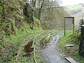
English: Alltwyllt incline connected the Talyllyn Railway at what is now Nant Gwernol railway station to the Galltymoelfre tramway, which led to Bryn Eglwys slate quaries.
Media in category "Alltwyllt incline"
The following 8 files are in this category, out of 8 total.
-
 Alltwyllt incline - 2008-03-18.jpg 2,592 × 1,944; 2.19 MB
-
 Board describing the Alltwyllt incline - geograph.org.uk - 268212.jpg 640 × 480; 176 KB
-
 GalltymoelfreTramway.jpg 480 × 640; 176 KB
-
 Looking down the Alltwyllt incline - geograph.org.uk - 2212663.jpg 681 × 1,024; 248 KB
-
 The head of the Alltwyllt incline - geograph.org.uk - 2212668.jpg 681 × 1,024; 277 KB
-

-
 Towards Nant Gwernol Station, Gwynedd - geograph.org.uk - 3015099.jpg 2,400 × 3,600; 6.96 MB
-
 Winding House, Nant Gwernol, Gwynedd - geograph.org.uk - 3016223.jpg 3,900 × 2,600; 7.15 MB


