Category:Alresford, Essex
Jump to navigation
Jump to search
English: Alresford is a village in Essex, England. It is located 9 km (6 miles) southeast of Colchester and is 39 km (24 miles) northeast from the county town of Chelmsford. The village is in the district of Tendring and in the parliamentary constituency of North Essex.
Lietuvių: Alresfordas - kaimas pietryčių Anglijoje, 9 km į pietryčius nuo Kolčesterio, aukščiau Alrefordo įlankos, 39 km į šiaurės rytus nuo grafystės centro – Čelmsfordo. Kaimas yra Tendringo rajone ir šiaurės Esekso parlamento rinkimų apygardoje. Kaime yra ir Alresfordo pradinė mokykla(apie 150 mokinių, nuo 4 iki 11 metų amžiaus). Kaimas turi savo geležinkelio stotį Kolčesterio – Klaktono linijoje, kuri jungia Alresfordą su geležinkelių tinklu aptarnaujantį rytų Angliją. Geležinkelio tarnybos operatorius yra kompanija „one“.
Nederlands: Alresford is een plaats in het bestuurlijke gebied Tendring, in het Engelse graafschap Essex. De plaats telt 2200 inwoners.
village in United Kingdom  | |||||
| Upload media | |||||
| Pronunciation audio | |||||
|---|---|---|---|---|---|
| Instance of | |||||
| Location | Tendring, Essex, East of England, England | ||||
| Said to be the same as | Alresford (Wikimedia duplicated page, civil parish) | ||||
 | |||||
Subcategories
This category has the following 4 subcategories, out of 4 total.
A
- Alresford War Memorial (2 F)
P
- St Peter's church, Alresford (10 F)
- The Pointer, Alresford (1 F)
Media in category "Alresford, Essex"
The following 96 files are in this category, out of 96 total.
-
 A Train at Alresford (49989104807).jpg 666 × 374; 120 KB
-
 Across Alresford Creek - geograph.org.uk - 2576137.jpg 640 × 426; 60 KB
-
 Alexander Meadow - geograph.org.uk - 5607949.jpg 640 × 424; 95 KB
-
 Alexander Revisited - geograph.org.uk - 5607936.jpg 424 × 640; 88 KB
-
 Alexander's Autumn Tidy Up - geograph.org.uk - 5607952.jpg 640 × 424; 102 KB
-
 Algae-covered rocks, River Colne - geograph.org.uk - 1143851.jpg 640 × 427; 98 KB
-
 Alresford Business Centre - geograph.org.uk - 5438824.jpg 1,600 × 1,067; 698 KB
-
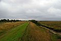
 Alresford Creek - geograph.org.uk - 2134268.jpg 1,024 × 683; 171 KB
-
 Alresford Creek - geograph.org.uk - 5952485.jpg 1,600 × 1,067; 309 KB
-
 Alresford Creek at low tide - geograph.org.uk - 5952461.jpg 1,600 × 1,066; 489 KB
-
 Alresford Creek saltings - geograph.org.uk - 1143616.jpg 640 × 427; 79 KB
-
 Alresford Creek, 1999 - geograph.org.uk - 6129482.jpg 1,600 × 935; 331 KB
-
 Alresford Creek, 2014 - geograph.org.uk - 6355820.jpg 1,024 × 768; 325 KB
-
 Alresford Creek, ford from south.jpg 3,072 × 2,304; 2.7 MB
-
 Alresford Garage - geograph.org.uk - 5381642.jpg 640 × 480; 58 KB
-
 Alresford Grange from across the Colne - geograph.org.uk - 1274981.jpg 640 × 514; 173 KB
-
 Alresford Quarry - geograph.org.uk - 2234968.jpg 4,000 × 3,000; 2.84 MB
-
 Alresford Tidal Crossing - geograph.org.uk - 3414434.jpg 3,872 × 2,592; 2.34 MB
-
 Alresford village sign - geograph.org.uk - 4580551.jpg 640 × 480; 93 KB
-
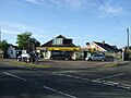 Alresford Village Stores - geograph.org.uk - 5381652.jpg 640 × 480; 59 KB
-
 Alresford, Essex - geograph.org.uk - 2134272.jpg 1,024 × 681; 212 KB
-
 B1027 near Alresford Garage - geograph.org.uk - 5381646.jpg 640 × 480; 63 KB
-
 B1027 railway bridge, Alresford - geograph.org.uk - 5438850.jpg 1,600 × 1,066; 640 KB
-
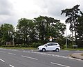
 B1027, Alresford - geograph.org.uk - 5381658.jpg 640 × 480; 58 KB
-
 B1027, Alresford - geograph.org.uk - 5381663.jpg 640 × 480; 53 KB
-
 Bluebells and Captains Wood - geograph.org.uk - 419032.jpg 640 × 426; 170 KB
-
 Borrow dyke near Wivenhoe - geograph.org.uk - 1000890.jpg 427 × 640; 102 KB
-
 Bridgekeeper's boathouse - geograph.org.uk - 1143804.jpg 640 × 415; 84 KB
-
 Cockaynes Wood Reserve - geograph.org.uk - 3022324.jpg 640 × 429; 69 KB
-

-
 Entrance to Alresford Creek - geograph.org.uk - 1143854.jpg 640 × 427; 97 KB
-
 Entrance to footpath in Ford Lane Alresford - geograph.org.uk - 2234964.jpg 4,000 × 3,000; 2.9 MB
-
 Ford across Alresford Creek - geograph.org.uk - 5967589.jpg 1,600 × 1,067; 381 KB
-
 Ford Lane Alresford - geograph.org.uk - 2234966.jpg 4,000 × 3,000; 2.92 MB
-
 Former gravel working - geograph.org.uk - 5952440.jpg 1,600 × 1,067; 456 KB
-
 Former sand jetty, Alresford Creek - geograph.org.uk - 1141812.jpg 640 × 427; 83 KB
-
 Ghost of The Crab and Winkle Line - geograph.org.uk - 228489.jpg 640 × 426; 79 KB
-
 Houses, Elmstead Heath - geograph.org.uk - 5381634.jpg 640 × 480; 82 KB
-
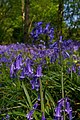 Hyacinthoides non-scripta - geograph.org.uk - 422951.jpg 426 × 640; 110 KB
-
 John Constable - The Quarters behind Alresford Hall - Google Art Project.jpg 5,782 × 3,745; 7.87 MB
-
 Junction of Alresford Creek ^ River Colne - geograph.org.uk - 6122990.jpg 1,024 × 768; 354 KB
-
 Junction with Withenhoe Road, Alresford - geograph.org.uk - 5438854.jpg 1,600 × 1,279; 980 KB
-
 Landing stage in Alresford Creek - geograph.org.uk - 1143620.jpg 640 × 427; 50 KB
-
 Landing stage in Alresford Creek - geograph.org.uk - 1143847.jpg 640 × 427; 81 KB
-
 Landing Stage, Alresford Creek - geograph.org.uk - 2234967.jpg 4,000 × 3,000; 2.86 MB
-

-

-
 Level crossing, Coach Road - geograph.org.uk - 3934768.jpg 1,117 × 745; 167 KB
-
 Low water in the Colne Estuary - geograph.org.uk - 5952426.jpg 1,600 × 1,067; 403 KB
-
 Makeshift jetty at Thorrington tide mill - geograph.org.uk - 5965681.jpg 1,600 × 1,066; 273 KB
-
 Mill Pond - geograph.org.uk - 3101102.jpg 640 × 424; 243 KB
-
 Mill Pond - geograph.org.uk - 3101133.jpg 640 × 424; 249 KB
-
 Old sand jetty, Alresford Creek - geograph.org.uk - 1141795.jpg 640 × 427; 65 KB
-
 Overhead conveyor support pylon - geograph.org.uk - 1142440.jpg 427 × 640; 89 KB
-
 Path Beside Tenpenny Brook - geograph.org.uk - 5607946.jpg 424 × 640; 118 KB
-
 Radio mast and pylon - geograph.org.uk - 122746.jpg 480 × 640; 79 KB
-
 Railway towards Clacton - geograph.org.uk - 5381674.jpg 640 × 463; 68 KB
-
 Railway towards Colchester - geograph.org.uk - 5381675.jpg 640 × 480; 78 KB
-
 River Colne from Fingringhoe LNR - geograph.org.uk - 5308245.jpg 1,600 × 1,200; 570 KB
-
 River Colne south of Wivenhoe - geograph.org.uk - 6355866.jpg 1,600 × 1,200; 956 KB
-
 River Colne, with Fingringhoe LNR in distance - geograph.org.uk - 5856301.jpg 1,024 × 771; 209 KB
-

-
 Sewage works - geograph.org.uk - 122989.jpg 640 × 361; 41 KB
-

-
 Sixpenny Brook - geograph.org.uk - 5952478.jpg 1,600 × 1,067; 340 KB
-
 Sunset at Alresford Creek - geograph.org.uk - 1143622.jpg 640 × 401; 71 KB
-
 Tenpenny Hill (B1027), Alresford - geograph.org.uk - 4579484.jpg 640 × 480; 69 KB
-
 The Pointer public house, Alresford - geograph.org.uk - 5381679.jpg 640 × 480; 81 KB
-
 Thorrington Tide Mill - Breastshot Wheel - geograph.org.uk - 3101071.jpg 424 × 640; 269 KB
-
 Thorrington Tide Mill - Dust Floor - geograph.org.uk - 3101146.jpg 640 × 424; 249 KB
-
 Thorrington Tide Mill - External Drive - geograph.org.uk - 3101123.jpg 424 × 640; 255 KB
-
 Thorrington Tide Mill - Gear Housing - geograph.org.uk - 3101194.jpg 424 × 640; 232 KB
-
 Thorrington Tide Mill - geograph.org.uk - 3101096.jpg 424 × 640; 257 KB
-
 Thorrington Tide Mill - geograph.org.uk - 3101147.jpg 640 × 424; 285 KB
-
 Thorrington Tide Mill - Lucum - geograph.org.uk - 3101135.jpg 424 × 640; 246 KB
-
 Towards the Seaside - geograph.org.uk - 395049.jpg 426 × 640; 95 KB
-
 Used car sales, Elmstead Heath - geograph.org.uk - 5438818.jpg 1,600 × 1,065; 667 KB
-
 View from the top of the footpath by Wivenhoe Road - geograph.org.uk - 5952404.jpg 1,600 × 1,067; 523 KB
-
 View from Thorrington Tide Mill - geograph.org.uk - 3101152.jpg 640 × 424; 245 KB
-
 View of River Colne estuary from Alresford Creek - geograph.org.uk - 5308236.jpg 1,600 × 1,199; 456 KB
-
 Villa Wood panorama - geograph.org.uk - 3474939.jpg 640 × 200; 31 KB
-
 Window sales centre, Elmstead Heath - geograph.org.uk - 5438819.jpg 1,600 × 1,200; 676 KB
-
 Wivenhoe Road, Alresford - geograph.org.uk - 4580544.jpg 640 × 480; 71 KB
-
 Alexander Reserve - geograph.org.uk - 1467706.jpg 640 × 428; 120 KB
-
 Alexander View - geograph.org.uk - 1467725.jpg 640 × 428; 118 KB
-
 Alresford Grange - geograph.org.uk - 368793.jpg 602 × 400; 56 KB
-
 Captains Wood Path - geograph.org.uk - 395223.jpg 640 × 426; 181 KB
-
 Captains Wood Stump - geograph.org.uk - 423015.jpg 640 × 426; 163 KB
-
 Foundry Mark - geograph.org.uk - 395427.jpg 640 × 438; 123 KB
-
 Hockley Place - geograph.org.uk - 395069.jpg 640 × 432; 127 KB
-
 Path in Captains Wood - geograph.org.uk - 422996.jpg 426 × 640; 186 KB
-
 Plumptons Track - geograph.org.uk - 228441.jpg 640 × 426; 95 KB
-
 Red Campion - geograph.org.uk - 422985.jpg 426 × 640; 93 KB
-
 Sign on Frating Hill - geograph.org.uk - 395403.jpg 640 × 426; 87 KB
-
 The Ford - geograph.org.uk - 122726.jpg 1,320 × 903; 221 KB
-
 View From "Robbies" Hide - geograph.org.uk - 45752.jpg 640 × 465; 79 KB
.jpg)


,_Alresford_-_geograph.org.uk_-_4579484.jpg)


