Category:Alte Neuländer (FNa Ruhland)
Jump to navigation
Jump to search
| Object location | | View all coordinates using: OpenStreetMap |
|---|
Diese Kategorie umfasst den alten Flurnamen Alte Neuländer in der Gemarkung Ruhland.
Media in category "Alte Neuländer (FNa Ruhland)"
The following 38 files are in this category, out of 38 total.
-
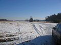
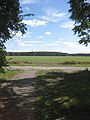
 Ruhland, Alte Neuländer (FNa), Blick bei Neulandweg 5 nach Westsüdwest, Winter.jpg 2,272 × 1,704; 559 KB
-
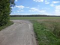
 Ruhland, Alte Neuländer (FNa), Blick vom Weg zur Wiesenstraße nach Osten, Winter.jpg 2,272 × 1,704; 417 KB
-

-
 Ruhland, beim Spielplatz Wohnpark Neue Sorge, Blick nach Südwest, Winter 01.jpg 2,272 × 1,704; 508 KB
-
 Ruhland, beim Spielplatz Wohnpark Neue Sorge, Blick nach Südwest, Winter 02.jpg 2,272 × 1,704; 553 KB
-
 Ruhland, Dürrbachgraben nordostwärts nach Einmündung Blumengraben, Sommer, 01.jpg 3,648 × 2,736; 3.85 MB
-
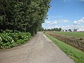
 Ruhland, Dürrbachgrabenweg hinter der Wiesenstr. nordostwärts, Sommer, 01.jpg 3,648 × 2,736; 3.22 MB
-
 Ruhland, Dürrbachgrabenweg hinter der Wiesenstr. nordostwärts, Sommer, 02.jpg 3,648 × 2,736; 2.93 MB
-
 Ruhland, Dürrbachgrabenweg nach dem Spielplatz südwestwärts, Sommer, 01.jpg 3,648 × 2,736; 5.65 MB
-
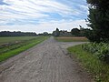
 Ruhland, Dürrbachgrabenweg nordostwärts vom Neulandweg, Sommer, 01.jpg 3,648 × 2,736; 3.67 MB
-
 Ruhland, Dürrbachgrabenweg nordostwärts vom Stichweg von Am Fließ, Sommer, 01.jpg 3,648 × 2,736; 3.5 MB
-
 Ruhland, Dürrbachgrabenweg nordostwärts vom Stichweg von Am Fließ, Sommer, 02.jpg 3,648 × 2,736; 3.25 MB
-
 Ruhland, Dürrbachgrabenweg nordostwärts vor Neulandweg, Sommer, 01.jpg 3,648 × 2,736; 3.66 MB
-
 Ruhland, Dürrbachgrabenweg nordostwärts vor Neulandweg, Sommer, 02.jpg 3,648 × 2,160; 5.39 MB
-
 Ruhland, Dürrbachgrabenweg südwestwärts vom Neulandweg, Sommer, 01.jpg 3,648 × 1,839; 4.43 MB
-
 Ruhland, Dürrbachgrabenweg südwestwärts vom Neulandweg, Sommer, 02.jpg 3,648 × 2,736; 6.25 MB
-
 Ruhland, Dürrbachgrabenweg südwestwärts vom Stichweg von Am Fließ, Sommer, 01.jpg 3,648 × 2,736; 5.83 MB
-
 Ruhland, Dürrbachgrabenweg südwestwärts von Bernsdorfer Str., Sommer, 01.jpg 3,648 × 1,810; 3.91 MB
-
 Ruhland, Dürrbachgrabenweg südwestwärts von Bernsdorfer Str., Sommer, 02.jpg 3,648 × 1,688; 3.92 MB
-
 Ruhland, Dürrbachgrabenweg südwestwärts vor Neulandweg, Sommer, 01.jpg 3,648 × 2,736; 3.35 MB
-
 Ruhland, Dürrbachgrabenweg südwestwärts vor Neulandweg, Sommer, 02.jpg 3,648 × 2,736; 6.04 MB
-
 Ruhland, Dürrbachgrabenweg südwestwärts vor Stichweg von Am Fließ, Sommer, 01.jpg 3,648 × 2,736; 6.21 MB
-
 Ruhland, Dürrbachgrabenweg vom Spielplatz südwestwärts, Sommer, 01.jpg 3,541 × 2,357; 5.7 MB
-
 Ruhland, Dürrbachgrabenweg vor dem Spielplatz nordostwärts, Sommer, 01.jpg 3,648 × 2,736; 3.23 MB
-
 Ruhland, Dürrbachgrabenweg vor dem Spielplatz nordostwärts, Sommer, 02.jpg 3,648 × 2,736; 2.54 MB
-
 Ruhland, Dürrbachgrabenweg vor dem Spielplatz südwestwärts, Sommer, 01.1.jpg 3,648 × 2,736; 5.27 MB
-
 Ruhland, Dürrbachgrabenweg vor dem Spielplatz südwestwärts, Sommer, 01.2.jpg 3,648 × 2,232; 4.77 MB
-
 Ruhland, Dürrbachgrabenweg vor dem Spielplatz südwestwärts, Sommer, 01.3.jpg 3,041 × 2,196; 4.33 MB
-
 Ruhland, Dürrbachgrabenweg vor der Wiesenstr. westwärts, Sommer, 01.jpg 3,648 × 2,736; 7.26 MB
-
 Ruhland, Hermsdorfer Str., von der Kreuzung Alte Hermsdorfer Str. nordnordwestwärts.jpg 2,272 × 1,704; 413 KB
-
 Ruhland, Hermsdorfer Str., Waldstück parallel zur Theodor Schmidt-Str., Südansicht.jpg 2,272 × 1,704; 804 KB
-

-

-
 Ruhland, Hermsdorfer Str., Waldstück parallel zur Theodor Schmidt-Str., Westansicht.jpg 2,272 × 1,704; 790 KB
-
 Ruhland, im Lug-Gäßchen zum Dürrbachgrabenweg, Sommer, 01.jpg 2,736 × 3,648; 2.74 MB
-
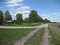
 Ruhland, Neulandweg nordwärts vom Dürrbachgrabenweg, Sommer, 01.jpg 3,648 × 2,736; 3.89 MB
-
 Ruhland, Neulandweg südwärts vor Dürrbachgrabenweg, Sommer, 01.jpg 3,648 × 2,736; 6.65 MB
-

,_Blick_bei_Neulandweg_5_nach_Wests%C3%BCdwest,_Winter.jpg)
,_Blick_vom_Weg_zur_Wiesenstra%C3%9Fe_nach_Osten,_Winter.jpg)
,_Blick_von_der_Trafostation_am_Weg_zur_Wiesenstra%C3%9Fe_nach_Nordost,_Winter.jpg)


