Category:Alte Pfarrkirche (Radibor)
Jump to navigation
Jump to search
| Object location | | View all coordinates using: OpenStreetMap |
|---|
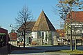
church building in Radibor, Germany .jpeg) .jpeg) | |||||
| Upload media | |||||
| Instance of | |||||
|---|---|---|---|---|---|
| Location | Radibor, Bautzen District, Saxony, Germany | ||||
| Street address |
| ||||
| Heritage designation | |||||
| Inception |
| ||||
 | |||||
Media in category "Alte Pfarrkirche (Radibor)"
The following 18 files are in this category, out of 18 total.
-
 Radibor - Dorfplatz - Alte Pfarrkirche 01 ies.jpg 5,616 × 3,744; 10.76 MB
-
 Radibor - Dorfplatz - Alte Pfarrkirche 02 ies.jpg 5,616 × 3,744; 10.9 MB
-
 Radibor - Dorfplatz - Alte Pfarrkirche 03 ies.jpg 5,616 × 3,744; 10.45 MB
-
 Radibor - Dorfplatz - Alte Pfarrkirche 04 ies.jpg 3,744 × 5,616; 6.51 MB
-
 Radibor - Dorfplatz 03 ies.jpg 3,744 × 5,616; 8.81 MB
-
 Radibor-Alte-Kirche-1.jpg 3,132 × 2,088; 2.4 MB
-
 Radibor-Alte-Kirche-2.jpg 2,885 × 2,494; 2.46 MB
-
 Radibor-Alte-Kirche-3.jpg 3,006 × 2,004; 1.81 MB
-
 Radibor-Alte-Kirche-4.jpg 3,648 × 2,432; 2.02 MB
-
 Radwor Stara wosadna cyrkej (napohlad).jpeg 734 × 557; 130 KB
-
 Radwor Stara wosadna cyrkej (podrys).jpeg 469 × 516; 39 KB
-
 Radwor Stara wosadna cyrkej 1.jpeg 265 × 516; 20 KB
-
 Radwor Stara wosadna cyrkej 2.jpeg 242 × 547; 25 KB
-
 Radwor Stara wosadna cyrkej 3.jpeg 241 × 577; 27 KB
-
 Radwor Stara wosadna cyrkej 4.jpeg 215 × 559; 23 KB
-
 Radwor Stara wosadna cyrkej 5.jpeg 363 × 541; 36 KB
-
 Radwor Stara wosadna cyrkej 6.jpeg 461 × 577; 62 KB
-
 Radwor Stara wosadna cyrkej 7.jpeg 223 × 591; 20 KB


