Category:Althengstett
Jump to navigation
Jump to search
Deutsch: Althengstett ist eine Kommune im Landkreis Calw, Baden Württemberg. Sie besteht aus den drei Teilorten Althengstett, Neuhengstett und Ottenbronn
municipality in Baden-Württemberg, Germany    | |||||
| Upload media | |||||
| Instance of |
| ||||
|---|---|---|---|---|---|
| Location |
| ||||
| Population |
| ||||
| Area |
| ||||
| Elevation above sea level |
| ||||
| official website | |||||
 | |||||
Subcategories
This category has the following 6 subcategories, out of 6 total.
Media in category "Althengstett"
The following 65 files are in this category, out of 65 total.
-
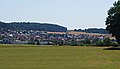
 Althengstett - panoramio (1).jpg 3,072 × 1,536; 2.56 MB
-
 Althengstett - panoramio (2).jpg 3,072 × 1,536; 2.77 MB
-
 Althengstett - panoramio (3).jpg 3,264 × 1,632; 2.39 MB
-
 Althengstett - panoramio (4).jpg 2,272 × 1,136; 1.45 MB
-
 Althengstett - panoramio.jpg 3,072 × 1,536; 2.71 MB
-
 Althengstett in CW.svg 243 × 245; 718 KB
-
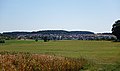
 Althengstett Ost.jpg 5,472 × 3,265; 3.55 MB
-
 Althengstett West.jpg 5,472 × 3,140; 3.35 MB
-
 Althengstett, Andreas Kieser.png 648 × 533; 634 KB
-
 Ansicht Althengstett Nord.jpg 5,466 × 3,224; 3.71 MB
-
 Blick Richtung Nordschwarzwald - panoramio (1).jpg 3,072 × 2,304; 4.58 MB
-
 Blick Richtung Nordschwarzwald - panoramio.jpg 3,072 × 1,834; 3.12 MB
-
 Blick Richtung Nordwesten - panoramio (1).jpg 4,608 × 3,456; 7.77 MB
-
 Blick Richtung Schwäbische Alb - panoramio.jpg 3,072 × 1,536; 2.78 MB
-
 Blick Richtung Westen - panoramio (7).jpg 3,264 × 1,632; 2.92 MB
-
 Blick Richtung Westen - panoramio (8).jpg 4,800 × 1,536; 4 MB
-

-
 DEU Althengstett COA.svg 701 × 742; 23 KB
-
 Die Lang-Gaststätte Hengstetter Hof in Althengstett - panoramio (1).jpg 3,264 × 2,448; 3.04 MB
-
 Die Lang-Gaststätte Hengstetter Hof in Althengstett - panoramio.jpg 3,072 × 1,721; 3.18 MB
-
 Flagge Althengstett.svg 600 × 1,500; 28 KB
-
 Gartenterrasse Gaststätte und Hotel Hengstetter Hof - panoramio.jpg 3,072 × 1,536; 2.62 MB
-

-

-

-
-
-

-

-

-

-
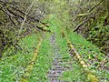
 Hermann-Hesse-Bahn, Zustand der Trasse bei Althengstett 2014.jpg 3,264 × 2,448; 4.17 MB
-
 Hm-netzwerke GmbH in Althengstett - panoramio.jpg 3,240 × 2,414; 2.41 MB
-
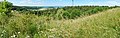
 Hochfläche bei Althengstett - panoramio.jpg 4,590 × 3,432; 7.21 MB
-
 Kiesersche Forstkarte Nr. 185 Ottenbronner Dahl (Ottenbronner Tal).jpg 1,024 × 750; 282 KB
-
 Kiesersche Forstkarte Nr. 189 Ottenbron (Ottenbronn).jpg 1,024 × 764; 329 KB
-
 Kiesersche Forstkarte Nr. 190 Hengstett (Althengstett).jpg 1,024 × 756; 331 KB
-
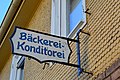 Landappbw 494652 1822 Bäckerei Ladenschild Ottenbronn.jpg 6,016 × 4,000; 2.08 MB
-

-

-
 Naturschutzgebiet Omeles Berg im Hochnebel - panoramio.jpg 3,072 × 2,304; 3.54 MB
-
 Ost - Schwarzwälder Höhenradweg - Schutzhütte - panoramio (1).jpg 4,608 × 3,456; 7.61 MB
-
 Ost - Schwarzwälder Höhenradweg - Schutzhütte - panoramio.jpg 4,596 × 3,438; 4.91 MB
-
 Ottenbronn - panoramio.jpg 3,264 × 1,632; 2.03 MB
-
 Ottenbronn, Althengstett, Andreas Kieser.png 740 × 494; 759 KB
-
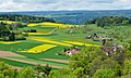
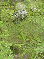
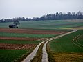
 Rapsblüte - panoramio (1).jpg 3,072 × 2,304; 4.68 MB
-
 Schlossbergkellerei, Althengstett. - panoramio.jpg 3,030 × 1,536; 2.31 MB
-

-

-

-
 Schuetzenhausturm 01042014.png 1,089 × 2,113; 2.99 MB
-
 Sportplatz in Althengstett - panoramio.jpg 4,608 × 2,304; 4.69 MB
-
 SV Althengstett - panoramio.jpg 3,072 × 1,713; 3.31 MB
-
 Telefonmast Althengstett 01042014 1.png 2,824 × 4,236; 16.21 MB
-
 Telefonmast Althengstett 01042014 2.JPG 2,778 × 4,167; 6.67 MB
-
 Täfelberg Althengstett.jpg 3,264 × 1,836; 3.95 MB
-
 Täfelberg althenstett.jpeg 3,264 × 1,836; 1.62 MB
-
 Täfelberghaus - panoramio.jpg 3,072 × 2,304; 4.92 MB
-
 Wanderweg - panoramio (69).jpg 3,264 × 2,448; 5.89 MB
-
 Wanderweg - panoramio (79).jpg 3,264 × 2,448; 5.91 MB
-
 Wanderweg - panoramio (80).jpg 3,264 × 2,448; 6.48 MB
-
 Wappen Althengstett.png 432 × 509; 32 KB
-
 Wappen Ottenbronn.png 380 × 444; 16 KB
-

-
 Würm-Heckengäu, Reute - panoramio.jpg 3,072 × 2,304; 4.39 MB
.jpg)
.jpg)
.jpg)
.jpg)


.jpg)

.jpg)

.jpg)


.jpg)


.jpg)
.jpg)
.jpg)
.jpg)
.jpg)
.jpg)
.jpg)


.jpg)
.jpg)
.jpg)

_warmen_Tag_(20.10.)_in_diesem_Jahr!_Ortsrand_Ostelsheim.jpg)


.jpg)


.jpg)

.jpg)
.jpg)


.jpg)
.jpg)
.jpg)


.jpg)