Category:Ambrosden
Jump to navigation
Jump to search
village and civil parish in Cherwell district, Oxfordshire, England, UK  | |||||
| Upload media | |||||
| Instance of | |||||
|---|---|---|---|---|---|
| Location | Cherwell, Oxfordshire, South East England, England | ||||
| Population |
| ||||
| Area |
| ||||
 | |||||
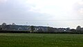
English: Ambrosden is a village and civil parish on the north side of the valley of the River Ray in Oxfordshire, England, southeast of Bicester.
Subcategories
This category has only the following subcategory.
M
Media in category "Ambrosden"
The following 92 files are in this category, out of 92 total.
-
 A41 looking west - geograph.org.uk - 2836099.jpg 640 × 480; 49 KB
-
 A41 nears Bicester - geograph.org.uk - 2836110.jpg 640 × 481; 39 KB
-
 A41 towards Aylesbury - geograph.org.uk - 5638097.jpg 640 × 428; 82 KB
-
 A41 towards Aylesbury - geograph.org.uk - 5638101.jpg 640 × 428; 94 KB
-
 A41 towards Aylesbury - geograph.org.uk - 5638104.jpg 640 × 428; 95 KB
-
 Across the fields towards A41 and container depot - geograph.org.uk - 5325398.jpg 4,321 × 2,447; 1.95 MB
-
 Branch line to Bicester - geograph.org.uk - 1506016.jpg 640 × 427; 100 KB
-
 Level crossing in Ambrosden - geograph.org.uk - 1767686.jpg 640 × 480; 74 KB
-
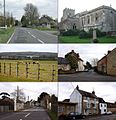 Ambrosden composite.jpg 1,283 × 1,328; 300 KB
-
 Ambrosden HollyTreeCottage.JPG 2,450 × 1,960; 723 KB
-
 Ambrosden Level Crossing - geograph.org.uk - 1744227.jpg 1,500 × 1,000; 189 KB
-
 Ambrosden OldSchool.JPG 2,800 × 1,400; 524 KB
-
 Ambrosden ParkFarmhouse.JPG 3,000 × 2,000; 3.08 MB
-
 Ambrosden Post Office - geograph.org.uk - 4872850.jpg 1,964 × 1,418; 813 KB
-
 Ambrosden1.jpg 640 × 480; 82 KB
-
 Ambrosden7RiverRay.jpg 640 × 480; 166 KB
-
 Amcars garage on Merton Road - geograph.org.uk - 4872866.jpg 2,048 × 1,536; 1.49 MB
-
 Bentley Design at Symmetry Park, Bicester - geograph.org.uk - 6057367.jpg 1,920 × 1,280; 1,015 KB
-
 Birch Road, Ambrosden - geograph.org.uk - 6272651.jpg 5,388 × 3,286; 2.35 MB
-
 Building site on Merton Road, Ambrosden - geograph.org.uk - 4877283.jpg 2,048 × 1,536; 1.46 MB
-
 Canteen - geograph.org.uk - 5325394.jpg 5,202 × 3,465; 2.74 MB
-
 Chapel Drive, Ambrosden - geograph.org.uk - 4872858.jpg 2,048 × 1,536; 1.49 MB
-
 Church Leys Field - geograph.org.uk - 6272681.jpg 5,146 × 3,441; 1.46 MB
-
 Churchyard of St Mary the Virgin church, Ambrosden - geograph.org.uk - 5494462.jpg 2,522 × 1,891; 669 KB
-
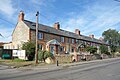
 Cottages on Merton Road, Ambrosden - geograph.org.uk - 4871898.jpg 2,048 × 1,536; 1.5 MB
-
 Crab Apple Tree, Ambrosden - geograph.org.uk - 6272619.jpg 5,353 × 3,511; 3.94 MB
-

-
 Dryden House, Ambrosden - geograph.org.uk - 5494464.jpg 2,592 × 1,944; 1.64 MB
-
 End of the path from Middle Wretchwick farm - geograph.org.uk - 5325429.jpg 5,202 × 3,465; 3.89 MB
-
-
 Field by Middle Wretchwick farm - geograph.org.uk - 5325411.jpg 5,202 × 3,465; 3.94 MB
-
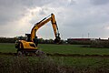
 Forgotten digging equipment - geograph.org.uk - 5325417.jpg 4,721 × 2,715; 4.18 MB
-
 Hedgerow by Merton Road - geograph.org.uk - 4872739.jpg 2,048 × 1,536; 1.49 MB
-
 House on the corner of Merton Road and Old Ambrosden Road - geograph.org.uk - 4872804.jpg 2,048 × 1,536; 1.51 MB
-
 House opposite Wretchwick Farm - geograph.org.uk - 5325343.jpg 4,825 × 2,978; 2.87 MB
-
 Houses on Birch Road, Ambrosden - geograph.org.uk - 4872494.jpg 2,048 × 1,536; 1.49 MB
-
 JCB at work - geograph.org.uk - 5325426.jpg 5,202 × 3,465; 3.05 MB
-
 Junction with A41 - geograph.org.uk - 2181239.jpg 640 × 480; 77 KB
-
 Langford Park House in Bicester - geograph.org.uk - 1744170.jpg 1,500 × 961; 224 KB
-
 Little Wretchwick farm - geograph.org.uk - 5325372.jpg 5,202 × 3,465; 2.97 MB
-
 Little Wretchwick farm yard - geograph.org.uk - 5325382.jpg 5,202 × 3,465; 2.89 MB
-
 Llamas in a field near Home Farm - geograph.org.uk - 1744266.jpg 1,500 × 1,000; 177 KB
-
 Looking across a field to Jasper's Copse - geograph.org.uk - 1744271.jpg 1,500 × 962; 161 KB
-
 Marsh marigolds and lesser celandine - geograph.org.uk - 386322.jpg 640 × 479; 374 KB
-
 Merton Road before Ambrosden - geograph.org.uk - 4872690.jpg 2,048 × 1,536; 1.5 MB
-
 Merton Road leaving Ambrosden - geograph.org.uk - 4872737.jpg 2,002 × 1,472; 911 KB
-
 Merton Road leaving Ambrosden - geograph.org.uk - 4872748.jpg 2,048 × 1,536; 1.48 MB
-
 Merton Road, Ambrosden - geograph.org.uk - 4871896.jpg 2,048 × 1,536; 1.5 MB
-
 Merton Road, Ambrosden - geograph.org.uk - 4877269.jpg 2,048 × 1,536; 1.41 MB
-
 Merton Road, Ambrosden - geograph.org.uk - 4877276.jpg 2,048 × 1,536; 1.52 MB
-
 Middle Wretchwick farm from across the field - geograph.org.uk - 5325406.jpg 3,884 × 2,507; 2.5 MB
-
 Middle Wretchwick farmhouse - geograph.org.uk - 5325420.jpg 5,202 × 3,465; 4.87 MB
-
 Morrell Way, Symmetry Park - geograph.org.uk - 6273209.jpg 5,311 × 3,010; 1.31 MB
-
 New houses on Merton Road - geograph.org.uk - 4872876.jpg 2,048 × 1,536; 1.5 MB
-
 New offices in Symmetry Park, Bicester - geograph.org.uk - 6177212.jpg 1,848 × 1,162; 1.29 MB
-
 Old Arncott Road in Ambrosden - geograph.org.uk - 1744204.jpg 1,500 × 990; 177 KB
-
 Old Car on the Corner - geograph.org.uk - 6272644.jpg 5,207 × 3,153; 2.01 MB
-
 Path from Middle Wretchwick to A41 - geograph.org.uk - 5325422.jpg 5,202 × 3,465; 4.39 MB
-
 Path to A41 - geograph.org.uk - 5325385.jpg 5,202 × 3,465; 2.54 MB
-
 Path to Launton - geograph.org.uk - 5325375.jpg 5,202 × 3,465; 3.9 MB
-
 Path to Little Wretchwick Farm - geograph.org.uk - 5325345.jpg 5,202 × 3,465; 4.59 MB
-
 Path to Middle Wretchwick farm - geograph.org.uk - 5325346.jpg 5,202 × 3,465; 5.7 MB
-
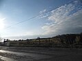
 Ploughley Road - geograph.org.uk - 5215631.jpg 640 × 428; 181 KB
-
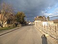
 Ploughley Road enters Ambrosden - geograph.org.uk - 5215633.jpg 640 × 428; 117 KB
-
 Ploughley Road, Ambrosden - geograph.org.uk - 4872441.jpg 2,048 × 1,536; 1.51 MB
-
 Ploughley Road, Arncott - geograph.org.uk - 4873225.jpg 2,048 × 1,536; 725 KB
-

-
 Road to Little Wretchwick farm - geograph.org.uk - 5325363.jpg 5,202 × 3,465; 4.62 MB
-
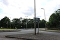 Roundabout on Charbridge Lane, Bicester - geograph.org.uk - 6176448.jpg 1,839 × 1,225; 1.03 MB
-
 Roundabout on Wretchwick Way, Bicester - geograph.org.uk - 6176449.jpg 1,920 × 1,280; 1.13 MB
-
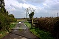
 Rural track off Ploughley Road - geograph.org.uk - 1744198.jpg 1,500 × 1,000; 246 KB
-
 St Mary the Virgin church, Ambrosden - geograph.org.uk - 5494458.jpg 2,592 × 1,944; 1.56 MB
-
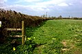
 Stile on field path to Middle Wretchwick - geograph.org.uk - 5325402.jpg 5,202 × 3,465; 7.42 MB
-
 Terrace on Merton Road - geograph.org.uk - 6272628.jpg 5,472 × 3,648; 2.73 MB
-
 The A41, Ambrosden - geograph.org.uk - 6181560.jpg 1,872 × 1,204; 1.07 MB
-
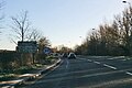
 The B4011 at the junction of the A41 east of Bicester - geograph.org.uk - 4871689.jpg 2,048 × 1,536; 1.49 MB
-
 The B4011 at the junction of the A41 east of Bicester - geograph.org.uk - 4873222.jpg 2,042 × 1,528; 843 KB
-
 The B4011 to Bicester - geograph.org.uk - 3965889.jpg 1,500 × 916; 97 KB
-
 The entrance to Symmetry Park Bicester - geograph.org.uk - 6177216.jpg 1,920 × 1,280; 1.1 MB
-
 The exit to Bicester on the A41 - geograph.org.uk - 4871675.jpg 2,048 × 1,536; 1.49 MB
-
 The ground frame at Bicester C.O.D - geograph.org.uk - 1506025.jpg 640 × 419; 84 KB
-
 The military railway to Arncott - geograph.org.uk - 1744237.jpg 1,500 × 1,000; 230 KB
-

-
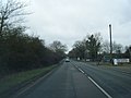
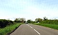
 The road to Ambrosden - geograph.org.uk - 1744193.jpg 1,500 × 1,000; 308 KB
-
 The road to Ambrosden - geograph.org.uk - 1744268.jpg 1,500 × 983; 191 KB
-
 The straight road to Merton - geograph.org.uk - 1744258.jpg 1,500 × 969; 230 KB
-
 Tree by Merton Road - geograph.org.uk - 4872707.jpg 2,048 × 1,536; 1.53 MB
-
 Ambrosden TurnerArms.JPG 3,000 × 2,000; 2.44 MB
-
 The Turner Arms in Ambrosden - geograph.org.uk - 1744206.jpg 1,500 × 984; 144 KB
-
 Units at Symmetry Park - geograph.org.uk - 6273217.jpg 5,472 × 3,425; 2.14 MB
-
 Wretchwick Way in Bicester - geograph.org.uk - 4363414.jpg 1,500 × 999; 137 KB
-
 Pasture and roadside hedge, Ambrosden - geograph.org.uk - 386659.jpg 640 × 480; 229 KB


