Category:American River (California)
Vai alla navigazione
Vai alla ricerca
fiume della California   | |||||
| Carica un file multimediale | |||||
| Istanza di |
| ||||
|---|---|---|---|---|---|
| Luogo | California, Stati del Pacifico | ||||
| Designazione del patrimonio | |||||
| Lunghezza |
| ||||
| Foce | |||||
| Bacino di drenaggio |
| ||||
 | |||||
English: The American River — in Northern California.
- The river runs from the central Sierra Nevada mountains, through the Sacramento metropolitan area of the Central Valley, where it enters into the Sacramento River.
- The site of Sutter's Mill where gold was found in 1848, leading to the California Gold Rush.
- A designated Wild and Scenic River of the United States, known for its whitewater rapids.

Sottocategorie
Questa categoria contiene le 12 sottocategorie indicate di seguito, su un totale di 12.
- Middle Fork American River (4 F)
A
- American River, Folsom (17 F)
B
D
- Discovery Park (Sacramento) (5 F)
F
L
- Lake Natoma (24 F)
N
- Nimbus Dam (125 F)
S
File nella categoria "American River (California)"
Questa categoria contiene 103 file, indicati di seguito, su un totale di 103.
-
 Americanrivermap.png 500 × 500; 330 KB
-
 Auburnreservoirmap.jpg 777 × 845; 244 KB
-

-
 880601-A-3200N-001 (5083527929).jpg 2 400 × 3 600; 8 MB
-
 Folsom Dam on the American River (5384724149).jpg 3 008 × 1 960; 3,86 MB
-
 American river running through the El Dorado hills.jpg 1 465 × 1 050; 687 KB
-
 Folsom Dam Spillway construction (5263755594).jpg 5 616 × 3 744; 11,98 MB
-
 Folsom Dam Water Release (5268527059).jpg 5 616 × 3 744; 10,26 MB
-
 Winter water releases at the Folsom Spillway (5320592488).jpg 5 616 × 3 744; 11,83 MB
-
 American River levee construction (6104055838).jpg 4 812 × 3 187; 9,73 MB
-
 American River levee improvement construction (6303610103).jpg 4 752 × 3 168; 7,03 MB
-
 American River levee improvement construction (6304132778).jpg 4 752 × 3 168; 7,61 MB
-
 American River levee improvement construction (6304129510).jpg 4 343 × 3 146; 6,95 MB
-
 Multi-use trail open, levee path closed during construction (7728865214).jpg 4 295 × 2 510; 8,73 MB
-
 American River at Sutter's Mill.JPG 4 896 × 3 672; 7,07 MB
-
 A view of the newly repaved American River Parkway trail (8201719300).jpg 4 383 × 2 630; 13,4 MB
-

-
 Alden Memorial "Truss" bridge over the American River.jpg 2 570 × 1 930; 1,16 MB
-
 Am. River Fair Oaks 561 - panoramio.jpg 1 901 × 1 426; 824 KB
-
 Am. River Fair Oaks 564 - panoramio.jpg 1 901 × 1 426; 842 KB
-
 Am. River Fair Oaks 569 - panoramio.jpg 2 160 × 1 620; 851 KB
-
 Am. River Fair Oaks 589 - panoramio.jpg 2 160 × 1 620; 847 KB
-
 Am. River Fair Oaks 591 - panoramio.jpg 2 160 × 1 620; 1,14 MB
-
 American River at Sunrise Park, June 1974 (26251615404).jpg 1 584 × 1 028; 122 KB
-
 American River at William B. Pond Recreation Area .jpg 1 024 × 760; 336 KB
-
 American River CA.jpg 1 500 × 997; 457 KB
-
 American River levee construction (6103510145).jpg 4 469 × 3 160; 8,82 MB
-
 American River on William B. Pond Recreation Area .jpg 1 024 × 760; 322 KB
-
 American River seepage wall partially exposed (9685958957).jpg 4 928 × 3 264; 8,5 MB
-
 American River, Auburn, CA - panoramio - UncleVinny (1).jpg 1 536 × 1 152; 578 KB
-
 American River, Auburn, CA - panoramio - UncleVinny (2).jpg 1 152 × 1 536; 576 KB
-
 American River, Auburn, CA - panoramio - UncleVinny (3).jpg 1 536 × 1 152; 627 KB
-
 American River, Auburn, CA - panoramio - UncleVinny.jpg 1 152 × 1 536; 740 KB
-
 American River, Auburn, CA - panoramio.jpg 1 536 × 1 152; 703 KB
-
 American River, Eastern CA 8-10 (15357214077).jpg 2 106 × 2 450; 3,49 MB
-
 American River, Folsom - panoramio - UncleVinny (4).jpg 768 × 576; 90 KB
-

-
 American River, Gold Fields, CA 8-10 (12347210483).jpg 1 770 × 1 388; 1,27 MB
-
 American River, Hwy 50, Carson Pass, CA 8-2010 (5733884243).jpg 1 536 × 1 152; 814 KB
-
 Americn River, Auburn, California - panoramio - UncleVinny (1).jpg 1 152 × 1 536; 588 KB
-
 Americn River, Auburn, California - panoramio - UncleVinny (2).jpg 1 536 × 1 152; 558 KB
-
 Americn River, Auburn, California - panoramio.jpg 1 536 × 1 152; 606 KB
-

-
 Mirror view, Lake Angeline, Cal. (no. 468) (NYPL b11707292-G89F367 003F).tiff 3 072 × 1 774; 15,59 MB
-
 Beavers sample American River habitat (6643655459).jpg 4 543 × 3 010; 8,25 MB
-
 Bend in the American River, Folsom - panoramio.jpg 1 616 × 1 616; 636 KB
-
 California fish and game (20326130420).jpg 1 416 × 2 112; 1,3 MB
-
 California fish and game (20520581631).jpg 1 412 × 2 108; 1,23 MB
-
 CALIFORNIA-SILVER RIVER - NARA - 542991.jpg 2 055 × 3 000; 782 KB
-
 CBS Sacramento’s Morning Show (6313334568).jpg 3 149 × 2 098; 4,7 MB
-
 Chinook Salmon (Oncorhynchus (=salmo) tshawytscha) (12435393153).jpg 4 416 × 3 312; 4,67 MB
-
 Chinook Salmon Lower American River (5456981448).jpg 4 416 × 3 312; 5,86 MB
-
 Corps contractor digs deep for answers (6462041219).jpg 3 264 × 4 928; 14,82 MB
-
 Corps judges STEM-inspired student regatta (17945819078).jpg 5 186 × 3 457; 5,7 MB
-
 Corps judges STEM-inspired student regatta (17945825798).jpg 5 616 × 3 744; 5,68 MB
-
 Corps judges STEM-inspired student regatta (17946039780).jpg 5 616 × 3 744; 4,99 MB
-
 Corps judges STEM-inspired student regatta (17947444439).jpg 5 616 × 3 744; 6,75 MB
-
 Corps judges STEM-inspired student regatta (17947459719).jpg 5 616 × 3 744; 6,48 MB
-
 Corps judges STEM-inspired student regatta (18107239696).jpg 4 960 × 3 306; 5,66 MB
-
 Corps judges STEM-inspired student regatta (18134827121).jpg 5 616 × 3 744; 5,47 MB
-
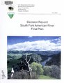 Decision record South Fork American River final plan (IA decisionrecordso00unit).pdf 1 445 × 1 877, 12 pagine; 1,43 MB
-
 Folsom Dam mitigation site (5763049076).jpg 2 048 × 1 536; 1,68 MB
-
 Greylag Goose by American River - Flickr - jeimey31.jpg 4 000 × 3 000; 3,19 MB
-
 Image of William pond park on lower American river in Rio Vista.jpg 2 048 × 1 366; 67 KB
-
 July 4 on Sacramento River 2002.jpg 476 × 312; 37 KB
-
 Levee work begins at Howe Ave. bridge (14542789873).jpg 4 928 × 3 264; 8,44 MB
-
 Lower American River (5456985580).jpg 3 072 × 2 048; 2,19 MB
-
 Lower American River William Pond Park (5456373749).jpg 3 504 × 2 336; 2,59 MB
-
 Lower American River-William Pond Park.jpg 3 504 × 2 336; 2,38 MB
-
 Map of American River Lands.jpg 3 614 × 3 620; 3,17 MB
-
 Map of Higgins Point.png 980 × 1 134; 2,16 MB
-
 Marshall Gold Discrovery State Park, Amer. River - panoramio.jpg 1 536 × 1 152; 669 KB
-
 Mining on the American River near Sacramento, circa 1852.jpg 1 600 × 902; 749 KB
-
 My Public Lands Roadtrip (18929707482).jpg 2 000 × 1 446; 3,92 MB
-
 Negro Bar, American River Folsom - panoramio.jpg 2 304 × 3 072; 845 KB
-
 Old Dam, Amer. River 763 - panoramio.jpg 2 160 × 1 620; 1,18 MB
-
 Old Dam, Amer. River 764 - panoramio.jpg 2 160 × 1 620; 998 KB
-
 Pano, Am. Riv. a tNatoma Lake South - panoramio.jpg 3 021 × 979; 943 KB
-
 Pano, Am. Riv. atNatoma Lake North - panoramio.jpg 6 022 × 1 649; 2,51 MB
-

-
 River Runners Inc. on the South Fork of the American River.jpg 2 720 × 2 040; 1,46 MB
-
 Sac State American River from Guy West Bridge.jpg 800 × 600; 477 KB
-

-
 Secretary Darcy, Rep. Matsui visit Sacramento levee project (6195919762).jpg 4 599 × 3 169; 9,94 MB
-
 Secretary Darcy, Rep. Matsui visit Sacramento levee project (6195921662).jpg 4 691 × 3 153; 9,01 MB
-
 View of Folsom bridges from Lake Natoma Crossing Bridge.jpg 8 192 × 1 856; 5,28 MB
-
 Woody material providing fish habitat and sediment accrual (6643664663).jpg 2 728 × 1 320; 784 KB
-
 Yellow orange life jackets american river.jpg 2 560 × 1 920; 2,44 MB
-
-
 American River, from Green Bluffs, by Watkins, Carleton E., 1829-1916.jpg 2 737 × 1 419; 1,71 MB
-
 American River, from Green Bluffs, by Watkins, Carleton E., 1829-1916.png 2 737 × 1 419; 5,41 MB
-

-
-

-

-

-

-

-

-

-
 Rocky cut above Alta, and American River, 2,000 feet below, by Thomas Houseworth & Co..png 2 737 × 1 395; 5,14 MB
-
-


_and_P.D._Sergent_on_a_trip_up_the_American_River_Canyon_near_Kyburz,_California._(37317656701).jpg)
.jpg)
.jpg)

.jpg)
.jpg)
.jpg)
.jpg)
.jpg)
.jpg)
.jpg)
.jpg)

.jpg)


.jpg)


.jpg)

.jpg)
.jpg)
.jpg)
.jpg)


.jpg)
.jpg)

.jpg)
.jpg)
.jpg)
.jpg)

_(14781036462).jpg)
.jpg)

.jpg)
.jpg)

.jpg)
_tshawytscha)_(12435393153).jpg)
.jpg)
.jpg)
.jpg)
.jpg)
.jpg)
.jpg)
.jpg)
.jpg)
.jpg)
.jpg)


.jpg)
.jpg)
.jpg)


.jpg)


.jpg)
.jpg)
.jpg)

_River_and_Ca%C3%B1on_from_Cape_Horn,_river_below_railroad_1,400_feet._57_miles_from_Sacramento,_by_Watkins,_Carleton_E.,_1829-1916.jpg)


,_from_Robert_N._Dennis_collection_of_stereoscopic_views.jpg)
Categorie:
- Rivers of California
- Rivers of the Sierra Nevada (USA)
- Tributaries of the Sacramento River
- Central Valley of California
- Geography of El Dorado County, California
- Geography of Placer County, California
- Geography of Sacramento County, California
- California Gold Rush
- Rivers of the United States by name
- Things named after the United States