Category:Apache County, Arizona
Zur Navigation springen
Zur Suche springen
County im US-Bundesstaat Arizona   | |||||
| Medium hochladen | |||||
| Ist ein(e) | |||||
|---|---|---|---|---|---|
| Benannt nach | |||||
| Ort |
| ||||
| Hauptstadt | |||||
| Datum der Gründung, Erstellung, Entstehung, Erbauung |
| ||||
| Einwohnerzahl |
| ||||
| Fläche |
| ||||
| Verschieden von | |||||
| offizielle Website | |||||
 | |||||
English: Media related to Apache County, Arizona, a county in the northeastern corner of Arizona, United States.
Unterkategorien
Es werden 26 von insgesamt 26 Unterkategorien in dieser Kategorie angezeigt:
In Klammern die Anzahl der enthaltenen Kategorien (K), Seiten (S), Dateien (D)
B
- Blue Gap Mission (7 D)
C
F
G
H
M
- Maps of Apache County, Arizona (83 D)
N
P
R
S
- Sunrise Park Resort (7 D)
T
W
- Wood Springs 2 Fire (20 D)
Medien in der Kategorie „Apache County, Arizona“
Folgende 22 Dateien sind in dieser Kategorie, von 22 insgesamt.
-
 Apache County, AZ, USA - panoramio (16).jpg 3.264 × 2.448; 2,8 MB
-
 Apache County, AZ, USA - panoramio (17).jpg 3.264 × 2.448; 2,87 MB
-
 Apache County, AZ, USA - panoramio (18).jpg 3.264 × 2.448; 2,72 MB
-
 Arizona DPS Report DR2001-070756 Milton William Cooper.pdf 3.333 × 5.333, 83 Seiten; 22,11 MB
-
 Az apache1 sr264.jpg 1.536 × 1.024; 454 KB
-
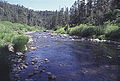 BlackRiver01.jpg 331 × 223; 28 KB
-
 Clouds in Apache County, Arizona.jpg 3.072 × 2.304; 1,61 MB
-
 Cottonwood canyon - panoramio.jpg 4.896 × 3.672; 3,91 MB
-
 Great sky. Arizona (4917559792).jpg 600 × 800; 85 KB
-
 Map of the Navajo Volcanic Fields.jpg 1.280 × 1.467; 568 KB
-
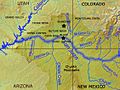 Map of the Upper San Juan Basin.jpg 562 × 423; 140 KB
-
 Near Cienega Draw - Flickr - aspidoscelis.jpg 3.600 × 2.400; 4,66 MB
-
 Near Navajo, Ariz. (8644079185).jpg 2.121 × 1.414; 2,39 MB
-
 Near Navajo, Ariz. (8645176136).jpg 2.121 × 1.414; 2,79 MB
-
 Northwest of St. Johns - Flickr - aspidoscelis.jpg 3.600 × 2.400; 4,8 MB
-
 Red Valley - Flickr - aspidoscelis (1).jpg 8.000 × 4.000; 10,71 MB
-
 Red Valley - Flickr - aspidoscelis.jpg 8.000 × 2.800; 6,37 MB
-
 Sanjuanrivermap.jpg 617 × 429; 247 KB
-
 Sanjuanrivermappiedrahighlighted.jpg 1.612 × 1.160; 466 KB
-
 US 160 near Four Corners - panoramio.jpg 4.608 × 3.456; 2,82 MB
-
 USA Apache County, Arizona age pyramid.svg 520 × 600; 8 KB
-
 Wind Patterns Near Show Low, Arizona (101305901).jpg 1.600 × 1.200; 617 KB
.jpg)
.jpg)
.jpg)


.jpg)


.jpg)
.jpg)

.jpg)


.jpg)