Category:NARA images of Apache County, Arizona
Jump to navigation
Jump to search
Apache County, Arizona.
Subcategories
This category has the following 5 subcategories, out of 5 total.
Media in category "NARA images of Apache County, Arizona"
The following 11 files are in this category, out of 11 total.
-
 Cooley's Ranch, 10 miles east of Camp Apache, Arizona, 1873 - NARA - 519733.jpg 3,000 × 1,911; 1.59 MB
-
 Fishing - Arizona - DPLA - eeca0967153ce4056a016a096753458b.jpg 4,758 × 3,774; 2.17 MB
-
 HOUSE BETWEEN HILL AND DUMP - NARA - 544174.jpg 2,027 × 3,000; 1.34 MB
-
 OLD CARS SERVE AS WATER-BREAK ON NAVAJO RESERVATION - NARA - 544433.jpg 3,000 × 2,017; 1.23 MB
-
 Prehistoric pictographs on sand rocks, Adamana, Arizona, 08-1903 - NARA - 521044.jpg 3,000 × 2,157; 1.19 MB
-
 Prehistoric pictographs on sand rocks, Adamana, Arizona, 08-1903 - NARA - 521044.tif 3,000 × 2,157; 6.17 MB
-
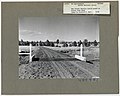 Range Improvements - Structural - All States - DPLA - 41832d8b010c132078a5da265155c697.jpg 4,746 × 3,793; 2.12 MB
-

-
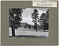 Scenery and Landscapes - Arizona - DPLA - 165934a0ffeb60844a6a0c755c49df44.jpg 4,758 × 3,757; 2.22 MB
-
 TEPEE GAS STATION ON ROUTE 66 - NARA - 544152 (cropped).jpg 1,995 × 2,386; 546 KB
-
 TEPEE GAS STATION ON ROUTE 66 - NARA - 544152.jpg 2,020 × 3,000; 665 KB


.jpg)
