Category:Maricopa County, Arizona
Jump to navigation
Jump to search
county in Arizona, United States    | |||||
| Upload media | |||||
| Instance of | |||||
|---|---|---|---|---|---|
| Named after | |||||
| Location | Arizona | ||||
| Capital | |||||
| Inception |
| ||||
| Population |
| ||||
| Area |
| ||||
| Different from | |||||
| official website | |||||
 | |||||
Subcategories
This category has the following 38 subcategories, out of 38 total.
B
C
D
F
G
H
L
M
- Mobile, Arizona (3 F)
N
P
R
S
- Sunflower Fire (4 F)
T
U
V
- Vosberg Ranch (2 F)
W
- Western Dam (Arizona) (4 F)
Media in category "Maricopa County, Arizona"
The following 52 files are in this category, out of 52 total.
-
 Flag of Maricopa County, Arizona.gif 324 × 216; 9 KB
-
 Flag of Maricopa County.svg 1,117 × 745; 32 KB
-
 1PgOnHisPoorStats.pdf 1,275 × 1,650; 18 KB
-
 2012-366-199 I'm Really in Arizona? (7601820878).jpg 5,184 × 3,456; 5.7 MB
-
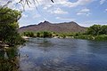 2014, View West, Rio Salado at the Rio Verde Confluence - panoramio.jpg 6,000 × 4,000; 8.34 MB
-

-
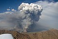 Arizona Bushfire Pyrocumulus.jpg 2,662 × 1,806; 2.91 MB
-
 Arizona Sky.JPG 3,072 × 2,304; 2.1 MB
-

-

-
 Discovering The 300 (73433561).jpeg 2,048 × 1,360; 502 KB
-
 Dressed for the occasion (3290829211).jpg 2,880 × 2,160; 1.4 MB
-
 Dusk near Bartlett Dam. - panoramio (1).jpg 3,200 × 2,400; 2.07 MB
-
 Dusk near Bartlett Dam. - panoramio.jpg 3,200 × 2,400; 1.9 MB
-
 Exit to Tonopah, Arizona, Interstate 10 Between Buckeye and Quartzite, Arizona.jpg 4,000 × 3,000; 2.52 MB
-
 Flag map of Maricopa County, Arizona.svg 512 × 459; 32 KB
-
 Fountain (124848923).jpeg 2,048 × 1,365; 410 KB
-
 Gilliland img058 (9194233008).jpg 6,208 × 4,080; 5.48 MB
-
 Groves over the Rio Verde - panoramio.jpg 4,000 × 3,000; 2.27 MB
-
 Hassayampa "River" (39768239082).jpg 2,048 × 1,539; 4.15 MB
-
 Hills (4471027912).jpg 4,742 × 3,011; 5.05 MB
-
How to Get Mail to an Inmate - Maricopa County Jail System.ogv 3 min 42 s, 1,920 × 1,080; 90.16 MB
-
 Knot (73433227).jpeg 2,048 × 1,360; 745 KB
-
 Le Conte's Thrasher habitat, Maricopa Co., AZ (16643663532).jpg 3,264 × 2,448; 2.65 MB
-
 Leaves Ii (73433557).jpeg 1,360 × 2,048; 359 KB
-
 Lookin-Good (3134334766).jpg 900 × 675; 289 KB
-
 Map of Gila Valley, Arizona USGS 1903 Gila and Salt River Meridian.png 1,675 × 1,788; 3.24 MB
-
 Maricopa County Board of Supervisors.svg 360 × 185; 976 bytes
-
 Maricopa County Jail bookings and population.png 1,024 × 768; 26 KB
-
 Maricopa County, AZ, USA - panoramio.jpg 3,072 × 2,048; 12.93 MB
-
 My Jeep just a little close to the edge. - panoramio.jpg 2,848 × 2,136; 1.75 MB
-
 Near Hyder Arizona (8628632799).jpg 4,608 × 3,456; 4.31 MB
-
 Near Sentinel Arizona (8628636643).jpg 4,168 × 3,126; 2.54 MB
-
 NewYears-Morning-Wood (2509104625).jpg 900 × 675; 222 KB
-
 Observing (73433639).jpeg 2,048 × 1,360; 590 KB
-

-

-
 One of the first west bounds of 2010 by Shawmut (4255367406).jpg 640 × 480; 189 KB
-
 Patch of the Maricopa County Sheriff's Office.png 309 × 352; 191 KB
-
 Pathway (124848925).jpeg 2,048 × 1,365; 467 KB
-
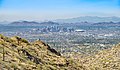 Phoenix Maricopa County Arizona.jpg 8,128 × 4,755; 24.96 MB
-
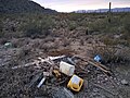 Pile of locals trash- not from homeless- near Aguila Arizona.jpg 3,891 × 2,919; 2.52 MB
-
 Polistes arizonensis 69452849.jpg 2,048 × 1,536; 798 KB
-
 Rest Stop (73433541).jpeg 2,048 × 1,360; 1.29 MB
-
 Shooting Reprise (73433583).jpeg 2,048 × 1,360; 1,022 KB
-
 Solar motor for pumping water near Phoenix Arizona, ca.1903 (CHS-1304).jpg 3,998 × 5,178; 1.49 MB
-

-
 Tiger Pride Sign.jpg 4,032 × 3,024; 5.41 MB
-
 To The River (73433377).jpeg 2,048 × 1,360; 1.45 MB
-
 USA Maricopa County, Arizona age pyramid.svg 520 × 600; 8 KB
-
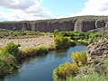 Verde River flowing South. - panoramio.jpg 3,200 × 2,400; 3.14 MB
-
 Waterman Wash, Goodyear, Arizona.jpg 2,688 × 1,512; 1.38 MB

.jpg)


.jpg)

.jpeg)
.jpg)
.jpg)


.jpeg)
.jpg)

.jpg)
.jpg)
.jpeg)
.jpg)
.jpeg)
.jpg)


.jpg)
.jpg)
.jpg)
.jpeg)


.jpg)

.jpeg)


.jpeg)
.jpeg)
.jpg)
.jpg)

.jpeg)


