Category:Apartment buildings in the London Borough of Haringey
Jump to navigation
Jump to search

Subcategories
This category has the following 3 subcategories, out of 3 total.
Media in category "Apartment buildings in the London Borough of Haringey"
The following 74 files are in this category, out of 74 total.
-
 George Lansbury House Elizabeth Blackwell House Wood Green London.jpg 3,312 × 4,417; 13.27 MB
-
 Block of flats on Lordship Lane, Tottenham, London, England 1.jpg 3,783 × 2,837; 7.51 MB
-
 2022-03-05 Hale Wharf Footbridge and apartments, Tottenham Hale.jpg 4,032 × 3,024; 2.3 MB
-
 Pacific CC v Crossbats CC at Wood Green, London, England 074.jpg 4,580 × 3,435; 13.8 MB
-
 Andrula Court Lordship Lane N22.jpg 2,019 × 1,497; 622 KB
-
 Apartment block, New River Village, Hornsey - geograph.org.uk - 4794636.jpg 2,630 × 1,831; 1.44 MB
-
 Aylmer Court on Sheldon Avenue - geograph.org.uk - 3874195.jpg 1,200 × 798; 414 KB
-
 Barrington Court, Muswell Hill - geograph.org.uk - 1097941.jpg 640 × 480; 111 KB
-
 Block - 1 Slab City - Tottenham Hale.jpg 4,800 × 2,700; 2.19 MB
-
 Block at corner of Lordship Lane and A10.jpg 1,228 × 1,896; 419 KB
-
 Block of flats on Crouch End Hill - geograph.org.uk - 4158445.jpg 2,304 × 1,728; 821 KB
-
 Block of flats on Hillcrest, Highgate - geograph.org.uk - 4227002.jpg 2,304 × 1,728; 1.19 MB
-
 Block of flats, near Turnpike Lane - geograph.org.uk - 4476336.jpg 474 × 600; 132 KB
-
 Broughton Gardens, Highgate - geograph.org.uk - 4278395.jpg 1,600 × 1,087; 295 KB
-
 Bruce Castle Court.jpg 1,630 × 1,044; 491 KB
-

-
 Cedar Court, Muswell Hill - geograph.org.uk - 1080534.jpg 640 × 480; 134 KB
-
 Charles House - Due for Destruction by Haringey Council.jpg 2,750 × 3,350; 2.15 MB
-
 Coldham Court Lordship Lane N22.jpg 1,846 × 1,084; 600 KB
-
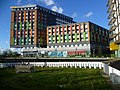
 Colourful Building, Tottenham Hale, London N17 - geograph.org.uk - 4422558.jpg 1,167 × 875; 1.01 MB
-
 Doran Manor - geograph.org.uk - 5197388.jpg 640 × 403; 62 KB
-
 Doran Manor and Linksview - geograph.org.uk - 441421.jpg 640 × 480; 90 KB
-

-
 Dorchester Court, Colney Hatch Lane, Muswell Hill, May 2023.jpg 4,032 × 3,024; 3.31 MB
-
 Dorchester Court, Muswell Hill - geograph.org.uk - 1097926.jpg 640 × 480; 60 KB
-

-
 Flats on Cholmeley Park - geograph.org.uk - 4928191.jpg 640 × 480; 90 KB
-
 Flats on Coolhurst Road, Crouch End - geograph.org.uk - 4128418.jpg 2,250 × 1,654; 1.31 MB
-
 Flats on Muswell Hill - geograph.org.uk - 4200287.jpg 2,190 × 1,564; 1.32 MB
-
 Flats on New Road, Crouch End - geograph.org.uk - 4128454.jpg 2,304 × 1,728; 838 KB
-
 Flats on Priory Road, Hornsey - geograph.org.uk - 4800138.jpg 2,304 × 1,728; 893 KB
-
 Flats on the corner of Coolhurst Road and Hurst Avenue - geograph.org.uk - 4128412.jpg 2,304 × 1,728; 802 KB
-
 Flats on West Green Road - geograph.org.uk - 734246.jpg 640 × 480; 126 KB
-
 Flats on West Green Road - geograph.org.uk - 755914.jpg 640 × 480; 108 KB
-
 Flats on West Green Road, N15 - geograph.org.uk - 755954.jpg 640 × 480; 105 KB
-
 Former White Hart PH, Devonshire Hill Lane, N17.jpg 2,133 × 1,600; 576 KB
-
 Former White Hart Pub, Devonshire Hill Lane, N17.jpg 2,133 × 1,600; 686 KB
-
 Hale Village - geograph.org.uk - 4243193.jpg 4,000 × 3,000; 4.04 MB
-
 Hale Village from Ferry Lane - geograph.org.uk - 4243262.jpg 4,000 × 3,000; 3.89 MB
-
 Hale Village on Ferry Lane - geograph.org.uk - 5220067.jpg 1,568 × 2,192; 1.27 MB
-
 Hale village, Tottenham - geograph.org.uk - 3063059.jpg 480 × 640; 51 KB
-
 Harvey House, Hornsey - geograph.org.uk - 4773164.jpg 3,525 × 2,109; 7.58 MB
-
 High Sheldon, Sheldon Avenue - geograph.org.uk - 432405.jpg 640 × 622; 145 KB
-
 Lyndum Court Lordship Lane N22.jpg 2,046 × 1,266; 375 KB
-
 Millicent Fawcett Court (North Block) from Lordship Lane N17.jpg 1,992 × 1,094; 352 KB
-
 Mountview Court, Green Lanes, N8 - geograph.org.uk - 658814.jpg 640 × 480; 82 KB
-
 New flats on Turnpike Lane, Hornsey - geograph.org.uk - 2231655.jpg 1,600 × 1,200; 520 KB
-
 New Flats, Brownlow Road, London N11 - geograph.org.uk - 3585252.jpg 1,024 × 768; 865 KB
-
 New tower block Seven Sisters, N15 - 30316048847.jpg 2,304 × 3,072; 5.26 MB
-
 New tower block Seven Sisters, N15.jpg 2,304 × 3,072; 1.39 MB
-
 Northwood Hall - geograph.org.uk - 1318668.jpg 389 × 640; 173 KB
-
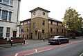
 Old School Court, Drapers Road N17 - geograph.org.uk - 2561046.jpg 640 × 475; 57 KB
-
 Olive Tree House - geograph.org.uk - 3829288.jpg 640 × 430; 71 KB
-
 Pickering Court Lordship Lane N22.jpg 1,617 × 1,203; 225 KB
-
 Priory Grange on Fortis Green - geograph.org.uk - 3969153.jpg 2,304 × 1,728; 812 KB
-
 Ramsey Court - geograph.org.uk - 2252117.jpg 1,600 × 1,067; 667 KB
-
 Ramsey Court, Park Road, Crouch End - geograph.org.uk - 1097843.jpg 640 × 480; 111 KB
-
 Ravensdale Mansions on Haringey Park - geograph.org.uk - 3703829.jpg 1,600 × 1,200; 537 KB
-
 Rear of flats on Shepherds Hill - geograph.org.uk - 3636511.jpg 1,600 × 1,200; 604 KB
-
 Ridgeway Gardens - geograph.org.uk - 1318655.jpg 427 × 640; 215 KB
-
 Seven sisters tower from the ladder.jpg 3,072 × 2,304; 1.39 MB
-
 Seven Sisters Tower from Walthamstow Wetlands.jpg 2,304 × 3,072; 1.22 MB
-
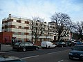
 Seymour Court, Muswell Hill - geograph.org.uk - 1116754.jpg 640 × 480; 108 KB
-
 Sky City from Mayes Road.jpg 2,764 × 2,156; 2.67 MB
-
 Station Mansions - geograph.org.uk - 3823936.jpg 430 × 640; 54 KB
-
 Station Mansions, Wightman Road, N8 - geograph.org.uk - 661956.jpg 640 × 480; 67 KB
-
 Student accommodation, Hale Village - geograph.org.uk - 4782678.jpg 1,840 × 2,267; 1.12 MB
-
 Tottenham Hale station MMB 07.jpg 3,798 × 2,385; 3.41 MB
-
 Tower blocks near Bounds Green Road from Alexandra Park - geograph.org.uk - 4423724.jpg 2,516 × 1,860; 1.44 MB
-
 Towerblocks, Wood Green - geograph.org.uk - 3812307.jpg 640 × 430; 76 KB
-
 Twyford Court, Muswell Hill - geograph.org.uk - 4027068.jpg 800 × 552; 180 KB
-
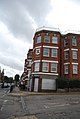
 Tynemouth House on Tynemouth Road, N15 - geograph.org.uk - 2245851.jpg 640 × 480; 101 KB
-
 Verandah Cottages (49445666796).jpg 5,184 × 3,888; 3.68 MB
-
 Whitehall Court, Muswell Hill - geograph.org.uk - 1116733.jpg 640 × 480; 70 KB


_from_Lordship_Lane_N17.jpg)


.jpg)
