Category:Appley Bridge
Jump to navigation
Jump to search
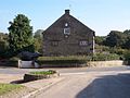
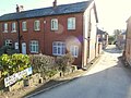
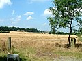
English: Appley Bridge is a village in West Lancashire, England. It is located off Junction 27 of the M6 motorway and is nestled in the Douglas valley alongside the Leeds and Liverpool Canal.
village in West Lancashire, England  | |||||
| Upload media | |||||
| Instance of | |||||
|---|---|---|---|---|---|
| Location | Wrightington, West Lancashire, Lancashire, North West England, England | ||||
 | |||||
Subcategories
This category has the following 3 subcategories, out of 3 total.
A
S
Media in category "Appley Bridge"
The following 68 files are in this category, out of 68 total.
-

-
 After the flood water-line on house.jpg 400 × 286; 130 KB
-
 All Saints Church, Appley Bridge - geograph.org.uk - 702772.jpg 640 × 480; 251 KB
-
 Appley Bridge Community Centre.JPG 4,320 × 3,240; 4.87 MB
-
 Appley Bridge village hall.JPG 4,320 × 3,240; 3.87 MB
-
 Appley Lane North Bridge, Appley Bridge (geograph 4531343).jpg 1,024 × 683; 219 KB
-
 Appley Lane North, Appley Bridge.JPG 4,608 × 3,456; 3.46 MB
-
 Aspinall's Farmhouse - Geograph 2111068.jpg 1,600 × 1,198; 449 KB
-
 Back Lane, Appley Bridge - geograph.org.uk - 3172082.jpg 640 × 480; 176 KB
-
 Back Skull House Lane, Appley Bridge - geograph.org.uk - 4338791.jpg 1,024 × 768; 358 KB
-
 Barn near Aspinall's Farmhouse - Geograph 2459314.jpg 640 × 480; 244 KB
-
 Canal and towpath. - geograph.org.uk - 1713320.jpg 3,648 × 2,736; 2.65 MB
-
 Canal Bank, Appley Bridge (geograph 4531286).jpg 1,024 × 683; 250 KB
-
 Canal boats, Leeds and Liverpool Canal, Appley Bridge (geograph 4531276).jpg 1,024 × 683; 240 KB
-
 Canal boats.jpg 579 × 372; 66 KB
-
 Decorated cottage, Appley Bridge.JPG 4,608 × 3,456; 3.53 MB
-
 Douglas Bank Cottage - geograph.org.uk - 42647.jpg 640 × 480; 184 KB
-

-
 Leeds - Liverpool Canal at Appley Bridge - geograph.org.uk - 638691.jpg 640 × 467; 103 KB
-
 Leeds and Liverpool Canal at Appley Bridge (1).JPG 4,608 × 3,456; 3.45 MB
-
 Leeds and Liverpool Canal at Appley Bridge (2).JPG 4,608 × 3,456; 3.41 MB
-
 Leeds and Liverpool Canal at Appley Bridge (3).JPG 4,608 × 3,456; 3.44 MB
-

-
 Leeds and Liverpool Canal towards Parbold - geograph.org.uk - 330696.jpg 640 × 480; 111 KB
-
 Leeds and Liverpool Canal, Appley Bridge (geograph 4531289).jpg 1,024 × 683; 285 KB
-
 Leeds and Liverpool Canal, Appley Bridge (geograph 4531337).jpg 1,024 × 683; 213 KB
-
 Mallard drakes, Appley Bridge (geograph 4531293).jpg 1,024 × 683; 146 KB
-
 Mallard ducks, Appley Bridge (geograph 4531341).jpg 1,024 × 683; 273 KB
-
 Miles Lane, Appley Bridge - geograph.org.uk - 3172076.jpg 640 × 480; 147 KB
-
 Moorings, Herons Wharf, Appley Bridge (geograph 4531302).jpg 1,024 × 683; 245 KB
-
 Moorings, Leeds and Liverpool Canal, Appley Bridge (geograph 4531278).jpg 1,024 × 683; 239 KB
-
 Quiet seclusion - geograph.org.uk - 98005.jpg 640 × 426; 135 KB
-
 Railway bridge over Mill Lane, Appley Bridge.JPG 4,608 × 3,456; 3.35 MB
-
 Skull House Lane about to join Appley Lane North - geograph.org.uk - 4446376.jpg 1,024 × 658; 122 KB
-
 Skull House Lane, Appley Bridge - geograph.org.uk - 4337853.jpg 1,024 × 768; 288 KB
-
 Skull House Mews, Appley Bridge - geograph.org.uk - 4338786.jpg 1,024 × 768; 320 KB
-
 Spherical Hyperbaric Oxygen Chamber, Appley Bridge (1).JPG 3,240 × 4,320; 4.13 MB
-
 Spherical Hyperbaric Oxygen Chamber, Appley Bridge (2).JPG 3,240 × 4,320; 3.93 MB
-
 Sunken boat, Leeds and Liverpool Canal, Appley Bridge (geograph 4531296).jpg 1,024 × 683; 289 KB
-

-
 The Boathouse pub, Appley Bridge (geograph 4531298).jpg 1,024 × 683; 251 KB
-
 The Inn on Appley Moor - geograph.org.uk - 26830.jpg 640 × 480; 98 KB
-
 The Lees Trout Farm - geograph.org.uk - 97025.jpg 640 × 426; 82 KB
-
 The road past Appley Bridge (B5375) - geograph.org.uk - 2113691.jpg 4,592 × 3,056; 5.86 MB
-
 The Star Inn - geograph.org.uk - 42653.jpg 640 × 480; 163 KB
-
 The Vale Methodist Church, Appley Bridge - geograph.org.uk - 3172073.jpg 640 × 480; 118 KB
-

-
 Water's Edge, Appley Bridge (1).JPG 4,608 × 3,456; 3.49 MB
-
 Water's Edge, Appley Bridge (2).JPG 4,608 × 3,456; 3.56 MB
-
 Woodland path in 'Fairy Glen' - geograph.org.uk - 1492159.jpg 640 × 480; 150 KB
-
 Bridge over Gathurst Road - geograph.org.uk - 47411.jpg 640 × 480; 113 KB
-
 Bridge over stream at Ashurst - geograph.org.uk - 1426150.jpg 640 × 424; 168 KB
-
 Canal Cottages, Appley Bridge - geograph.org.uk - 39339.jpg 640 × 480; 167 KB
-
 Canalside refreshment at Appley Bridge - geograph.org.uk - 557538.jpg 640 × 426; 117 KB
-
 Dangerous Corner - geograph.org.uk - 26828.jpg 640 × 480; 115 KB
-

-

-
 Elmers Green School - geograph.org.uk - 132271.jpg 640 × 426; 79 KB
-
 Fir Tree Farm Fisheries - geograph.org.uk - 47408.jpg 640 × 480; 250 KB
-
 Footpath at Dalton Lees - geograph.org.uk - 1426191.jpg 640 × 424; 125 KB
-
 Footpath at Dalton Lees - geograph.org.uk - 1426200.jpg 424 × 640; 181 KB
-
 Forest Fold - geograph.org.uk - 47410.jpg 640 × 480; 197 KB
-
 Holland Lees - geograph.org.uk - 173745.jpg 640 × 480; 217 KB
-
 Jollies i'th Dean - geograph.org.uk - 42625.jpg 640 × 480; 224 KB
-
 Over the top - geograph.org.uk - 128447.jpg 640 × 426; 67 KB
-
 River Douglas at Appley Bridge - geograph.org.uk - 174858.jpg 512 × 640; 210 KB
-
 Seasonal flooding - geograph.org.uk - 574454.jpg 640 × 480; 209 KB
-
 To a tee - geograph.org.uk - 97033.jpg 640 × 426; 89 KB


.jpg)


.jpg)
.jpg)


.JPG)
.JPG)
.JPG)


.jpg)
.jpg)
.jpg)
.jpg)

.jpg)
.jpg)


.JPG)
.JPG)
.jpg)

.jpg)


_-_geograph.org.uk_-_2113691.jpg)


.JPG)
.JPG)


