Category:April 2008 in County Tyrone
Jump to navigation
Jump to search
English: Images taken in County Tyrone, Northern Ireland in this month of 2008 (not the date of the upload).
| Jan | Feb | Mar | Apr | May | Jun | Jul | Aug | Sep | Oct | Nov | Dec | ||
| ← | 159 | 43 | 93 | 40 | 10 | 72 | 89 | 97 | 80 | 81 | 116 | 195 | → |
|---|
Media in category "April 2008 in County Tyrone"
The following 40 files are in this category, out of 40 total.
-
 "exSALONce", Omagh - geograph.org.uk - 751221.jpg 640 × 479; 60 KB
-
 Air Vent - geograph.org.uk - 765158.jpg 640 × 480; 70 KB
-
 Ballynahatty Bridge - geograph.org.uk - 746675.jpg 640 × 284; 46 KB
-
 Ballynahatty Bridge - geograph.org.uk - 746679.jpg 640 × 285; 42 KB
-
 Ballynahatty Fair Green - geograph.org.uk - 746641.jpg 640 × 480; 76 KB
-
 Ballynahatty Road - geograph.org.uk - 746630.jpg 640 × 480; 46 KB
-
 Ballyscally Townland - geograph.org.uk - 782610.jpg 640 × 479; 54 KB
-
 Ballyscally Townland - geograph.org.uk - 782616.jpg 640 × 479; 50 KB
-
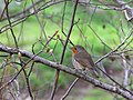 Brave wee robin, Omagh - geograph.org.uk - 751183.jpg 640 × 481; 57 KB
-
 Brookmount Road, Omagh - geograph.org.uk - 769614.jpg 640 × 480; 54 KB
-
 Bus Stop, Killyclogher - geograph.org.uk - 755261.jpg 640 × 479; 58 KB
-
 Camowen River, Omagh - geograph.org.uk - 759273.jpg 640 × 480; 73 KB
-
 Cannondale, Omagh - geograph.org.uk - 754252.jpg 640 × 479; 71 KB
-
 Carryclogher Townland - geograph.org.uk - 782621.jpg 640 × 479; 41 KB
-
 Carryclogher Townland - geograph.org.uk - 782624.jpg 640 × 479; 50 KB
-
 Church Street, Omagh - geograph.org.uk - 768324.jpg 640 × 301; 30 KB
-
 Corleaghan Townland - geograph.org.uk - 782447.jpg 640 × 479; 61 KB
-
 Corleaghan Townland - geograph.org.uk - 782448.jpg 640 × 479; 72 KB
-
 Cranny, Omagh - geograph.org.uk - 761324.jpg 640 × 480; 77 KB
-
 Dublin Road, Omagh - geograph.org.uk - 754233.jpg 640 × 279; 37 KB
-
 Ford at Killaney - geograph.org.uk - 782717.jpg 640 × 479; 78 KB
-
 Gammy Townland - geograph.org.uk - 746618.jpg 640 × 480; 50 KB
-
 Gammy Townland - geograph.org.uk - 746626.jpg 640 × 480; 50 KB
-
 James Street, Omagh - geograph.org.uk - 748998.jpg 640 × 480; 53 KB
-
 Kevlin Road, Omagh - geograph.org.uk - 754240.jpg 640 × 479; 82 KB
-
 Kirk's Garage, Omagh - geograph.org.uk - 769611.jpg 640 × 480; 59 KB
-
 Knockmoe Heights, Killyclogher - geograph.org.uk - 755285.jpg 640 × 479; 53 KB
-
 Laneway, Donaghanie Old Graveyard - geograph.org.uk - 764040.jpg 640 × 479; 81 KB
-
 Laneway, Donaghanie Old Graveyard - geograph.org.uk - 764041.jpg 640 × 479; 87 KB
-

-
 Lover's Retreat, Omagh - geograph.org.uk - 761367.jpg 640 × 287; 48 KB
-
 McConnell Place, Omagh - geograph.org.uk - 769619.jpg 640 × 480; 55 KB
-
 Oxfam shop, Omagh - geograph.org.uk - 759264.jpg 640 × 480; 54 KB
-
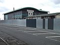 Police Station, Omagh - geograph.org.uk - 768332.jpg 640 × 480; 41 KB
-
 Road at Killyclogher - geograph.org.uk - 755260.jpg 640 × 479; 62 KB
-

-
 St Mary's RC Church, Killyclogher - geograph.org.uk - 755256.jpg 640 × 479; 53 KB
-
 The Killyclogher Burn - geograph.org.uk - 755267.jpg 640 × 479; 123 KB
-
 View from Donaghanie Graveyard - geograph.org.uk - 764044.jpg 640 × 479; 63 KB
-
 View from Donaghanie Graveyard - geograph.org.uk - 764046.jpg 640 × 479; 61 KB


