Category:April 2009 in Dorset
Jump to navigation
Jump to search
Deutsch: Bilder, die im April 2009 in Dorset aufgenommen worden sind. Bitte beachten Sie, dass dies weder das Datum des Uploads noch das Datum des Scannens eines Fotos ist.
English: Images/pictures taken in Dorset during April 2009. Note this is not the date of the upload, nor the date a photo was scanned.
Español: Fotografías o imágenes tomadas en Dorset durante abril 2009. No es la fecha de subida ni escaneo, sino la fecha en que las fotografías o imágenes se crearon.
Esperanto: Bildoj faritaj en Dorset en aprilo 2009. Tio ne estas la dato, kiam la bildoj estis alŝutitaj aŭ skanitaj.
Français : Photographies ou images prises en Dorset durant avril 2009. Ce n'est pas la date du téléchargement ou du scan.
Galego: Fotografías ou imaxes tomadas en Dorset durante abril 2009. Non é a data de subida nin escaneamento, senón a data na que se crearon as fotografías ou imaxes.
Italiano: Fotografie o immagini scattate a Dorset nel aprile 2009. Nota bene: la data non si riferisce né a quella di upload né a quella in cui la foto è stata digitalizzata.
Norsk bokmål: Bilder tatt i Dorset i løpet av april 2009. Merk at dette ikke er datoen for opplasting, eller når et bilde har blitt skannet.
Norsk nynorsk: Bilete teke i Dorset i løpet av april 2009. Merk at dette ikkje er datoen for opplasting, eller når eit bilete har vorte skanna.
Русский: Изображения, сделанные в Dorset в течение апрель 2009 (не дата загрузки изображения).
Українська: Зображення, зроблені в Dorset протягом квітень 2009. Зауважте, що це не дата завантаження чи дата сканування фотографії.
| April 2008 | ← | April 2009 | → | April 2010 | |||||||
| Jan | Feb | Mar | Apr | May | Jun | Jul | Aug | Sep | Oct | Nov | Dec |
| 108 | 196 | 141 | 121 | 170 | 268 | 261 | 198 | 156 | 138 | 70 | 85 |
|---|---|---|---|---|---|---|---|---|---|---|---|
Media in category "April 2009 in Dorset"
The following 121 files are in this category, out of 121 total.
-
 2009-04-09 swanage town hall.jpg 2,448 × 3,264; 2.09 MB
-
 St James Alderholt - geograph.org.uk - 1296589.jpg 640 × 543; 115 KB
-
 Ballard point - Swanage Bay - geograph.org.uk - 1737634.jpg 640 × 458; 63 KB
-
 Barn at Mappowder Court Farm - geograph.org.uk - 1261053.jpg 640 × 427; 370 KB
-

-
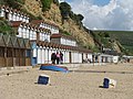 Beach huts at Swanage - geograph.org.uk - 2155587.jpg 640 × 480; 91 KB
-
 Bere Regis, fire hooks - geograph.org.uk - 1268859.jpg 640 × 480; 63 KB
-
 Bere Regis, watercress beds - geograph.org.uk - 1268828.jpg 640 × 480; 102 KB
-

-
 Boat and pontoon - geograph.org.uk - 2154409.jpg 640 × 454; 72 KB
-
 Bournemouth , Car Park - geograph.org.uk - 1289038.jpg 640 × 218; 54 KB
-
 Bournemouth , Car Park - geograph.org.uk - 1289047.jpg 640 × 234; 66 KB
-

-
 Bournemouth , Coastal Car Park - geograph.org.uk - 1289036.jpg 640 × 480; 63 KB
-
 Bournemouth , Multi-storey Car Park - geograph.org.uk - 1288866.jpg 640 × 480; 70 KB
-
 Bournemouth , Multi-Storey Car Park - geograph.org.uk - 1288877.jpg 640 × 195; 41 KB
-

-
 Building site - geograph.org.uk - 1738066.jpg 480 × 640; 95 KB
-
 Closed kids fun park - Swanage - geograph.org.uk - 1737452.jpg 640 × 436; 71 KB
-
 Co-op carpark, Corfe Mullen - geograph.org.uk - 1234916.jpg 640 × 480; 53 KB
-
 Coastal defences - Swanage Bay - geograph.org.uk - 2158182.jpg 480 × 640; 119 KB
-
 Crossroads Ferndown - geograph.org.uk - 1295134.jpg 640 × 480; 116 KB
-
 Curiosity - High Street, Swanage - geograph.org.uk - 1737651.jpg 640 × 454; 74 KB
-
 Daggons, molehills - geograph.org.uk - 1245414.jpg 640 × 480; 63 KB
-
 Deck Chairs for hire - geograph.org.uk - 2158117.jpg 471 × 640; 79 KB
-
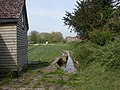
 Deer Fence - geograph.org.uk - 1268565.jpg 640 × 428; 103 KB
-
 Dorset police in Swanage - geograph.org.uk - 2158174.jpg 640 × 450; 68 KB
-
 Earthlights - geograph.org.uk - 1738036.jpg 640 × 458; 75 KB
-
 Earthlights - geograph.org.uk - 1738044.jpg 640 × 458; 83 KB
-
 Eastworth Farmhouse - geograph.org.uk - 1258215.jpg 640 × 480; 60 KB
-
 Eastworth Play Area - geograph.org.uk - 1258176.jpg 640 × 480; 85 KB
-
 Eastworth, dismantled bridge - geograph.org.uk - 1258267.jpg 480 × 640; 122 KB
-
 Eastworth, fingerpost - geograph.org.uk - 1258193.jpg 480 × 640; 114 KB
-
 Eastworth, footpath - geograph.org.uk - 1258223.jpg 640 × 480; 74 KB
-
 Eastworth, former railway line - geograph.org.uk - 1258293.jpg 640 × 480; 64 KB
-
 Eastworth, road bridge - geograph.org.uk - 1258252.jpg 640 × 480; 76 KB
-
 Enfield Motor Accessories - geograph.org.uk - 1738059.jpg 640 × 498; 96 KB
-
 Eroded rocks, Harlyn Bay - geograph.org.uk - 1285537.jpg 640 × 450; 132 KB
-
 Field near Lower Kingcombe - geograph.org.uk - 1259689.jpg 640 × 428; 66 KB
-
 Field near Toller Porcorum - geograph.org.uk - 1259729.jpg 640 × 428; 90 KB
-
 Fields at Grove Stall Farm - geograph.org.uk - 1259652.jpg 640 × 428; 54 KB
-
 Fields near Fryer Mayne Dairy - geograph.org.uk - 1247328.jpg 640 × 455; 84 KB
-
 Fields near Lancombe Farm - geograph.org.uk - 1259688.jpg 640 × 428; 70 KB
-
 Fields near Wynford Eagle - geograph.org.uk - 1259780.jpg 640 × 428; 83 KB
-
 Footbridge near Keynston Mill - geograph.org.uk - 1275835.jpg 640 × 480; 94 KB
-
 Former railway terminus, West Bay - geograph.org.uk - 1234072.jpg 640 × 480; 77 KB
-

-
 From Custard Hill to Whiteway Hill - geograph.org.uk - 1295997.jpg 640 × 480; 86 KB
-
 Funworld - geograph.org.uk - 1737433.jpg 640 × 456; 66 KB
-
 Funworld arcade - Swanage - geograph.org.uk - 1737635.jpg 640 × 444; 64 KB
-
 Going to surf at Harlyn Bay - geograph.org.uk - 1285530.jpg 640 × 447; 81 KB
-

-

-
 Groynes at Swanage - geograph.org.uk - 2155581.jpg 640 × 480; 68 KB
-
 Gulland Rock from Harlyn Bay beach - geograph.org.uk - 1285507.jpg 640 × 425; 59 KB
-
 Harlyn Bay beach scene - geograph.org.uk - 1292461.jpg 640 × 426; 115 KB
-
 Harlyn Bay beach sunset - geograph.org.uk - 1292460.jpg 640 × 426; 74 KB
-
 Harlyn Bay stroll - geograph.org.uk - 1285568.jpg 640 × 447; 121 KB
-
 Harlyn Bay, stream crossing beach - geograph.org.uk - 1285527.jpg 600 × 399; 69 KB
-
 HDR sky on fire (8241288871).jpg 3,872 × 2,592; 9.11 MB
-
 Hedgeline near Harlyn Bay - geograph.org.uk - 1285250.jpg 640 × 426; 89 KB
-
 Hedgerow near Ryme Intrinseca - geograph.org.uk - 1269344.jpg 640 × 448; 92 KB
-
 High Street - Swanage - geograph.org.uk - 2158938.jpg 640 × 480; 94 KB
-

-
 Highcliffe, shops in Saulfland Place - geograph.org.uk - 1249069.jpg 640 × 480; 72 KB
-
 Hollow Oak, watercress beds - geograph.org.uk - 1268699.jpg 640 × 480; 106 KB
-
 House with a view at Harlyn Bay - geograph.org.uk - 1285823.jpg 640 × 485; 101 KB
-
 House with a view, Harlyn Bay - geograph.org.uk - 1285517.jpg 640 × 470; 67 KB
-
 Houses above the beach at Harlyn Bay - geograph.org.uk - 1294320.jpg 640 × 446; 88 KB
-

-
 Ice cream kiosk - geograph.org.uk - 1737442.jpg 640 × 449; 60 KB
-
 Information for visitors - geograph.org.uk - 1737655.jpg 640 × 452; 73 KB
-
 JJ Moore - Butchers - geograph.org.uk - 1738039.jpg 640 × 461; 64 KB
-
 Joining the B3081 near Ashmore - geograph.org.uk - 1296059.jpg 640 × 480; 68 KB
-

-

-
 Kings East Road - geograph.org.uk - 1738061.jpg 640 × 480; 95 KB
-
 Kingston Lacy House - geograph.org.uk - 1295530.jpg 640 × 480; 149 KB
-
 Kiteflying at Harlyn Bay - geograph.org.uk - 1285497.jpg 519 × 640; 66 KB
-
 Leaving the surf, Harlyn Bay - geograph.org.uk - 1285522.jpg 640 × 441; 82 KB
-
 Line of Beach Huts - geograph.org.uk - 2155588.jpg 640 × 480; 86 KB
-
 Lonely Dutch Barn - geograph.org.uk - 1281147.jpg 640 × 480; 64 KB
-
 Louse Lane - geograph.org.uk - 1281197.jpg 640 × 480; 104 KB
-
 Money well spent - geograph.org.uk - 1542282.jpg 480 × 640; 84 KB
-
 New Tractor and Trailer - geograph.org.uk - 1259732.jpg 640 × 479; 117 KB
-
 Old Railway Bridge - geograph.org.uk - 1281260.jpg 640 × 480; 98 KB
-
 Old trailer near Spetisbury - geograph.org.uk - 1281502.jpg 640 × 480; 88 KB
-
 On the roof of the tearoom - geograph.org.uk - 1296265.jpg 640 × 476; 199 KB
-
 Path behind the shops - geograph.org.uk - 1738069.jpg 464 × 640; 79 KB
-
 Railings on Swanage pier - geograph.org.uk - 2158255.jpg 640 × 457; 84 KB
-
 Rainbow's End - geograph.org.uk - 1737658.jpg 640 × 464; 87 KB
-
 Rear of the Town Hall, Bridport - geograph.org.uk - 1232104.jpg 640 × 480; 94 KB
-
 Replacing the decking - geograph.org.uk - 2158261.jpg 480 × 640; 119 KB
-
 Ringwood Road, Alderholt, Dorset - geograph.org.uk - 1281995.jpg 640 × 371; 87 KB
-
 Ringwood Road, Alderholt, Dorset - geograph.org.uk - 1283161.jpg 640 × 426; 80 KB
-
 Road Traffic Accident Victim - geograph.org.uk - 1259773.jpg 640 × 428; 121 KB
-
 Romford, old railway - geograph.org.uk - 1258307.jpg 640 × 480; 158 KB
-
 Romford, old road bridge - geograph.org.uk - 1258321.jpg 640 × 480; 140 KB
-
 Ryme Intrinseca - geograph.org.uk - 1269343.jpg 640 × 480; 87 KB
-
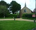
 Saint Martin's Church - geograph.org.uk - 1271864.jpg 640 × 480; 93 KB
-
 Shrubs clinging on, Harlyn Bay - geograph.org.uk - 1294323.jpg 426 × 640; 148 KB
-
 Silhouettes on Harlyn Bay beach - geograph.org.uk - 1285237.jpg 640 × 439; 77 KB
-

-
 Stocks Inn, Furzehill - geograph.org.uk - 1273289.jpg 640 × 486; 123 KB
-
 Stocks Inn, Furzehill - geograph.org.uk - 1273317.jpg 480 × 640; 125 KB
-
 Sunset over Harlyn Bay beach - geograph.org.uk - 1285252.jpg 600 × 414; 53 KB
-
 Swanage Bay - geograph.org.uk - 1542294.jpg 640 × 448; 58 KB
-
 Swans at Crawford Bridge - geograph.org.uk - 1281174.jpg 640 × 480; 62 KB
-
 The door has got its hat on - geograph.org.uk - 1273230.jpg 467 × 640; 102 KB
-
 The A31 Ashley Heath junction - geograph.org.uk - 1295081.jpg 640 × 480; 79 KB
-
 The car park at Harlyn Bay beach - geograph.org.uk - 1294326.jpg 640 × 426; 105 KB
-
 The lane to Higher Halstock Leigh - geograph.org.uk - 1252887.jpg 480 × 640; 158 KB
-
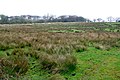
 The north hide, RSPB Radipole Lakes - geograph.org.uk - 1232446.jpg 640 × 480; 92 KB
-
 Trig point in use on Warren Hill - geograph.org.uk - 1243137.jpg 480 × 640; 96 KB
-
 Victoria Road, Ferndown - geograph.org.uk - 1295101.jpg 640 × 480; 113 KB
-
 View across Swanage Bay - geograph.org.uk - 1737456.jpg 640 × 457; 80 KB
-

-
 Walkers Car Park - geograph.org.uk - 1268566.jpg 640 × 428; 73 KB
-
 Weather vane, Shaftesbury - geograph.org.uk - 1255427.jpg 640 × 480; 71 KB
-

-
 Young surfer at Harlyn Bay - geograph.org.uk - 1294344.jpg 640 × 494; 70 KB


.jpg)


