Category:April 2015 in Queensland
Jump to navigation
Jump to search
States of Australia: New South Wales · Queensland · South Australia · Tasmania · Victoria · Western Australia
Internal territories of Australia: Australian Capital Territory · Northern Territory
External territories of Australia:
Internal territories of Australia: Australian Capital Territory · Northern Territory
External territories of Australia:
Deutsch: Bilder, die im April 2015 in Queensland aufgenommen worden sind. Bitte beachten Sie, dass dies weder das Datum des Uploads noch das Datum des Scannens eines Fotos ist.
English: Images/pictures taken in Queensland during April 2015. Note this is not the date of the upload, nor the date a photo was scanned.
Español: Fotografías o imágenes tomadas en Queensland durante abril 2015. No es la fecha de subida ni escaneo, sino la fecha en que las fotografías o imágenes se crearon.
Esperanto: Bildoj faritaj en Queensland en aprilo 2015. Tio ne estas la dato, kiam la bildoj estis alŝutitaj aŭ skanitaj.
Français : Photographies ou images prises en Queensland durant avril 2015. Ce n'est pas la date du téléchargement ou du scan.
Galego: Fotografías ou imaxes tomadas en Queensland durante abril 2015. Non é a data de subida nin escaneamento, senón a data na que se crearon as fotografías ou imaxes.
Italiano: Fotografie o immagini scattate a Queensland nel aprile 2015. Nota bene: la data non si riferisce né a quella di upload né a quella in cui la foto è stata digitalizzata.
Norsk bokmål: Bilder tatt i Queensland i løpet av april 2015. Merk at dette ikke er datoen for opplasting, eller når et bilde har blitt skannet.
Norsk nynorsk: Bilete teke i Queensland i løpet av april 2015. Merk at dette ikkje er datoen for opplasting, eller når eit bilete har vorte skanna.
Русский: Изображения, сделанные в Queensland в течение апрель 2015 (не дата загрузки изображения).
Українська: Зображення, зроблені в Queensland протягом квітень 2015. Зауважте, що це не дата завантаження чи дата сканування фотографії.
| April 2014 | ← | April 2015 | → | April 2016 | |||||||
| Jan | Feb | Mar | Apr | May | Jun | Jul | Aug | Sep | Oct | Nov | Dec |
| 44 | 26 | 16 | 93 | 74 | 198 | 114 | 60 | 91 | 50 | 47 | 12 |
|---|---|---|---|---|---|---|---|---|---|---|---|
Subcategories
This category has the following 2 subcategories, out of 2 total.
B
Media in category "April 2015 in Queensland"
The following 91 files are in this category, out of 91 total.
-
 Beach alongside a bay at K'gari, Queensland.jpg 5,184 × 3,456; 2.51 MB
-
 Churchbank Weir on Warrill Creek (east branch).jpg 3,264 × 2,448; 4.4 MB
-
Churchbank Weir.webm 12 h 2 min 55 s, 1,280 × 736; 5.7 MB
-
 Cleveland jetty plaque.jpg 3,264 × 2,448; 4.42 MB
-
 Cleveland war memorial.jpg 3,264 × 2,448; 3.52 MB
-
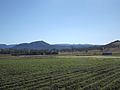 Crops at Frazerview.jpg 3,264 × 2,448; 3.89 MB
-
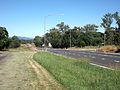 Cunningham Highway at Mutdapilly.jpg 3,264 × 2,448; 4.39 MB
-
 Cunningham Highway at Warrill View.jpg 3,027 × 1,890; 3.32 MB
-
 Cunninghams Gap from Kents Lagoon.jpg 3,264 × 1,952; 3.09 MB
-
 Farm at Munbilla.jpg 3,264 × 2,448; 3.79 MB
-
 Farm at Teviotville.jpg 3,264 × 2,448; 3.74 MB
-
 Farming shed at Kents Lagoon.jpg 3,264 × 2,448; 4.52 MB
-
 Farms in Kalbar.jpg 3,264 × 2,448; 4.23 MB
-
 Fernleigh Cleveland.jpg 3,264 × 2,448; 5.31 MB
-
 Fields along Carmichaels Road Purga.jpg 3,264 × 2,448; 4.04 MB
-
 Fields along Kengoon Road Silverdale.jpg 3,264 × 2,448; 4.04 MB
-
 Fields along Mount Walker West Road Merryvale.jpg 3,264 × 2,448; 3.82 MB
-
 Fields along Mount Walker West Road Mount Walker West.jpg 3,264 × 2,448; 3.57 MB
-
 Fields along Stokes Crossing Road Lower Mount Walker.jpg 3,264 × 2,448; 3.92 MB
-
 Fields at Coleyville 2.jpg 3,264 × 2,448; 3.81 MB
-
 Fields at Coleyville.jpg 3,264 × 2,448; 3.71 MB
-
 Fields at Kents Lagoon.jpg 3,224 × 2,049; 3.82 MB
-
 Fields at Mutdapilly.jpg 3,264 × 2,448; 3.89 MB
-
 Fields at Teviotville 2.jpg 3,264 × 2,448; 3.85 MB
-
 Fields at Teviotville.jpg 2,448 × 3,264; 4.06 MB
-
 Fields in Fassifern Valley.jpg 3,264 × 2,448; 3.51 MB
-
 Fields in Rosevale 2.jpg 3,264 × 2,448; 3.76 MB
-
 Fields in Rosevale.jpg 3,264 × 2,448; 3.81 MB
-
 Flinders Peak from Teviotville.jpg 3,264 × 2,448; 3.83 MB
-
 Flinders Peak.jpg 3,264 × 2,448; 3.75 MB
-
 Flinders Uniting Church Peak Crossing.jpg 3,202 × 2,282; 3.94 MB
-
 Former Cleveland Hotel 2.jpg 3,264 × 2,448; 6.99 MB
-
 Former Cleveland Hotel.jpg 3,264 × 2,448; 4.98 MB
-
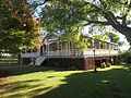
 Front dining room Rosevale Retreat Hotel.jpg 3,264 × 2,448; 4.51 MB
-
 Front verandah and stairs Wiss House Kalbar.jpg 3,264 × 2,448; 3.48 MB
-
 Grand View Hotel and North Street Cleveland.jpg 3,264 × 2,448; 3.52 MB
-
 Grand View Hotel Cleveland.jpg 3,264 × 2,448; 3.87 MB
-
 Hillards Creek at Ormiston Park.jpg 3,264 × 2,448; 4.34 MB
-
 Hughes Road Purga.jpg 3,264 × 2,448; 3.91 MB
-
 Information display at Hardings Paddock Picnic Area Goolman.jpg 3,264 × 2,448; 3.92 MB
-
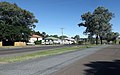
 Ipswich Boonah Road at Peak Crossing.jpg 3,264 × 2,448; 4.04 MB
-
 Irrigation equipment at Kents Lagoon.jpg 3,264 × 2,448; 4.09 MB
-
 Kalbar war memorial.jpg 3,264 × 2,448; 4.72 MB
-
 Kents Lagoon.jpg 3,264 × 2,448; 3.51 MB
-

-
 Main Range from Rosevale.jpg 3,264 × 2,448; 4.32 MB
-
 Mount French from Kents Lagoon.jpg 3,264 × 2,448; 3.99 MB
-
 Mount Walker Scenic Rim Region.jpg 3,264 × 2,448; 4.4 MB
-
 Mutdapilly State School building.jpg 3,264 × 2,448; 3.98 MB
-
 Mutdapilly State School grounds.jpg 3,264 × 2,448; 4.43 MB
-
 No.440 tram at Rosevale Retreat Hotel.jpg 3,264 × 2,448; 3.79 MB
-
 Norfolk Island Pine Trees, Cleveland 2.jpg 2,424 × 3,240; 3.9 MB
-
 Norfolk Island Pine Trees, Cleveland.jpg 2,448 × 3,264; 3.58 MB
-
 Old Cleveland Court House 2.jpg 2,648 × 1,906; 2.5 MB
-
 Old Cleveland Court House plaque.jpg 3,264 × 2,448; 4.11 MB
-
 Old Cleveland Court House.jpg 3,264 × 2,448; 3.97 MB
-
 Old Cleveland Police Station 2.jpg 2,761 × 1,583; 3.13 MB
-
 Old Cleveland Police Station.jpg 3,264 × 2,448; 3.61 MB
-
 Ormiston Fellmongery detail.jpg 3,126 × 1,805; 4.11 MB
-
 Ormiston Fellmongery fenced area.jpg 3,264 × 2,448; 6.45 MB
-
 Ormiston Fellmongery remnants.jpg 3,264 × 2,448; 4.59 MB
-
 Ormiston House.jpg 3,264 × 2,448; 3.7 MB
-
 Paddocks along Kengoon Road Silverdale.jpg 3,264 × 2,448; 4.27 MB
-
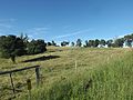
 Pastures at Fassifern.jpg 3,264 × 2,448; 4.27 MB
-
 Peak Crossing Public Hall.jpg 3,264 × 2,448; 3.71 MB
-
 Picnic facilities at Hardings Paddock Picnic Area Goolman.jpg 3,264 × 2,448; 4.54 MB
-
 Purga Aboriginal Cemetery gravestones.jpg 3,264 × 2,448; 4.03 MB
-
 Purga Aboriginal Cemetery sign.jpg 3,264 × 2,448; 4.06 MB
-
 Purga Aboriginal Cemetery.jpg 3,264 × 2,448; 4.23 MB
-
 Purga School Road Purga.jpg 3,264 × 2,448; 3.95 MB
-
 Purga United Church and hall.jpg 3,085 × 2,108; 3.35 MB
-
 Purga United Church side.jpg 3,082 × 2,296; 3.55 MB
-
 Purga United Church.jpg 3,213 × 2,301; 3.83 MB
-
 Rosevale Retreat Hotel courtyard.jpg 3,264 × 2,448; 4.52 MB
-
 Rosevale Retreat Hotel front.jpg 3,264 × 2,448; 4.09 MB
-
 Rosewood Warrill View Road at Mount Walker.jpg 3,264 × 2,448; 3.89 MB
-
 Site of former Cleveland jetty.jpg 3,264 × 2,448; 3.51 MB
-
 St Andrews Church, Ormiston entrance.jpg 3,264 × 2,448; 4.26 MB
-
 St Andrews Church, Ormiston.jpg 3,264 × 2,448; 4.4 MB
-
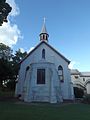
 St John’s Lutheran Church Kalbar.jpg 3,264 × 2,448; 3.72 MB
-
 St Patricks Catholic Church gravestones, Rosevale.jpg 3,264 × 2,448; 4.2 MB
-
 St Patricks Catholic Church Rosevale.jpg 3,264 × 2,448; 3.66 MB
-
 St Paul's Lutheran Church Rosevale.jpg 3,264 × 2,448; 3.76 MB
-
 St Pauls Anglican Church, Cleveland 2.jpg 2,448 × 3,264; 3.24 MB
-
 St Pauls Anglican Church, Cleveland.jpg 2,448 × 3,264; 3.22 MB
-
 Teviot Range from Mutdapilly.jpg 3,264 × 2,448; 4.47 MB
-
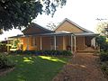
 Whepstead detail.jpg 3,264 × 2,448; 3.88 MB
-
 Whepstead front entrance.jpg 3,264 × 2,448; 5.83 MB
-
 Whepstead rear.jpg 2,554 × 1,518; 3.02 MB
-
 Wiss Brothers Store at Kalbar.jpg 3,264 × 2,448; 3.63 MB
-
 Wiss House Kalbar.jpg 3,264 × 2,448; 4.76 MB

.jpg)


