Category:April 2015 in Surrey
Jump to navigation
Jump to search
Ceremonial counties of England: Bedfordshire · Berkshire · Buckinghamshire · Cambridgeshire · Cheshire · Cornwall · Cumbria · Derbyshire · Devon · Dorset · Durham · East Riding of Yorkshire · East Sussex · Essex · Gloucestershire · Greater London · Greater Manchester · Hampshire · Herefordshire · Hertfordshire · Kent · Lancashire · Leicestershire · Lincolnshire · Merseyside · Norfolk · North Yorkshire · Northamptonshire · Northumberland · Nottinghamshire · Oxfordshire · Shropshire · Somerset · South Yorkshire · Staffordshire · Suffolk · Surrey · Tyne and Wear · Warwickshire · West Midlands · West Sussex · West Yorkshire · Wiltshire · Worcestershire
City-counties: Bristol ·
Former historic counties:
Other former counties:
City-counties: Bristol ·
Former historic counties:
Other former counties:
Deutsch: Bilder, die im April 2015 in Surrey aufgenommen worden sind. Bitte beachten Sie, dass dies weder das Datum des Uploads noch das Datum des Scannens eines Fotos ist.
English: Images/pictures taken in Surrey during April 2015. Note this is not the date of the upload, nor the date a photo was scanned.
Español: Fotografías o imágenes tomadas en Surrey durante abril 2015. No es la fecha de subida ni escaneo, sino la fecha en que las fotografías o imágenes se crearon.
Esperanto: Bildoj faritaj en Surrey en aprilo 2015. Tio ne estas la dato, kiam la bildoj estis alŝutitaj aŭ skanitaj.
Français : Photographies ou images prises en Surrey durant avril 2015. Ce n'est pas la date du téléchargement ou du scan.
Galego: Fotografías ou imaxes tomadas en Surrey durante abril 2015. Non é a data de subida nin escaneamento, senón a data na que se crearon as fotografías ou imaxes.
Italiano: Fotografie o immagini scattate a Surrey nel aprile 2015. Nota bene: la data non si riferisce né a quella di upload né a quella in cui la foto è stata digitalizzata.
Norsk bokmål: Bilder tatt i Surrey i løpet av april 2015. Merk at dette ikke er datoen for opplasting, eller når et bilde har blitt skannet.
Norsk nynorsk: Bilete teke i Surrey i løpet av april 2015. Merk at dette ikkje er datoen for opplasting, eller når eit bilete har vorte skanna.
Русский: Изображения, сделанные в Surrey в течение апрель 2015 (не дата загрузки изображения).
Українська: Зображення, зроблені в Surrey протягом квітень 2015. Зауважте, що це не дата завантаження чи дата сканування фотографії.
| April 2014 | ← | April 2015 | → | April 2016 | |||||||
| Jan | Feb | Mar | Apr | May | Jun | Jul | Aug | Sep | Oct | Nov | Dec |
| 19 | 21 | 25 | 142 | 115 | 219 | 9 | 13 | 24 | 4 | 6 | 1 |
|---|---|---|---|---|---|---|---|---|---|---|---|
Media in category "April 2015 in Surrey"
The following 141 files are in this category, out of 141 total.
-
 Baguley built "Altonia" at Reeds Road Station.jpg 4,608 × 3,456; 3.55 MB
-
 43086 passes Woking 5th April 2015.jpg 4,608 × 3,456; 3.76 MB
-
 66165 passes Ash 25th April 2015.jpg 4,608 × 3,456; 4.08 MB
-
 A Class 166 unit at Ash station in 2015.jpg 4,608 × 3,456; 3.6 MB
-
 A Class 456 unit at Ash level crossing in 2015.jpg 4,608 × 3,456; 4 MB
-
 A Class 456 unit at Ash station in 2015.jpg 4,608 × 3,456; 3.82 MB
-
 Bagshot Park Entrance Gate - geograph.org.uk - 4459371.jpg 4,603 × 1,880; 2.94 MB
-
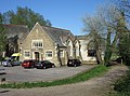
 Binscombe Church, Loseley Road, Binscombe (April 2015) (1).JPG 4,600 × 2,800; 3.08 MB
-
 Binscombe Church, Loseley Road, Binscombe (April 2015) (2).JPG 4,200 × 2,800; 2.71 MB
-
 Binscombe Church, Loseley Road, Binscombe (April 2015) (3).JPG 4,000 × 2,000; 1.63 MB
-
 Bocketts Farm - Tearooms - geograph.org.uk - 5253841.jpg 2,560 × 1,920; 2.93 MB
-
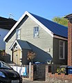
 Brethren Meeting Room, New Pond Road, Artington, near Guildford (April 2015) (1).JPG 4,608 × 3,456; 4.41 MB
-
 Brethren Meeting Room, New Pond Road, Artington, near Guildford (April 2015) (2).JPG 4,608 × 3,456; 5.43 MB
-
 Brethren Meeting Room, New Pond Road, Artington, near Guildford (April 2015) (3).JPG 4,200 × 2,400; 2.12 MB
-
 Brethren Meeting Room, New Pond Road, Artington, near Guildford (April 2015) (4).JPG 4,608 × 3,456; 3.82 MB
-
 Brethren Meeting Room, New Pond Road, Artington, near Guildford (April 2015) (5).JPG 3,200 × 1,400; 1.11 MB
-
 Brethren Meeting Room, New Pond Road, Artington, near Guildford (April 2015) (6).JPG 4,608 × 3,456; 4.39 MB
-

-
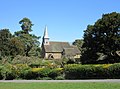
 Children's Garden, Guildford Cathedral - geograph.org.uk - 4428984.jpg 640 × 480; 397 KB
-

-

-
 Epsom Downs railway station (site), Surrey (geograph 4428101).jpg 1,600 × 1,200; 325 KB
-
 Estate Agents Signs, Ewell - geograph.org.uk - 4454428.jpg 640 × 480; 124 KB
-
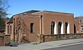
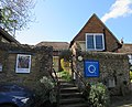
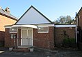
 Farncombe Community Centre, 2015.jpg 4,600 × 2,400; 1.79 MB
-
 First Church of Christ, Scientist, Ockford Road, Godalming (April 2015) (1).JPG 4,600 × 3,400; 3.79 MB
-
 First Church of Christ, Scientist, Ockford Road, Godalming (April 2015) (2).JPG 3,600 × 2,200; 2.1 MB
-
 First Church of Christ, Scientist, Ockford Road, Godalming (April 2015) (3).JPG 4,200 × 3,000; 6.26 MB
-
 First Church of Christ, Scientist, Ockford Road, Godalming (April 2015) (4).JPG 4,600 × 3,200; 3.43 MB
-
 First Church of Christ, Scientist, Ockford Road, Godalming (April 2015) (5).JPG 4,400 × 2,800; 2.72 MB
-
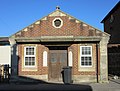
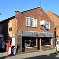
 Former British School, Bridge Street, Godalming (April 2015).JPG 4,400 × 2,600; 2.44 MB
-
 Former Farncombe Baptist Church, St John's Street, Farncombe (April 2015) (2).JPG 3,400 × 3,000; 2.06 MB
-

-
 Former Farncombe Baptist Church, St John's Street, Farncombe (April 2015) (4).JPG 4,200 × 3,200; 2.3 MB
-
 Former Godalming Congregational Church, Bridge Road, Godalming (April 2015) (1).JPG 4,200 × 3,000; 3.03 MB
-
 Former Godalming Congregational Church, Bridge Road, Godalming (April 2015) (2).JPG 4,000 × 3,200; 2.5 MB
-
 Former Godalming Congregational Church, Bridge Road, Godalming (April 2015) (3).JPG 4,400 × 3,200; 4.08 MB
-
 Former Godalming Congregational Church, Bridge Road, Godalming (April 2015) (4).JPG 3,200 × 3,000; 1.6 MB
-
 Former Godalming Congregational Church, Bridge Road, Godalming (April 2015) (5).JPG 4,000 × 2,800; 2.3 MB
-
 Former Gospel Hall, Lower Manor Road, Farncombe (April 2015) (1).JPG 2,600 × 3,000; 3.51 MB
-
 Former Gospel Hall, Lower Manor Road, Farncombe (April 2015) (2).JPG 2,800 × 2,800; 1.45 MB
-
 Former Gospel Hall, Lower Manor Road, Farncombe (April 2015) (3).JPG 2,800 × 2,600; 3.97 MB
-
 Former Gospel Hall, Lower Manor Road, Farncombe (April 2015) (4).JPG 3,000 × 3,200; 1.89 MB
-
 Former Salvation Army Hall, Mint Street, Godalming (April 2015) (1).JPG 3,400 × 3,200; 4.92 MB
-
 Former Salvation Army Hall, Mint Street, Godalming (April 2015) (2).JPG 3,200 × 3,200; 2.19 MB
-
 Former Salvation Army Hall, Mint Street, Godalming (April 2015) (3).JPG 3,000 × 2,800; 1.87 MB
-
 Former Salvation Army Hall, Mint Street, Godalming (April 2015) (4).JPG 2,800 × 3,200; 2.22 MB
-
 Former Salvation Army Hall, Mint Street, Godalming (April 2015) (5).JPG 3,400 × 3,600; 2.24 MB
-
 Former Wesleyan Chapel, Farncombe Street, Farncombe (April 2015) (1).JPG 2,400 × 2,000; 1.08 MB
-
 Former Wesleyan Chapel, Farncombe Street, Farncombe (April 2015) (2).JPG 2,600 × 2,600; 1.42 MB
-
 Friends Meeting House, Mill Lane, Godalming (April 2015) (1).JPG 4,400 × 2,800; 2.75 MB
-
 Friends Meeting House, Mill Lane, Godalming (April 2015) (2).JPG 4,400 × 3,200; 3.18 MB
-
 Friends Meeting House, Mill Lane, Godalming (April 2015) (3).JPG 4,200 × 3,400; 3.03 MB
-
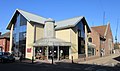
 G-Live, Guildford Civic Hall - geograph.org.uk - 4429259.jpg 640 × 480; 259 KB
-
 Former Salvation Army Hall, Mint Street, Godalming (April 2015) (6).JPG 3,200 × 4,400; 2.43 MB
-
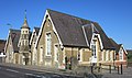
 Godalming Baptist Church, Queen Street, Godalming (April 2015).JPG 4,400 × 2,600; 2.41 MB
-
 Godalming United Church, Bridge Road, Godalming (April 2015) (1).JPG 4,200 × 3,400; 3.49 MB
-
 Godalming United Church, Bridge Road, Godalming (April 2015) (2).JPG 4,000 × 3,000; 3 MB
-
 Godalming United Church, Bridge Road, Godalming (April 2015) (3).JPG 3,200 × 3,000; 2.59 MB
-
 Godalming United Church, Bridge Road, Godalming (April 2015) (4).JPG 4,000 × 3,200; 3.11 MB
-
 Godalming United Church, Bridge Road, Godalming (April 2015) (5).JPG 3,400 × 3,000; 2.68 MB
-
 Godalming United Church, Bridge Road, Godalming (April 2015) (6).JPG 4,400 × 3,200; 2.96 MB
-
 Godalming United Church, Bridge Road, Godalming (April 2015) (7).JPG 4,600 × 3,400; 2.62 MB
-
 Godalming United Church, Bridge Road, Godalming (April 2015) (Church Hall).JPG 4,600 × 3,400; 4.03 MB
-
 Guildford - Castle - geograph.org.uk - 5254020.jpg 2,560 × 1,920; 3.42 MB
-
 Guildford Cathedral (detail) - geograph.org.uk - 4428973.jpg 480 × 640; 298 KB
-
 Guildford Cathedral - geograph.org.uk - 4428612.jpg 640 × 480; 302 KB
-
 Guildford Cathedral, Stag Hill - geograph.org.uk - 4428967.jpg 480 × 640; 282 KB
-
 Guildford Railway Station - geograph.org.uk - 4429212.jpg 640 × 480; 305 KB
-
 Kingdom Hall, Carlos Street, Godalming (April 2015) (1).JPG 4,000 × 2,800; 1.69 MB
-
 Kingdom Hall, Carlos Street, Godalming (April 2015) (2).JPG 3,200 × 2,400; 1.54 MB
-
 Kingdom Hall, Carlos Street, Godalming (April 2015) (3).JPG 3,800 × 2,800; 1.58 MB
-
 Level Crossing by Whyteleafe Station - geograph.org.uk - 4420548.jpg 1,600 × 1,200; 421 KB
-
 Meadrow Unitarian Chapel, Meadrow, Godalming (April 2015) (1).JPG 4,600 × 3,400; 4.03 MB
-
 Meadrow Unitarian Chapel, Meadrow, Godalming (April 2015) (2).JPG 4,600 × 3,400; 3.86 MB
-
 Meadrow Unitarian Chapel, Meadrow, Godalming (April 2015) (3).JPG 4,300 × 3,000; 2.72 MB
-
 Meadrow Unitarian Chapel, Meadrow, Godalming (April 2015) (4).JPG 4,600 × 3,000; 4.15 MB
-
 Meadrow Unitarian Chapel, Meadrow, Godalming (April 2015) (5).JPG 4,200 × 2,800; 2.84 MB
-
 Meadrow Unitarian Chapel, Meadrow, Godalming (April 2015) (Church Hall 1).JPG 4,600 × 3,200; 3.83 MB
-
 Meadrow Unitarian Chapel, Meadrow, Godalming (April 2015) (Church Hall 2).JPG 4,600 × 3,400; 3.15 MB
-
 Meadrow Unitarian Chapel, Meadrow, Godalming (April 2015) (Noticeboard).JPG 4,400 × 3,200; 3.11 MB
-
 Meadrow Unitarian Chapel, Meadrow, Godalming (April 2015) (Porch).JPG 3,456 × 4,608; 4.12 MB
-
 Railway Viaduct, Bagshot - geograph.org.uk - 4459329.jpg 2,306 × 1,618; 1.14 MB
-
 Shell Filling Station on Woodbridge Road - geograph.org.uk - 4480453.jpg 640 × 427; 236 KB
-
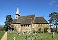
 St Edmund King and Martyr's Church, Croft Road, Godalming (April 2015) (1).JPG 4,200 × 2,800; 2.64 MB
-
 St Edmund King and Martyr's Church, Croft Road, Godalming (April 2015) (2).jpg 4,000 × 3,000; 4.07 MB
-
 St Edmund King and Martyr's Church, Croft Road, Godalming (April 2015) (3).jpg 3,903 × 3,122; 2.05 MB
-
 St Edmund King and Martyr's Church, Croft Road, Godalming (April 2015) (4).JPG 4,000 × 2,800; 2.03 MB
-
 St Edmund King and Martyr's Church, Croft Road, Godalming (April 2015) (5).JPG 3,800 × 3,000; 3.28 MB
-
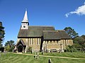
 St John the Baptist's Church, Brighton Road, Busbridge (April 2015) (1).JPG 3,400 × 3,600; 2.79 MB
-
 St John the Baptist's Church, Brighton Road, Busbridge (April 2015) (10).JPG 4,000 × 3,200; 3.36 MB
-
 St John the Baptist's Church, Brighton Road, Busbridge (April 2015) (11).JPG 3,400 × 2,400; 2.22 MB
-
 St John the Baptist's Church, Brighton Road, Busbridge (April 2015) (12).JPG 3,400 × 3,400; 2.39 MB
-
 St John the Baptist's Church, Brighton Road, Busbridge (April 2015) (2).JPG 4,400 × 3,200; 3.15 MB
-
 St John the Baptist's Church, Brighton Road, Busbridge (April 2015) (3).JPG 3,400 × 4,400; 4.41 MB
-
 St John the Baptist's Church, Brighton Road, Busbridge (April 2015) (4).JPG 4,600 × 3,400; 4.16 MB
-
 St John the Baptist's Church, Brighton Road, Busbridge (April 2015) (5).JPG 4,600 × 3,400; 4.08 MB
-
 St John the Baptist's Church, Brighton Road, Busbridge (April 2015) (6).JPG 3,400 × 3,400; 2.26 MB
-
 St John the Baptist's Church, Brighton Road, Busbridge (April 2015) (7).JPG 4,400 × 3,400; 3.1 MB
-
 St John the Baptist's Church, Brighton Road, Busbridge (April 2015) (8).JPG 4,600 × 3,400; 8.87 MB
-
 St John the Baptist's Church, Brighton Road, Busbridge (April 2015) (9).JPG 4,400 × 3,000; 3.82 MB
-
 St John the Baptist's Church, Brighton Road, Busbridge (April 2015) (Church Hall).JPG 4,200 × 3,400; 3.5 MB
-
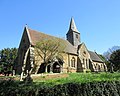
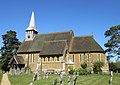
 St John the Evangelist's Church, St John's Street, Farncombe (April 2015) (1).JPG 4,400 × 3,200; 3.95 MB
-
 St John the Evangelist's Church, St John's Street, Farncombe (April 2015) (2).JPG 4,200 × 3,200; 3.72 MB
-
 St John the Evangelist's Church, St John's Street, Farncombe (April 2015) (3).JPG 3,400 × 4,000; 4.28 MB
-
 St John the Evangelist's Church, St John's Street, Farncombe (April 2015) (4).JPG 4,400 × 3,200; 3.43 MB
-
 St Mark's Church, Franklyn Road, Ockford Ridge (April 2015) (1).JPG 3,800 × 2,600; 2.18 MB
-
 St Mark's Church, Franklyn Road, Ockford Ridge (April 2015) (2).JPG 4,400 × 2,800; 2.88 MB
-
 St Mark's Church, Franklyn Road, Ockford Ridge (April 2015) (3).JPG 4,600 × 3,400; 2.94 MB
-
 St Mark's Church, Franklyn Road, Ockford Ridge (April 2015) (4).JPG 4,600 × 3,200; 4.17 MB
-
 St Peter and St Paul's Church, Church Street, Godalming (April 2015) (1).JPG 3,400 × 4,600; 2.99 MB
-
 St Peter and St Paul's Church, Church Street, Godalming (April 2015) (10).JPG 4,200 × 3,200; 2.84 MB
-
 St Peter and St Paul's Church, Church Street, Godalming (April 2015) (11).JPG 3,400 × 3,400; 3.27 MB
-
 St Peter and St Paul's Church, Church Street, Godalming (April 2015) (2).JPG 3,400 × 4,200; 3.35 MB
-
 St Peter and St Paul's Church, Church Street, Godalming (April 2015) (3).JPG 3,400 × 4,400; 3.26 MB
-
 St Peter and St Paul's Church, Church Street, Godalming (April 2015) (4).JPG 3,400 × 4,400; 3.05 MB
-
 St Peter and St Paul's Church, Church Street, Godalming (April 2015) (5).JPG 3,400 × 4,400; 3.06 MB
-
 St Peter and St Paul's Church, Church Street, Godalming (April 2015) (6).JPG 4,600 × 3,400; 2.92 MB
-
 St Peter and St Paul's Church, Church Street, Godalming (April 2015) (7).JPG 4,200 × 3,400; 3.62 MB
-
 St Peter and St Paul's Church, Church Street, Godalming (April 2015) (8).JPG 4,600 × 3,400; 3.28 MB
-
 St Peter and St Paul's Church, Church Street, Godalming (April 2015) (9).JPG 3,400 × 4,400; 2.72 MB
-
 St Peter and St Paul's Church, Church Street, Godalming (April 2015) (Church Hall).JPG 4,600 × 3,400; 3.91 MB
-
 St Peter and St Paul's Church, Church Street, Godalming (April 2015) (Churchyard).JPG 4,600 × 3,400; 4.16 MB
-
 St Peter and St Paul's Church, Church Street, Godalming (April 2015) (East Window).JPG 3,400 × 4,600; 2.95 MB
-

-
 St Peter and St Paul's Church, Church Street, Godalming (April 2015) (Interior).JPG 4,608 × 3,456; 3.5 MB
-
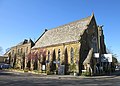
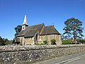
 St Peter's Church, School Lane, Hascombe (April 2015) (1).JPG 4,600 × 3,400; 3.69 MB
-
 St Peter's Church, School Lane, Hascombe (April 2015) (10).JPG 4,600 × 3,400; 3.84 MB
-
 St Peter's Church, School Lane, Hascombe (April 2015) (11).JPG 3,400 × 3,200; 2.27 MB
-
 St Peter's Church, School Lane, Hascombe (April 2015) (12).JPG 3,400 × 3,800; 2.79 MB
-
 St Peter's Church, School Lane, Hascombe (April 2015) (13).JPG 4,600 × 3,400; 4.77 MB
-
 St Peter's Church, School Lane, Hascombe (April 2015) (14).JPG 4,200 × 3,200; 3.82 MB
-
 St Peter's Church, School Lane, Hascombe (April 2015) (2).JPG 4,200 × 2,800; 3.11 MB
-
 St Peter's Church, School Lane, Hascombe (April 2015) (3).JPG 4,000 × 3,200; 3.25 MB
-
 St Peter's Church, School Lane, Hascombe (April 2015) (4).JPG 4,200 × 3,400; 3.36 MB
-
 St Peter's Church, School Lane, Hascombe (April 2015) (5).JPG 3,400 × 2,400; 2.3 MB
-
 St Peter's Church, School Lane, Hascombe (April 2015) (6).JPG 4,000 × 2,800; 2.94 MB
-
 St Peter's Church, School Lane, Hascombe (April 2015) (7).JPG 4,200 × 3,200; 3.57 MB
-
 St Peter's Church, School Lane, Hascombe (April 2015) (8).JPG 4,400 × 3,200; 4.07 MB
-
 St Peter's Church, School Lane, Hascombe (April 2015) (9).JPG 4,400 × 3,200; 3.43 MB
-
 St Peter's Church, School Lane, Hascombe (April 2015) (Churchyard).JPG 4,600 × 3,400; 5.21 MB
-
 St Peter's Church, School Lane, Hascombe (April 2015) (Noticeboard).JPG 4,400 × 3,400; 3.38 MB


_(1).JPG)
_(2).JPG)
_(3).JPG)

_(1).JPG)
_(2).JPG)
_(3).JPG)
_(4).JPG)
_(5).JPG)
_(6).JPG)


,_Surrey_(geograph_4428101).jpg)


_(1).JPG)
_(2).JPG)
_(3).JPG)
_(4).JPG)
_(5).JPG)
.JPG)
_(2).JPG)
_(3).JPG)
_(4).JPG)
_(1).JPG)
_(2).JPG)
_(3).JPG)
_(4).JPG)
_(5).JPG)
_(1).JPG)
_(2).JPG)
_(3).JPG)
_(4).JPG)
_(1).JPG)
_(2).JPG)
_(3).JPG)
_(4).JPG)
_(5).JPG)
_(1).JPG)
_(2).JPG)
_(1).JPG)
_(2).JPG)
_(3).JPG)

_(6).JPG)
.JPG)
_(1).JPG)
_(2).JPG)
_(3).JPG)
_(4).JPG)
_(5).JPG)
_(6).JPG)
_(7).JPG)
_(Church_Hall).JPG)

_-_geograph.org.uk_-_4428973.jpg)


_(1).JPG)
_(2).JPG)
_(3).JPG)

_(1).JPG)
_(2).JPG)
_(3).JPG)
_(4).JPG)
_(5).JPG)
_(Church_Hall_1).JPG)
_(Church_Hall_2).JPG)
_(Noticeboard).JPG)
_(Porch).JPG)


_(1).JPG)
_(2).jpg)
_(3).jpg)
_(4).JPG)
_(5).JPG)
_(1).JPG)
_(10).JPG)
_(11).JPG)
_(12).JPG)
_(2).JPG)
_(3).JPG)
_(4).JPG)
_(5).JPG)
_(6).JPG)
_(7).JPG)
_(8).JPG)
_(9).JPG)
_(Church_Hall).JPG)
_(1).JPG)
_(2).JPG)
_(3).JPG)
_(4).JPG)
_(1).JPG)
_(2).JPG)
_(3).JPG)
_(4).JPG)
_(1).JPG)
_(10).JPG)
_(11).JPG)
_(2).JPG)
_(3).JPG)
_(4).JPG)
_(5).JPG)
_(6).JPG)
_(7).JPG)
_(8).JPG)
_(9).JPG)
_(Church_Hall).JPG)
_(Churchyard).JPG)
_(East_Window).JPG)
_(Holland_Family_Tomb).JPG)
_(Interior).JPG)
_(1).JPG)
_(10).JPG)
_(11).JPG)
_(12).JPG)
_(13).JPG)
_(14).JPG)
_(2).JPG)
_(3).JPG)
_(4).JPG)
_(5).JPG)
_(6).JPG)
_(7).JPG)
_(8).JPG)
_(9).JPG)
_(Churchyard).JPG)
_(Noticeboard).JPG)