Category:April 2017 in York
Jump to navigation
Jump to search
Deutsch: Bilder, die im April 2017 in York aufgenommen worden sind. Bitte beachten Sie, dass dies weder das Datum des Uploads noch das Datum des Scannens eines Fotos ist.
English: Images/pictures taken in York during April 2017. Note this is not the date of the upload, nor the date a photo was scanned.
Español: Fotografías o imágenes tomadas en York durante abril 2017. No es la fecha de subida ni escaneo, sino la fecha en que las fotografías o imágenes se crearon.
Esperanto: Bildoj faritaj en York en aprilo 2017. Tio ne estas la dato, kiam la bildoj estis alŝutitaj aŭ skanitaj.
Français : Photographies ou images prises en York durant avril 2017. Ce n'est pas la date du téléchargement ou du scan.
Galego: Fotografías ou imaxes tomadas en York durante abril 2017. Non é a data de subida nin escaneamento, senón a data na que se crearon as fotografías ou imaxes.
Italiano: Fotografie o immagini scattate a York nel aprile 2017. Nota bene: la data non si riferisce né a quella di upload né a quella in cui la foto è stata digitalizzata.
Norsk bokmål: Bilder tatt i York i løpet av april 2017. Merk at dette ikke er datoen for opplasting, eller når et bilde har blitt skannet.
Norsk nynorsk: Bilete teke i York i løpet av april 2017. Merk at dette ikkje er datoen for opplasting, eller når eit bilete har vorte skanna.
Русский: Изображения, сделанные в York в течение апрель 2017 (не дата загрузки изображения).
Українська: Зображення, зроблені в York протягом квітень 2017. Зауважте, що це не дата завантаження чи дата сканування фотографії.
| April 2016 | ← | April 2017 | → | April 2018 | |||||||
| Jan | Feb | Mar | Apr | May | Jun | Jul | Aug | Sep | Oct | Nov | Dec |
| 95 | 67 | 183 | 158 | 99 | 92 | 244 | 155 | 51 | 122 | 64 | 151 |
|---|---|---|---|---|---|---|---|---|---|---|---|
Media in category "April 2017 in York"
The following 158 files are in this category, out of 158 total.
-
 Along Elvington Lane - geograph.org.uk - 5360758.jpg 640 × 427; 236 KB
-
 Askham Bryan Lane - geograph.org.uk - 5341238.jpg 640 × 427; 189 KB
-
 Askham Lane - Foxwood Lane roundabout - geograph.org.uk - 5341233.jpg 640 × 427; 204 KB
-

-
 Beans growing near Gipsey Corner - geograph.org.uk - 5354255.jpg 640 × 427; 222 KB
-

-
 Bridleway across the Intake - geograph.org.uk - 5356599.jpg 640 × 427; 205 KB
-
 Bridleway from Old Hall Farm - geograph.org.uk - 5354970.jpg 640 × 427; 197 KB
-
 Bridleway to Gipsey Corner - geograph.org.uk - 5354254.jpg 640 × 427; 230 KB
-
 Bridleway to Kexby - geograph.org.uk - 5355990.jpg 640 × 427; 198 KB
-
 Bridleway to Old Hall Farm - geograph.org.uk - 5354391.jpg 427 × 640; 241 KB
-
 Bridleway towards Old Hall Farm - geograph.org.uk - 5355988.jpg 640 × 427; 200 KB
-
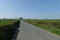 Cat Lane near the A64 - geograph.org.uk - 5341581.jpg 640 × 427; 191 KB
-
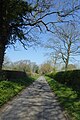 Chapel Lane - geograph.org.uk - 5341256.jpg 427 × 640; 294 KB
-
 Chapel Lane from York Road - geograph.org.uk - 5341269.jpg 640 × 427; 208 KB
-
 Chemistry Department - geograph.org.uk - 5343784.jpg 640 × 360; 106 KB
-
 Church of St Michael le Belfrey, York - geograph.org.uk - 5435319.jpg 1,024 × 768; 141 KB
-
 Clifford's Tower York - geograph.org.uk - 5354297.jpg 640 × 480; 59 KB
-
 Colton to Copmanthorpe road - geograph.org.uk - 5342808.jpg 640 × 427; 213 KB
-

-
 Daffodils by Chemistry E Block - geograph.org.uk - 5343787.jpg 360 × 640; 188 KB
-
 Dauby Lane - geograph.org.uk - 5354258.jpg 640 × 427; 205 KB
-
 Dauby Lane and footpath sign - geograph.org.uk - 5354377.jpg 640 × 427; 255 KB
-
 Dauby Lane approaches the A1079 - geograph.org.uk - 5356628.jpg 640 × 427; 207 KB
-
 Ditch beside Dauby Lane - geograph.org.uk - 5354414.jpg 640 × 427; 248 KB
-
 Farmland beside Chapel Lane - geograph.org.uk - 5341257.jpg 640 × 427; 212 KB
-
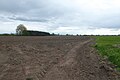 Farmland beside the Kexby bridleway - geograph.org.uk - 5356618.jpg 640 × 427; 211 KB
-
 Farmland near Low Barns Farm - geograph.org.uk - 5356633.jpg 640 × 427; 207 KB
-
 Farmland off Acaster Lane - geograph.org.uk - 5369769.jpg 640 × 427; 52 KB
-
 Farmland off Askham Bryan Lane - geograph.org.uk - 5341239.jpg 640 × 427; 191 KB
-
 Farmland south of Askham Richard - geograph.org.uk - 5341540.jpg 640 × 427; 213 KB
-
 Field and woods - geograph.org.uk - 5356605.jpg 640 × 427; 217 KB
-

-
 Fields near Old Hall Farm - geograph.org.uk - 5356551.jpg 640 × 427; 193 KB
-
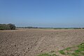 Fields near the A1237 - geograph.org.uk - 5341234.jpg 640 × 427; 205 KB
-
 Gateway through city wall, Wellington Row, York - geograph.org.uk - 5435339.jpg 1,024 × 768; 146 KB
-
 Gorse coming into flower - geograph.org.uk - 5341202.jpg 640 × 427; 233 KB
-
 Grape Lane, York - geograph.org.uk - 5435311.jpg 1,024 × 768; 175 KB
-
 Hallcroft Lane - geograph.org.uk - 5342818.jpg 640 × 427; 203 KB
-
 Hedgerow on Hob Moor - geograph.org.uk - 5341188.jpg 640 × 427; 203 KB
-
 High speed valves and gauges - geograph.org.uk - 5356580.jpg 640 × 427; 78 KB
-
 Horses investigating - geograph.org.uk - 5356547.jpg 640 × 360; 168 KB
-
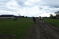 Horses near Old Hall Farm - geograph.org.uk - 5356535.jpg 640 × 427; 196 KB
-
 Interior of York station from platform 3 - geograph.org.uk - 5398361.jpg 1,024 × 768; 194 KB
-
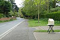 Jam for sale - geograph.org.uk - 5369763.jpg 640 × 427; 83 KB
-
 Jubbergate entrance to Shambles Market, York (geograph 5435307).jpg 1,024 × 768; 188 KB
-

-
 Kings Square, York - geograph.org.uk - 5435300.jpg 1,024 × 768; 218 KB
-
 Lakeside - geograph.org.uk - 5369753.jpg 640 × 427; 45 KB
-
 Lambs next to Acaster Lane - geograph.org.uk - 5369773.jpg 640 × 374; 275 KB
-
 Lendal Bridge Landing, York - geograph.org.uk - 5435345.jpg 1,024 × 768; 163 KB
-
 Lendal Bridge, York - geograph.org.uk - 5435343.jpg 1,024 × 768; 220 KB
-
 Lock House, near Strensall - geograph.org.uk - 5372655.jpg 1,600 × 1,200; 488 KB
-
 Lone tree and rape - geograph.org.uk - 5356548.jpg 640 × 427; 186 KB
-
 Lovers Lane Footpath to Pouys Street - geograph.org.uk - 5354115.jpg 4,608 × 3,072; 1.73 MB
-
 Main Street - geograph.org.uk - 5341247.jpg 427 × 640; 212 KB
-
 Main Street near Chapel Lane - geograph.org.uk - 5341253.jpg 640 × 427; 227 KB
-
 Main Street near the village pond - geograph.org.uk - 5341251.jpg 640 × 427; 277 KB
-
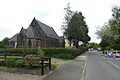 Methodist Church - geograph.org.uk - 5369767.jpg 640 × 427; 63 KB
-
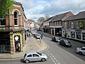 Micklegate From York City Walls - geograph.org.uk - 5354751.jpg 640 × 480; 89 KB
-
 Middlethorpe Common - geograph.org.uk - 5342826.jpg 640 × 427; 209 KB
-
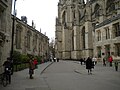 Minster Yard, York - geograph.org.uk - 5435314.jpg 1,024 × 768; 158 KB
-
 Museum Gardens, York (1) - geograph.org.uk - 5435321.jpg 1,024 × 768; 237 KB
-
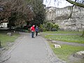 Museum Gardens, York (2) - geograph.org.uk - 5435323.jpg 1,024 × 768; 228 KB
-
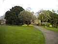 Museum Gardens, York (3) - geograph.org.uk - 5435331.jpg 1,024 × 768; 164 KB
-
 No through footpath - geograph.org.uk - 5354387.jpg 640 × 427; 230 KB
-
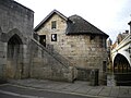 North Street Postern Tower, York - geograph.org.uk - 5435349.jpg 1,024 × 768; 147 KB
-
 Old Askham Lane - geograph.org.uk - 5341236.jpg 640 × 427; 315 KB
-
 Old Hall Farm - geograph.org.uk - 5354533.jpg 640 × 427; 196 KB
-
 Outskirts of Askham Bryan - geograph.org.uk - 5341245.jpg 640 × 427; 240 KB
-
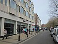
-
 Paths crossing Hob Moor - geograph.org.uk - 5341198.jpg 640 × 427; 221 KB
-
 Paths on Hob Moor - geograph.org.uk - 5341187.jpg 640 × 427; 187 KB
-
 Ploughed and rape fields - geograph.org.uk - 5356595.jpg 640 × 427; 231 KB
-
 Ploughed fields near Langwith Lodge - geograph.org.uk - 5354252.jpg 640 × 427; 231 KB
-
 Pool next to Tadcaster Road - geograph.org.uk - 5342824.jpg 640 × 427; 223 KB
-
 Postbox and phone box - geograph.org.uk - 5369758.jpg 640 × 427; 88 KB
-
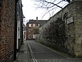 Precentor's Court, York (geograph 5435316).jpg 1,024 × 768; 180 KB
-
 Rape beside Dauby Lane - geograph.org.uk - 5356642.jpg 640 × 427; 200 KB
-
 Rape field off Dauby Lane - geograph.org.uk - 5354262.jpg 640 × 427; 247 KB
-
 Rape off Dauby Lane - geograph.org.uk - 5356644.jpg 640 × 427; 204 KB
-
 Rape south of Askham Richard - geograph.org.uk - 5341573.jpg 640 × 427; 256 KB
-
 Rawcliffe Ings and the A1237 bridge over the river Ouse - geograph.org.uk - 5342995.jpg 1,600 × 1,200; 548 KB
-
 River Foss near Strensall - geograph.org.uk - 5372663.jpg 1,600 × 1,200; 518 KB
-

-

-
 River Ouse, York - geograph.org.uk - 5435336.jpg 1,024 × 768; 158 KB
-
 Road near Low Barns Farm - geograph.org.uk - 5356641.jpg 640 × 427; 206 KB
-
 Road to Copmanthorpe - geograph.org.uk - 5342807.jpg 640 × 427; 203 KB
-
 Road to Copmanthorpe - geograph.org.uk - 5342810.jpg 640 × 427; 232 KB
-
 Road towards Broad Oak Farm - geograph.org.uk - 5354388.jpg 640 × 427; 190 KB
-
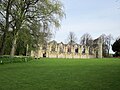 Ruins of St Mary's Abbey York - geograph.org.uk - 5353277.jpg 640 × 480; 91 KB
-
 Sheep and chickens - geograph.org.uk - 5354984.jpg 640 × 427; 217 KB
-
 Sheltered accommodation on Top Lane - geograph.org.uk - 5342821.jpg 640 × 427; 214 KB
-

-
 South west end of St Andrewgate, York - geograph.org.uk - 5435303.jpg 1,024 × 768; 169 KB
-
 St Wilfred's Catholic Church York - geograph.org.uk - 5353280.jpg 480 × 640; 58 KB
-
 St. Nicholas Church - geograph.org.uk - 5341249.jpg 640 × 427; 238 KB
-
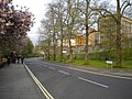 Station Avenue, York - geograph.org.uk - 5435353.jpg 1,024 × 768; 257 KB
-
 Strensall New Bridge - geograph.org.uk - 5372680.jpg 1,600 × 1,200; 458 KB
-
 Tadcaster Road - geograph.org.uk - 5342823.jpg 640 × 427; 206 KB
-
 The Hospitium York - geograph.org.uk - 5353275.jpg 640 × 480; 96 KB
-
 The Intake - geograph.org.uk - 5356611.jpg 640 × 427; 213 KB
-
 The Knavesmire - geograph.org.uk - 5343788.jpg 640 × 360; 68 KB
-
 The Mill on the Foss York - geograph.org.uk - 5354298.jpg 640 × 480; 113 KB
-
 The Plain - geograph.org.uk - 5354415.jpg 640 × 427; 206 KB
-

-
 The Ship at Strensall - geograph.org.uk - 5372667.jpg 1,600 × 1,200; 387 KB
-
 The University of York - geograph.org.uk - 5360949.jpg 900 × 1,075; 156 KB
-
 Towards Old Hall Cottages - geograph.org.uk - 5354820.jpg 640 × 427; 219 KB
-
 Towards the Nags Head - geograph.org.uk - 5341254.jpg 640 × 427; 206 KB
-
 Under the cables - geograph.org.uk - 5356620.jpg 640 × 427; 207 KB
-
 York - DRS 66426 and 66304.JPG 1,366 × 820; 463 KB
-
 York - Virgin 43295 with Golden Spanner.JPG 1,366 × 910; 406 KB
-

-

-
 York Architecture , Clifton Bingo, 52-54 Clifton, York - geograph.org.uk - 5376456.jpg 1,600 × 1,200; 443 KB
-

-
 York city wall alongside Station Road - geograph.org.uk - 5435351.jpg 1,024 × 768; 209 KB
-
 York City Walls in Springtime - geograph.org.uk - 5354747.jpg 640 × 480; 101 KB
-
 York City Walls Near Station - geograph.org.uk - 5354758.jpg 640 × 480; 95 KB
-
-
 York Minster - geograph.org.uk - 5360942.jpg 900 × 1,600; 268 KB
-
 York Minster - geograph.org.uk - 5360944.jpg 900 × 1,600; 418 KB
-
 York railway station - geograph.org.uk - 5356578.jpg 640 × 427; 85 KB
-
 York Road near the Agricultural College - geograph.org.uk - 5341270.jpg 640 × 427; 194 KB
-

-
 York Station Looking North - geograph.org.uk - 5352908.jpg 640 × 480; 108 KB
-
 York Station Looking South - geograph.org.uk - 5352911.jpg 640 × 480; 103 KB
-

-
 York Townscape , 34-36 High Petergate, York - geograph.org.uk - 5368226.jpg 1,600 × 1,200; 716 KB
-
 York Townscape , Acomb Police Station, Acomb Road, York - geograph.org.uk - 5372191.jpg 1,600 × 1,200; 448 KB
-
 York Townscape , Across Walmgate - geograph.org.uk - 5376575.jpg 1,600 × 1,200; 386 KB
-
 York Townscape , BBC Radio York, 20 Bootham Row, York - geograph.org.uk - 5376515.jpg 1,600 × 1,200; 271 KB
-

-
 York Townscape , Clifton Bingo Club, 52-54 Clifton, York - geograph.org.uk - 5376453.jpg 1,200 × 1,600; 405 KB
-
 York Townscape , Clifton Bingo, 52-54 Clifton, York - geograph.org.uk - 5376459.jpg 1,600 × 1,200; 429 KB
-
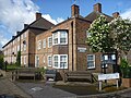
-
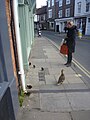 York Townscape , Duck And Ducklings, Walmgate, York - geograph.org.uk - 5376569.jpg 1,200 × 1,600; 373 KB
-
 York Townscape , Franklin's Yard, Fossgate - geograph.org.uk - 5376561.jpg 1,600 × 1,200; 335 KB
-
 York Townscape , Il Paradiso Del Cibo, 40 Walmgate, York - geograph.org.uk - 5368237.jpg 1,600 × 1,200; 458 KB
-
 York Townscape , Inside Micklegate Bar - geograph.org.uk - 5372170.jpg 1,600 × 1,200; 365 KB
-
 York Townscape , Inside Walmgate Bar, York - geograph.org.uk - 5372117.jpg 1,600 × 1,200; 371 KB
-

-
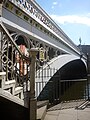 York Townscape , Lendal Bridge - geograph.org.uk - 5372435.jpg 1,200 × 1,600; 419 KB
-
 York Townscape , Micklegate - geograph.org.uk - 5372154.jpg 1,600 × 1,200; 485 KB
-
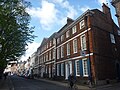 York Townscape , Micklegate, York - geograph.org.uk - 5372164.jpg 1,600 × 1,200; 490 KB
-
 York Townscape , River Ouse and Lendal Bridge - geograph.org.uk - 5372441.jpg 1,600 × 1,200; 407 KB
-
 York Townscape , Ukulele Street - geograph.org.uk - 5376528.jpg 1,200 × 1,600; 402 KB
-
 York Townscape , Water End Bridge, Clifton, York - geograph.org.uk - 5372651.jpg 1,600 × 1,200; 581 KB
-
 York Townscape , Water End Bridge, River Ouse - geograph.org.uk - 5372658.jpg 1,600 × 1,200; 390 KB
-

-

-
 York Townscape - 1953, A Great Year (geograph 5376550).jpg 1,200 × 1,600; 427 KB
-
 York Zero Post (detail), York station (geograph 5398358).jpg 768 × 1,024; 185 KB
-
 York Zero Post, York station (geograph 5398356).jpg 768 × 1,024; 162 KB
-
 Yorkshire Museum York - geograph.org.uk - 5353278.jpg 640 × 480; 51 KB
-
 Yorkshire Museum, York - geograph.org.uk - 5435327.jpg 1,024 × 768; 134 KB


.jpg)


_-_geograph.org.uk_-_5435321.jpg)
_-_geograph.org.uk_-_5435323.jpg)
_-_geograph.org.uk_-_5435331.jpg)


.jpg)


_-_geograph.org.uk_-_5372723.jpg)


_-_geograph.org.uk_-_5372312.jpg)

.jpg)
,_York_station_(geograph_5398358).jpg)
.jpg)

