Category:Apure (state)
Jump to navigation
Jump to search
Federal territory: Capital District · Federal Dependencies · Territorial claim: Guayana Esequiba

state of Venezuela      | |||||
| Upload media | |||||
| Instance of | |||||
|---|---|---|---|---|---|
| Named after | |||||
| Location | Venezuela | ||||
| Capital | |||||
| Legislative body |
| ||||
| Anthem |
| ||||
| Has part(s) |
| ||||
| Inception |
| ||||
| Population |
| ||||
| Area |
| ||||
| Elevation above sea level |
| ||||
| Different from | |||||
| official website | |||||
 | |||||
Apure is one of the 23 states of Venezuela, located in the south-western region.
Subcategories
This category has the following 10 subcategories, out of 10 total.
Media in category "Apure (state)"
The following 19 files are in this category, out of 19 total.
-
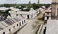 Avenida Miranda de Guasdualito en 1949.jpg 480 × 281; 38 KB
-
 Cementerio hinundado por el rio arauca en el estado apure.JPG 4,288 × 3,216; 2.22 MB
-
 Decreto municipal.jpg 770 × 1,080; 87 KB
-
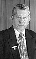
 Eduardopiñate (cropped).jpg 191 × 239; 11 KB
-
 Escudo Distrito Alto Apure (Venezuela).jpg 1,080 × 1,471; 452 KB
-
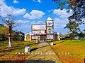
 Escuela basica Manuel Jose Hidalgo.jpg 1,662 × 1,808; 521 KB
-
 FEDERICO PUERTA.jpg 1,728 × 1,152; 1.19 MB
-
 Fotografia blanco y negro de Manuel Jose Hidalgo G.jpg 689 × 1,116; 236 KB
-
 Hospital José Antonio Páez, Guasdualito, estado Apure.jpg 1,080 × 714; 118 KB
-
 Iglesia Católica El Nula.jpg 1,056 × 1,052; 386 KB
-
 Iglesia San José De El Amparo.jpg 1,080 × 808; 229 KB
-
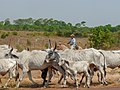 LLanero en Apure, Venezuela.jpg 2,560 × 1,920; 2.16 MB
-
 LLaneros en Apure, Venezuela.jpg 3,648 × 2,432; 4.13 MB
-
 Monumento Batalla de Guasdualito.jpg 1,080 × 810; 141 KB
-
 Paisaje del Llano Apureño.JPG 4,000 × 3,000; 3.72 MB
-
 Paisaje en Arichuna.JPG 4,320 × 3,240; 3.1 MB
-
 Plaza Bolívar de Guasdualito.jpg 1,599 × 1,331; 203 KB
-
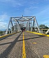 Puente Internacional José Antonio Páez.jpg 1,068 × 1,256; 557 KB
-
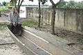
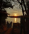 Río Sarare, sector Santos Luzardo, Guasdualito.jpg 3,000 × 3,549; 2.39 MB


.jpg)
.jpg)


