Category:Arabic-language SVG maps
Jump to navigation
Jump to search
Subcategories
This category has the following 4 subcategories, out of 4 total.
Media in category "Arabic-language SVG maps"
The following 88 files are in this category, out of 88 total.
-
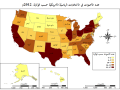
 2012 US presidential election Electoral College map-ar.svg 1,020 × 593; 40 KB
-
 Accreting coast Image6-ar.svg 1,481 × 697; 15 KB
-
 African language families ar.svg 600 × 650; 59 KB
-
 Aires linguistiques du nord-est algérien AR.svg 1,461 × 881; 114 KB
-
 Al Anbar-ar.svg 656 × 552; 121 KB
-
 Al-Jazira-ar.svg 1,586 × 1,211; 10.81 MB
-
 Al-qaim-area ar.svg 429 × 328; 450 KB
-
 Almohad dynasty of Morocco-ar.svg 555 × 361; 942 KB
-
 Almoravid dynasty of Morocco-ar.svg 362 × 457; 957 KB
-
 Arabic Varieties Map-2023.svg 2,051 × 1,151; 2.08 MB
-
 Baku pipelines-ar.svg 1,316 × 762; 139 KB
-
 Canal des Pharaons-ar.svg 684 × 738; 33 KB
-
 Carib Territory-ar.svg 1,500 × 1,189; 182 KB
-
 Carte Qibya-ar1.svg 330 × 715; 194 KB
-
 Carthage archaeological sites map-ar.svg 1,030 × 880; 427 KB
-
 Choropath Map 2012a-ar.svg 677 × 503; 138 KB
-

-
 Conquistaislamicapeninsula2-ar.svg 1,276 × 1,011; 242 KB
-
 Countries by Oil Production in 2013-ar.svg 863 × 396; 1.33 MB
-
 Course Channeltunnel ar.svg 472 × 387; 44 KB
-
 Dhofari Arabic.svg 600 × 735; 82 KB
-
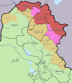 Disputed areas in Iraq-ar.svg 650 × 750; 432 KB
-
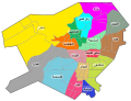 Districts of damascus arabic vector.svg 500 × 383; 378 KB
-
 DZ-16-01 ar.svg 1,031 × 499; 114 KB
-
 Earth cutaway schematic-ar.svg 1,149 × 901; 165 KB
-
 Europe-blocs-49-89x4-ar.svg 891 × 509; 436 KB
-
 European Ancestry Large-ar.svg 512 × 328; 207 KB
-
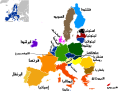 European Union map with arabic names.svg 680 × 520; 602 KB
-
 Former Saudi-Kuwaiti Neutral Zone ar.svg 635 × 695; 176 KB
-
 Gaza Strip map2-ar1.svg 725 × 888; 622 KB
-
 Georgia, Ossetia, Russia and Abkhazia (ar).png 1,280 × 757; 147 KB
-
 Golf-Kooperationsrat-ar.svg 682 × 664; 80 KB
-
 Grossgliederung Europas-ar.svg 683 × 709; 837 KB
-
 Human Y-chromosome DNA haplogroups (percentages)-ar.svg 1,144 × 709; 232 KB
-
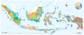 Indonesia Ethnic Groups Map-ar.svg 1,191 × 501; 7.38 MB
-
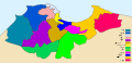
 Iran regions map Ar.svg 1,371 × 1,250; 831 KB
-
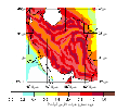 IranEarthquakeHazard-ar.svg 538 × 464; 34 KB
-
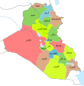 Iraqi Governorates ar.svg 1,241 × 1,264; 314 KB
-

-
 Israel map of Köppen climate classification-ar.svg 1,900 × 1,900; 15 KB
-
 Kantone der Schweiz-ar.svg 1,000 × 700; 2.72 MB
-
 Kirkuk–Baniyas pipeline-ar.svg 3,033 × 1,637; 566 KB
-
 Languages of Africa map-ar.svg 1,534 × 1,461; 751 KB
-
 Libya-kart3-ar.svg 1,190 × 1,271; 157 KB
-
 Magellan Elcano Circumnavigation-ar.svg 2,246 × 1,139; 222 KB
-
 Manufiya.svg 1,070 × 825; 63 KB
-
 Map of fertile crescent-ar.svg 1,987 × 2,441; 781 KB
-
 Map of ibn Abi Mahalli State - Arabic.svg 746 × 580; 306 KB
-
 Map of Morocco and Western Sahara-ar.svg 625 × 705; 157 KB
-
 Map of region of Basilicata, Italy, with provinces-ar.svg 1,952 × 2,278; 84 KB
-
 Map of USA with state names ar.svg 959 × 593; 344 KB
-
 Marinid dynasty of Morocco-ar.svg 701 × 363; 175 KB
-
 Median Empire-ar.svg 1,500 × 950; 2.01 MB
-
 Metro Alger - Plan Ligne - Juillet 2017.svg 1,535 × 1,024; 50 KB
-
 Muslim Percent Population-ar.svg 512 × 281; 780 KB
-
 N-Mesopotamia and Syria-ar.svg 2,185 × 1,254; 11 MB
-
 Nineveh Plains ar.svg 1,200 × 984; 223 KB
-
 North Macedonia, administrative divisions - ar - monochrome.svg 1,400 × 1,130; 252 KB
-
 Number of snake envenomings (2007)-ar.svg 940 × 477; 1.7 MB
-
 October 2023 Gaza−Israel conflict.svg 3,763 × 3,258; 8.39 MB
-
 Operation Olive Branch-ar.svg 3,317 × 2,302; 5.71 MB
-
 Oqba Ibn Naafi en Afrique du nord ARABE.svg 1,160 × 658; 94 KB
-
 Provinces and territories of Pakistan named ar.svg 1,126 × 1,052; 125 KB
-
 Regiones petroleras - Medio Oriente-ar.svg 616 × 631; 181 KB
-
 Saadi dynasty of Morocco-ar.svg 402 × 388; 904 KB
-
 Sawad of Iraq-ar.svg 1,996 × 1,751; 403 KB
-
 Sedes Copa Asia 2007-ar.svg 744 × 413; 270 KB
-
 Serbian Despotate (1422)-ar.svg 943 × 844; 398 KB
-
 South lebanon OSM.svg 560 × 688; 10.3 MB
-
 SpanishSparrowMap-ar.svg 5,365 × 2,796; 408 KB
-
 Spice Islands (Zanzibar highlighted)-ar.svg 713 × 879; 29 KB
-
 States of Germany-ar.svg 591 × 801; 225 KB
-
 Subduction-ar.svg 1,482 × 854; 3.07 MB
-
 Suicide rates map-ar.svg 940 × 477; 2.31 MB
-
 Switzerland map of Köppen climate classification-ar.svg 600 × 453; 57 KB
-
 Syriac Dialects AR.svg 1,190 × 810; 73 KB
-
 Syriac.svg 714 × 470; 220 KB
-
 Syrian refugees in the Middle East map-ar.svg 839 × 552; 101 KB
-
 The districts of Kerala-ar.svg 830 × 880; 2.62 MB
-
 Djerba topographic map-ar.svg 1,100 × 990; 570 KB
-
 Tunis Gulf topo map-ar.svg 1,990 × 1,800; 2.62 MB
-
 Western sahara walls moroccan map-ar.svg 1,676 × 1,302; 187 KB
-
 World, administrative divisions - ar - colored (all countries).svg 3,057 × 1,869; 2.77 MB
-
 Writing directions of the world ru.svg 1,684 × 1,055; 436 KB
-
 Writing directions of the world.svg 1,684 × 1,055; 307 KB
-
 الغزو الروسي لأوكرانيا 2022.png 6,702 × 4,505; 5.51 MB
-
 اللغات المنطوقة في الشمال الشرقي الجزائري.svg 1,461 × 881; 114 KB
-
 انتشار المسيحية السريانية.svg 1,273 × 685; 487 KB


.png)


-ar.svg)


-ar.svg)


-ar.svg)


-ar.svg)


.svg)


