Category:Archaeological sites in the Shetland Islands
Zur Navigation springen
Zur Suche springen
Council areas (municipalities) of Scotland: Aberdeen · Aberdeenshire · Angus · Argyll and Bute · Dumfries and Galloway · East Dunbartonshire · East Lothian · East Renfrewshire · Falkirk · Fife · Highland · Moray · North Ayrshire · Outer Hebrides · Orkney Islands · Perth and Kinross · Renfrewshire · Scottish Borders · Shetland Islands · South Ayrshire · South Lanarkshire · Stirling · West Dunbartonshire · West Lothian
Wikimedia-Kategorie | |||||
| Medium hochladen | |||||
| Ist ein(e) | |||||
|---|---|---|---|---|---|
| Kategorie kombiniert die Themen | |||||
| Shetlandinseln | |||||
nördlichste Inselgruppe des Vereinigten Königreich, seit 1469 schottisch    | |||||
| Ist ein(e) |
| ||||
| Ist Teil von | |||||
| Ort | Schottland | ||||
| Liegt am oder im Gewässer | |||||
| Hauptstadt | |||||
| Gesetzgebende Körperschaft |
| ||||
| Amtssprache | |||||
| Besteht aus | |||||
| Höchster Punkt | |||||
| Einwohnerzahl |
| ||||
| Fläche |
| ||||
| Verschieden von | |||||
| offizielle Website | |||||
 | |||||
Unterkategorien
Es werden 9 von insgesamt 9 Unterkategorien in dieser Kategorie angezeigt:
In Klammern die Anzahl der enthaltenen Kategorien (K), Seiten (S), Dateien (D)
B
H
- Haltadans (1 D)
N
- Ness of Burgi promontory fort (14 D)
O
- Old Scatness (24 D)
S
- Scord of Brouster (10 D)
- Stanydale Temple (25 D)
Medien in der Kategorie „Archaeological sites in the Shetland Islands“
Folgende 24 Dateien sind in dieser Kategorie, von 24 insgesamt.
-
 Ancient Walls - geograph.org.uk - 4652025.jpg 4.000 × 2.664; 4,23 MB
-
 Ancient Walls 2 - geograph.org.uk - 4652045.jpg 3.928 × 2.576; 3,61 MB
-
 Archaeological dig at Belmont - geograph.org.uk - 1379015.jpg 640 × 426; 98 KB
-
 Beach at Sandwick, Unst - geograph.org.uk - 148750.jpg 640 × 434; 81 KB
-
 Bressay Crosses St Mary's Church.jpg 480 × 640; 89 KB
-
 Bressay Underground Chamber.jpg 640 × 480; 175 KB
-
 Brig o'Waas and Scord of Brouster - geograph.org.uk - 51324.jpg 640 × 418; 95 KB
-
 Burga Water Dun - geograph.org.uk - 434541.jpg 640 × 480; 115 KB
-
 Burga Water Island Dun - geograph.org.uk - 437144.jpg 640 × 480; 105 KB
-
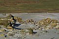
 Cairn - geograph.org.uk - 551130.jpg 640 × 480; 74 KB
-
 Catpund - geograph.org.uk - 4778.jpg 640 × 403; 222 KB
-
 Lunnasting stone.jpg 224 × 545; 42 KB
-
 Megawal58.jpg 935 × 425; 43 KB
-
 Neolithic axe factory - geograph.org.uk - 17925.jpg 640 × 480; 190 KB
-
 Neolithic axe factory - geograph.org.uk - 640385.jpg 640 × 480; 96 KB
-
 Neolithic house - geograph.org.uk - 551097.jpg 640 × 480; 79 KB
-
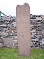 Papilstone.jpg 479 × 640; 52 KB
-
 Point of Mulla - geograph.org.uk - 652283.jpg 640 × 428; 26 KB
-
 Prehistoric House - geograph.org.uk - 633230.jpg 640 × 477; 112 KB
-
 Remains of a Viking longhouse - geograph.org.uk - 590290.jpg 640 × 426; 69 KB
-
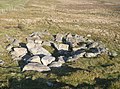
 Ronashillcairn.jpg 640 × 480; 110 KB
-
 Site of a Settlement, Ness of Houlland - geograph.org.uk - 4652018.jpg 3.912 × 2.536; 3,23 MB
-
 Wester Houran and Grass Water - geograph.org.uk - 438967.jpg 640 × 480; 71 KB
-
 Winyadepla east shore. - geograph.org.uk - 627931.jpg 439 × 640; 78 KB


