Category:Maps of traditional counties of Scotland
Jump to navigation
Jump to search
former statistical unit in Great Britain and Ireland | |||||
| Upload media | |||||
| Subclass of | |||||
|---|---|---|---|---|---|
| Location |
| ||||
| Has use | |||||
| |||||
| Counties of Scotland until 1890 | ||
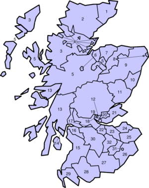
It may be noted that the map depicts a large number of exclaves physically detached from the county that they were politically deemed to be part of. Cromartyshire's borders, a particularly fragmentary example, were achieved as late as 1685, although at that time the word "county" was not applied to the sheriffdom.
Counties from 1890 to 1975[edit]
 |
|
Traditional counties (shires) of Scotland: Aberdeenshire · Angus · Argyll ≈ Argyllshire · Ayrshire · Banffshire · Berwickshire · Buteshire · Caithness · Clackmannanshire · Cromartyshire · Dumbartonshire · Dumfriesshire · East Lothian · Fife · Inverness-shire · Kincardineshire · Kinross-shire · Kirkcudbrightshire · Lanarkshire · Midlothian · Moray · Nairnshire · the Orkney Islands ≈ Orkney Islands · Peeblesshire · Perthshire · Renfrewshire · Ross-shire · Roxburghshire · Selkirkshire · the Shetland Islands ≈ Shetland Islands · Stirlingshire · Sutherland · West Lothian · Wigtownshire
Subcategories
This category has the following 40 subcategories, out of 40 total.
Media in category "Maps of traditional counties of Scotland"
The following 16 files are in this category, out of 16 total.
-
1801 Cary Map of Scotland (4 Sheets) - Geographicus - Scotland-cary-1801.jpg 7,000 × 6,322; 13.91 MB
-
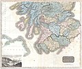
1815 Thomson Map of Southern Scotland - Geographicus - ScotlandSouth-t-15.jpg 5,000 × 4,224; 3.74 MB
-
1818 Pinkerton Map of Southern Scotland - Geographicus - ScotlandSouth-pinkerton-1818.jpg 5,000 × 3,711; 5.78 MB
-
1818 Pinkerton Map of Northern Scotland - Geographicus - ScotlandNorth-pinkerton-1818.jpg 5,000 × 3,724; 4.71 MB
-
1827 Finley Map of Scotland - Geographicus - Scotland-finley-1827.jpg 2,327 × 3,000; 2.1 MB
-
1855 Colton Map of Scotland - Geographicus - Scotland-colton-1855.jpg 2,904 × 3,500; 3.53 MB
-
Badenoch.png 191 × 261; 3 KB
-
Breadalbane.png 191 × 261; 3 KB
-
CountiesOfGreatBritain.PNG 797 × 1,264; 239 KB
-
Kintail.png 191 × 261; 3 KB
-
Scotland Administrative Map 1947.png 2,001 × 3,480; 2.32 MB
-
ScotlandCountiesBlank.png 1,616 × 1,848; 61 KB
-
ScotlandTradNumbered.png 400 × 504; 104 KB
-
Shires of Scotland by population (2011).png 940 × 1,226; 353 KB
-
Shires of Scotland by population density (2011).png 940 × 1,342; 407 KB
-
Topographical Map of Traditional Galloway.png 1,479 × 1,114; 909 KB


