Category:Argenbühl
Jump to navigation
Jump to search
municipality in Baden-Württemberg, Germany    | |||||
| Upload media | |||||
| Instance of |
| ||||
|---|---|---|---|---|---|
| Location | Landkreis Ravensburg, Tübingen Government Region, Baden-Württemberg, Germany | ||||
| Capital | |||||
| Population |
| ||||
| Area |
| ||||
| Elevation above sea level |
| ||||
| official website | |||||
 | |||||
Subcategories
This category has the following 23 subcategories, out of 23 total.
- Eglofstal (14 F)
B
C
E
H
- History of Argenbühl (15 F)
L
N
- Naturschutzgebiet Badsee (3 F)
- Naturschutzgebiet Bodenmöser (1 F)
O
- Oberer Schlossweiher (3 F)
P
S
Media in category "Argenbühl"
The following 18 files are in this category, out of 18 total.
-
 Argenbogen - panoramio.jpg 3,872 × 2,592; 1.24 MB
-
 Argenbuehl Wappen.png 236 × 252; 32 KB
-
 Argenbuehl Wappen.svg 256 × 287; 14 KB
-
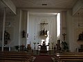 Argenbühl Altarraum - panoramio.jpg 2,816 × 2,120; 1.41 MB
-
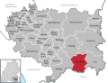 Argenbühl in RV.svg 718 × 550; 923 KB
-
 Argenbühl Kirchstraße - panoramio.jpg 2,816 × 2,120; 1.47 MB
-
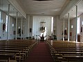 Argenbühl Moderner Innenraum - panoramio.jpg 2,816 × 2,120; 1.47 MB
-
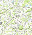 BudS - Argenbühl Topo.jpg 8,960 × 9,770; 36.87 MB
-
 Das Rasenkreuz durch Gitter geschützt - panoramio.jpg 2,816 × 2,120; 1.47 MB
-
 Flagge Argenbühl.svg 600 × 1,500; 15 KB
-
 Grotte an der Kirche - panoramio.jpg 1,320 × 1,752; 416 KB
-
 Interessante Kasettendecke in der Kirche - panoramio.jpg 1,432 × 1,691; 340 KB
-
 Landkreis Ravensburg Karte mit Ortsnamen.png 949 × 744; 165 KB
-
 Oberschwäbische Barockstraße - panoramio.jpg 2,816 × 2,120; 1.4 MB
-
 Rasenkreuz von Meggen - panoramio.jpg 2,816 × 2,120; 1.39 MB
-
 Schotterterrassen an der Unteren Argen bei Bliderazhofen.jpg 2,749 × 1,714; 2.16 MB
-
 Syrgenstein - panoramio (2).jpg 2,816 × 2,120; 1.17 MB
-
 Unterer Schloßweiher GO-1.jpg 2,592 × 1,944; 1.96 MB


.jpg)
