Category:Ashpole Presbyterian Church (Rowland, North Carolina)
Jump to navigation
Jump to search
| Object location | | View all coordinates using: OpenStreetMap |
|---|
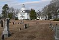
church building in North Carolina, United States of America _from_SE_2.JPG) | |||||
| Upload media | |||||
| Instance of | |||||
|---|---|---|---|---|---|
| Location | North Carolina | ||||
| Architectural style | |||||
| Heritage designation |
| ||||
| Inception |
| ||||
 | |||||
Media in category "Ashpole Presbyterian Church (Rowland, North Carolina)"
The following 7 files are in this category, out of 7 total.
-
 Ashpole Presbyterian (Rowland NC) from cemetery 1.JPG 2,369 × 1,673; 1 MB
-
 Ashpole Presbyterian (Rowland NC) from cemetery 2.JPG 2,559 × 1,725; 1.19 MB
-
 Ashpole Presbyterian (Rowland NC) from E 1.JPG 2,154 × 1,469; 926 KB
-
 Ashpole Presbyterian (Rowland NC) from S 1.JPG 1,649 × 1,860; 614 KB
-
 Ashpole Presbyterian (Rowland NC) from SE 1.JPG 2,272 × 1,490; 854 KB
-
 Ashpole Presbyterian (Rowland NC) from SE 2.JPG 1,538 × 1,528; 545 KB
-
 Ashpole Presbyterian (Rowland NC) from SW 1.JPG 1,756 × 1,615; 589 KB
_from_cemetery_1.JPG)
_from_cemetery_2.JPG)
_from_E_1.JPG)
_from_S_1.JPG)
_from_SE_1.JPG)
_from_SW_1.JPG)
Categories:
- Rowland, North Carolina
- National Register of Historic Places in Robeson County, North Carolina
- Churches in North Carolina built in 1865
- Presbyterian Church (USA) churches in North Carolina
- Buildings of religious function on the National Register of Historic Places in North Carolina
- Churches in Robeson County, North Carolina
- Churches of the Presbytery of Coastal Carolina