Category:Ashtead
Jump to navigation
Jump to search
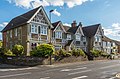
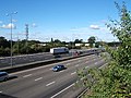
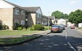
English: Ashtead is a large village situated within the Green Belt of Surrey, England, and is part of the suburbia of London. It is separated from Leatherhead by the M25, and from Epsom by Ashtead Common.
Nederlands: Ashtead is een plaats in het bestuurlijke gebied Mole Valley, in het Engelse graafschap Surrey. De plaats telt 13.494 [1] inwoners.
village in Mole Valley, Surrey, United Kingdom  | |||||
| Upload media | |||||
| Instance of | |||||
|---|---|---|---|---|---|
| Location | Mole Valley, Surrey, South East England, England | ||||
| Area |
| ||||
 | |||||
Subcategories
This category has the following 9 subcategories, out of 9 total.
A
- Ashtead Baptist Church (5 F)
- Ashtead Common (35 F)
- Ashtead railway station (39 F)
- Ashtead War Memorial (3 F)
- St George's Church, Ashtead (10 F)
P
S
- St Michael's Church, Ashtead (10 F)
Media in category "Ashtead"
The following 49 files are in this category, out of 49 total.
-
 A24 at the junction with The Warren - geograph.org.uk - 60222.jpg 640 × 480; 120 KB
-
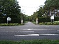 A243 Entrance to Leatherhead Golf Club - geograph.org.uk - 55105.jpg 640 × 480; 126 KB
-
 Agates Lane, Ashtead - geograph.org.uk - 430373.jpg 640 × 417; 70 KB
-
 Around Ashtead Woods Road - geograph.org.uk - 427917.jpg 640 × 480; 67 KB
-
 Ashtead - geograph.org.uk - 25454.jpg 640 × 430; 69 KB
-
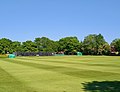 Ashtead Cricket Club ground (June 2021).jpg 2,511 × 1,931; 1.26 MB
-
 Ashtead Library - geograph.org.uk - 430360.jpg 640 × 431; 74 KB
-
 Ashtead Peace Memorial Hall - geograph.org.uk - 430358.jpg 640 × 434; 61 KB
-
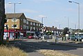
 Ashtead town centre - geograph.org.uk - 1274037.jpg 640 × 480; 65 KB
-
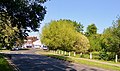
 Ashtead Woods Road - geograph.org.uk - 427893.jpg 640 × 414; 62 KB
-
 Barnett Wood Lane pond (June 2021).jpg 2,411 × 1,419; 1.38 MB
-
 Barnett Wood Lane, Ashtead - geograph.org.uk - 323369.jpg 640 × 480; 110 KB
-
 Barnett Wood Lane, Ashtead - geograph.org.uk - 323378.jpg 640 × 480; 103 KB
-
 Chalk Lane, Ashtead - geograph.org.uk - 430369.jpg 640 × 445; 99 KB
-
 Cottages, Woodfield Lane, Ashtead - geograph.org.uk - 430365.jpg 640 × 463; 55 KB
-
 Craddocks Lane, Ashtead - geograph.org.uk - 323382.jpg 640 × 480; 111 KB
-
 Feilding House almshouses, Ashtead - geograph.org.uk - 5979435.jpg 1,024 × 678; 730 KB
-
 Footpath leading to Grange Road - geograph.org.uk - 60211.jpg 480 × 640; 136 KB
-
 Former Free (Baptist) Church (a.k.a. Mission Hall), Barnett Wood Lane, Ashtead.JPG 1,800 × 1,400; 419 KB
-
 Green Lane, Ashtead - geograph.org.uk - 323365.jpg 640 × 480; 113 KB
-
 Howard Memorial Fountain, The Street, Ashtead (NHLE Code 1188512) (August 2013).JPG 1,400 × 2,000; 820 KB
-

-
 Links Road, Ashtead - geograph.org.uk - 323431.jpg 640 × 480; 120 KB
-
 M25 from footpath bridge - geograph.org.uk - 60216.jpg 640 × 480; 109 KB
-
 Murreys Court, Agates Lane, Ashtead - geograph.org.uk - 430374.jpg 640 × 405; 53 KB
-
 Ottways Lane, Ashtead - geograph.org.uk - 430372.jpg 585 × 462; 49 KB
-
 Overdale (2) - geograph.org.uk - 936845.jpg 640 × 426; 57 KB
-
 Overdale - Broadhurst - geograph.org.uk - 936838.jpg 640 × 480; 80 KB
-
 Overdale, Ashtead - geograph.org.uk - 430334.jpg 640 × 414; 56 KB
-
 Pasture, Rushett Farm - geograph.org.uk - 33869.jpg 640 × 504; 68 KB
-
 Railway to Leatherhead - geograph.org.uk - 25452.jpg 640 × 480; 167 KB
-
 Rectory Lane, Ashtead - geograph.org.uk - 430370.jpg 640 × 480; 78 KB
-
 Signs, Rectory Lane, Ashtead - geograph.org.uk - 430371.jpg 422 × 563; 81 KB
-
 SPAN development, Westfield, Ashtead - geograph.org.uk - 430359.jpg 640 × 448; 85 KB
-
 St Giles School, Ashtead (June 2021).jpg 3,126 × 2,044; 1.59 MB
-
 Thames Downs Link, Ashtead.jpg 3,000 × 1,995; 3.34 MB
-
 The Street, Ashtead (view NE) - geograph.org.uk - 430355.jpg 640 × 474; 61 KB
-
 The Street, Ashtead (view SW) - geograph.org.uk - 430356.jpg 640 × 410; 55 KB
-
 Tyrell House - geograph.org.uk - 25451.jpg 640 × 410; 54 KB
-
 Weald & Downland Museum (6982713727).jpg 2,388 × 2,592; 5.69 MB
-
 Wheat field, Rushett Farm - geograph.org.uk - 33886.jpg 640 × 471; 100 KB
-
 Bridleway at 30 Acre Barn - geograph.org.uk - 64079.jpg 640 × 480; 141 KB
-
 Bridleway at A24 - geograph.org.uk - 60231.jpg 640 × 480; 164 KB
-
 Brookers Close - geograph.org.uk - 25453.jpg 640 × 399; 74 KB
-
 Country Road Junction - geograph.org.uk - 27092.jpg 640 × 480; 117 KB
-
 Highlands Farm - geograph.org.uk - 60235.jpg 640 × 480; 92 KB
-
 Milner House - geograph.org.uk - 61523.jpg 640 × 480; 141 KB
-
 Newton Wood Road - geograph.org.uk - 25455.jpg 640 × 431; 63 KB
-


.jpg)


.jpg)


_Church_(a.k.a._Mission_Hall),_Barnett_Wood_Lane,_Ashtead.JPG)

_(August_2013).JPG)


_-_geograph.org.uk_-_936845.jpg)


.jpg)

_-_geograph.org.uk_-_430355.jpg)
_-_geograph.org.uk_-_430356.jpg)

.jpg)


,_A243_(ahead)_and_B2122_(left)._-_geograph.org.uk_-_60226.jpg)