Category:Ashwellthorpe
Jump to navigation
Jump to search
village in Norfolk, UK  | |||||
| Upload media | |||||
| Instance of |
| ||||
|---|---|---|---|---|---|
| Location | Ashwellthorpe and Fundenhall, South Norfolk, Norfolk, East of England, England | ||||
 | |||||
Subcategories
This category has the following 5 subcategories, out of 5 total.
A
- Ashwellthorpe railway station (13 F)
- Ashwellthorpe War Memorial (3 F)
L
- Lower Wood, Ashwellthorpe (16 F)
V
- Ashwellthorpe village sign (5 F)
Media in category "Ashwellthorpe"
The following 55 files are in this category, out of 55 total.
-
 Across the fields to Wreningham - geograph.org.uk - 1614151.jpg 640 × 464; 126 KB
-
 An idyllic spot - geograph.org.uk - 1614181.jpg 640 × 523; 187 KB
-

-
 Ashwellthorpe - geograph.org.uk - 345443.jpg 640 × 480; 90 KB
-
 Ashwellthorpe Village Hall - geograph.org.uk - 1614021.jpg 640 × 455; 112 KB
-
 Barn conversion in The Street - geograph.org.uk - 1614062.jpg 640 × 458; 167 KB
-

-
 Cottage in The Street - geograph.org.uk - 1614042.jpg 640 × 446; 88 KB
-
 Cottages in The Street - geograph.org.uk - 1614027.jpg 640 × 456; 90 KB
-
 Cottages in The Street - geograph.org.uk - 1614065.jpg 640 × 459; 113 KB
-
 Cottages in The Street - geograph.org.uk - 1614074.jpg 640 × 464; 116 KB
-
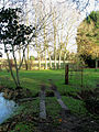
 Dark pond on the green - geograph.org.uk - 1614198.jpg 480 × 640; 140 KB
-
 Ditch north of All Saints church - geograph.org.uk - 1614163.jpg 480 × 640; 215 KB
-

-
-
 Hall Farm (farmhouse) - geograph.org.uk - 1614192.jpg 640 × 480; 179 KB
-
-

-
-
 Manor Farm, Fundenhall Street - geograph.org.uk - 345493.jpg 640 × 480; 102 KB
-
 Modern houses in The Street - geograph.org.uk - 1614047.jpg 640 × 457; 103 KB
-
 New Road Junction, Ashwellthorpe - geograph.org.uk - 345439.jpg 640 × 480; 100 KB
-
 New Road Junction, Ashwellthorpe - geograph.org.uk - 345447.jpg 640 × 480; 93 KB
-
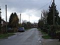 New Road, Ashwellthorpe - geograph.org.uk - 345451.jpg 640 × 480; 70 KB
-
 Oak tree in hedgerow - geograph.org.uk - 1614897.jpg 480 × 640; 165 KB
-
 Old oak in Rosemary's Meadow - geograph.org.uk - 1614959.jpg 640 × 480; 174 KB
-
 On the southern edge of Lower Wood - geograph.org.uk - 1614905.jpg 480 × 640; 152 KB
-
 OS bench mark - geograph.org.uk - 1614115.jpg 433 × 640; 153 KB
-
 Path in Lower Wood - geograph.org.uk - 473321.jpg 640 × 480; 163 KB
-
 Plank bridge over ditch - geograph.org.uk - 1614898.jpg 480 × 640; 213 KB
-
 Planks over ditch - geograph.org.uk - 1614159.jpg 640 × 480; 170 KB
-

-
 Public footpath to Lower Wood - geograph.org.uk - 1614894.jpg 640 × 480; 116 KB
-
 Public footpath to Wreningham - geograph.org.uk - 1614146.jpg 480 × 640; 171 KB
-
 Rosemary's Meadow - geograph.org.uk - 1614954.jpg 480 × 640; 218 KB
-
 Seat by ancient oak in Rosemary's Meadow - geograph.org.uk - 1614961.jpg 640 × 480; 185 KB
-

-
 Telephone box in The Street - geograph.org.uk - 1614038.jpg 640 × 456; 114 KB
-
 The green north of All Saints Church - geograph.org.uk - 1614187.jpg 640 × 480; 172 KB
-
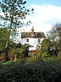 The Parsonage - geograph.org.uk - 1614058.jpg 480 × 640; 147 KB
-
 The Street in Ashwellthorpe - geograph.org.uk - 6416866.jpg 4,000 × 3,000; 3.73 MB
-
 The Street through Ashwellthorpe - geograph.org.uk - 1614078.jpg 640 × 442; 116 KB
-
 The Street, Ashwellthorpe - geograph.org.uk - 4608438.jpg 640 × 480; 80 KB
-
 The Street, Ashwellthorpe - geograph.org.uk - 4618730.jpg 640 × 480; 71 KB
-
 The White Horse, Ashwellthorpe - geograph.org.uk - 351814.jpg 640 × 480; 68 KB
-
 The White Horse, Ashwellthorpe - geograph.org.uk - 4590515.jpg 640 × 428; 76 KB
-
 This way to Rosemary's Meadow - geograph.org.uk - 1614953.jpg 640 × 480; 191 KB
-
 Thorpe (of Ashwell Thorpe, Norfolk) arms.svg 578 × 666; 13 KB
-

-

-

-

-
 View towards Ashwellthorpe village - geograph.org.uk - 1614903.jpg 640 × 430; 86 KB
-
 View west along The Street - geograph.org.uk - 1614070.jpg 640 × 450; 97 KB
-
 Wood Farm House, Ashwellthorpe - geograph.org.uk - 4407305.jpg 2,592 × 1,944; 1.25 MB


_-_geograph.org.uk_-_1614192.jpg)
_viewed_across_the_pond_on_the_green_-_geograph.org.uk_-_1614195.jpg)


_arms.svg)


