Category:Assab
Jump to navigation
Jump to search
city in Eritrea   | |||||
| Upload media | |||||
| Instance of | |||||
|---|---|---|---|---|---|
| Location | Southern Denkalya Subregion, Southern Red Sea Region, Eritrea | ||||
| Population |
| ||||
| Elevation above sea level |
| ||||
| Different from | |||||
 | |||||
Media in category "Assab"
The following 25 files are in this category, out of 25 total.
-
 Carta originale della baia d'Assab (Torino, Guido Cora, 1877).png 1,203 × 714; 1.37 MB
-
 Piano dello stabilimento italiano di Assab.jpg 1,559 × 1,522; 1.07 MB
-
 1886bibliotecapopolare epietrocola n1.jpg 600 × 900; 211 KB
-
 1939 Assab Lancia Aprilia Giuseppe Guzzo.jpg 800 × 509; 69 KB
-
 Admiralty Chart No 8e Red Sea Sheet 5, 1873 (detail of Asab Bay).jpg 3,052 × 2,668; 1.22 MB
-
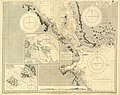 Admiralty Chart No 8e Red Sea Sheet 5, Published 1873.jpg 10,202 × 8,075; 12.31 MB
-
 Assab 1880.jpg 925 × 389; 158 KB
-
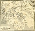
 Assab Bay (1885).jpg 1,977 × 1,965; 3.28 MB
-
 Assab map 1988.jpg 1,120 × 1,008; 273 KB
-
 Assab volcanic field.jpg 635 × 480; 71 KB
-
 Carta dell' Egitto, Sudan, Mar Rosso, Assab, Massaua, Abissinia ecc.tiff 6,274 × 5,420; 97.29 MB
-
-
 ER-Assab.png 462 × 409; 5 KB
-
 EthiopiaRAND1908.jpg 348 × 472; 60 KB
-
 European territorial claims on the coasts of the Red Sea 1885.jpg 8,016 × 3,633; 23.98 MB
-
 European territorial claims on the coasts of the Red Sea 1885.tif 8,016 × 3,633; 27.9 MB
-
 ISS013-E-7731 - View of Eritrea.jpg 1,520 × 1,008; 57 KB
-
 ISS016-E-10800 - View of Eritrea.jpg 3,032 × 2,008; 892 KB
-
 ISS022-E-11414 - View of Eritrea.jpg 4,288 × 2,848; 699 KB
-
 ISS022-E-11416 - View of Eritrea.jpg 4,288 × 2,848; 654 KB
-
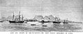
 Natives fishing in the vicinity of Assab (1885).jpg 944 × 481; 306 KB
-
 Plano de la bahia de Assab (1887).jpg 3,716 × 4,880; 11.55 MB
-
 Plano de la bahía de Assab (español).jpg 3,721 × 4,864; 10.66 MB
-
 Southern Dankalia, Eritrea - panoramio (1).jpg 2,592 × 1,944; 731 KB
-
 Southern Dankalia, Eritrea - panoramio (2).jpg 2,592 × 1,944; 620 KB
.png)


.jpg)


.jpg)


.jpg)
.jpg)
.jpg)
.jpg)
.jpg)