Category:Atchison, Kansas
Jump to navigation
Jump to search
city in and county seat of Atchison County, Kansas, United States  Коммершиал-стрит в центре Атчисона  | |||||
| Upload media | |||||
| Instance of | |||||
|---|---|---|---|---|---|
| Named after | |||||
| Location | Atchison County, Kansas | ||||
| Inception |
| ||||
| Population |
| ||||
| Area |
| ||||
| Elevation above sea level |
| ||||
| Different from | |||||
| official website | |||||
 | |||||
Subcategories
This category has the following 34 subcategories, out of 34 total.
A
- Amelia Earhart Bridge (1939) (6 F)
- Amelia Earhart Bridge (2012) (1 F)
- Atchison, Kansas post office (3 F)
B
E
H
J
M
S
Media in category "Atchison, Kansas"
The following 48 files are in this category, out of 48 total.
-

-
 Atchison 1880 - 00237493.jpg 3,600 × 2,585; 2.42 MB
-

-
 Atchison Kansas Commercial Street.jpg 2,722 × 1,170; 846 KB
-
 Atchison Kansas downtown.jpg 2,699 × 1,339; 976 KB
-
 Atchison Kansas mall.jpg 2,804 × 1,647; 1.51 MB
-
 Atchison Union Depot & Railroad - System Index Map.jpg 5,100 × 3,292; 5.03 MB
-
 Atchison WV Banner.jpg 2,637 × 376; 1.07 MB
-
 Atchison, Kansas (circa 1880-1900).jpg 971 × 756; 512 KB
-
 Atchison1860.jpg 678 × 398; 41 KB
-
 Birdseye view, Atchison, Kans LCCN2007662148.tif 3,425 × 702; 6.88 MB
-
 BNSF 5674 In Kansas.jpg 2,740 × 1,999; 3.27 MB
-
 Central School Atchison, KS.jpg 899 × 500; 79 KB
-

-

-

-

-

-
 Flag of Atchison, Kansas.svg 1,003 × 600; 36 KB
-

-
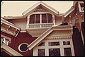
 Harwi Hardware Building.jpg 1,024 × 767; 194 KB
-
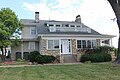 Howe House 2.jpg 240 × 160; 28 KB
-
 Inside of Citadel Caverns.jpg 1,224 × 1,632; 694 KB
-
 KSMap-doton-Atchison.png 300 × 156; 8 KB
-
 Main gate at Citadel Caverns.jpg 640 × 480; 150 KB
-
 Moriverbridge.jpg 792 × 594; 70 KB
-

-
-

-

-

-

-
-

-

-

-

-

-
-

-

-

-
 The street railway review (1891) (14574630929).jpg 1,516 × 898; 217 KB
-
 Tour of Dalbey Bottoms (8268344094).jpg 5,184 × 3,456; 1.69 MB
-
 US-73 & US-59 Wrong-Way Concurrency.jpg 211 × 609; 48 KB
-
 Valley Hope Administration Bldg looking toward South East - panoramio.jpg 2,272 × 1,704; 1.28 MB
-
 Valley Hope rear parking area on East side - panoramio.jpg 2,272 × 1,704; 919 KB
-


_Team_looks_at_a_washed_out_road_and_culvert_in_Atchison_County_caused_by_heavy_rains._FEMA_and_the_St_-_DPLA_-_8c062a17b30c57b8fa7f077741dca50a.jpg)


.jpg)


_(14574630929).jpg)
.jpg)


