Category:Atlas of Friedrich Getkant
Jump to navigation
Jump to search
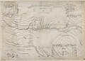
A collection of hand drawn maps by the prussian cartographer Friedrich (Fryderyk) Getkant.
Media in category "Atlas of Friedrich Getkant"
The following 14 files are in this category, out of 14 total.
-
 Entwerffung 0414.028.007 front.tif 10,058 × 7,274; 141.02 MB
-
 Kodak fortress.jpg 7,512 × 5,360; 1.41 MB
-
 Mariaeburgum 0414.028.005 Front.tif 10,100 × 7,329; 141.47 MB
-
 Munitio Insulae Passerinae 0414.028.009 front.tif 10,101 × 7,308; 132.69 MB
-
 Tabula Geographica Ukrainska.jpg 7,552 × 5,408; 1.73 MB
-
 Topographia Practica - 1. Munitio Dirschoviae Recognita Anno 1634.jpg 7,536 × 5,384; 1.77 MB
-
 Topographia Practica - 10. Pillaw Mensura.jpg 7,480 × 5,416; 1.26 MB
-
 Topographia Practica - 11. Delineatio Situs Pucensis Observata Anno 1634.jpg 7,496 × 5,424; 1.67 MB
-
 Topographia Practica - 13. Tabula Topographica Demonstrans Situm Sinus Pucensisa.jpg 7,520 × 5,448; 1.77 MB
-
 Topographia Practica - 2. Grudentinum Anno 1635.jpg 7,496 × 5,408; 1.75 MB
-
 Topographia Practica - 3. Regiomontum.jpg 7,544 × 5,368; 1.85 MB
-
 Topographia Practica - 6. Mewae Situs Conscriptus Anno 1635.jpg 7,496 × 5,424; 1.94 MB
-
 Topographia Practica - 9. Newburg.jpg 7,512 × 5,424; 1.76 MB
-
 Topographia Practica - cover sheet.jpg 7,248 × 5,203; 2.07 MB


